KING’S LYNN HARBOUR RAILWAY

©Tony Watson
We recommend viewing this page on a desktop pc or tablet for a better viewing experience.
Welcome to Norfolk’s disused Harbour Railway page. Here, you can learn about the first railway line in King's Lynn that served the River Ouse.
The King's Lynn Harbour Railway line ran from Harbour Junction, branching off the Lynn Ely main line and heading northwest towards the South Quay in King's Lynn. The junction is located 1 mile and 47 chains south of King's Lynn Central Station, near the site of the former M&GN South Lynn station.
The railway began operations in 1849 and was extended to South Quay and up to King's Staithe in 1855. A further extension to Boal Quay opened in 1857. The Harbour railway line also served the Muck works in South Lynn. However, services ceased in 1968, and the tracks were removed shortly after.
The only remaining track segments I found are located at the South Quay. Online sources mention that a bridge at South Lynn, which remained after the railway closed, has now been demolished. I have also heard that remnants of the old railway line were once visible on this disused bridge.
The bridge was still present in the late 90s and was nicknamed the Casey Jones Bridge.
Thanks to Lewis Collard’s page for all the information.
There was a 36-frame Saxby signal box overseeing Harbour Junction, guiding trains to both the M&GN South Lynn station and the Harbour Railway.
Thanks to Tony Watson.
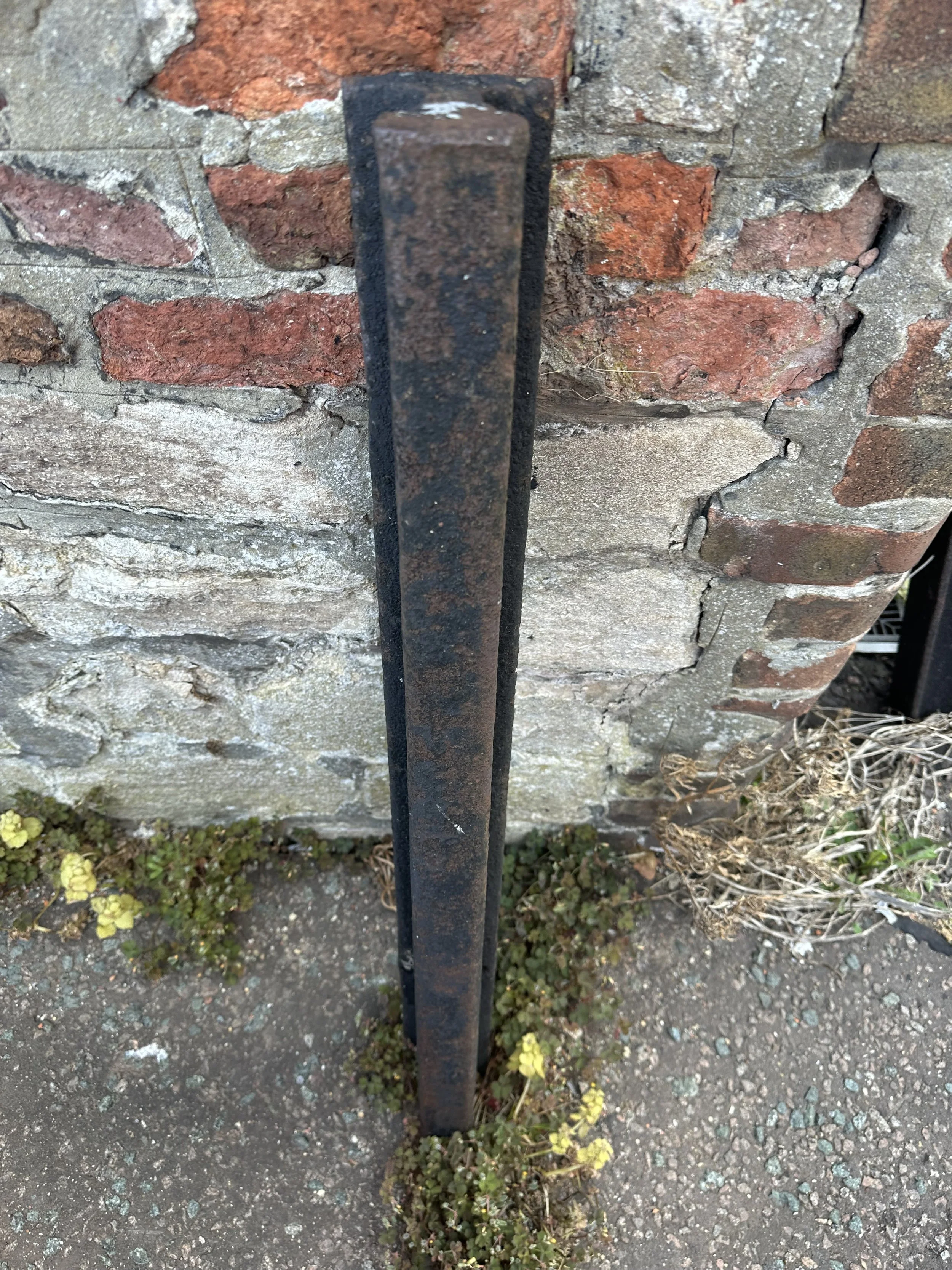
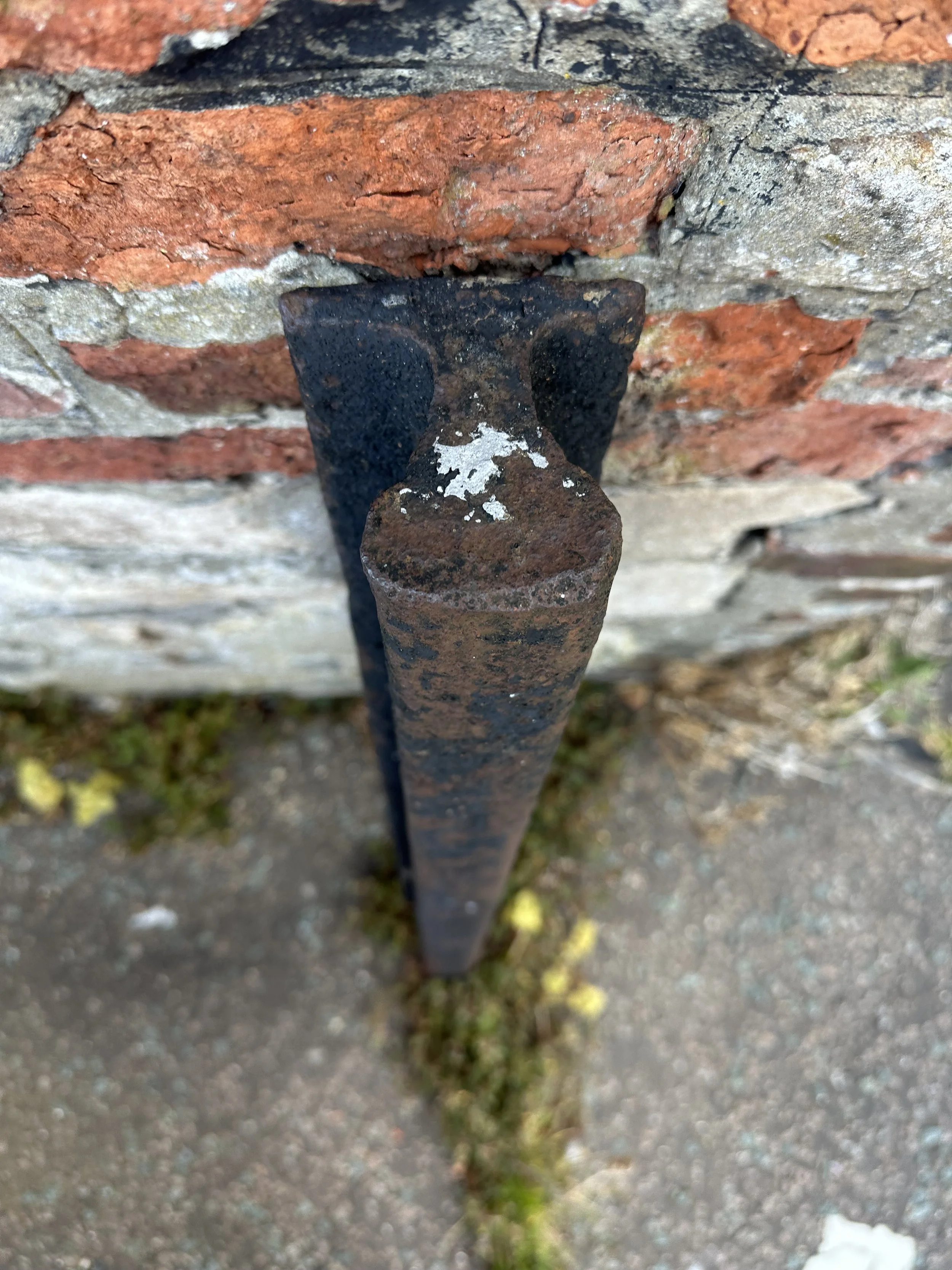
The only remnants of the railway are the semaphore signal near the Nar Valley Commercial Estate, close to the main Lynn Ely line, and, towards the quay, the raised trackbed walls still remain. Some parts of the railway close to the River Ouse, which were used by track-mounted cranes, also remain, as does a small section of railway track near Devils Alley in Lynn.
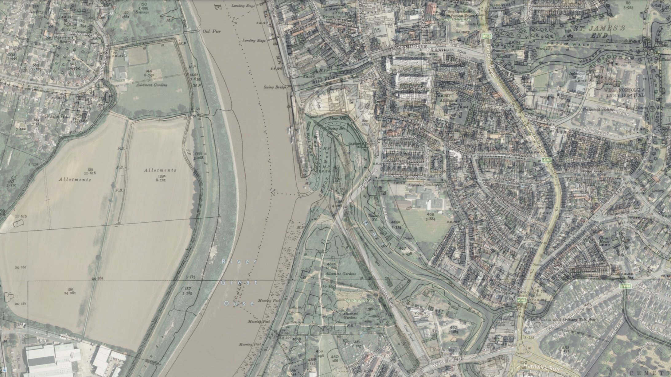
Historical maps
Harbour Junction
All maps used below are used with thanks, courtesy of The ©National Library of Scotland.
Harbour junction before the Lynn avoiding line was constructed.

Harbour junction after the Lynn avoiding line was constructed.

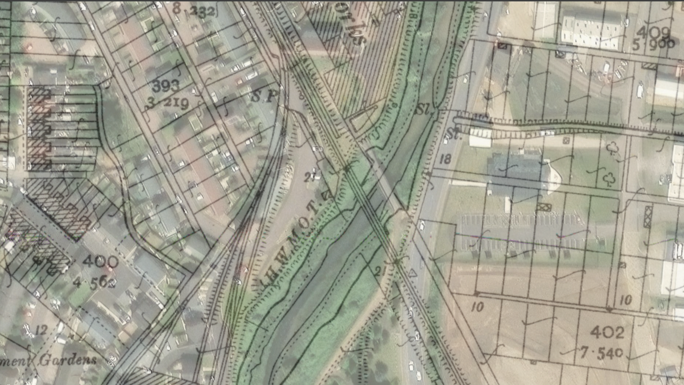
Harbour junction 50/50 Modern and historic views.

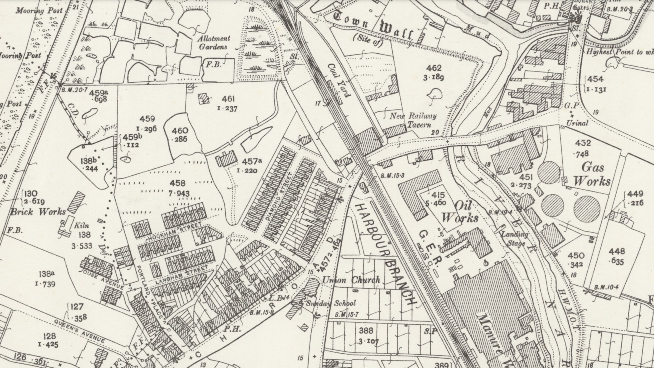
"South Lynn & the Muck Works."


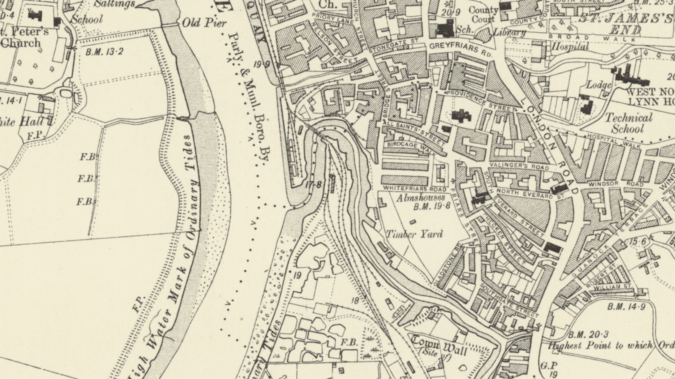
King’s Lynn Quay


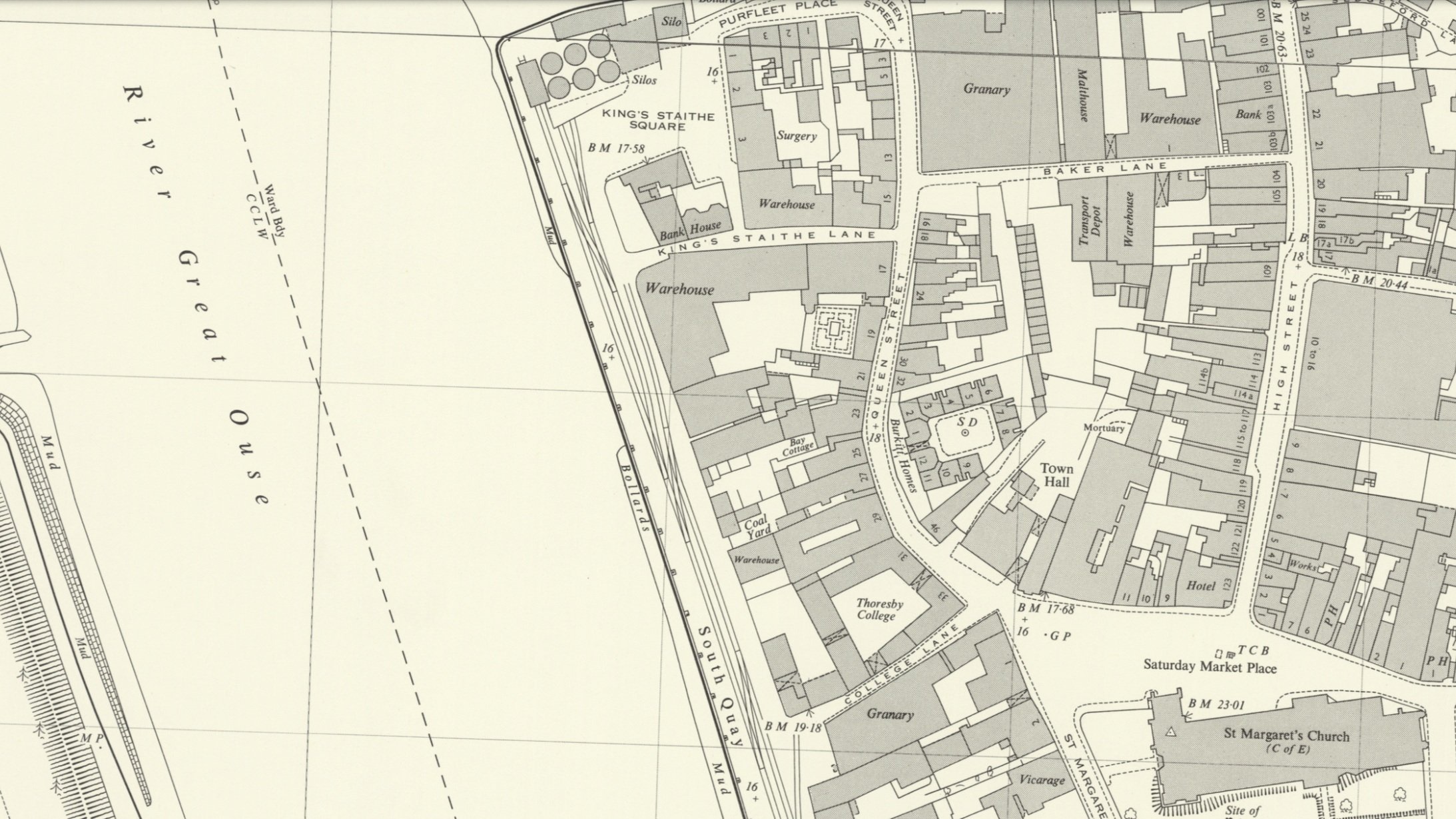
50-50 Modern and historic maps of the Quay at King’s Lynn.
Harbour junction
I would like to thank Tony Watson for allowing me to include his photos on this website through the Midland & Great Northern Joint Railway M&GN Facebook page. I appreciate Tony's generosity in sharing these photos of Harbour Junction with me.
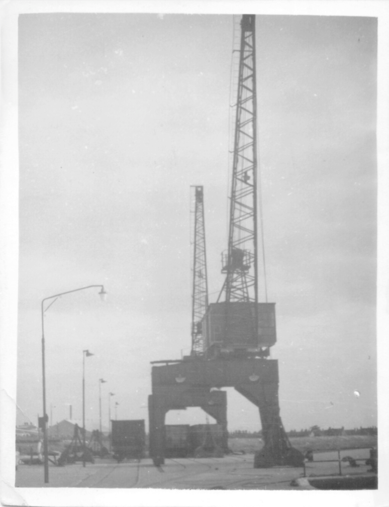
Harbour Junction layout (early 1980’s)

In this photograph, the Harbour line leading to King's Lynn Quay can be seen on the left side. The semaphore signal for the harbour line is also visible in the picture, which can be found in King's Lynn today (seen further down the page). On the right side of the photo, there is a small siding and a line that previously served the now-defunct Campbell's factory in King's Lynn. Some parts of the points still exist off the main line. Additionally, the line is still doubled in this picture, but it has since been converted to a single track after the electrification of the main line from King's Lynn to Cambridge.
King's Lynn and area Model by J T Colquhoun’s Facebook page has kindly donated these pictures of Harbour junction.
Harbour Junction signal box with the line to South Lynn visible to the left of the box. That line was originally the Lynn Sutton Bridge line in the 1800s, then was repurposed as the South Lynn link line when South Lynn station opened, taking the Lynn Sutton Bridge line away from the main station at King's Lynn.
King’s Lynn Harbour line was the opposite end of the signal box.
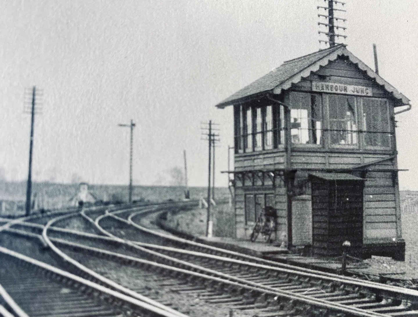
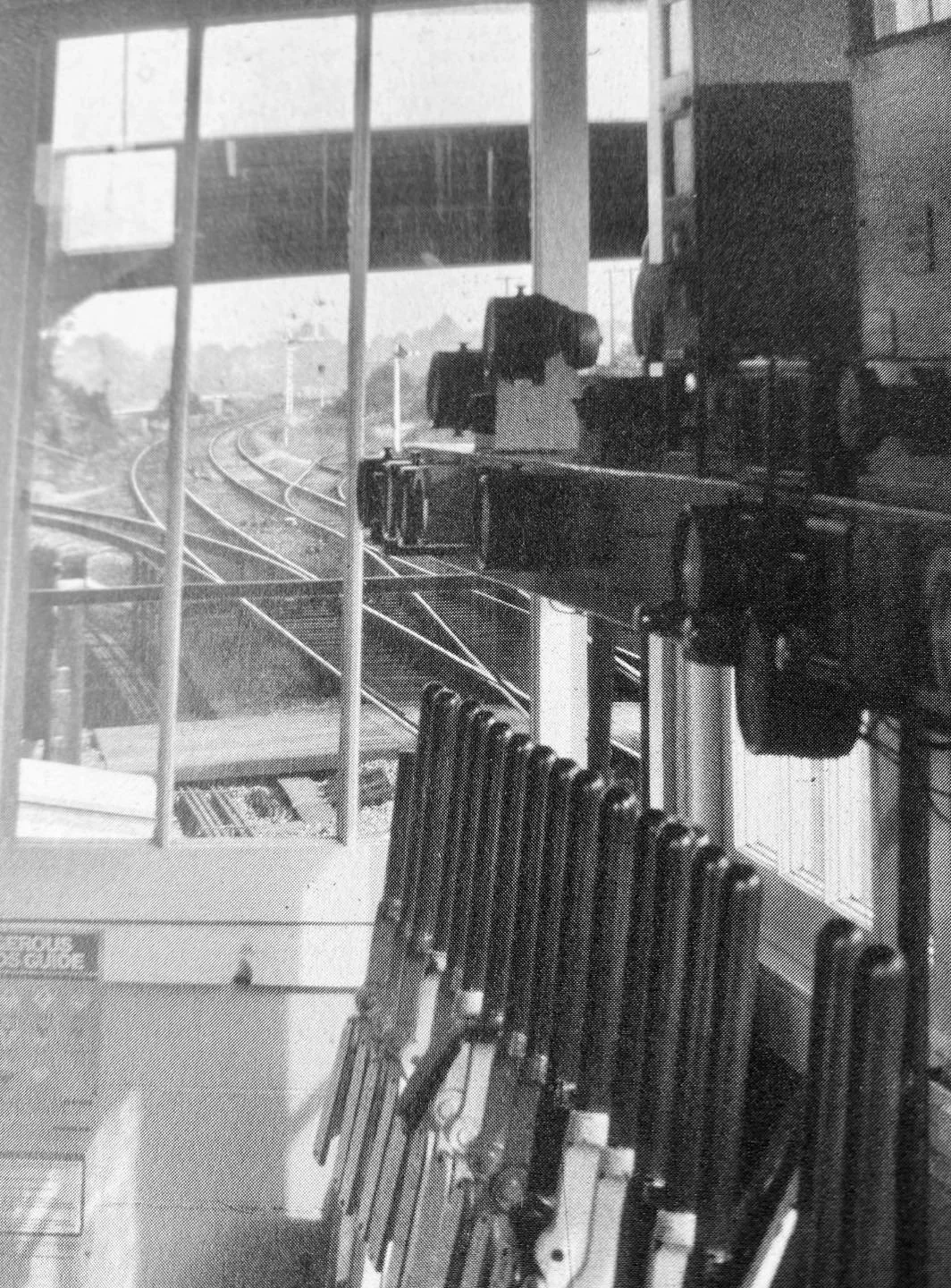
Internal view from the signal box showing the Harbour line leading off to the left, with the Lynn Ely line still doubled, and also Campbell's siding to the right.
A Campbell's freight service with the Harbour line seen heading off towards the left.

Year and photographer unknown if anybody has any infomation please feel free to get into contact.
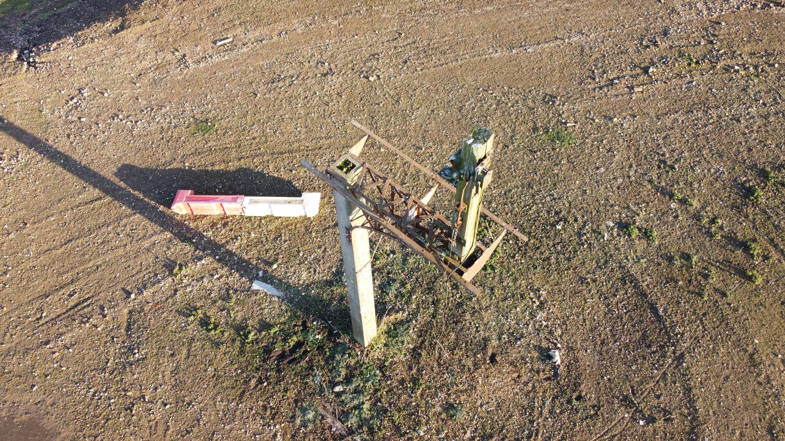
The Harbour Branch Semaphore signal.
Just past Harbour junction, this semaphore signal was sited and still luckily stands today, despite many construction projects taking place across South Lynn.

©National Library of Scotland
Thanks to Tony Watson, we have access to a photograph depicting the operational period of this signal.
Tony has informed us,
“The signal Originally had 2 signal arms, this was its final guise with 1 arm in the late 70’s early 80’s.”

©Tony Watson
The signal now.

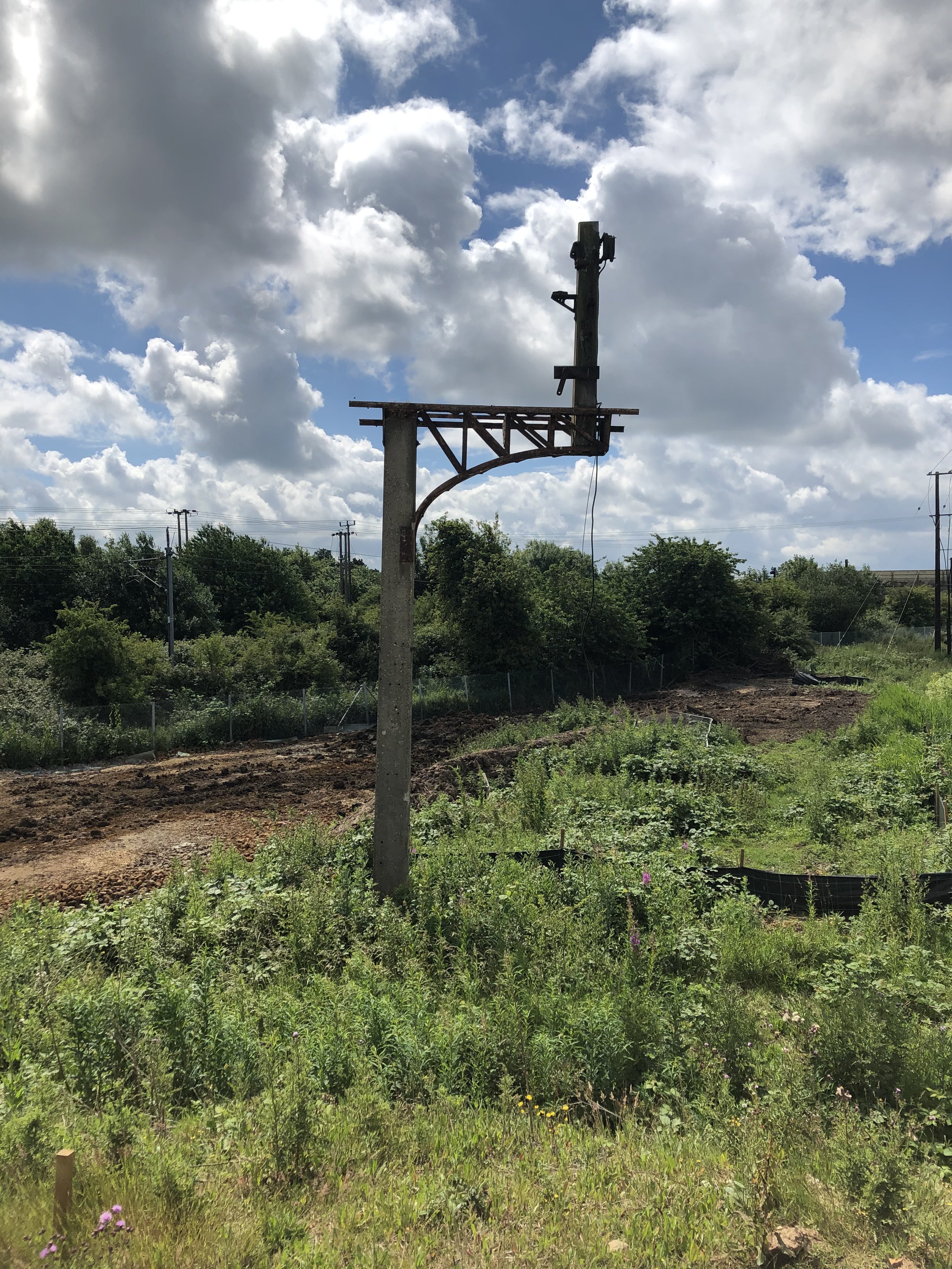
Photographed 2020
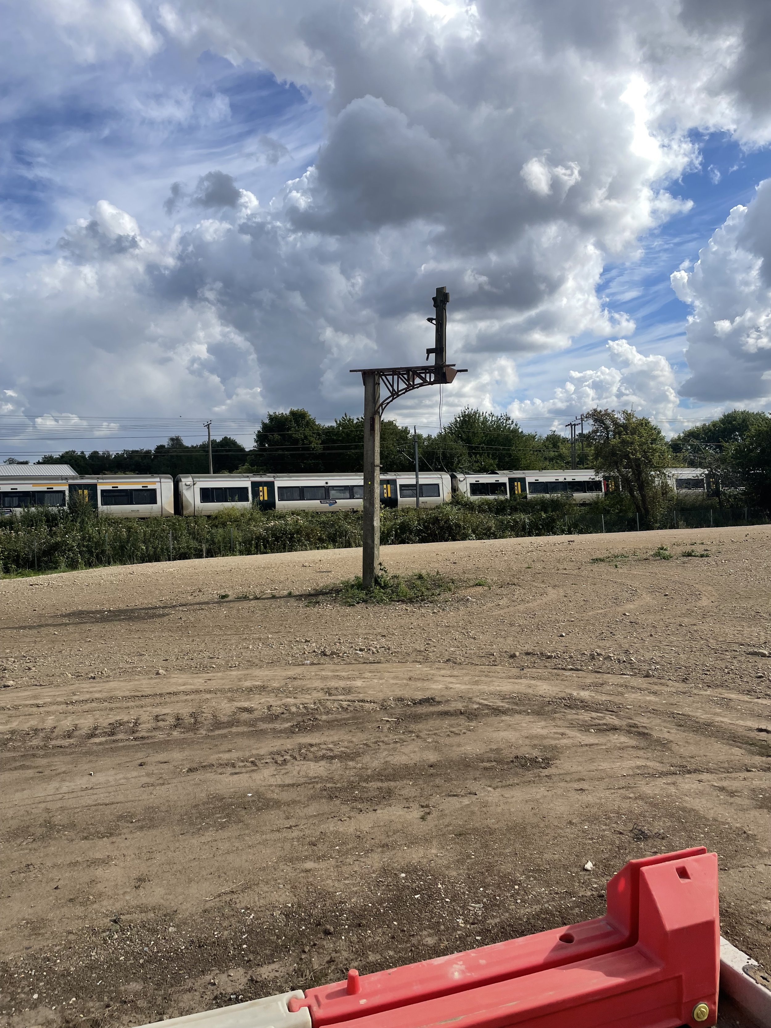
Photographed 2024
In 2025, I went back to the Nar Valley commercial park where the old signal still stands. I had a new drone with me, so I could take some fresh photos of the old signal.
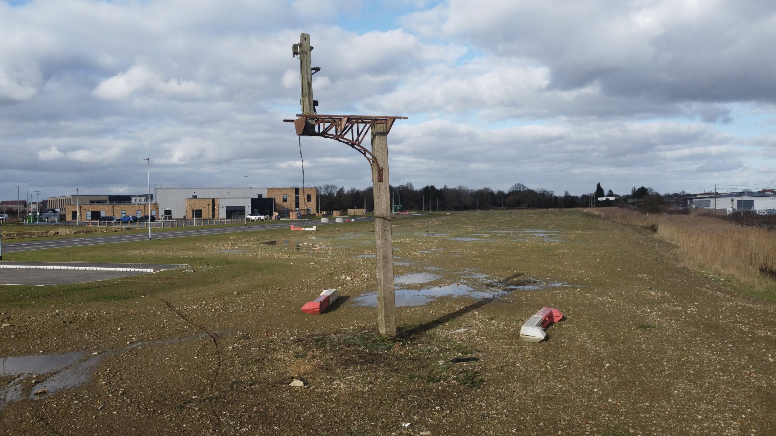
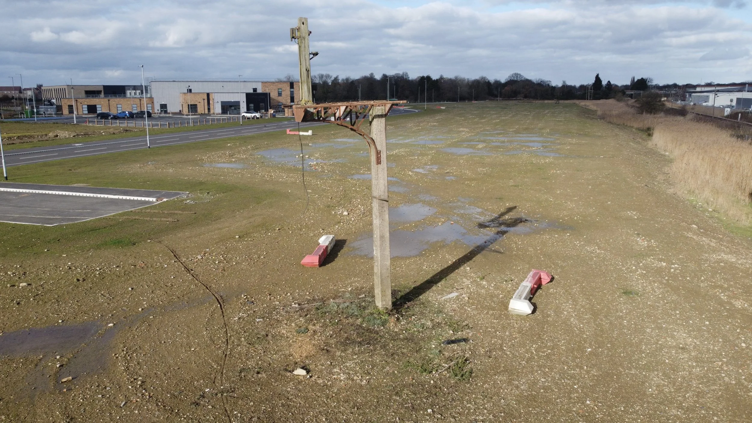
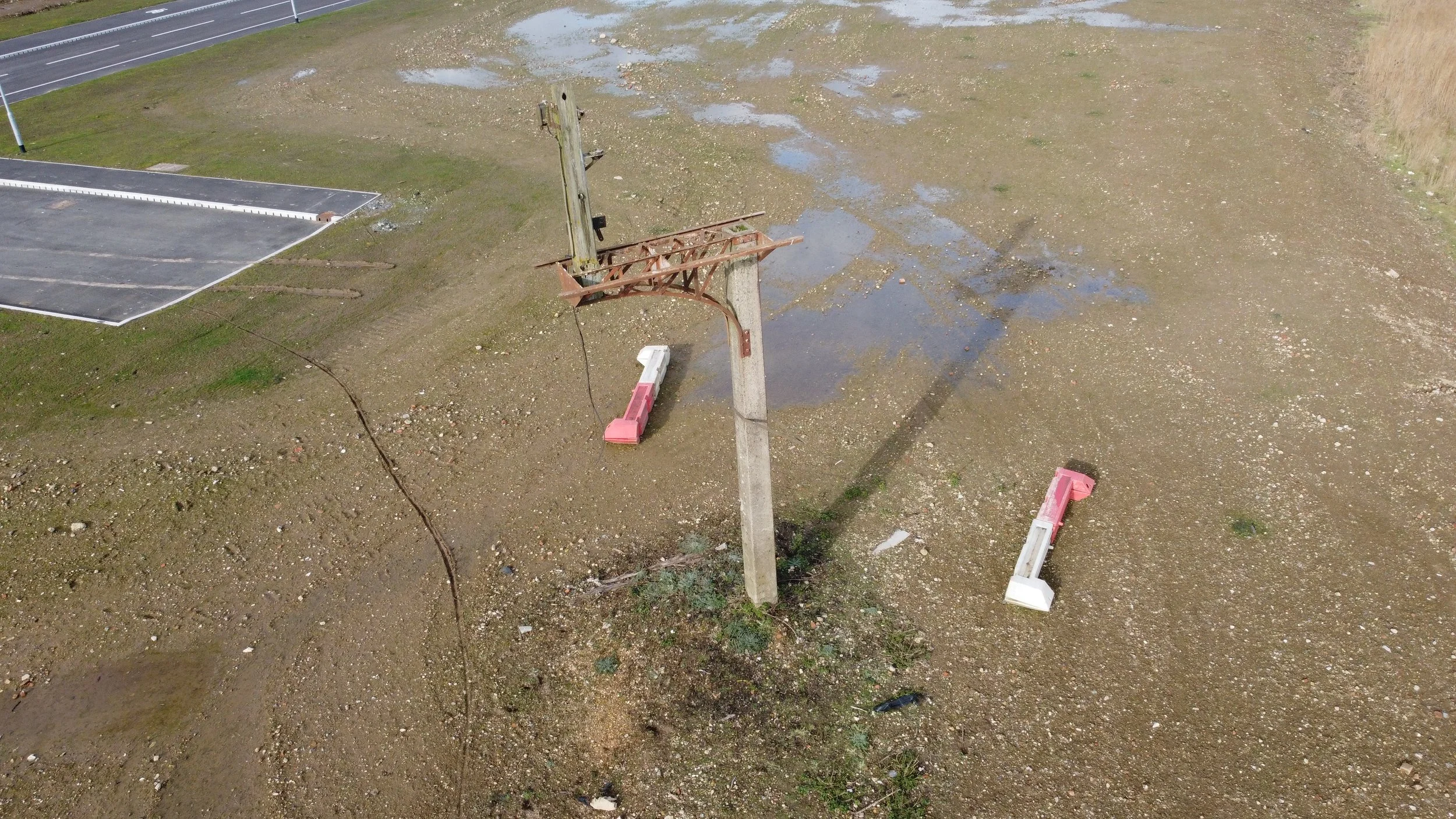
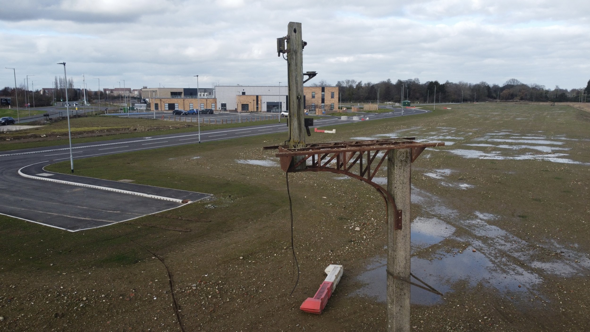
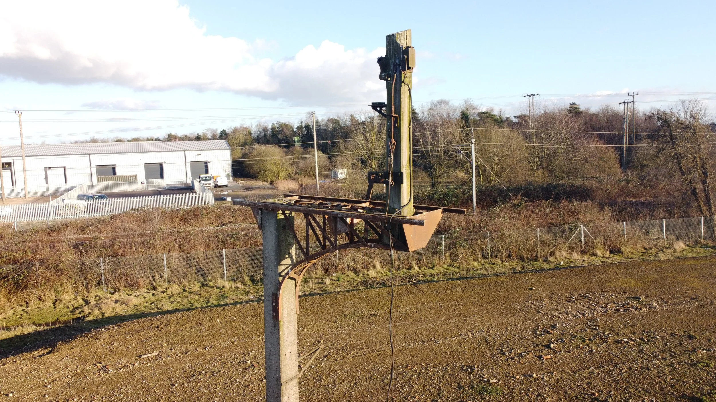
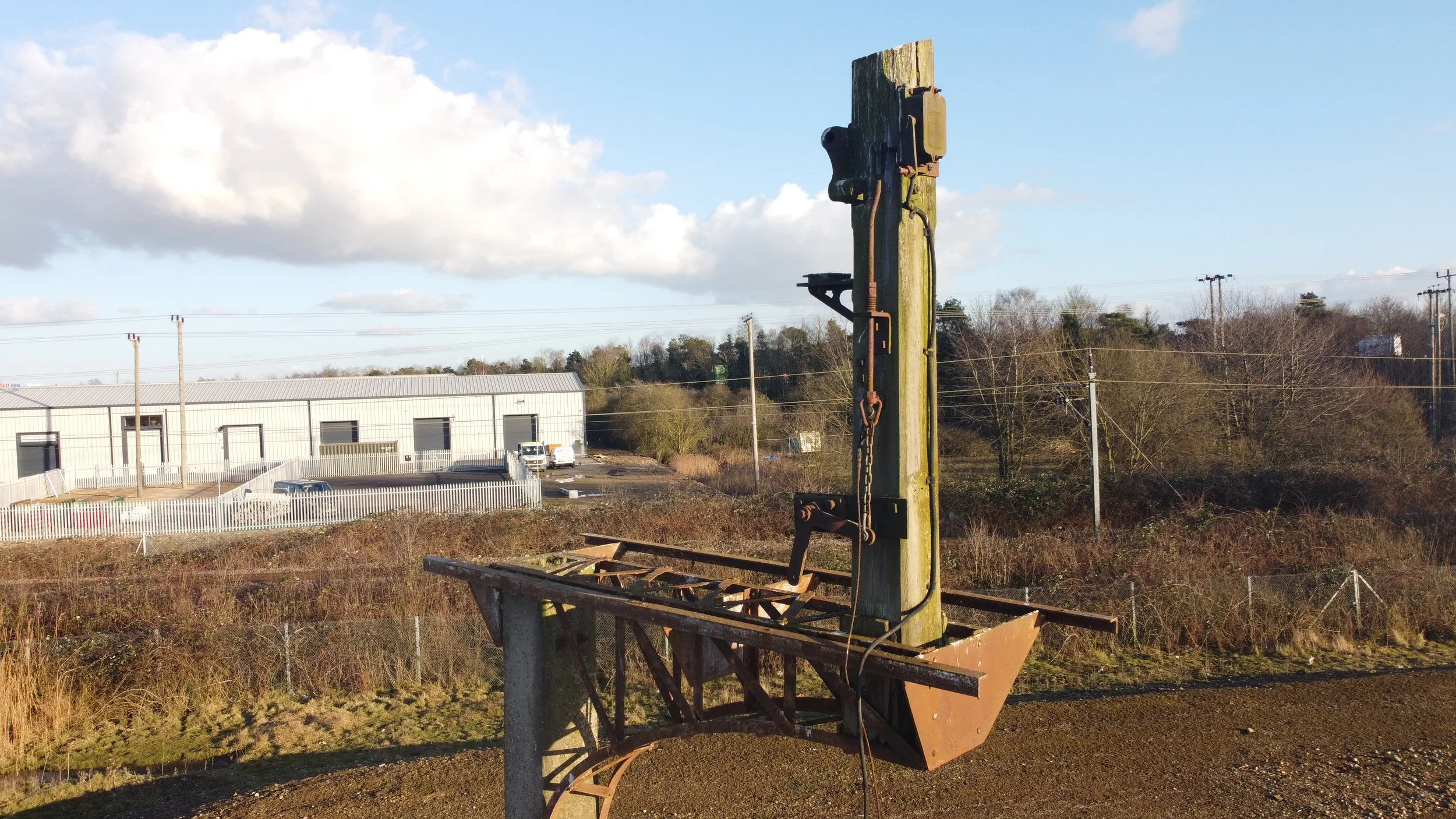
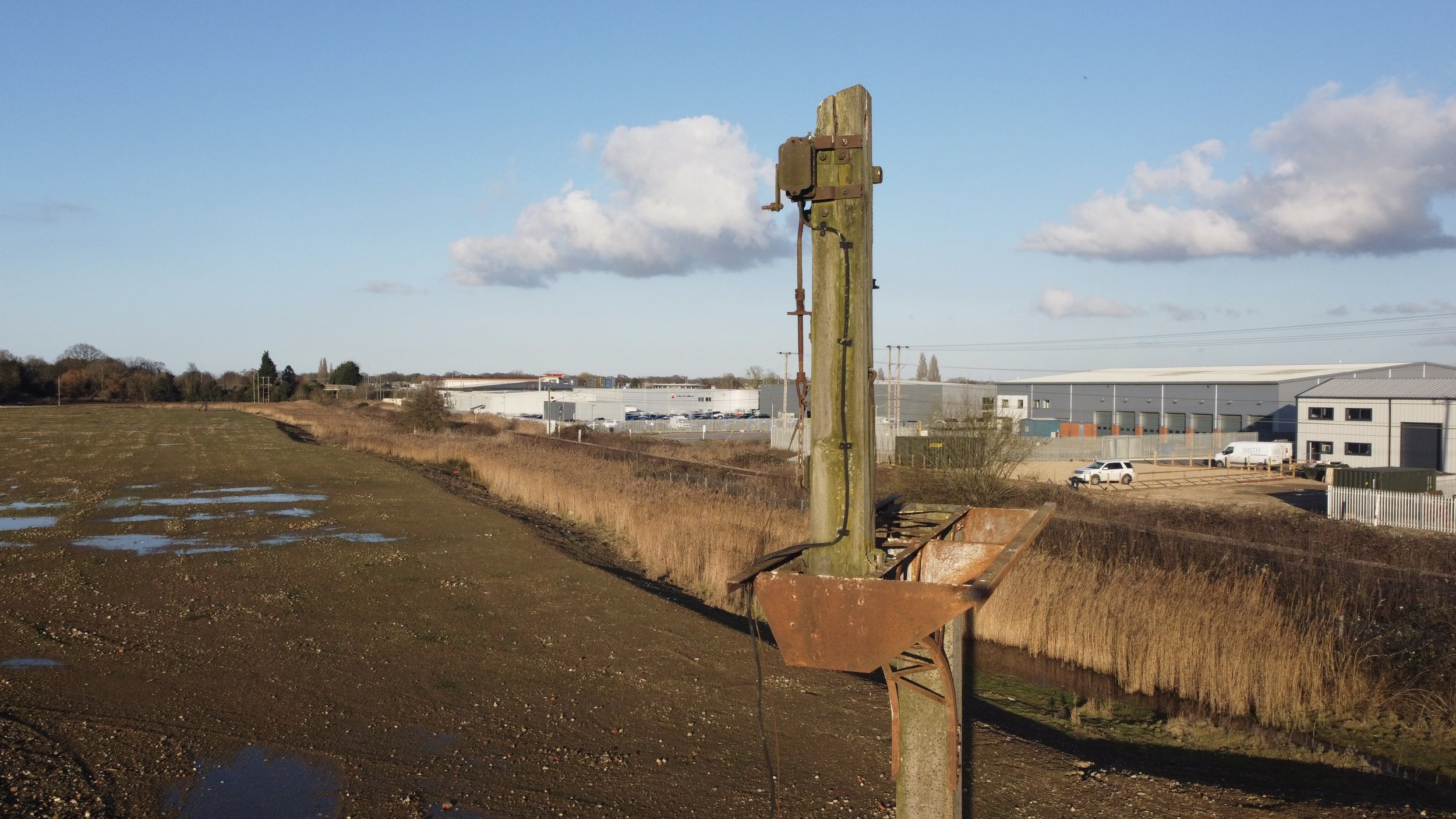
The signal site has said to have been designated as a protected monument of historical significance by King’s Lynn Borough Council.
Thanks a lot, Richard Woods.
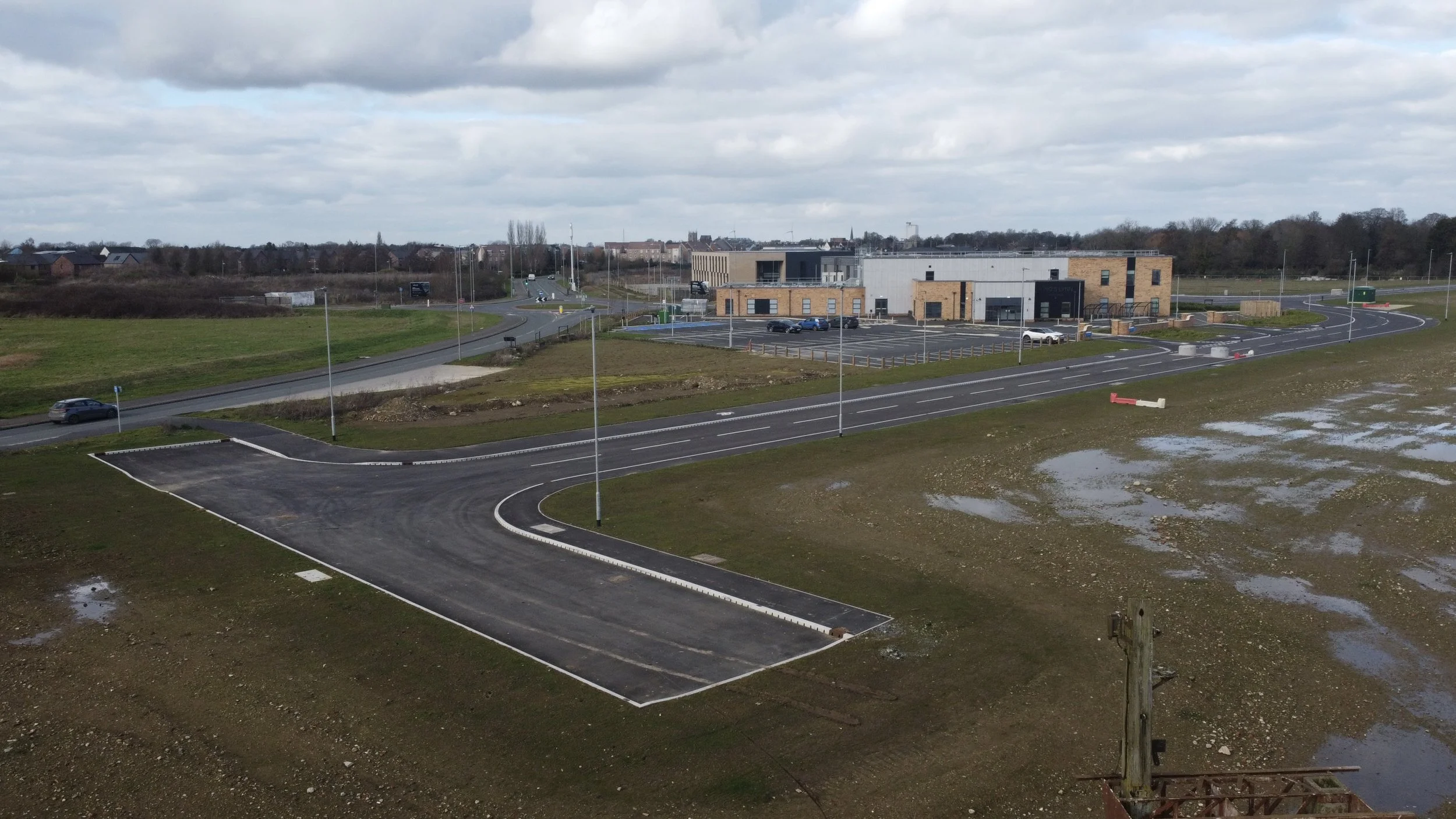
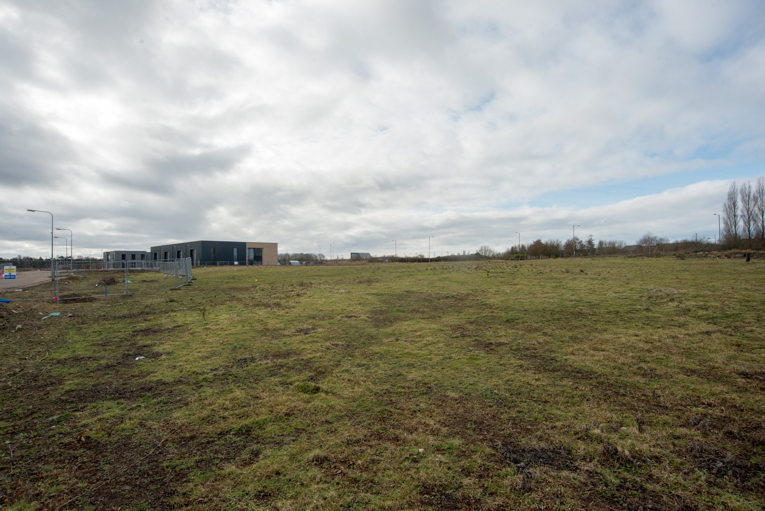
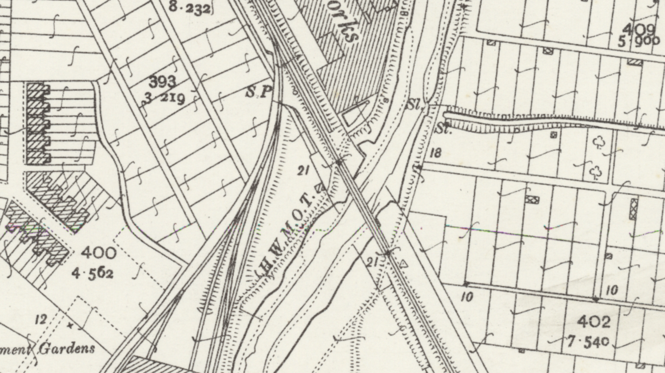
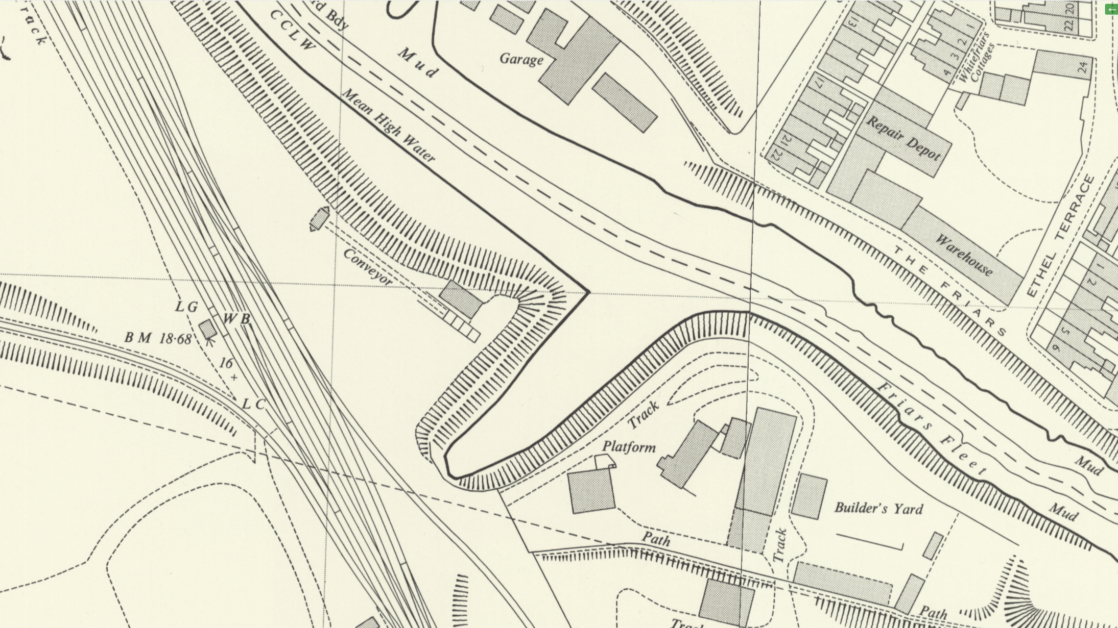
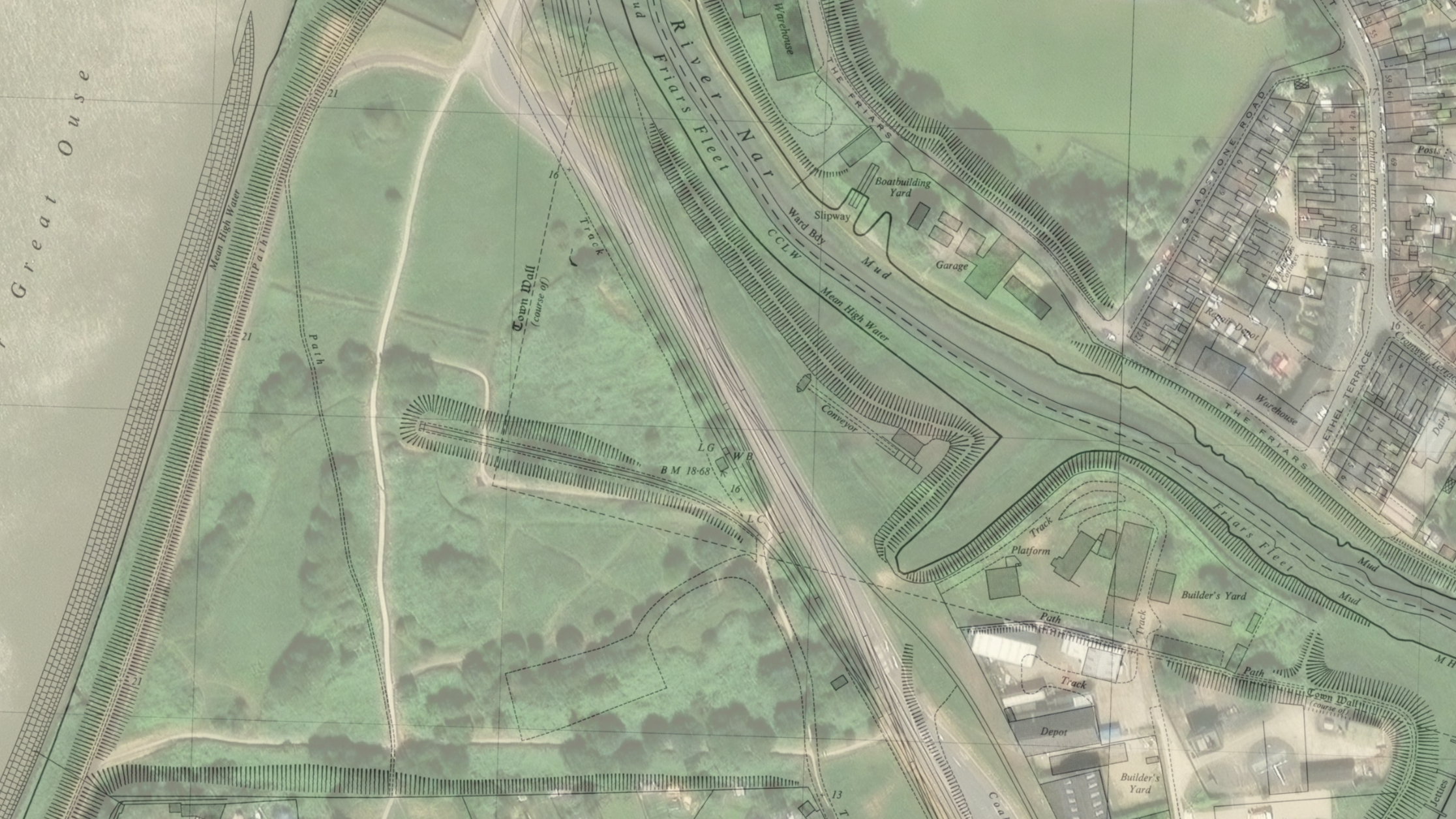
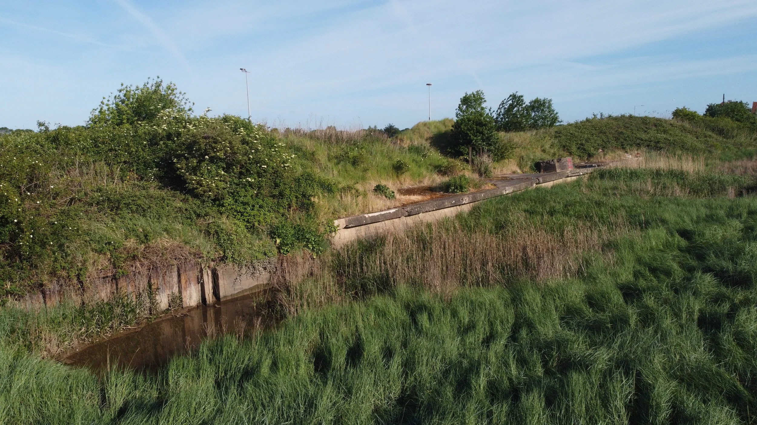
After the signal post, the railway curved around before heading directly towards the River Ouse and the South Quay, passing the manure works and crossing an old wooden and steel bridge. The vacant land where the railway once ran is now being developed with commercial units near the site of the old signal. A new footbridge has been constructed near the A148 Nar Valley Way, close to where the old railway bridge once stood. The railway then crossed through the area where the new housing estate now sits, roughly following Sandpiper Way; it crossed Wisbech Road at a level crossing and ran around the area where Hardings Road is now located. After crossing Wisbech Road, the railway began its final short journey to South Quay. When I visited in 2023, the Nar Valley construction site was being developed over the old Harbour line, which used to cross after coming off the Lynn Ely line before reaching the Wisbech Road level crossing.
A view of roughly where the old harbour line would have run many years back, as we can see the site has now been constructed over.

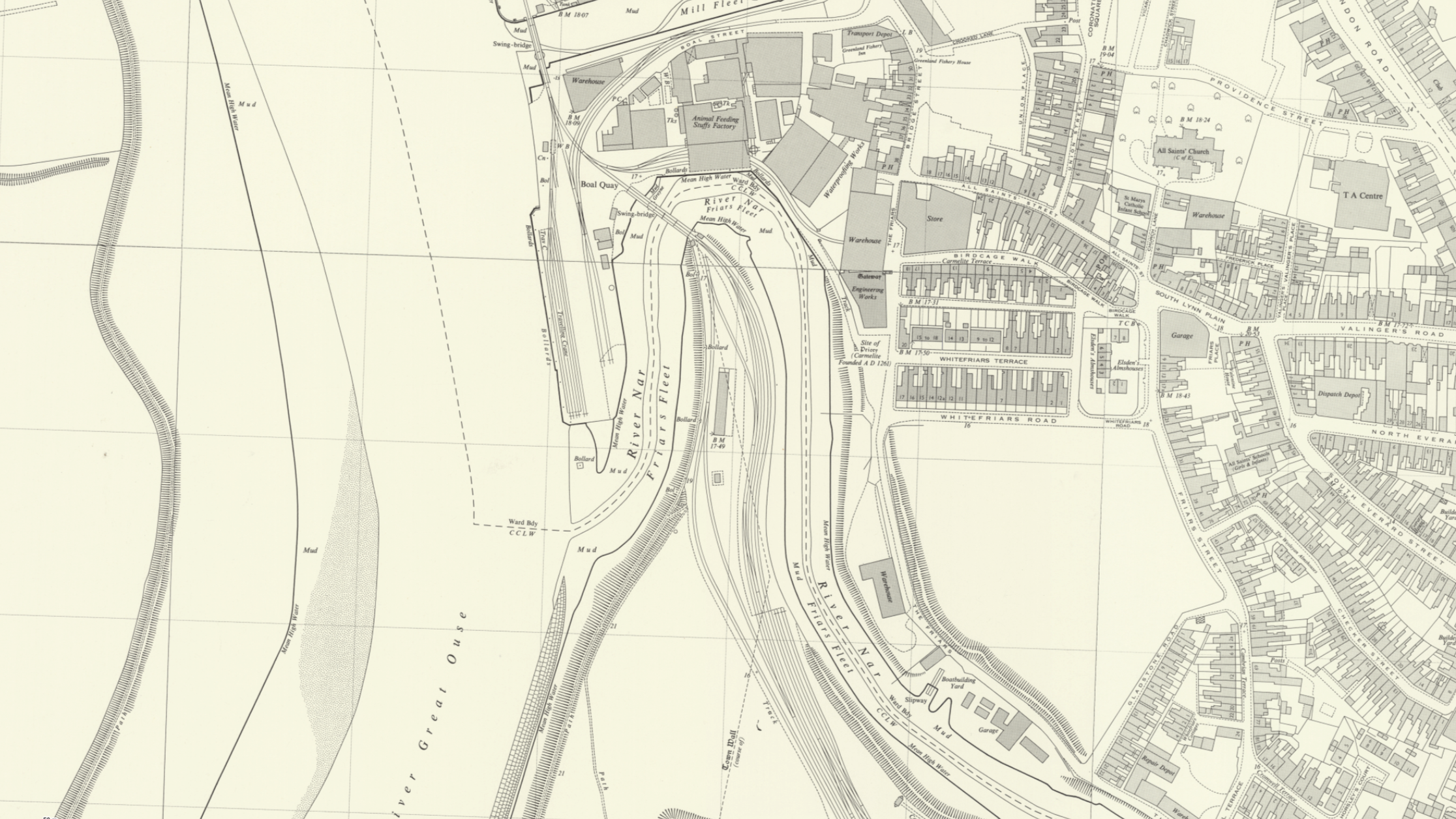
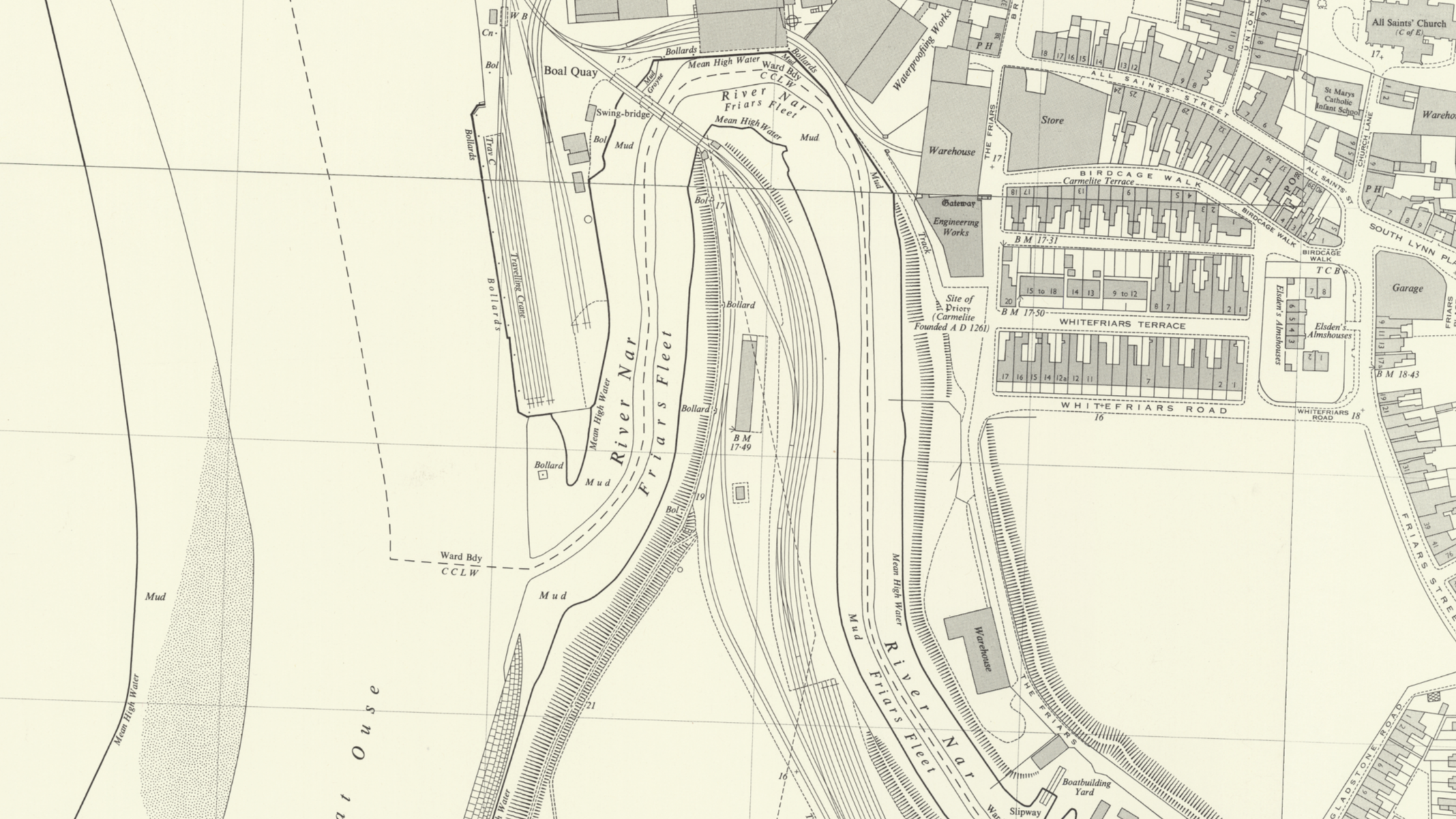
River Nar crossing.
Heading towards the South Quay, the railway would have crossed over the River Nar via this bridge.
The bridge was nicknamed "Casey Jones" due to its American appearance.
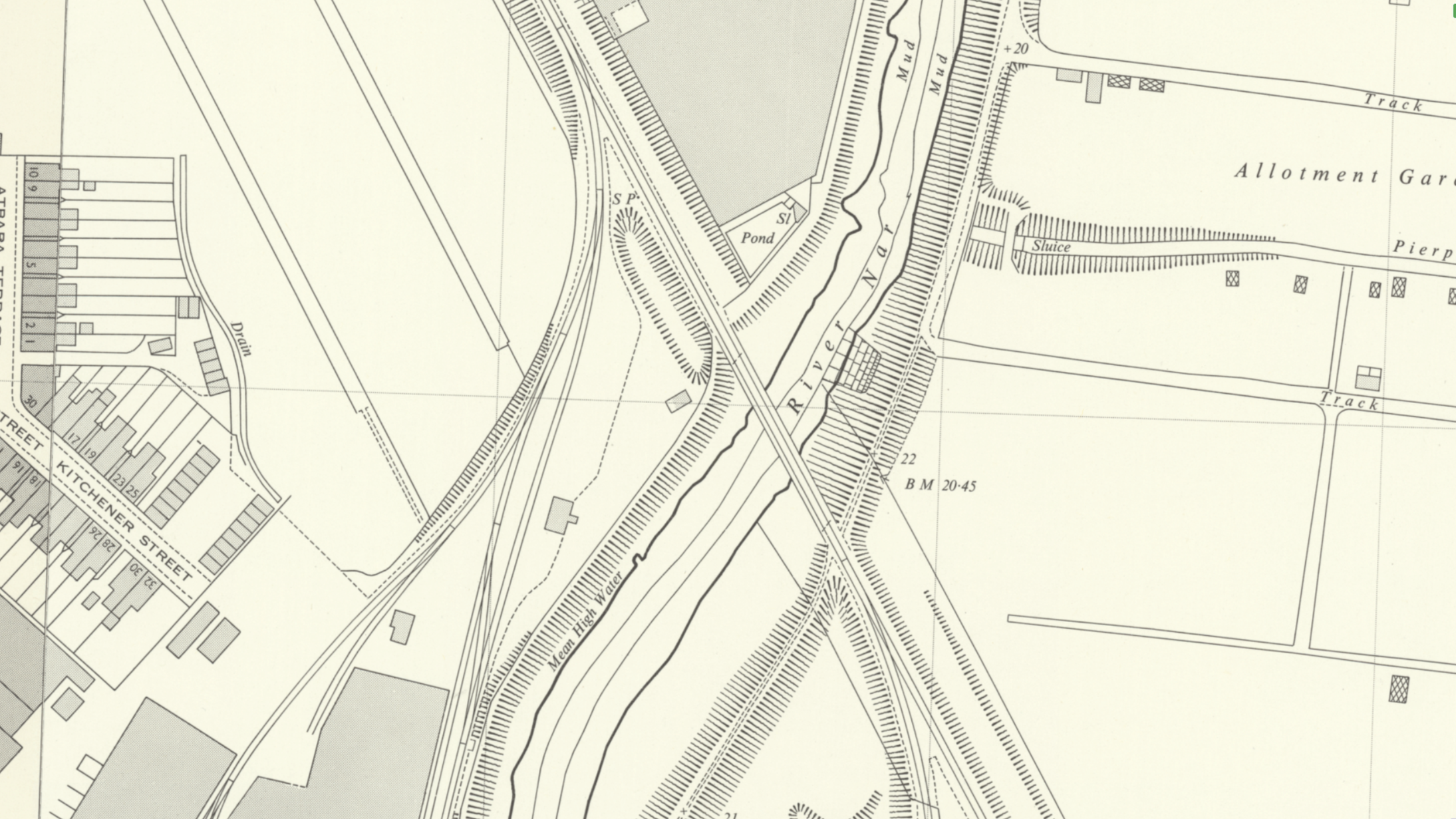
Past and present map coverage shows how close the two bridges were constructed.
©National Library of Scotland
This photograph was taken in 2007, and the bridge has since been demolished.
Lewis Collard, Attribution, via Wikimedia Commons.

©LEWIS COLLARD
King's Lynn Harbour Branch as seen on the Fakenham & Dereham Railway Society tour on the 29th March 1980.
©Fakenham & Dereham Railway Society-Norfolk Orbital Railway

With the railway bridge demolished, a new pedestrian bridge was constructed in roughly the same location at a later time.


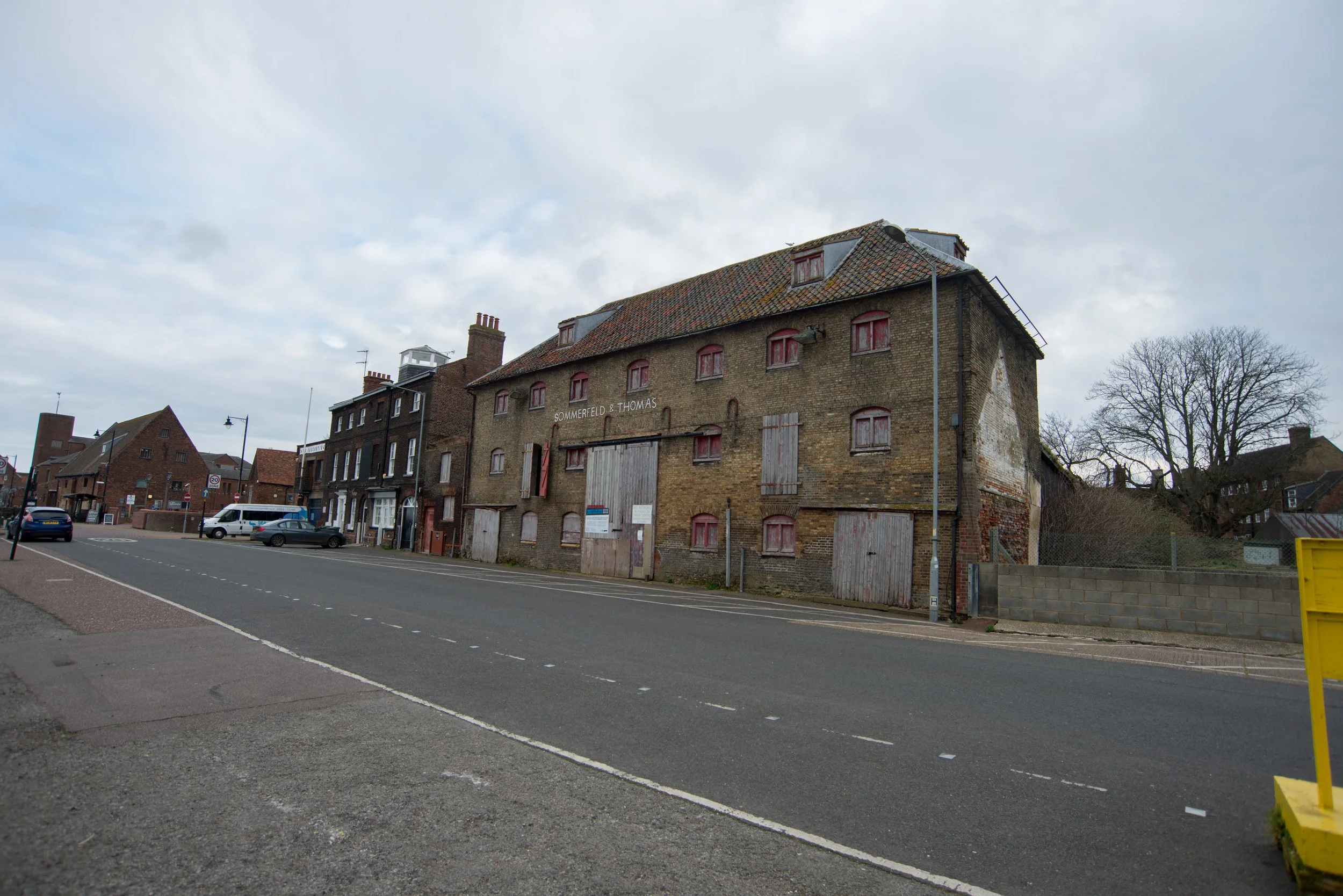
King's Lynn Muck Works
Opened in 1872, West Norfolk Fertilisers was a major industrial concern in King's Lynn during the 20th century, employing many local residents, often in highly specialised roles. The plant included an acid factory, tar works, laboratories, warehouses, and office buildings. The company expanded during the 1940s and 1950s but declined in the late 1960s, closing in 1967. The site had its own railway sidings, one of which connected to the Harbour railway. Historical maps also show that the works had a line into South Lynn station sidings. The building was demolished in 2002, and now a new housing estate has been built on the site, with further development underway on the Nar Valley project.
Thanks to the National Library of Scotland for the use of the historic maps depicting the old railway sidings from the South Lynn works.

Historical map showing the South Lynn works railway line that entered South Lynn M&GN station.

©National Library of Scotland
South Lynn Muck works

©Thanks to King’s Lynn Forums.
Aerial views
From the air, we can see the South Lynn Muck Works and the Harbour railway line running through it.

Thanks to Historic England for the aerial photo. Please click on the photo for a link to the source page.
Once the old works were closed and demolished, the land remained vacant for a few years until the Nar Valley project began. This housing estate was built partly over the former site of the works in South Lynn, with access to the estate near the level crossing at Wisbech Road.
This area is called Sandpiper Way.

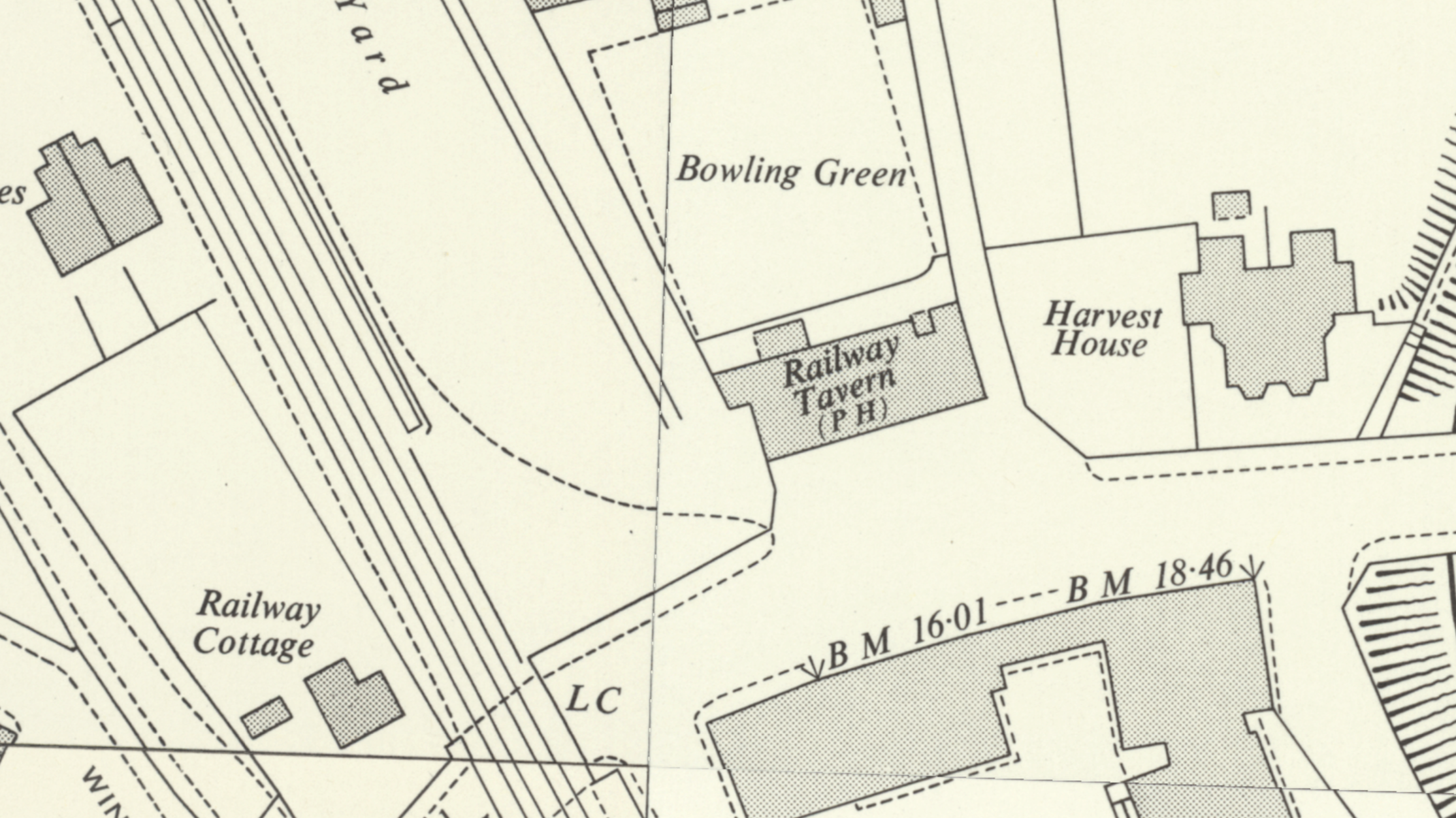
Wisbech Road crossing
Heading towards the Harbour, the railway crossed over Wisbech Road by a level crossing.
No trace remains to this day.
Early maps showing the crossing at Wisbech Road also show the Railway Tavern.
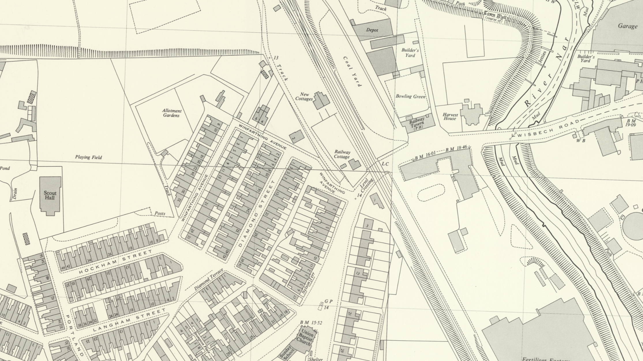
©National Library of Scotland
The Railway Tavern on Wisbech Road South Lynn was seen here before this public house was demolished in the late 1990s.
©National Library of Scotland
Railway Tavern
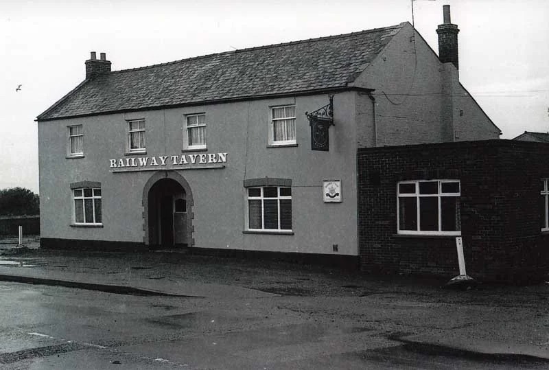
©KL FORUMS - YEAR UNKNOWN
The rough location of the Railway Tavern photographed in Febuary 2023

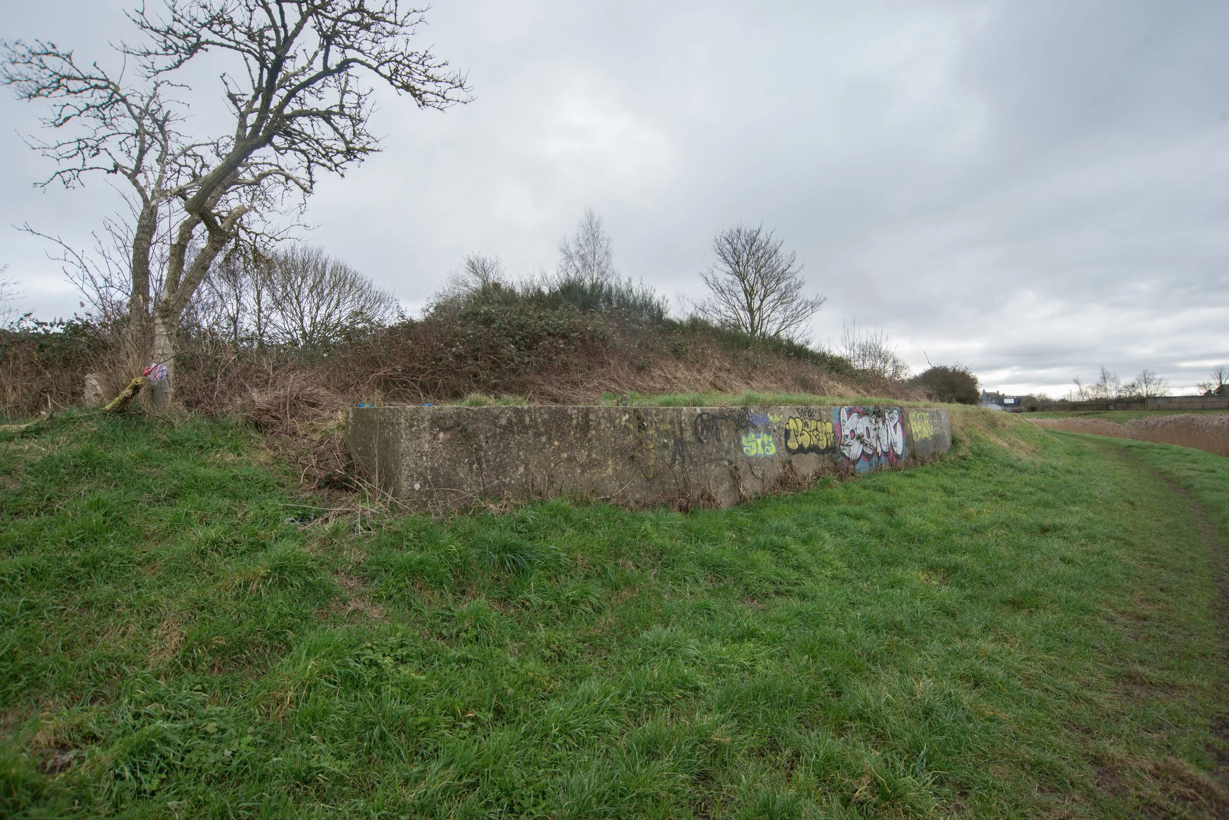
Just after Wisbech Road, just into Harding's Way, I found an old wall that I don't think is railway-related; I am more convinced it's for flood defenses and part of the town wall.

©National Library of Scotland
The remaining parts of the old town wall.
Hardings Way.
Once crossing Wisbech Road, the railway continued towards the South Quay; The railway roughly ran where Harding's Way now resides.
©National Library of Scotland
Harding’s way Photographed in 2022


Just beside Harding's Way, I spotted in the distance this concrete support that might have been part of an old bridge. Looking at old maps, this concrete support shows that it was not directly related to the railway but perhaps for a road or a footpath leading to a siding.
Please feel free to get in touch if you have any ideas.
Photographed in 2022 on my first visit to the Harbour branch.

Photographed 2023
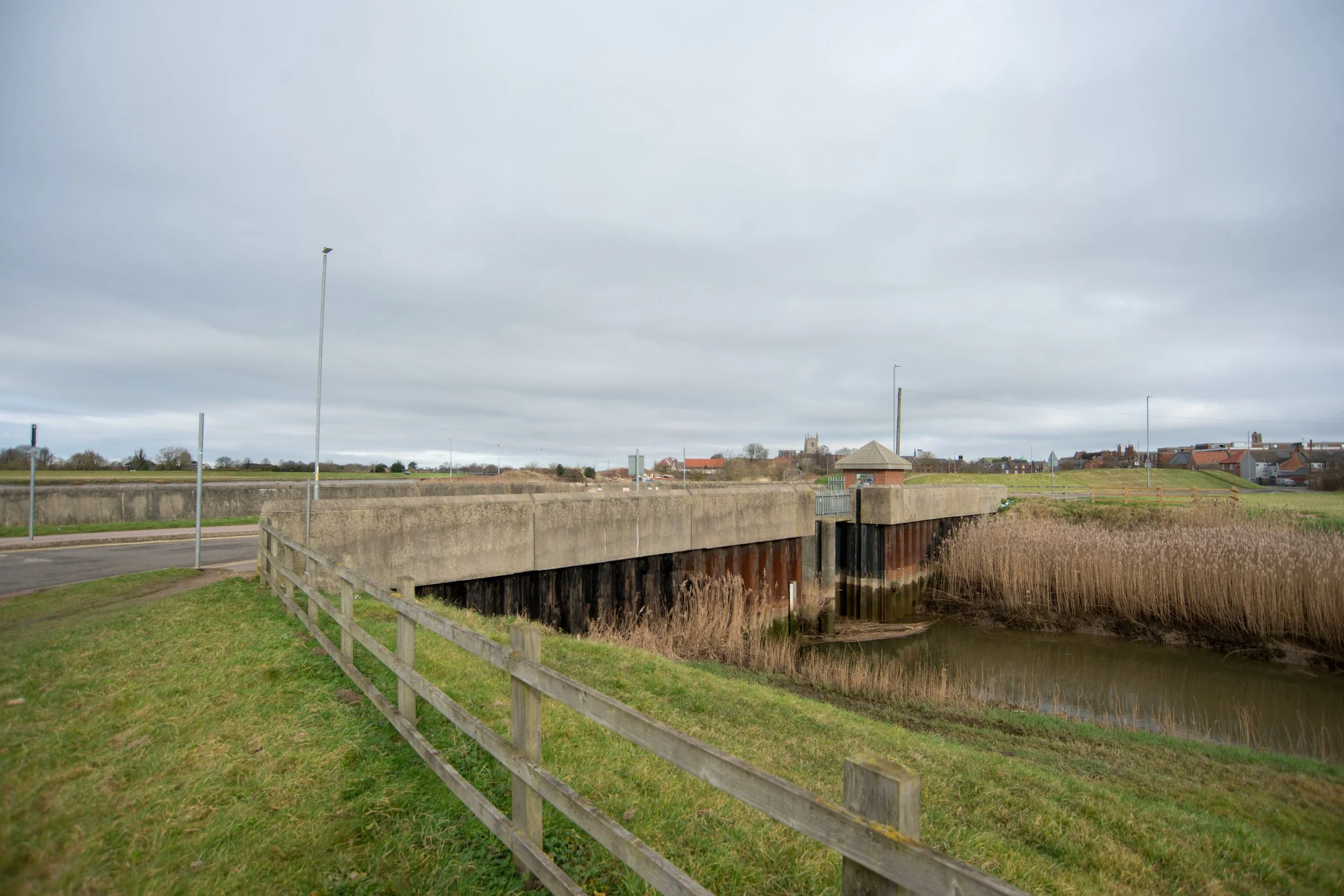
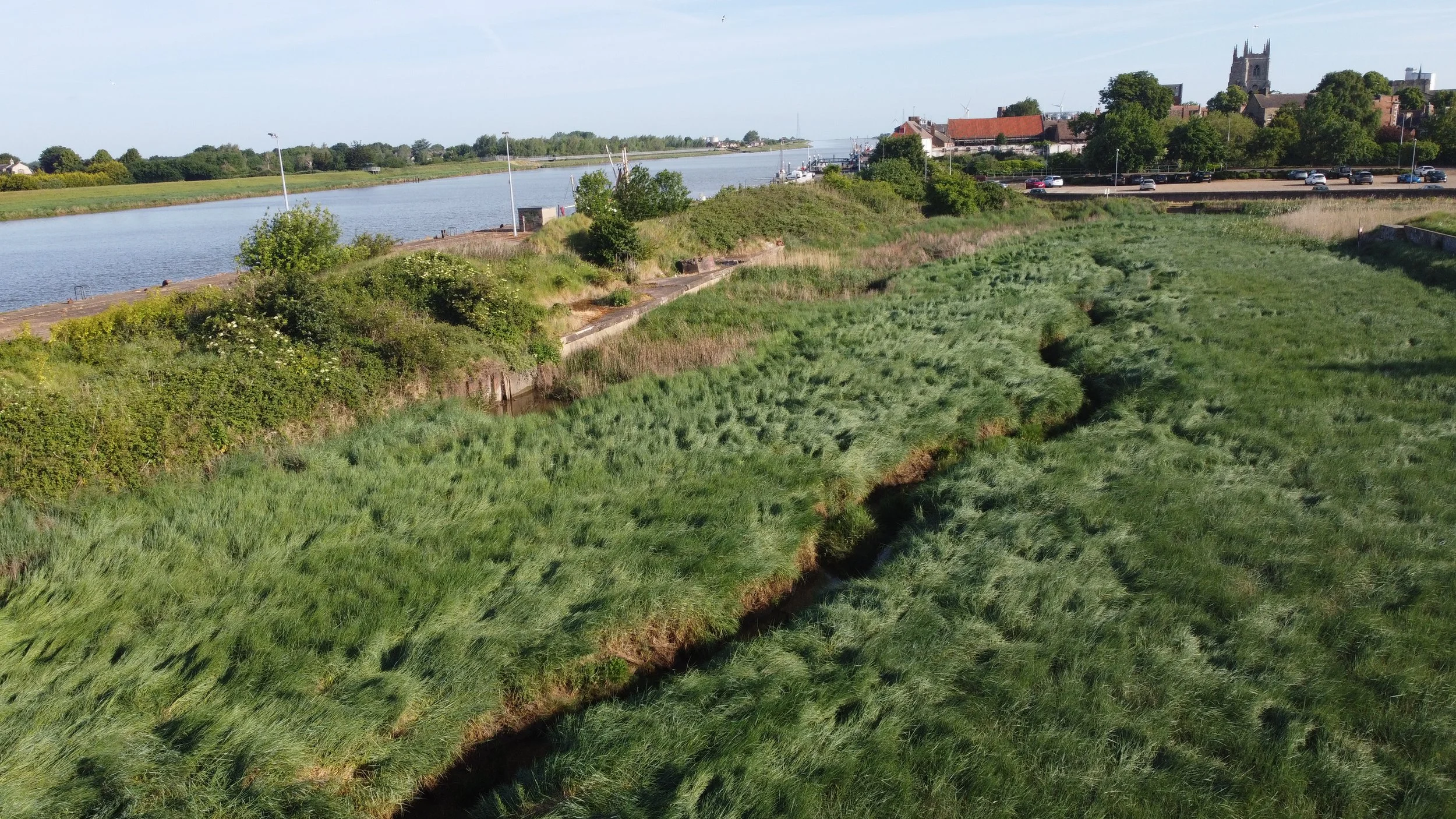
During my visit to the Harbour railway, a bridge now exists that crosses the river nar where it joins the River Ouse.
When the railway existed, the river's route was somewhat different, as shown on historical maps.
©National Library of Scotland Dated 1830s 1880s
©National Library of Scotland Dated 1888-1915
©National Library of Scotland
©National Library of Scotland
Modern and historic map coverage of the River Nar's path is shown below. The maps demonstrate how the river's course has changed due to the closure of the Harbour.
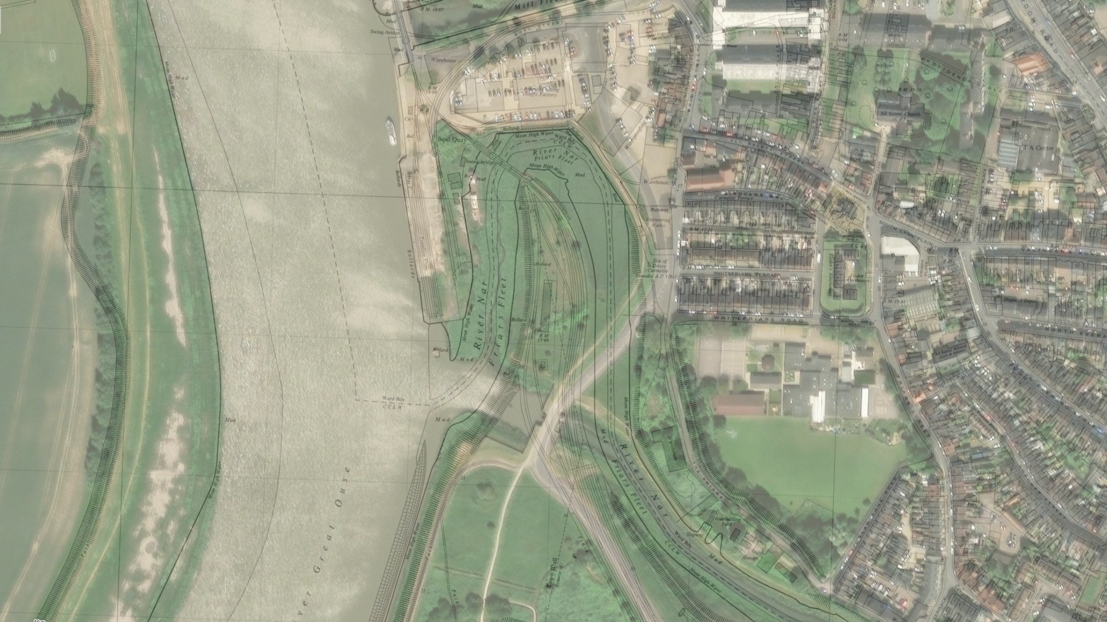
This newly constructed bridge crosses the River Nar at South Lynn, near the River Ouse. It was built long after the railway closed and is not related to railway infrastructure.
The River Nar also once had the Lynn Sutton Bridge railway, the Lynn South Link Line, and further upstream, the Lynn Narborough Line, all crossing the river at different locations.
Photographed febuary 2023


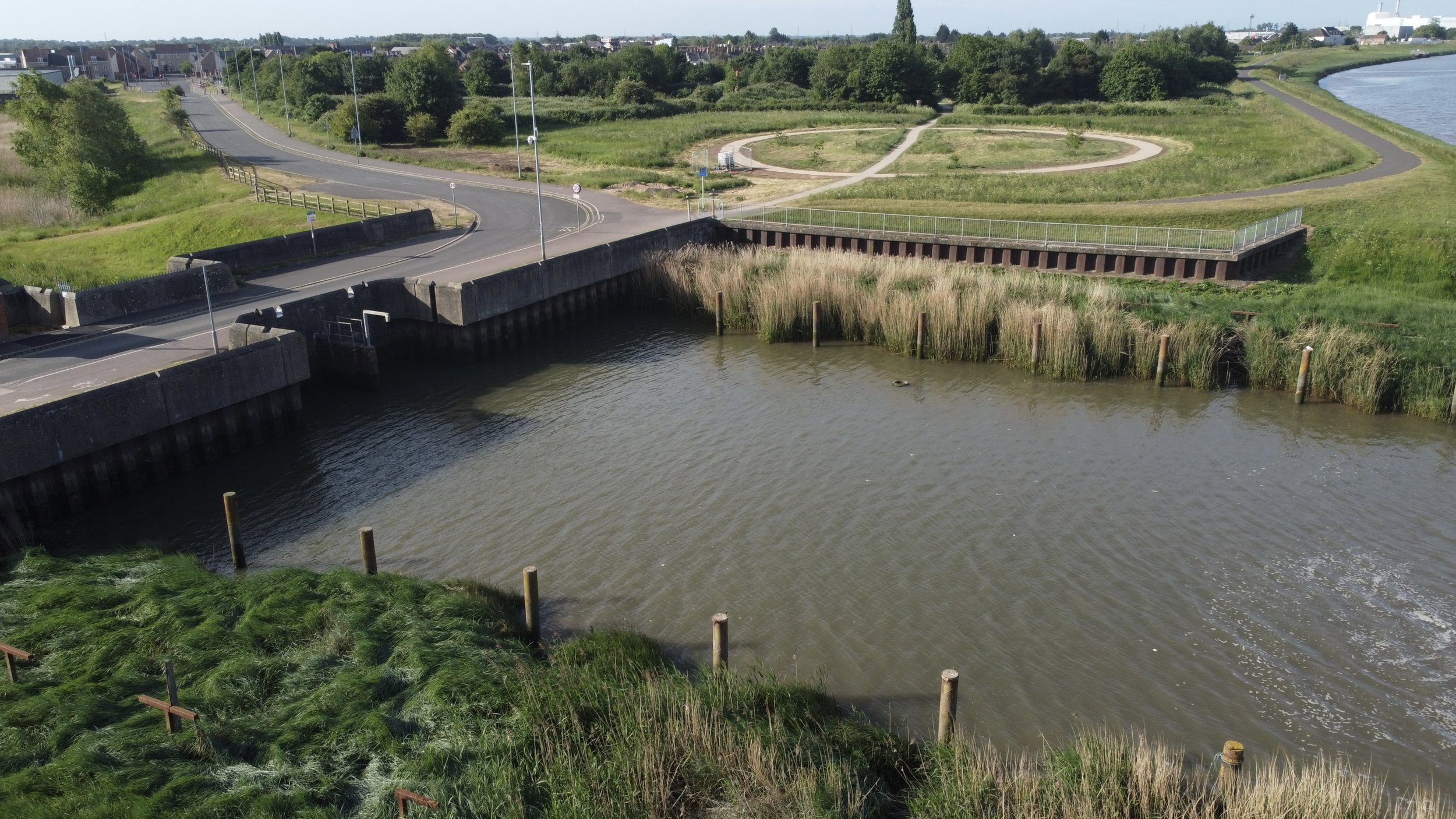
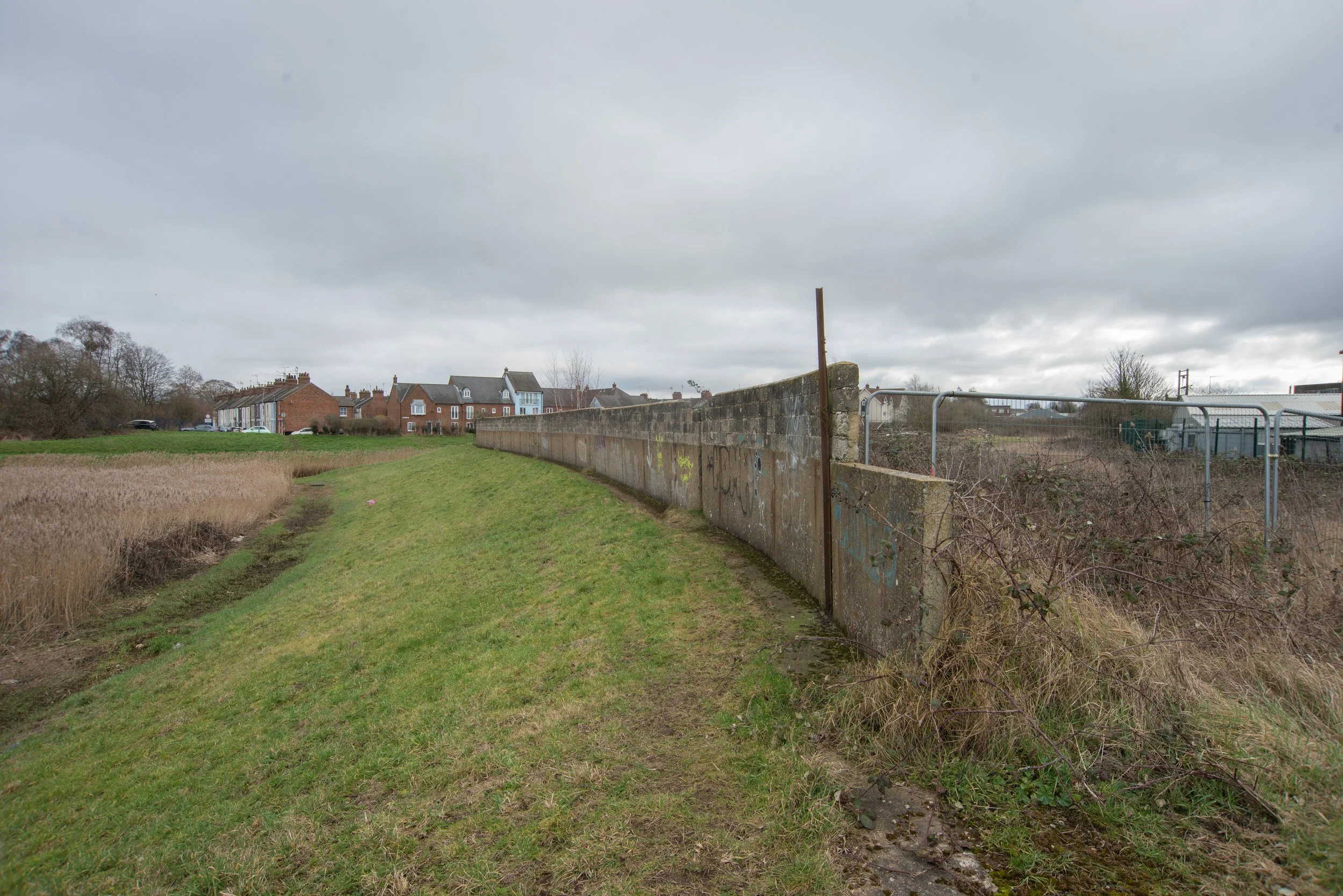
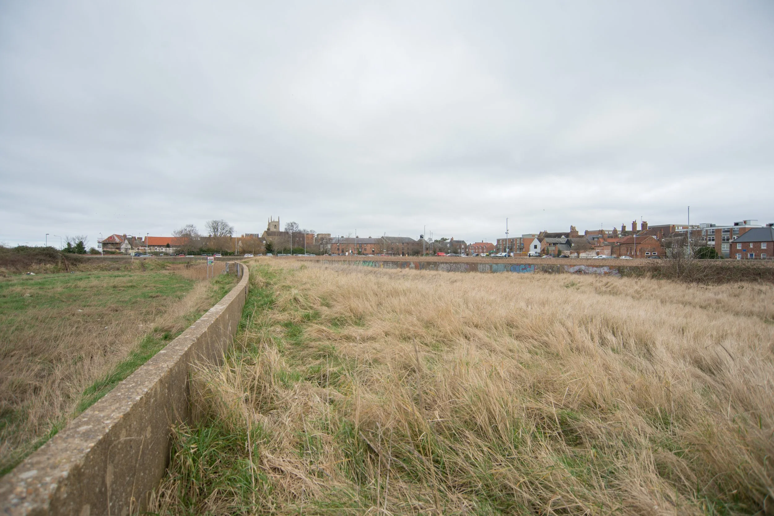
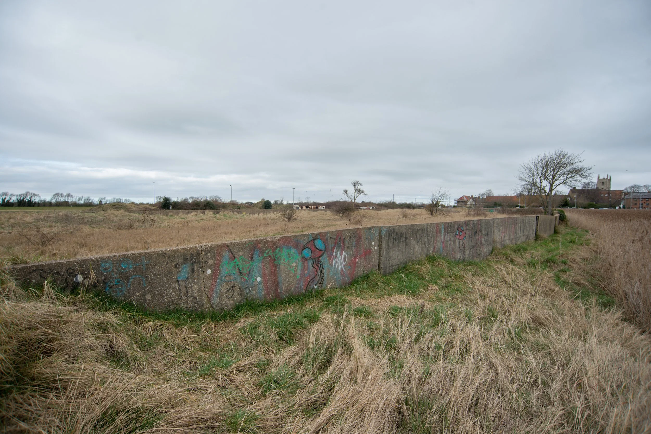
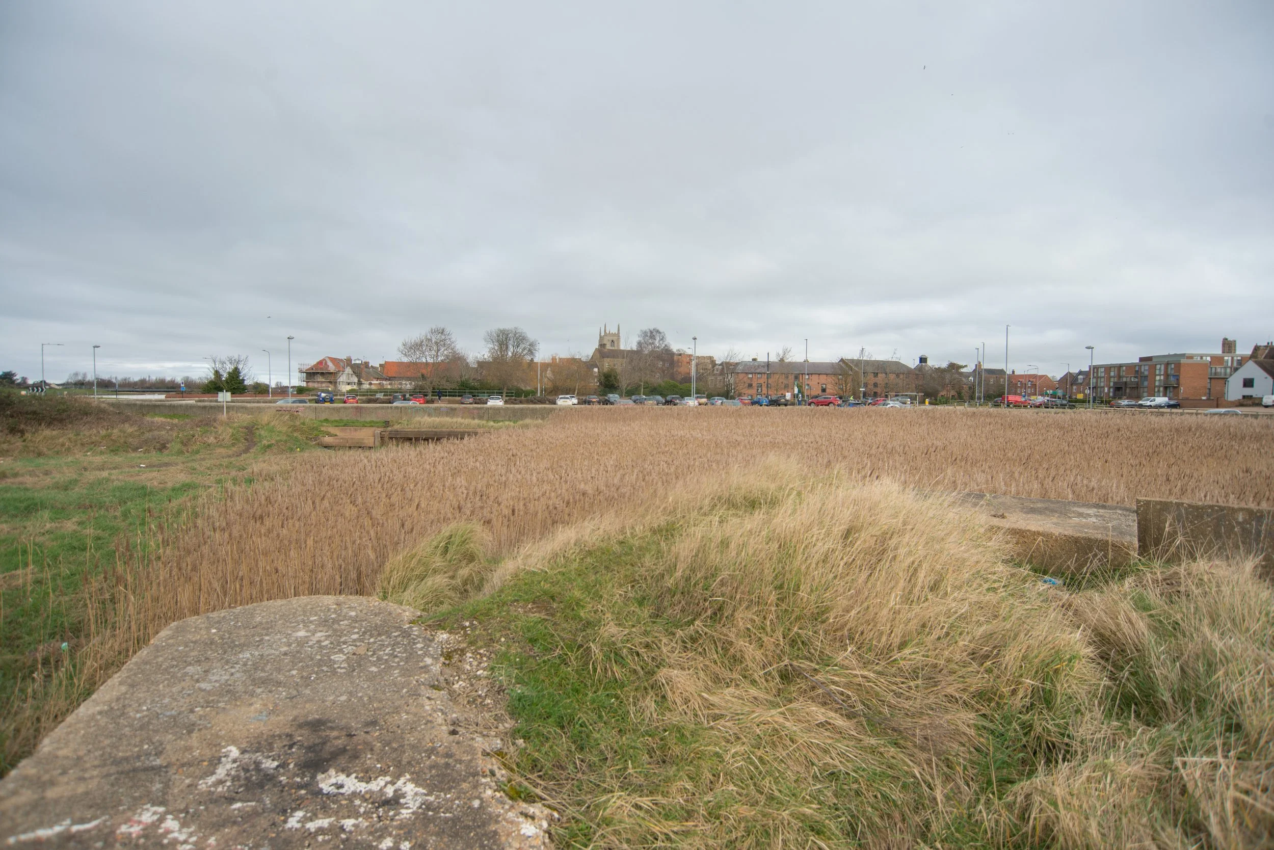
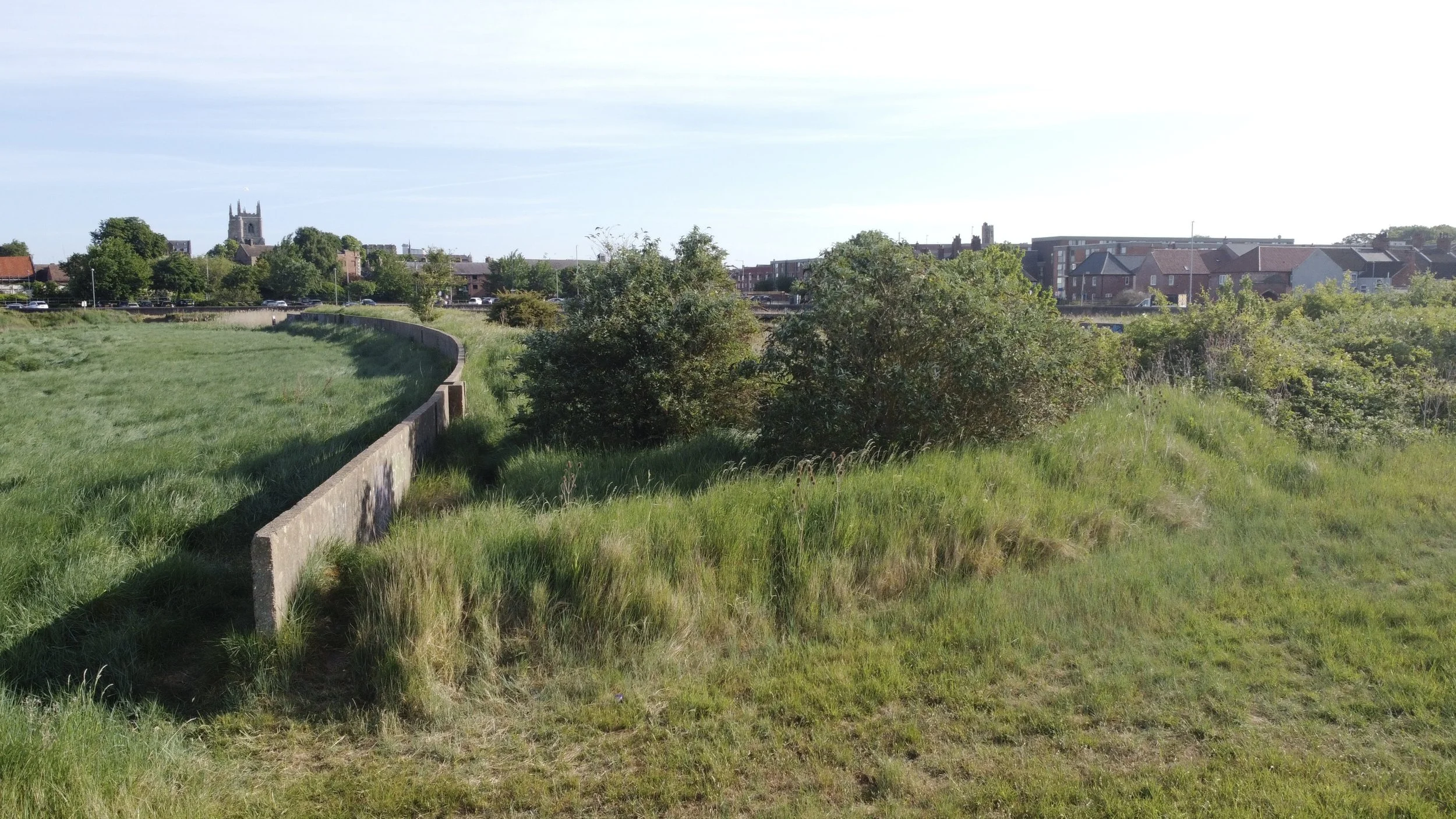
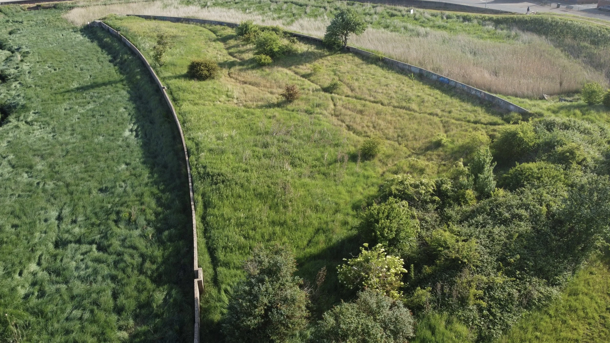
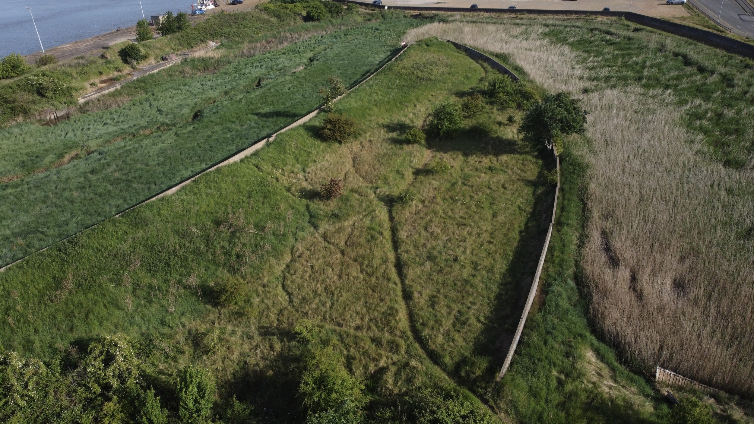
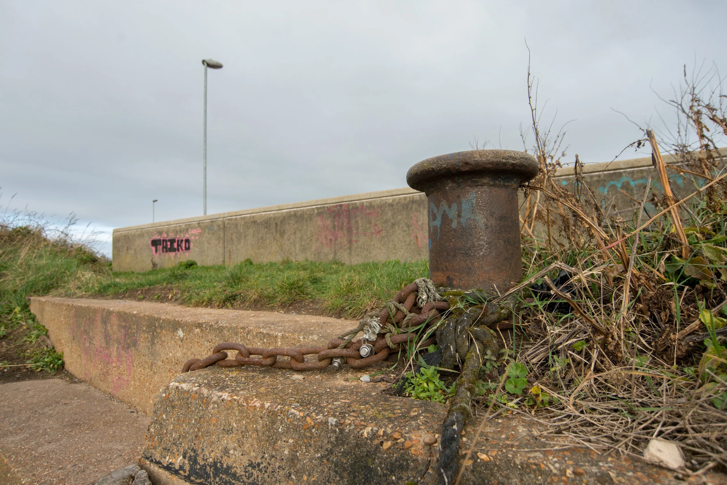
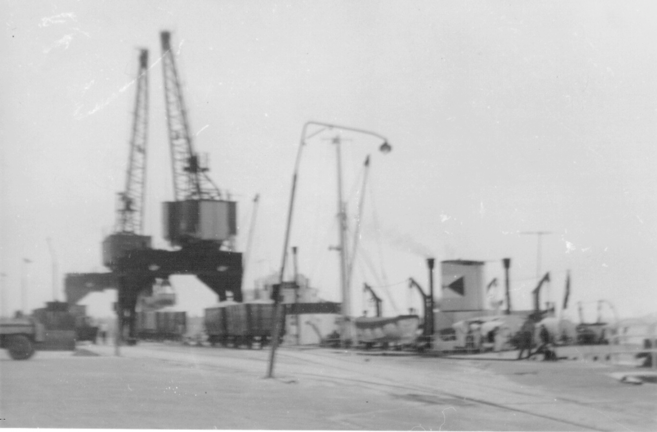
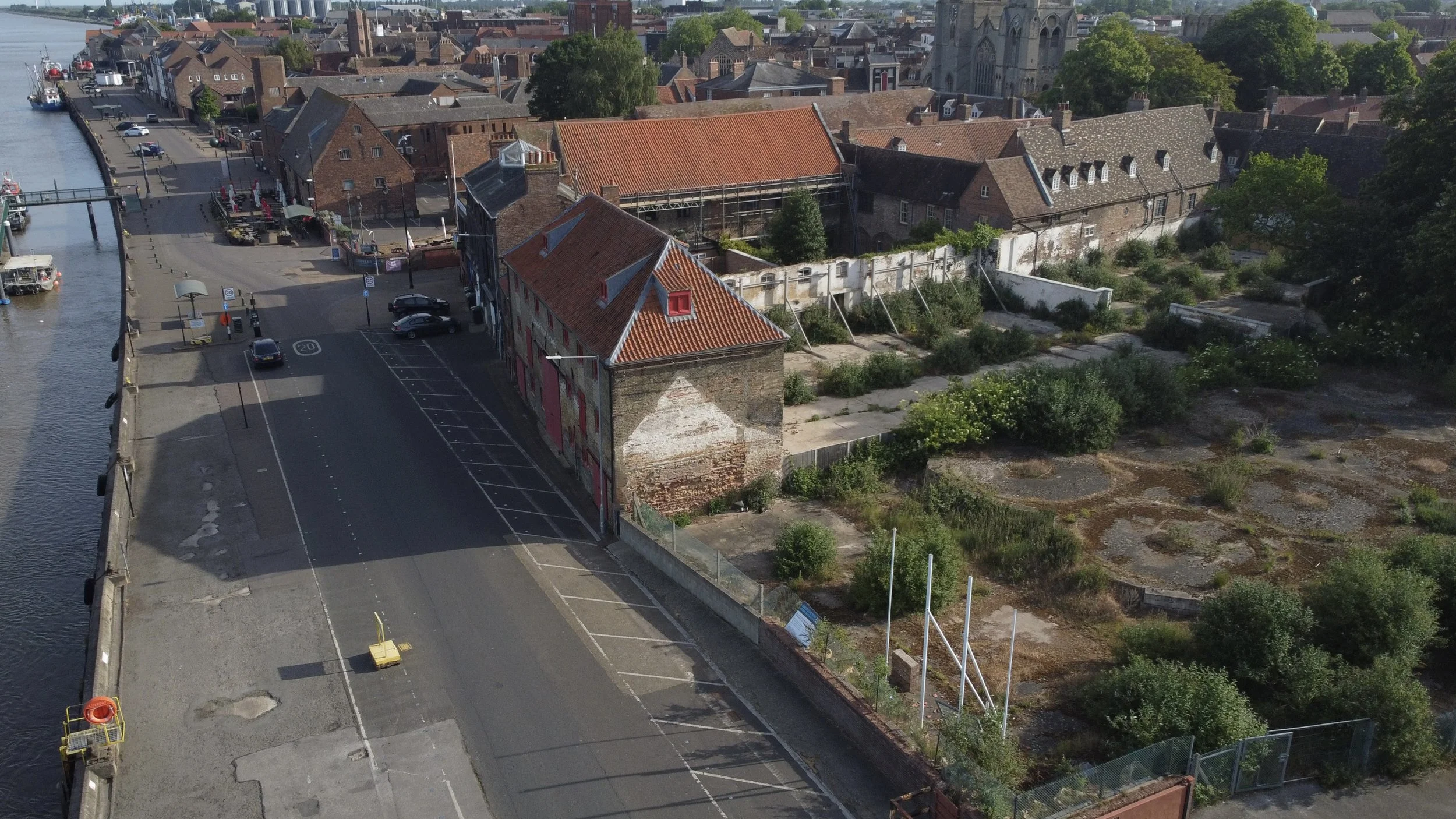
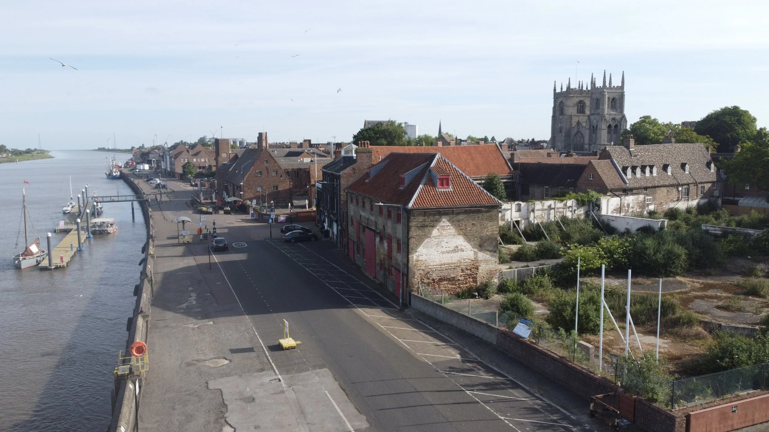
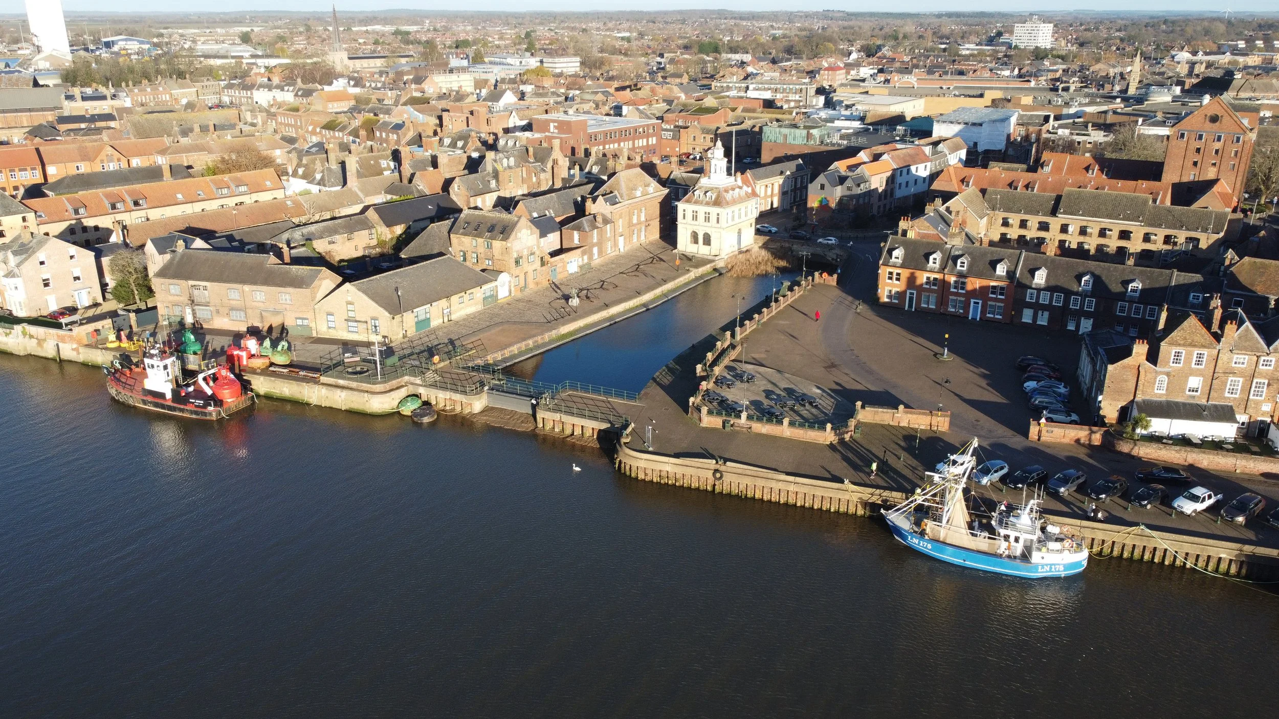
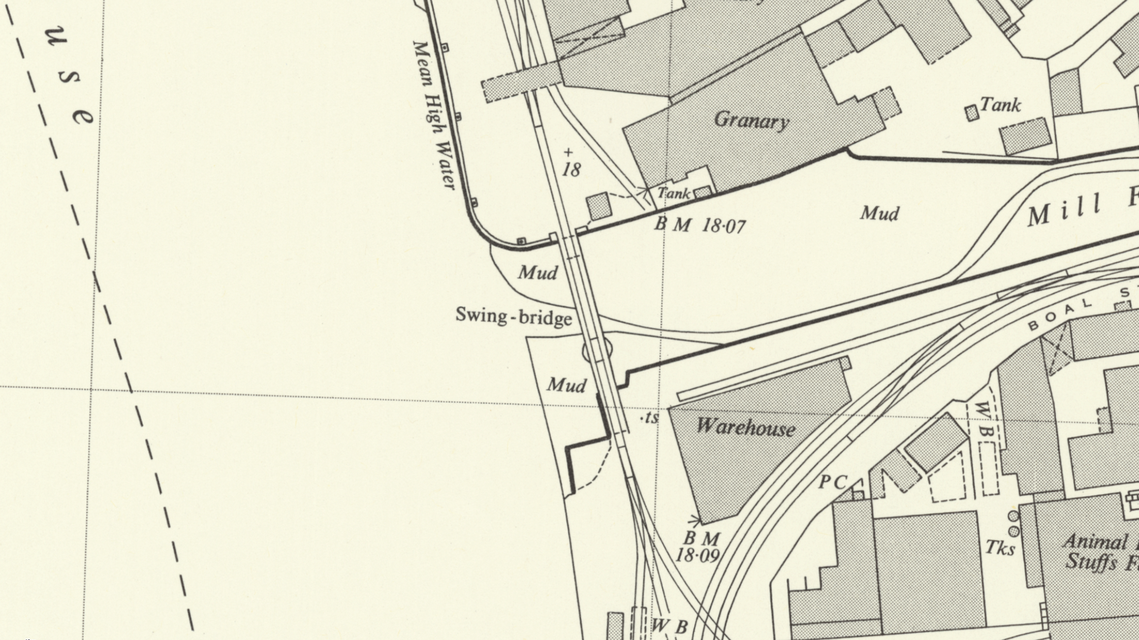
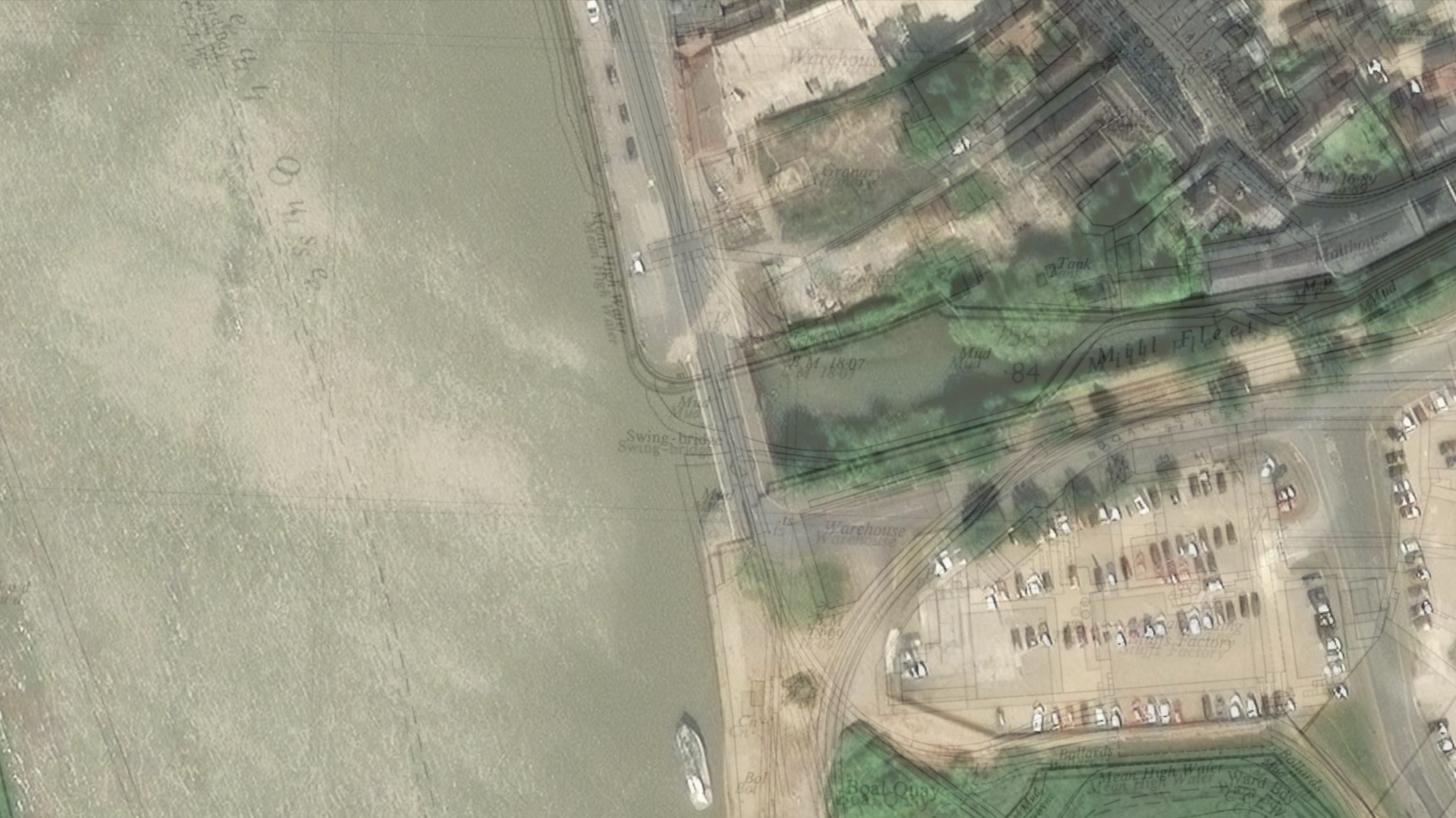
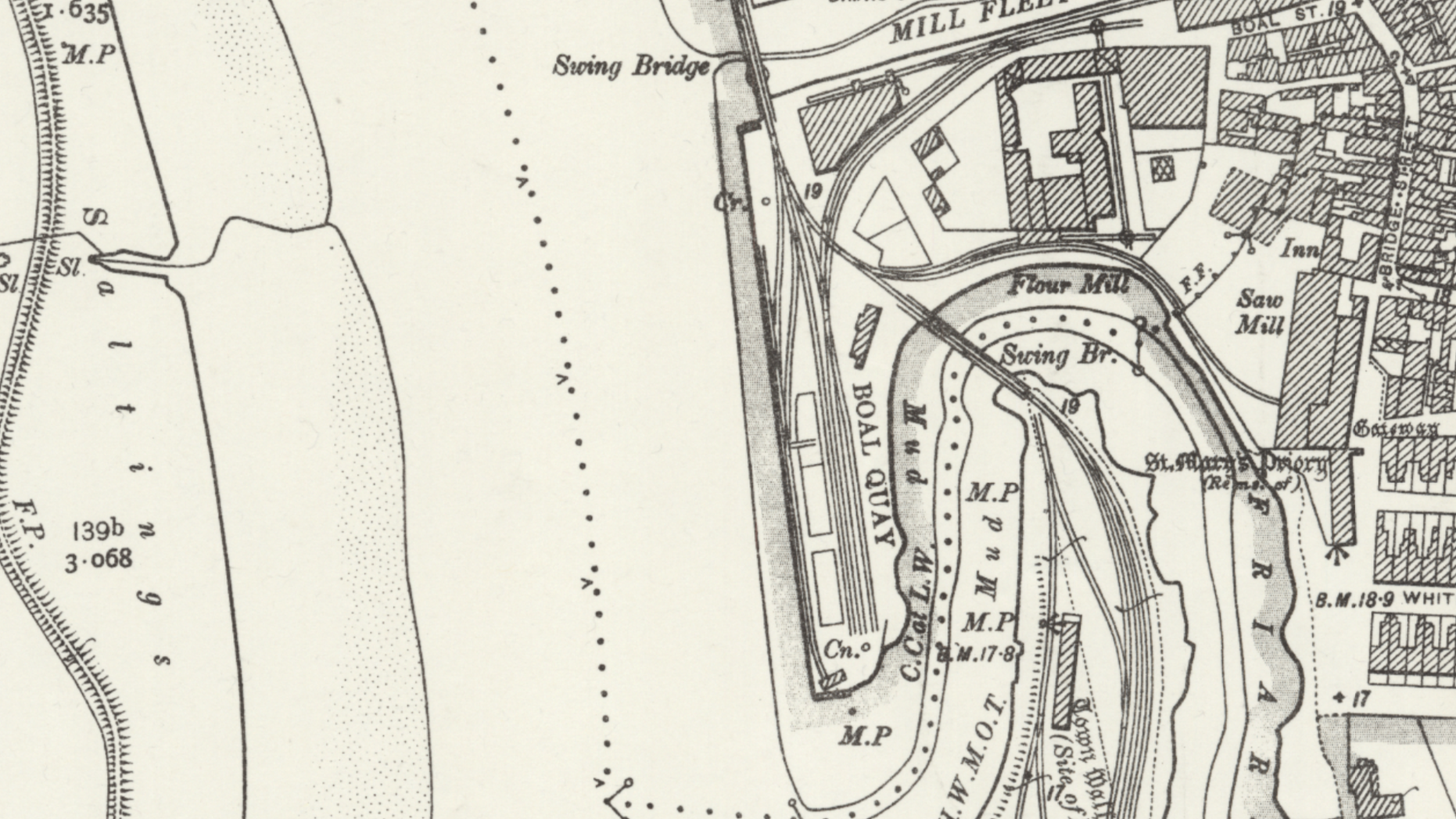
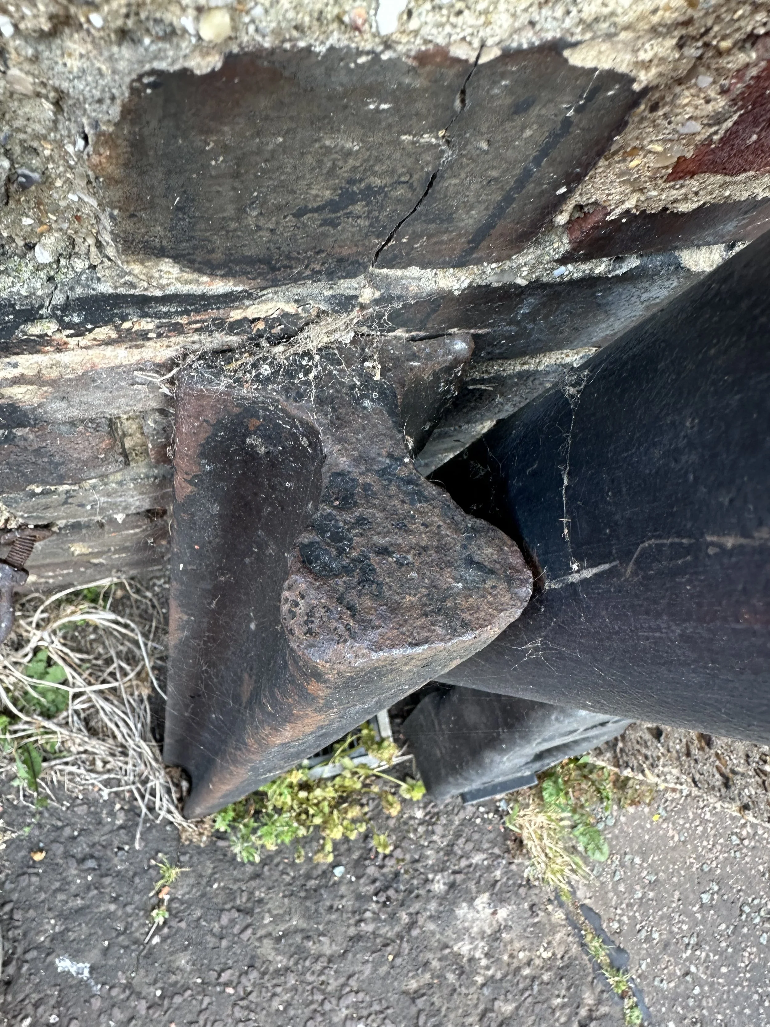
Harbour railway raised track bed & swing bridge
Next along the line, we come across the raised track bed that took the railway through the Quay and off towards King’s Lynn.
At the end of this raised track bed, the first of two swing bridges sat.

©National Library of Scotland
The King's Lynn Harbour branch railway track bed walls.
Photographed in 2023
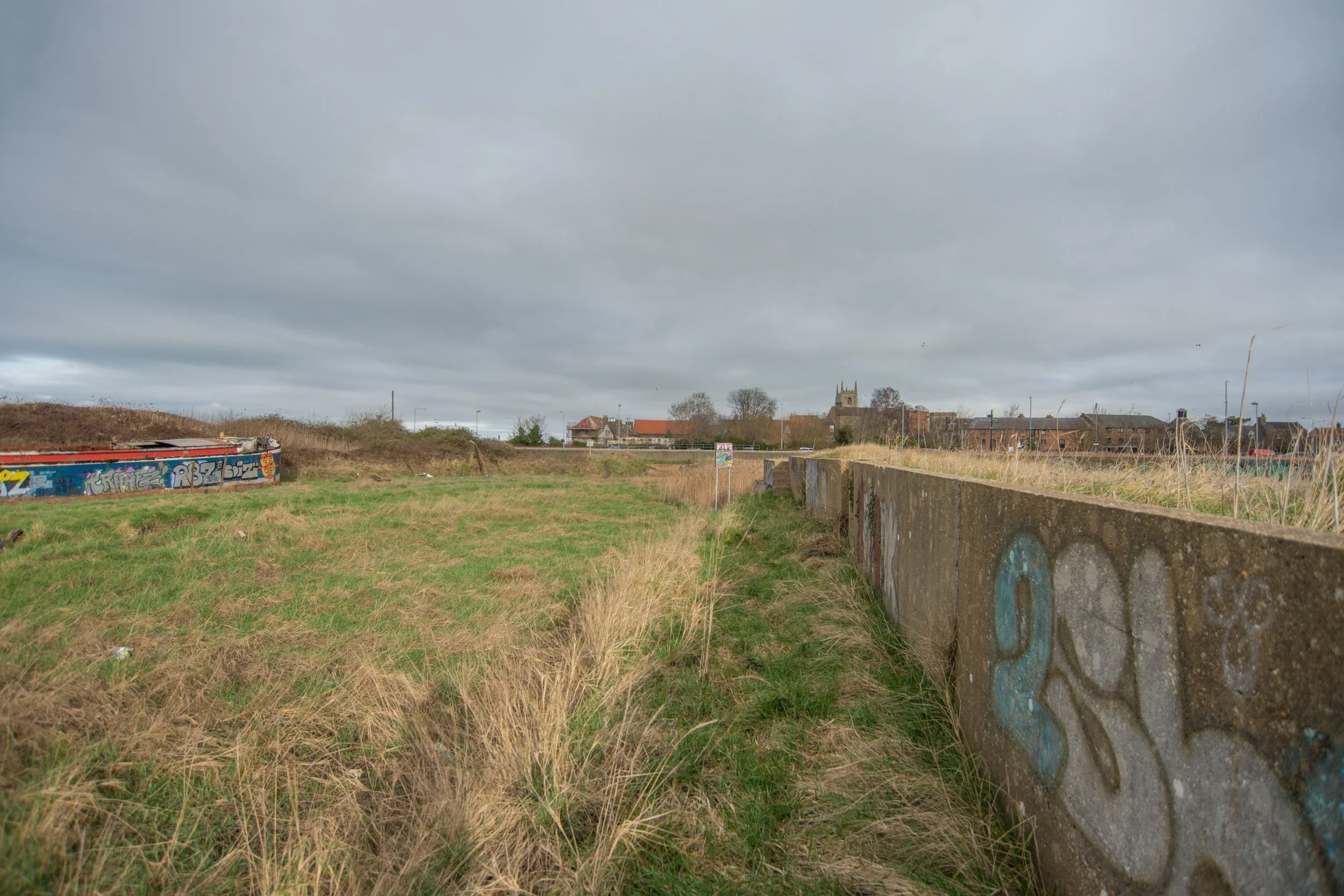
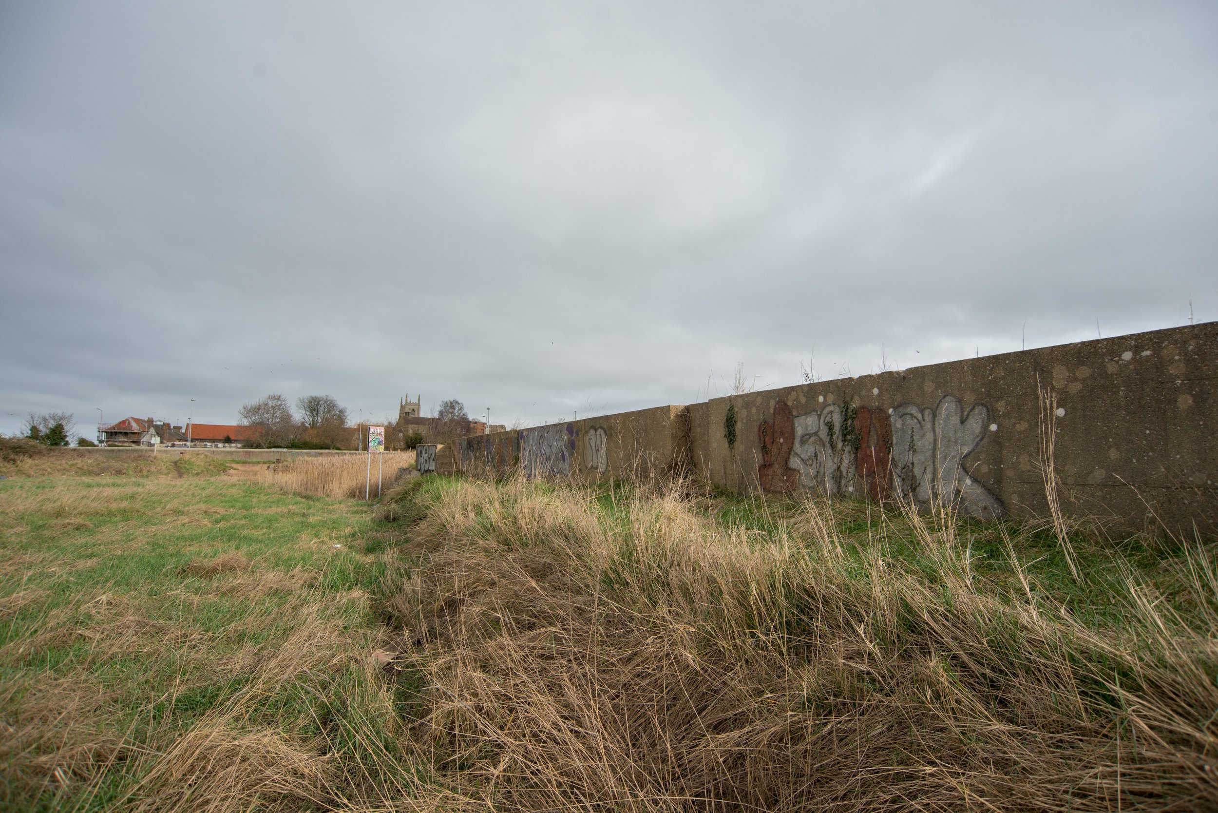
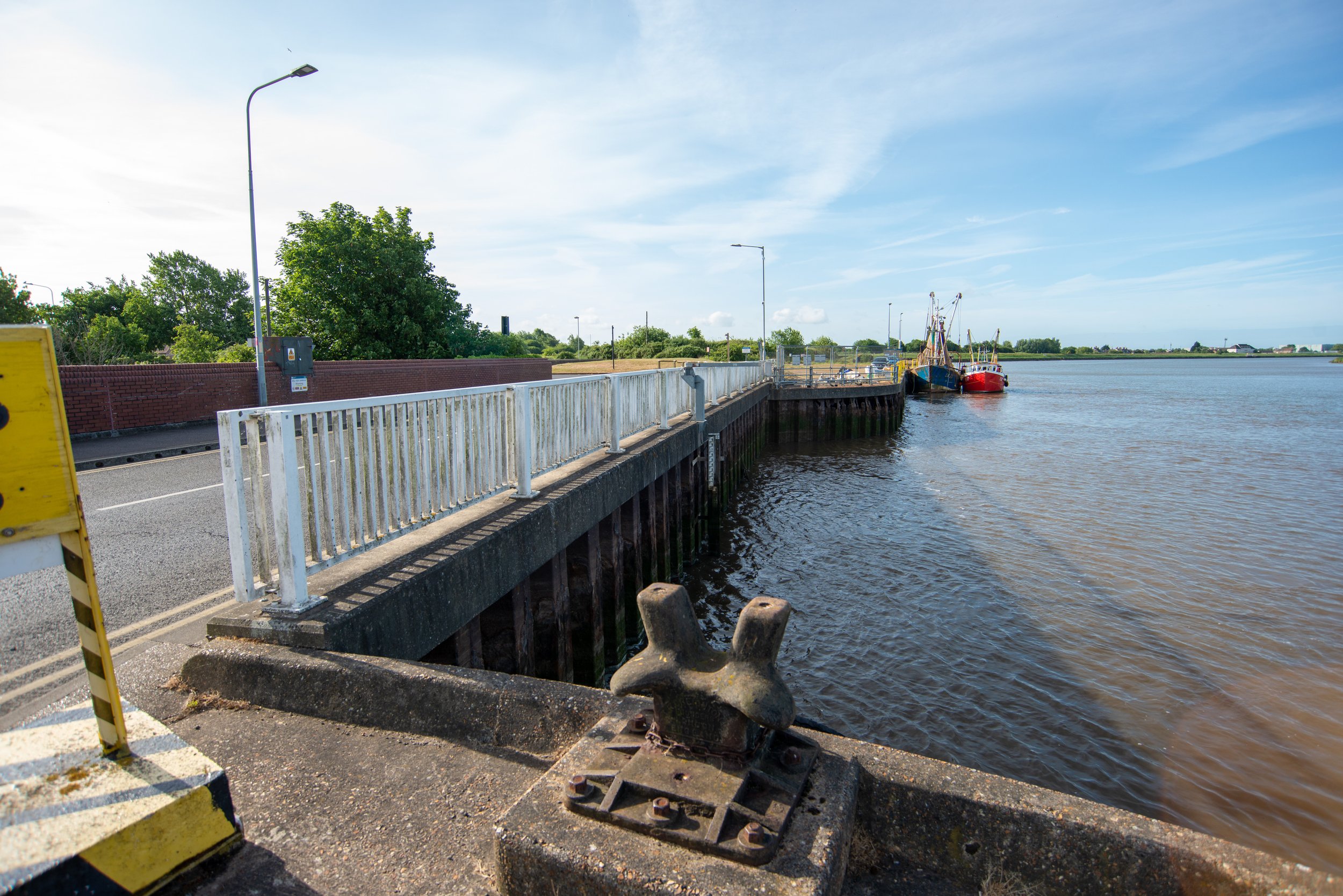
At the end of the railway track, there used to be a swing bridge that carried the railway over the River Ouse Channel and onto the South Quay at King's Lynn. The swing bridges were operated manually. They were reconstructed in 1894. A photograph taken in February 2023 shows that there is no longer any evidence of the swing bridge.
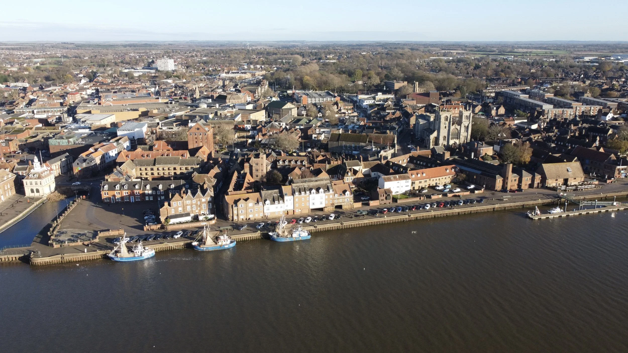
Aerial photography of the track bed walls
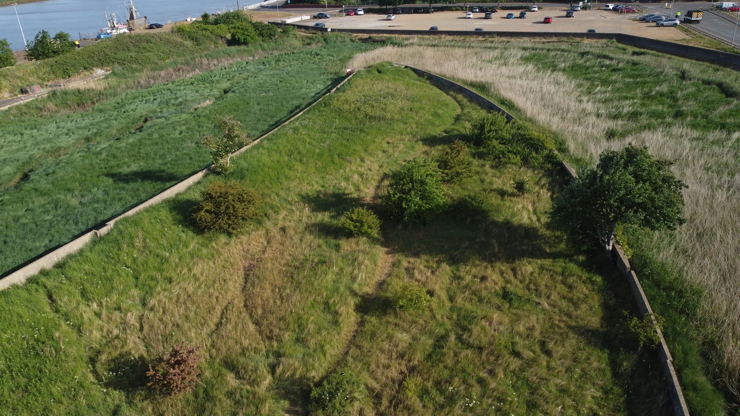
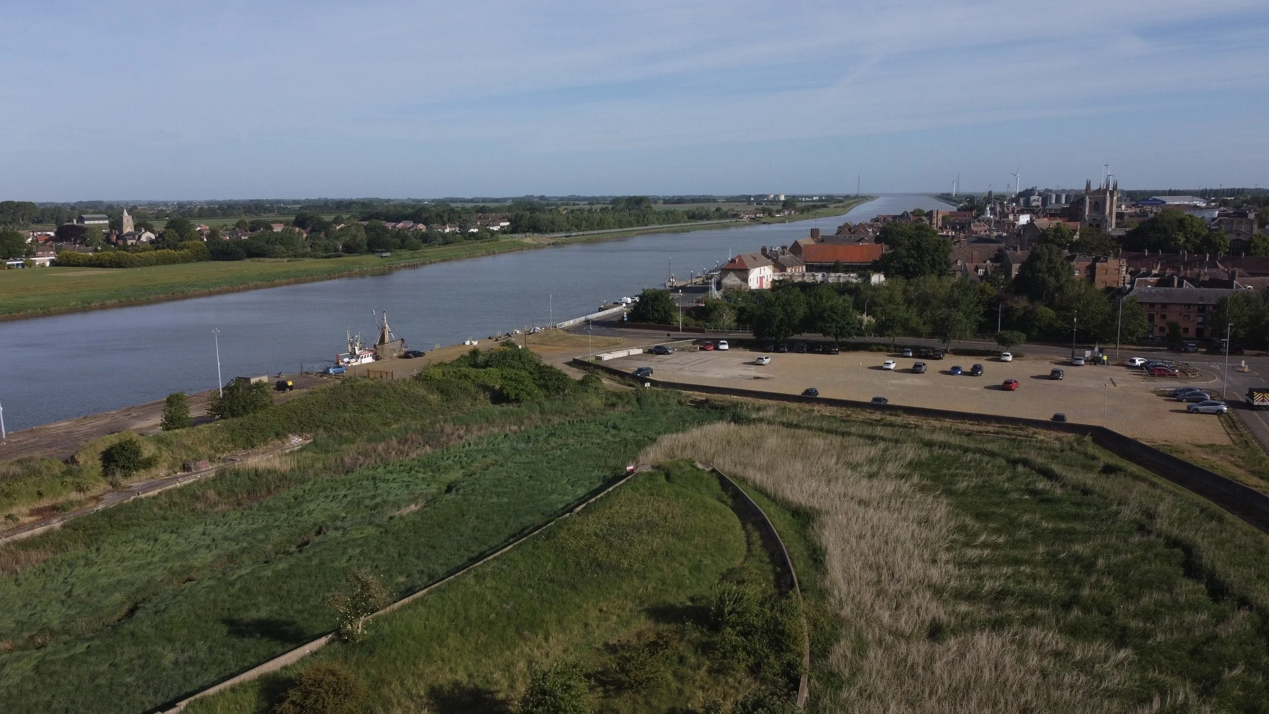
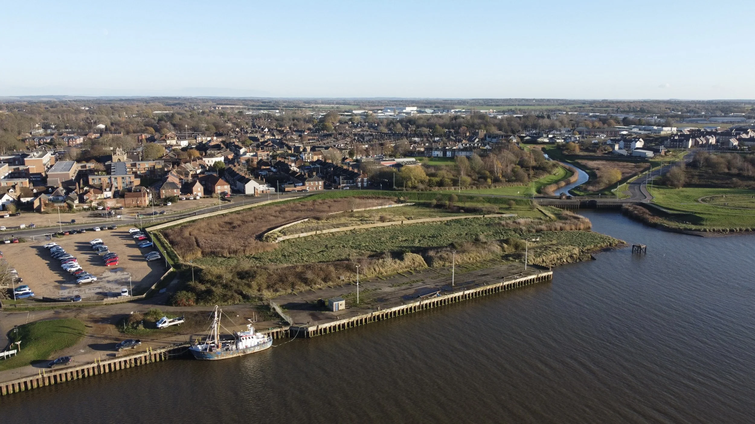
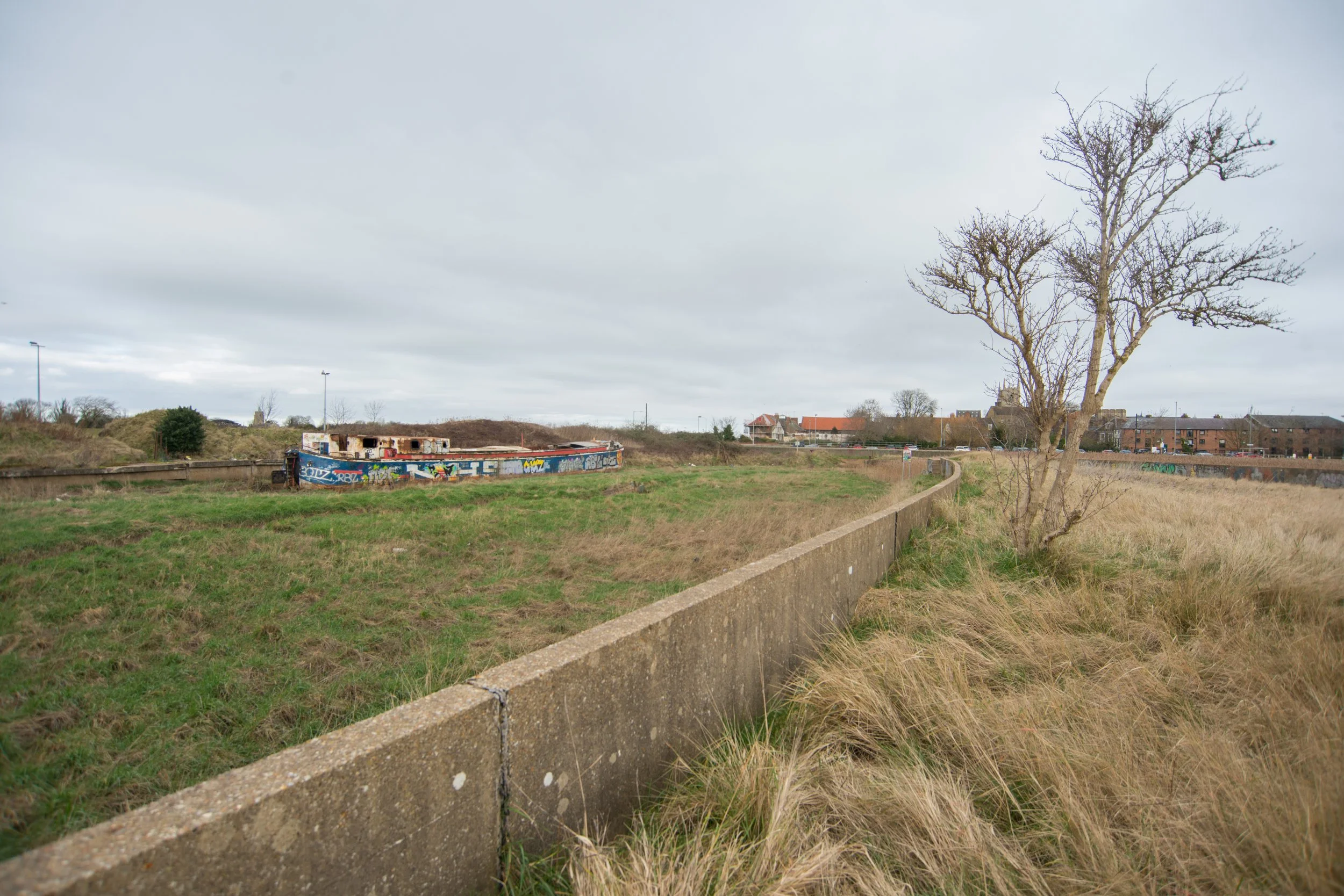
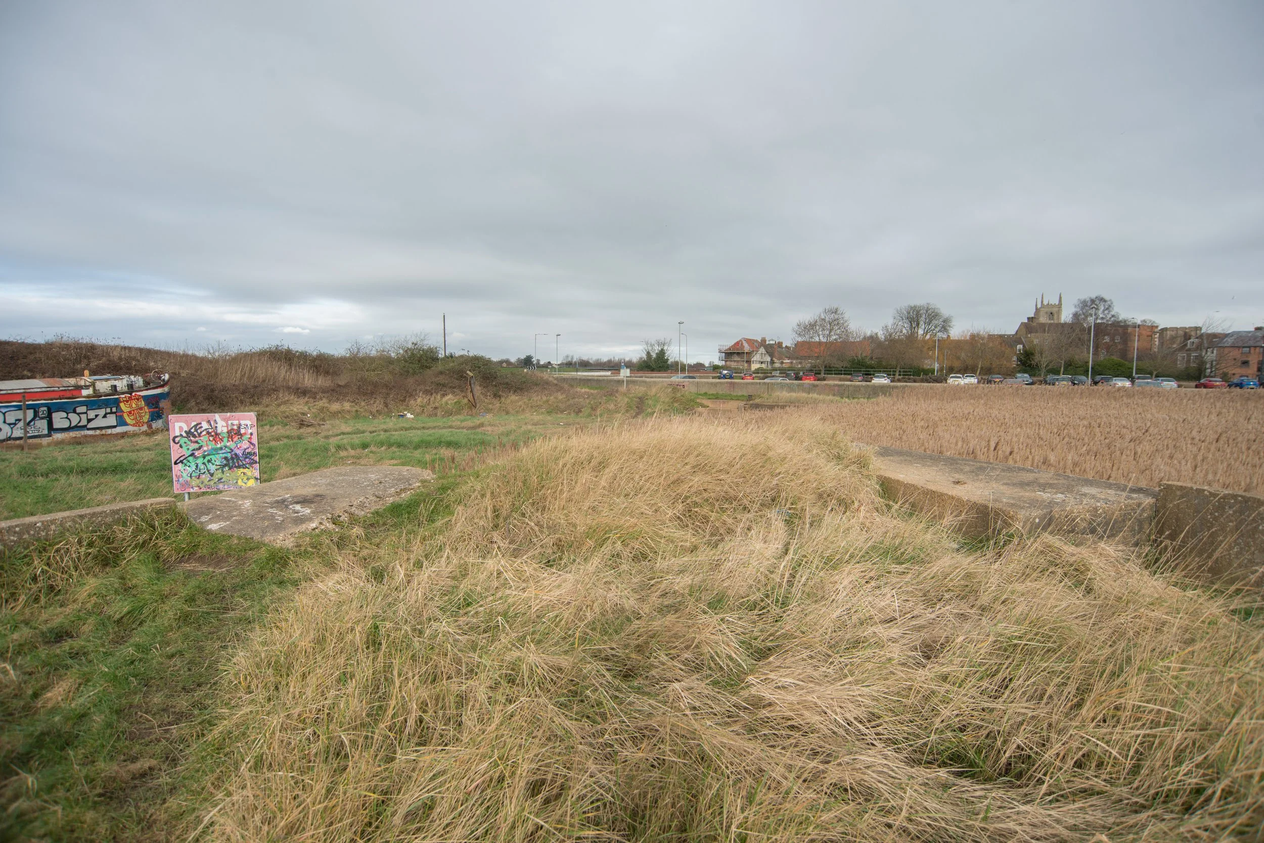
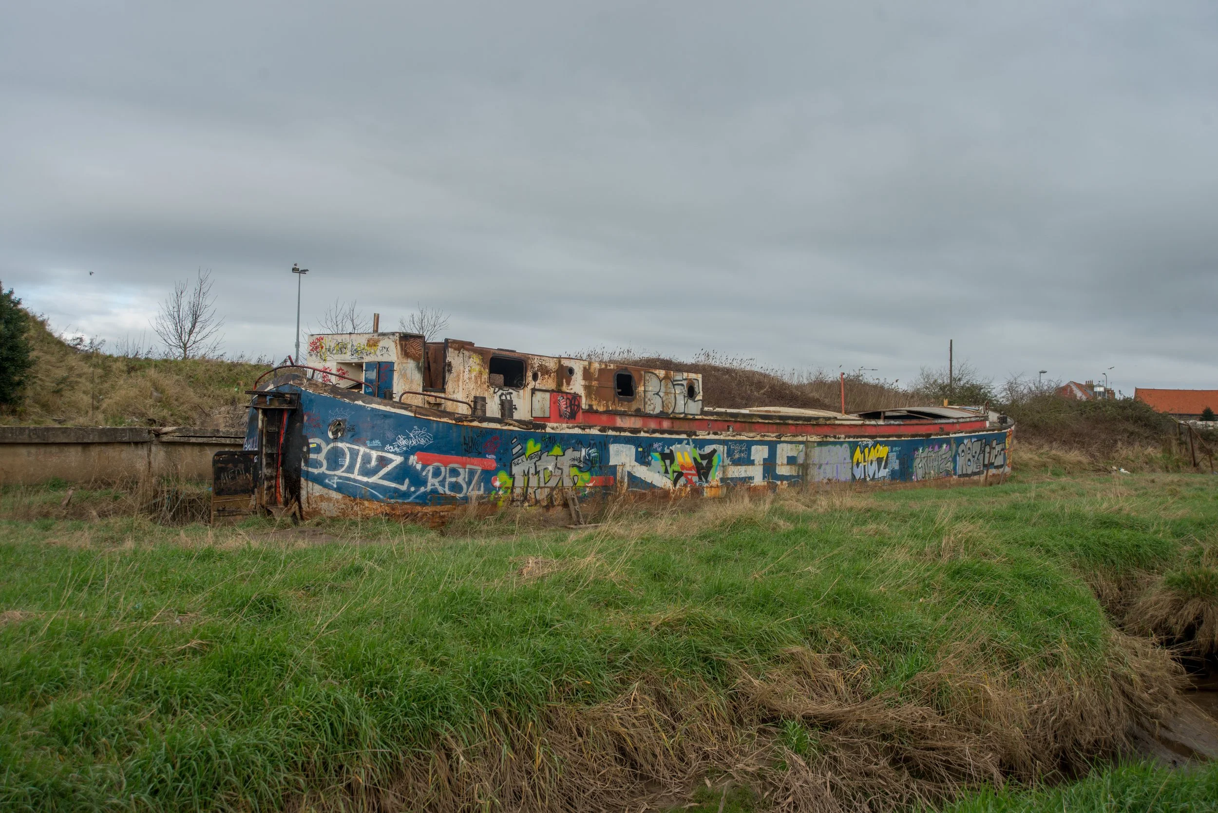
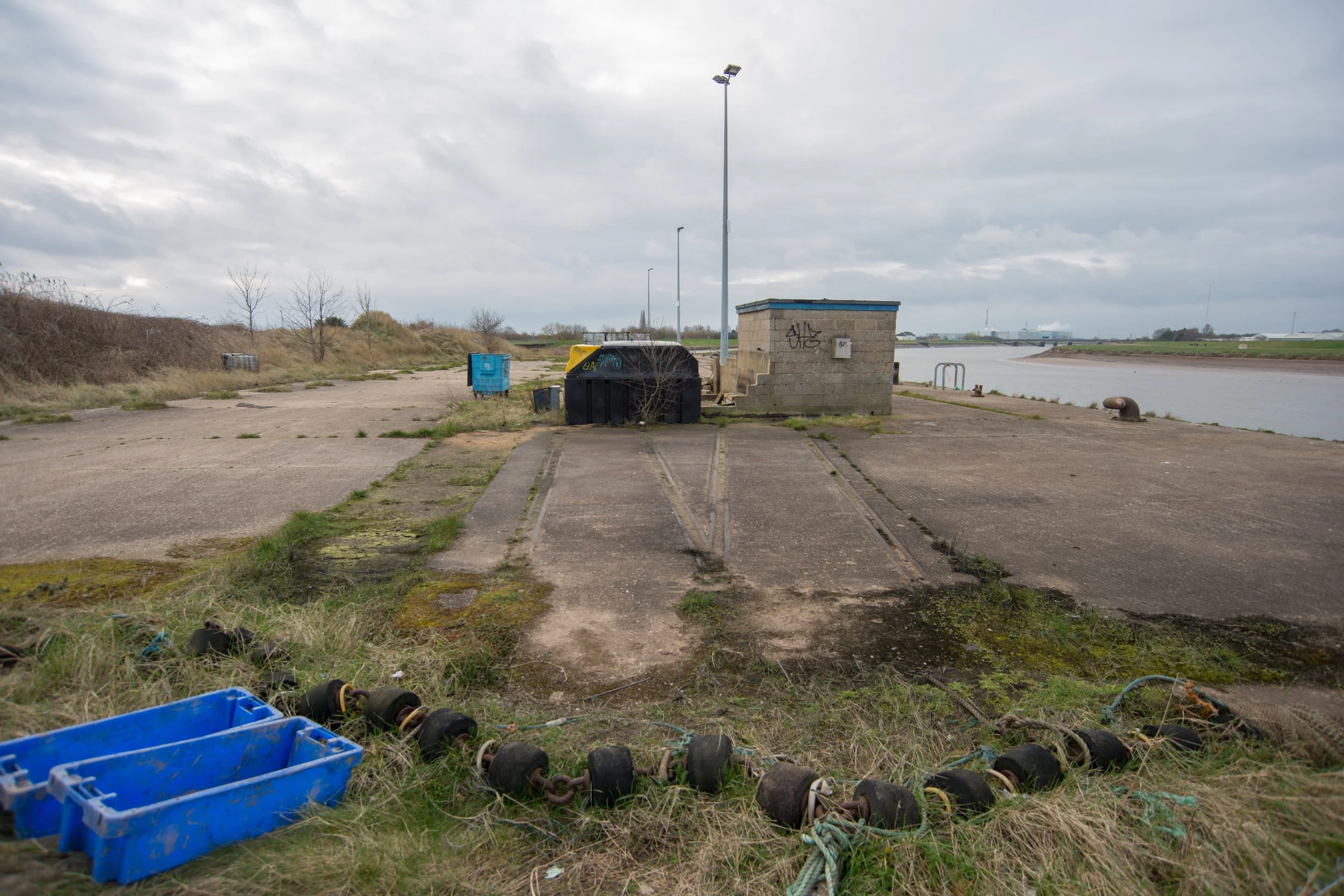
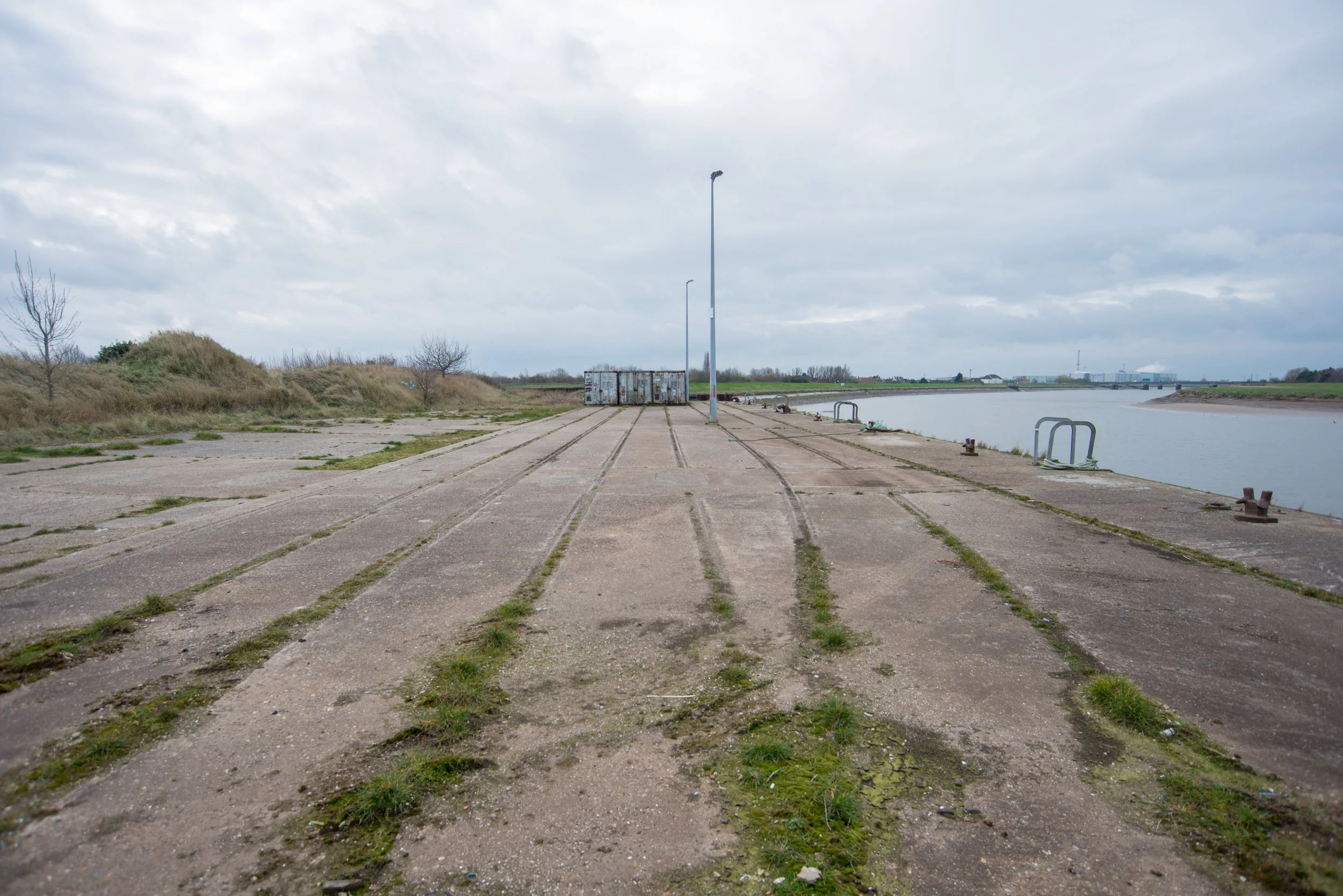
The disused dock area at the South Quay.
Although the dock area at South Quay has long been finished, some old parts still remained when I visited in 2022-2023. Sadly, in 2025, when I revisited for some drone shots, one of the old boats had been demolished.
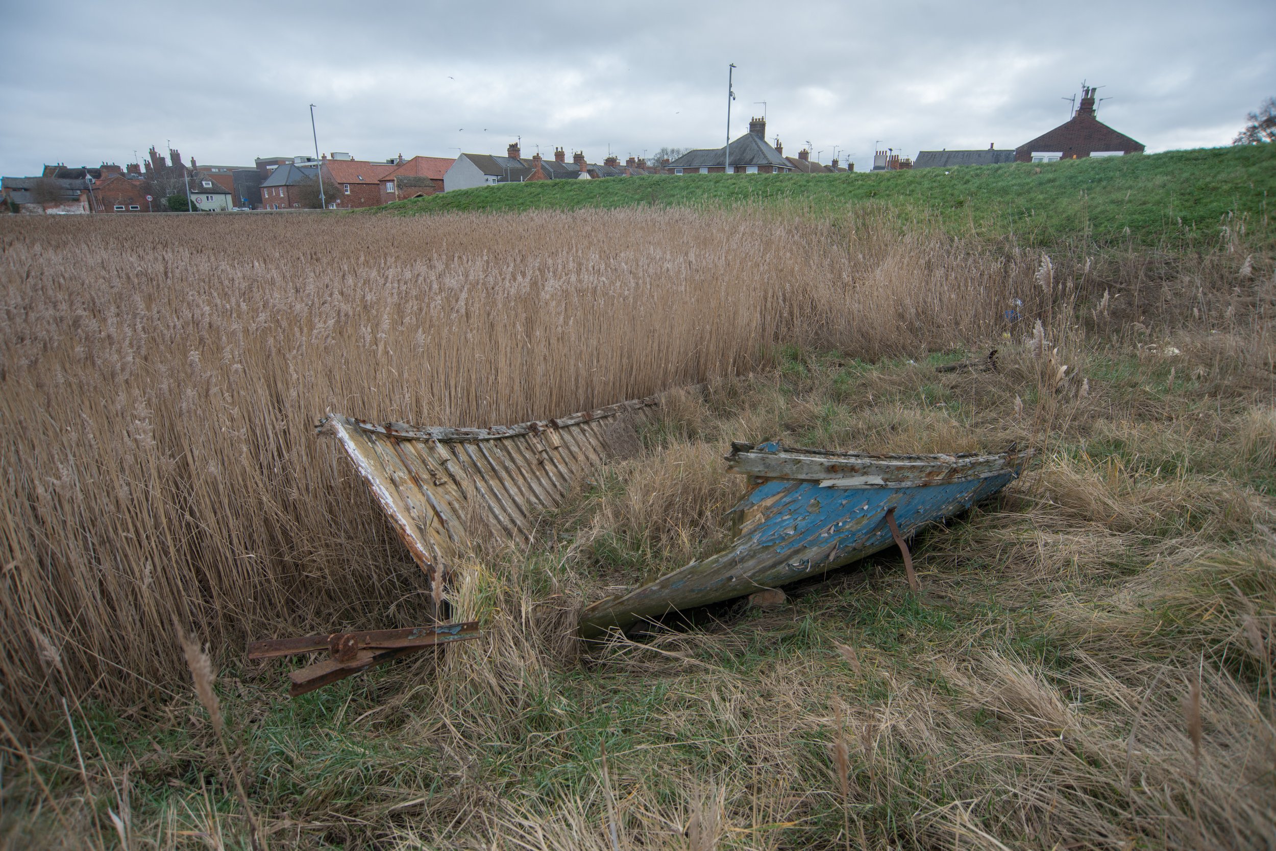


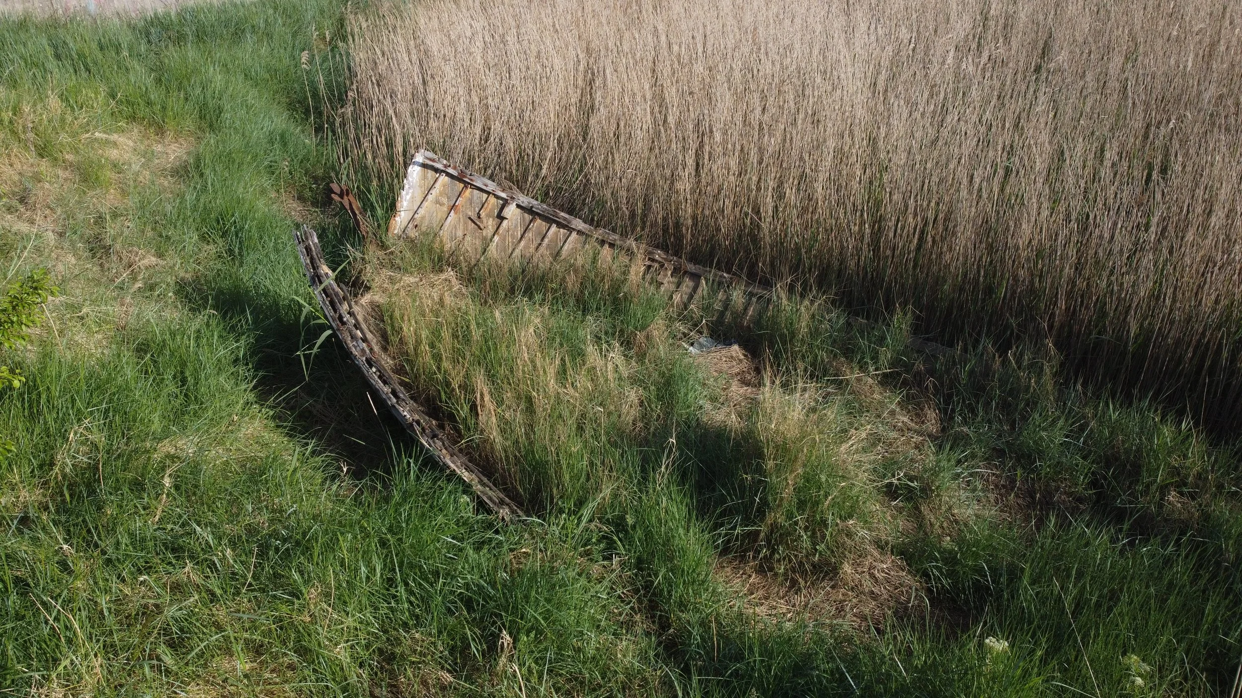
This old boat was also left behind and has since been demolished.

Thanks to John Fielding for permission via Twitter to use these aerial photos from John's fantastic Flickr profile.


I have permission to use the photos above; please do not copy this without asking.
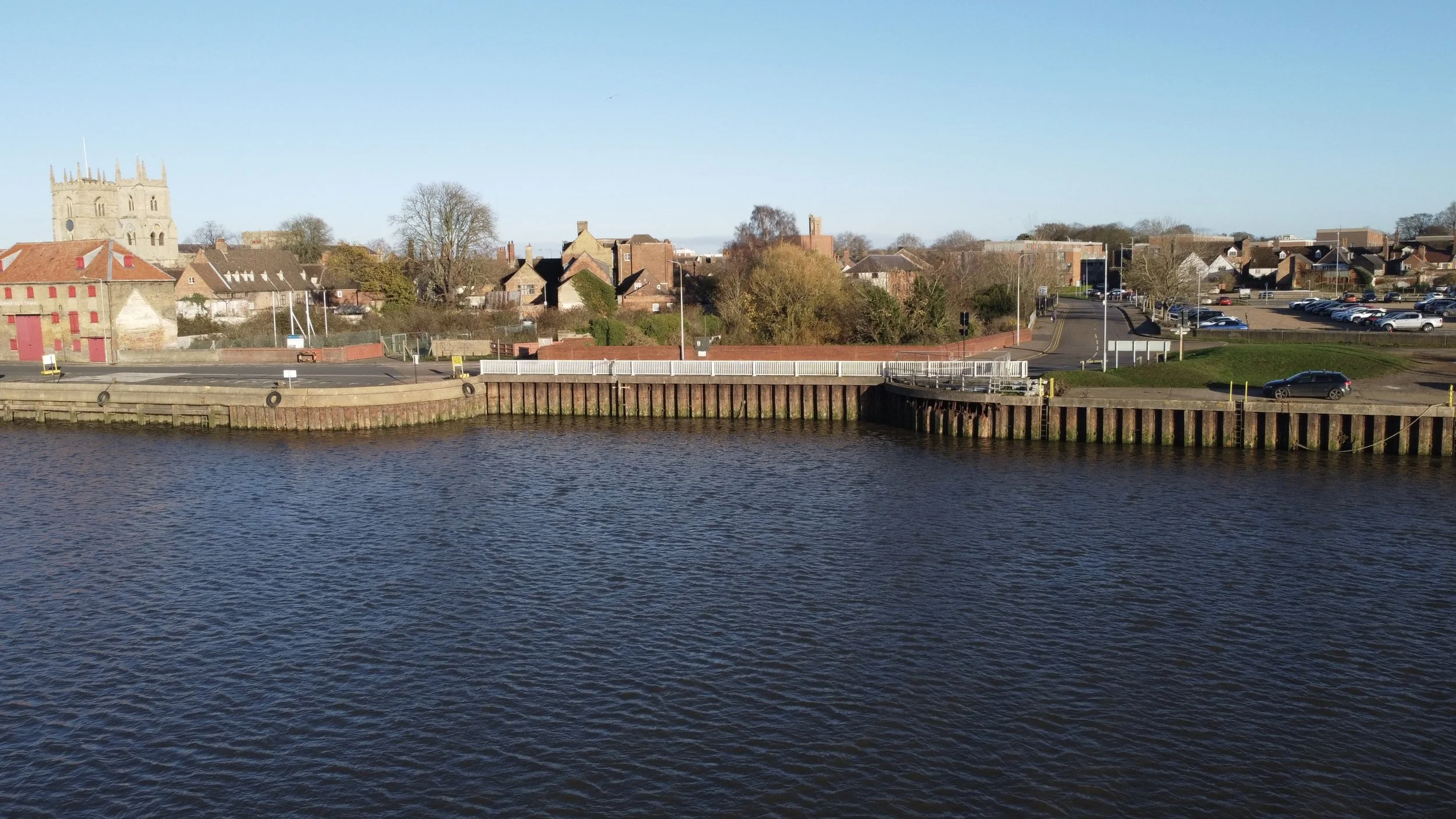
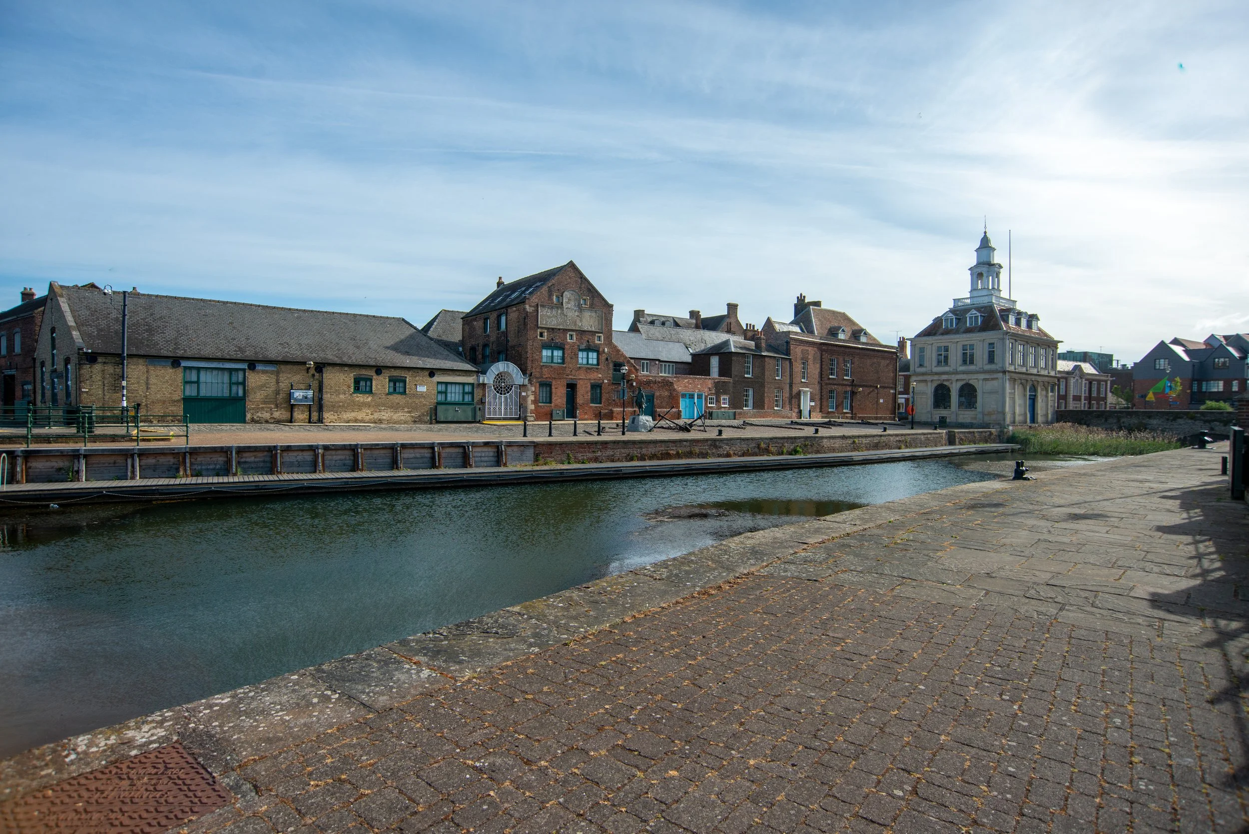
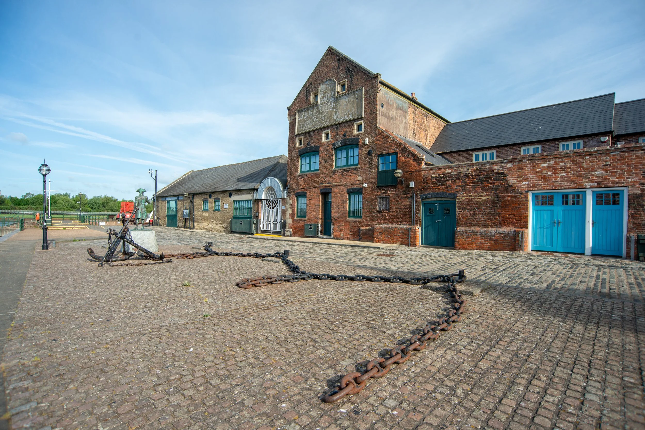
King’s Lynn South Quay
South Quay Historic maps

©National Library of Scotland
South Quay Past Photography
Pictures of the South Quay at King’s Lynn in different years of its life.
The years are unknown, as is the photographer.
Used from ©King's Lynn Forums.


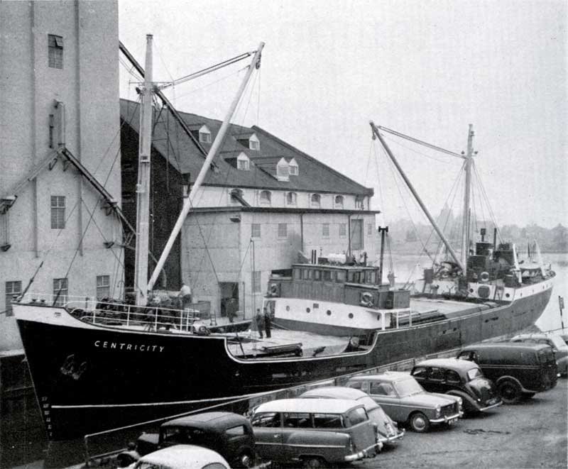
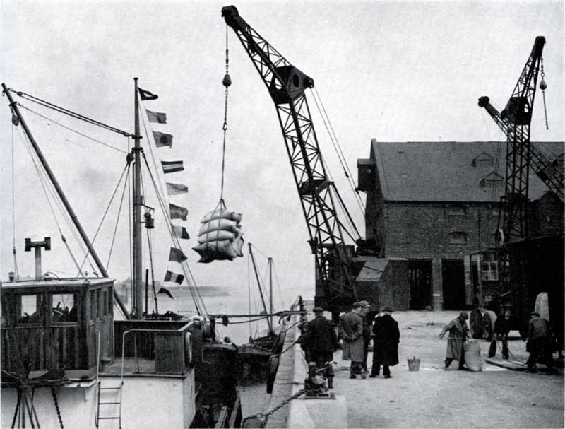

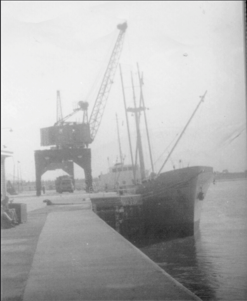
The following photos have been kindly shared with permission from a Flickr account named simonslittlelocos.
All photos are credited as ©H M Littleworth, Simon’s Late Father.

©License All rights reserved by simonslittlelocos

©License All rights reserved by simonslittlelocos

©License All rights reserved by simonslittlelocos
©License All rights reserved by simonslittlelocos
©License All rights reserved by simonslittlelocos
©License All rights reserved by simonslittlelocos

©License All rights reserved by simonslittlelocos
©License All rights reserved by simonslittlelocos
©License All rights reserved by simonslittlelocos
South Quay Historic Aerial Photography
The photos below shows the railway entering the South Quay at King’s Lynn, with the swing bridge and raised track beds leading to the Quay.

Thanks to Historic England for the aerial photo. Please click on the photo for a link to the source page.

Thanks to Historic England for the aerial photo. Please click on the photo for a link to the source page.

Thanks to Historic England for the aerial photo. Please click on the photo for a link to the source page.
South Quay Modern Aerial Photography
All photos below were taken by me at various times in 2025, unless stated otherwise.
Thanks to John Fielding for the modern aerial pictures, as seen below, donated from his Flickr page.

South Quay Second Swing bridge.
©National Library of Scotland
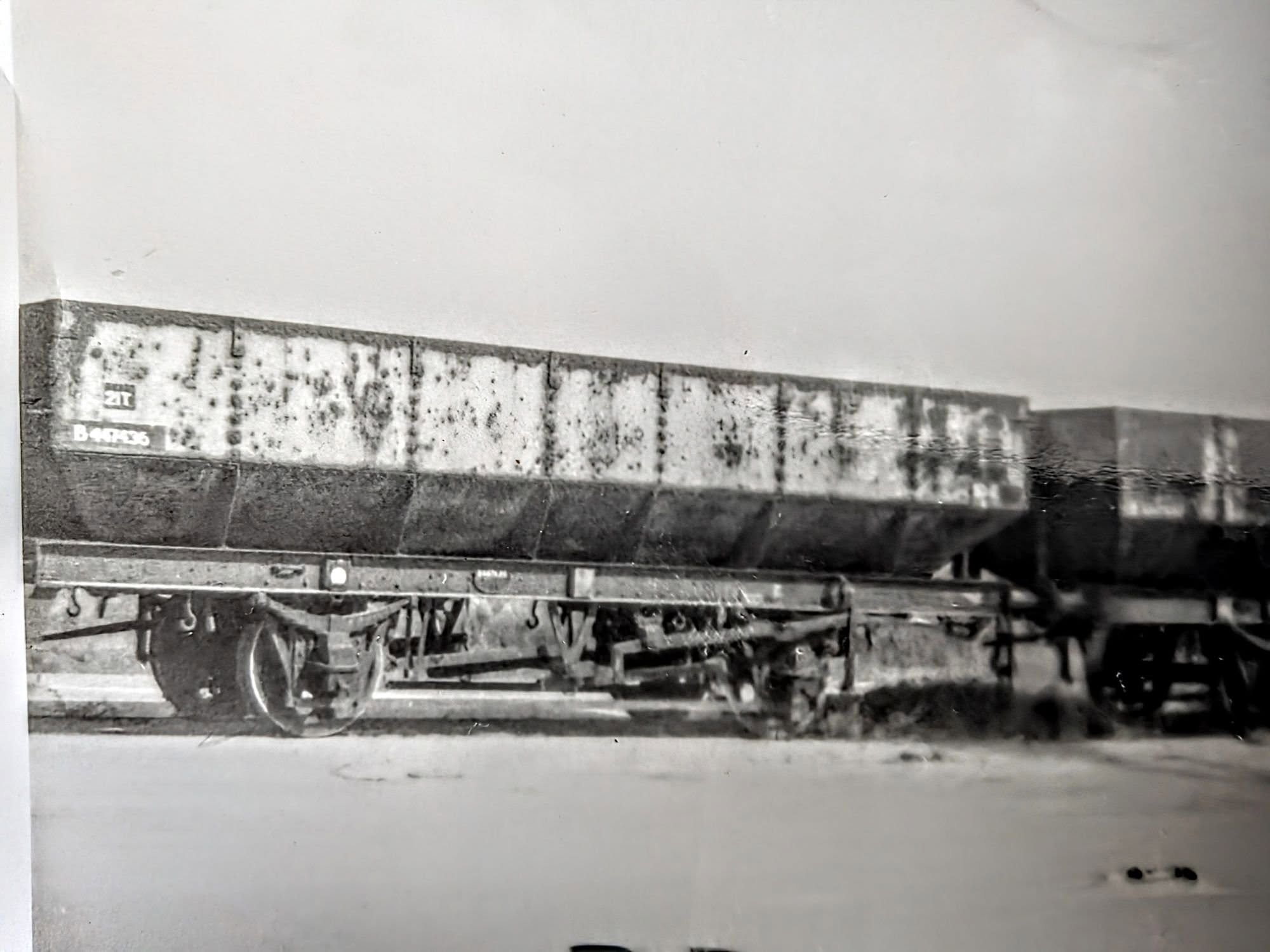
At King's Lynn's South Quay, there was once a second swing bridge that allowed the railway to cross and also swung open to let boats enter the Mill fleet. Once again, we see the historical picture donated to me by Simon's Little Locos, from his late father's collection. Showing the swing bridge at the South Quay. Many thanks once again.
The Photo is credited as ©H M Littleworth, Simon’s Late Father.
©©License All rights reserved by simonslittlelocos
Photographed 2025
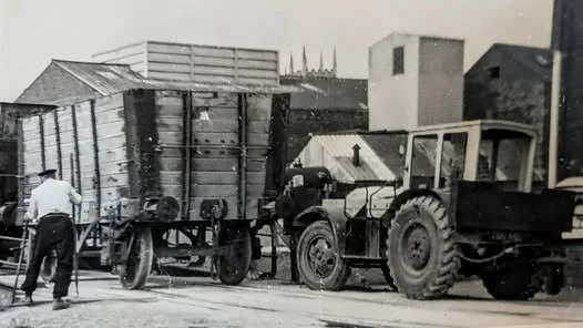
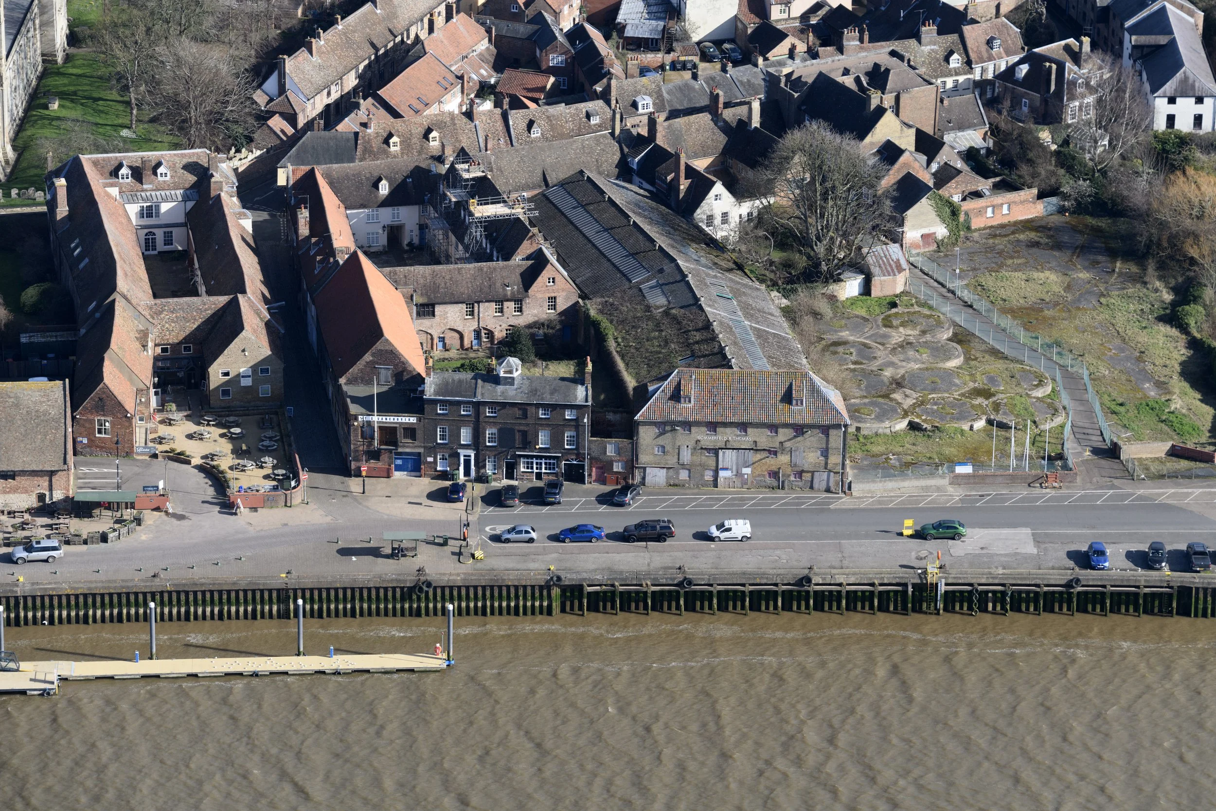
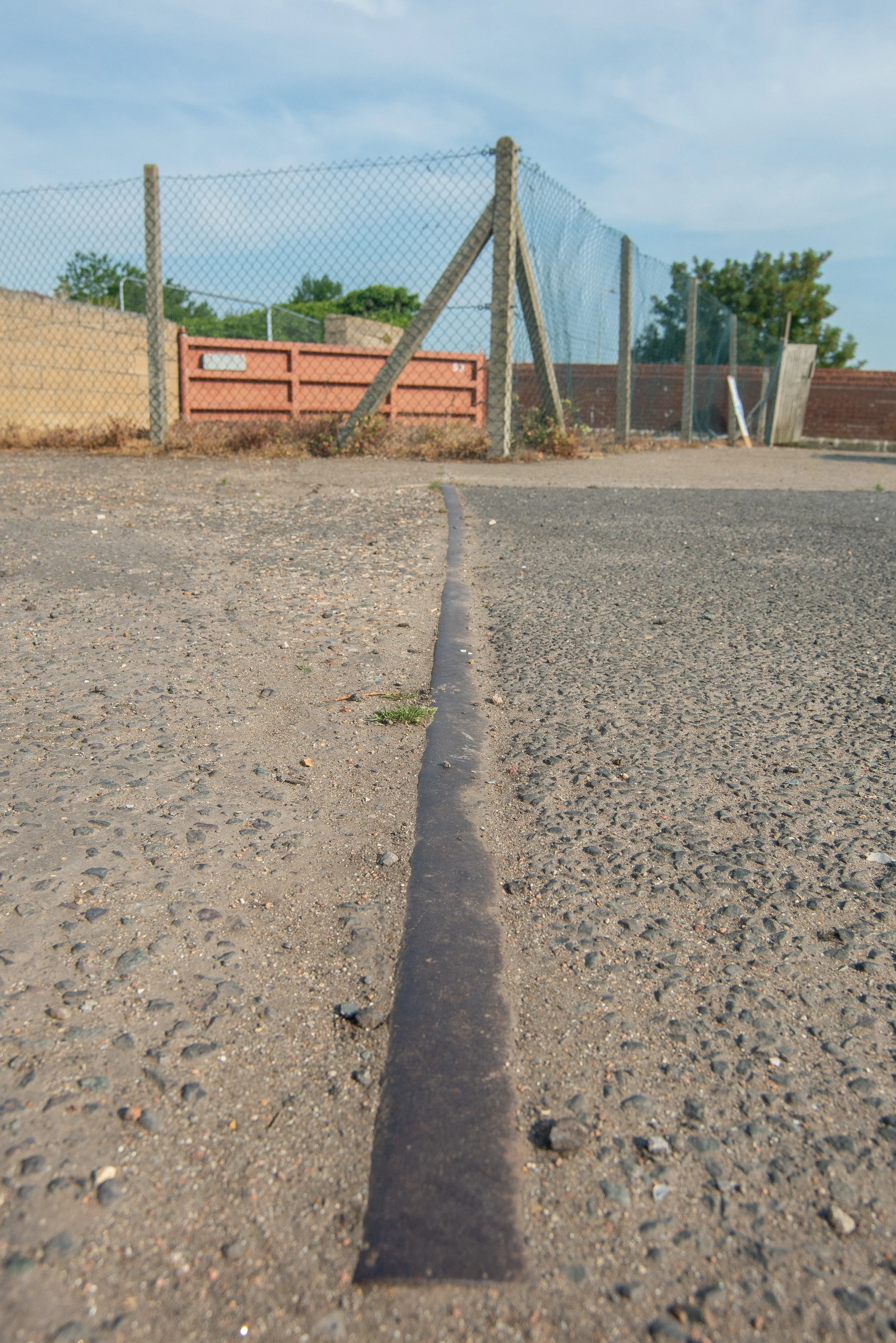
South Quay remaining railway tracks.
In March 2022, I discovered some old tracks on the south Quay that, at first, I assumed were part of a siding. Looking at historic maps, it seems they were used as sidings and also for a travelling crane.
Once again, we see the historical picture donated to me by Simon's Little Locos, from his late father's collection. Many thanks once again.
The Photo is credited as ©H M Littleworth, Simon’s Late Father.s
Photographed 2023
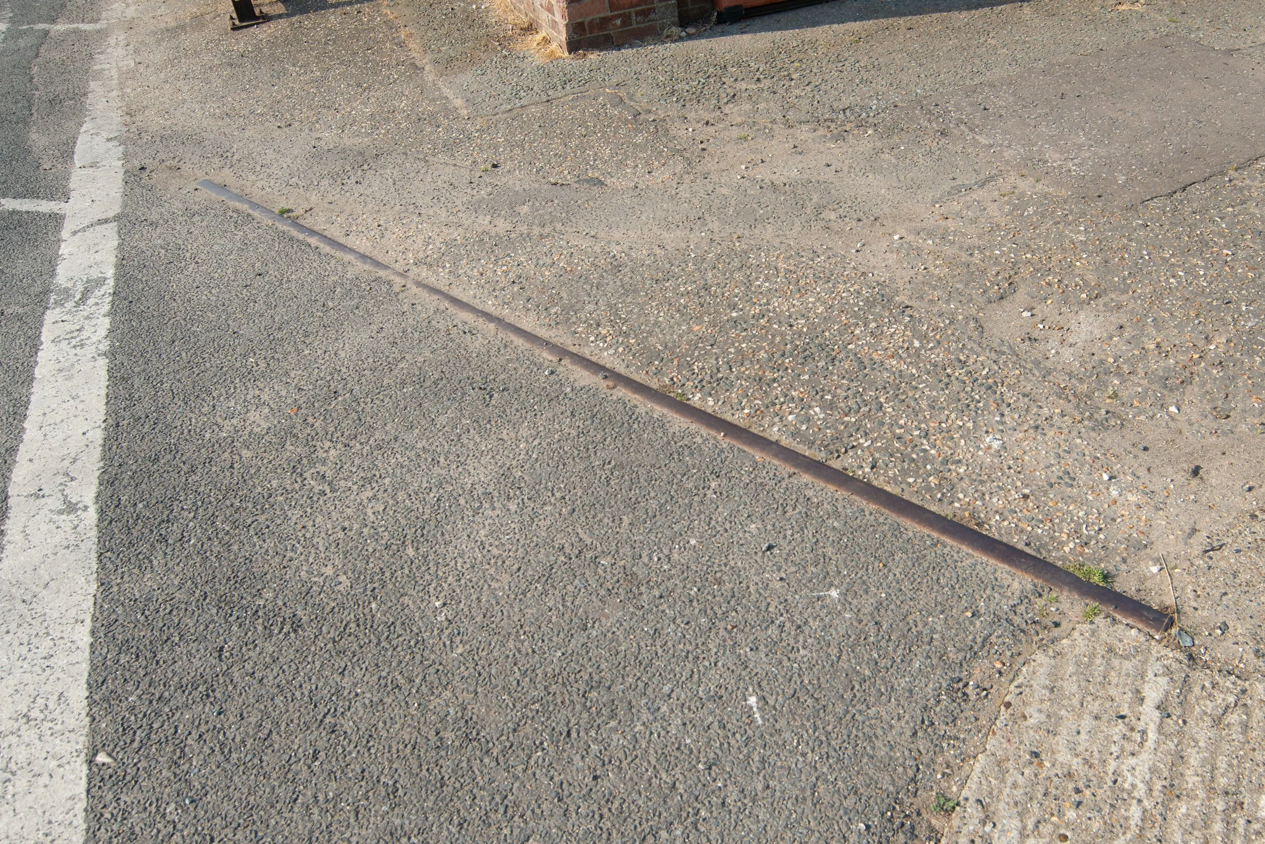
"Thanks to a tip-off, I found this old piece of railway track on the Quay at King’s Lynn near Devil's Alley. Historical maps indicate that it was part of a siding for the Granary."


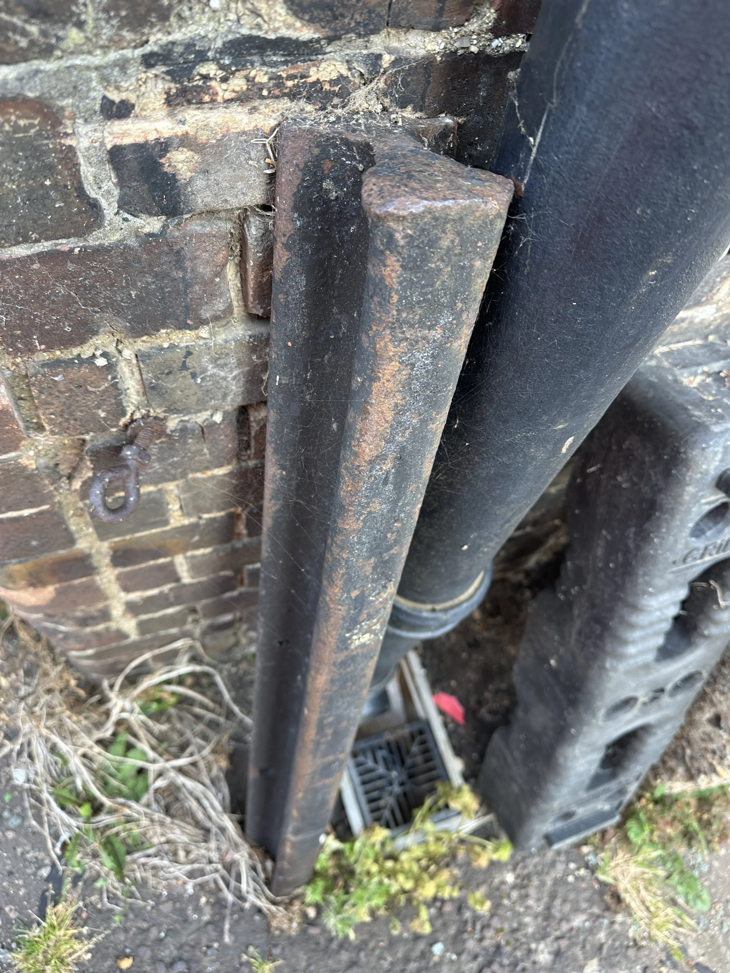
Whilst working in the area in 2026, I found what appear to be old narrow-gauge railway tracks that are now repurposed as supports for this old building.
Are these railway tracks or not?
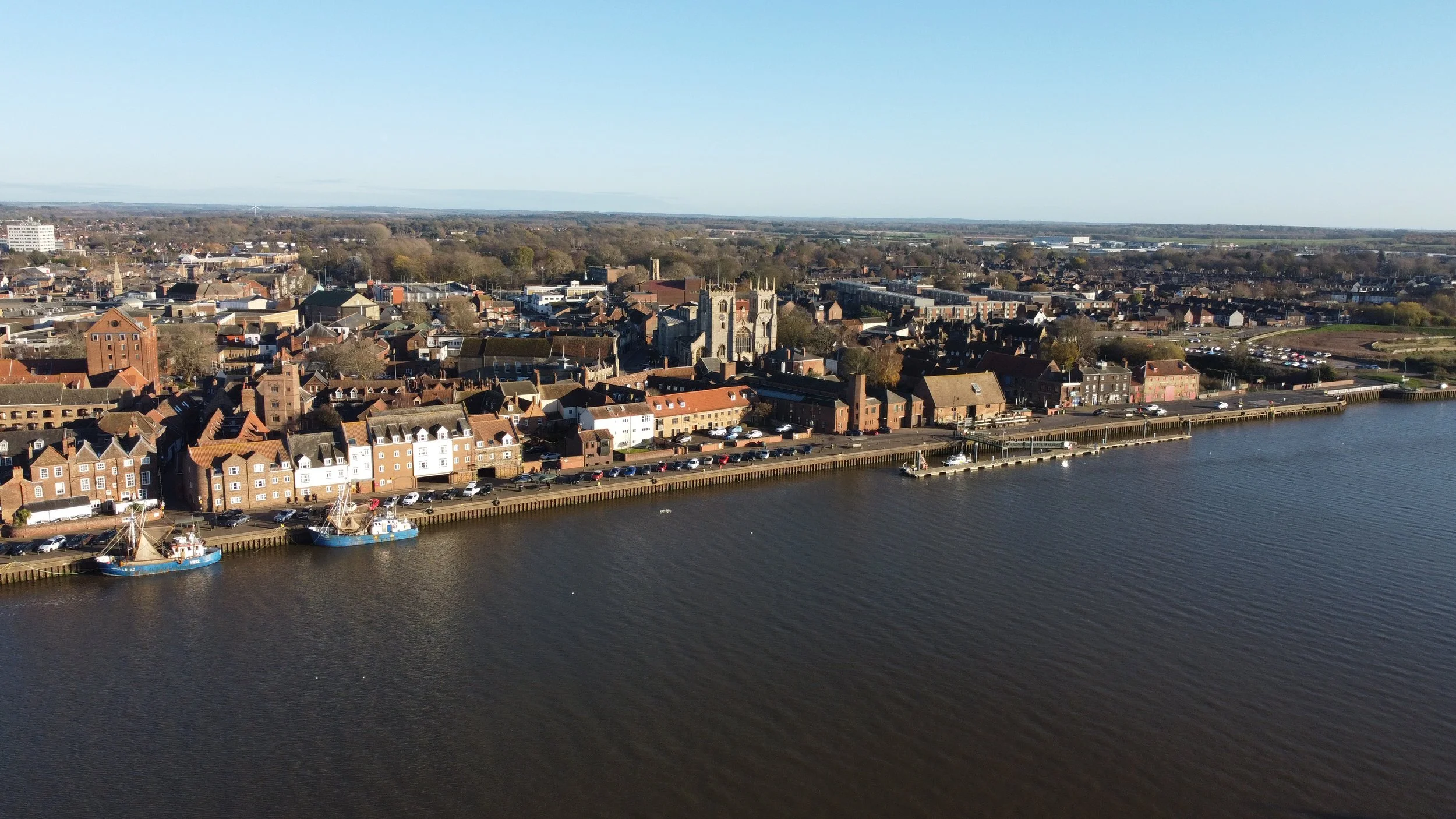
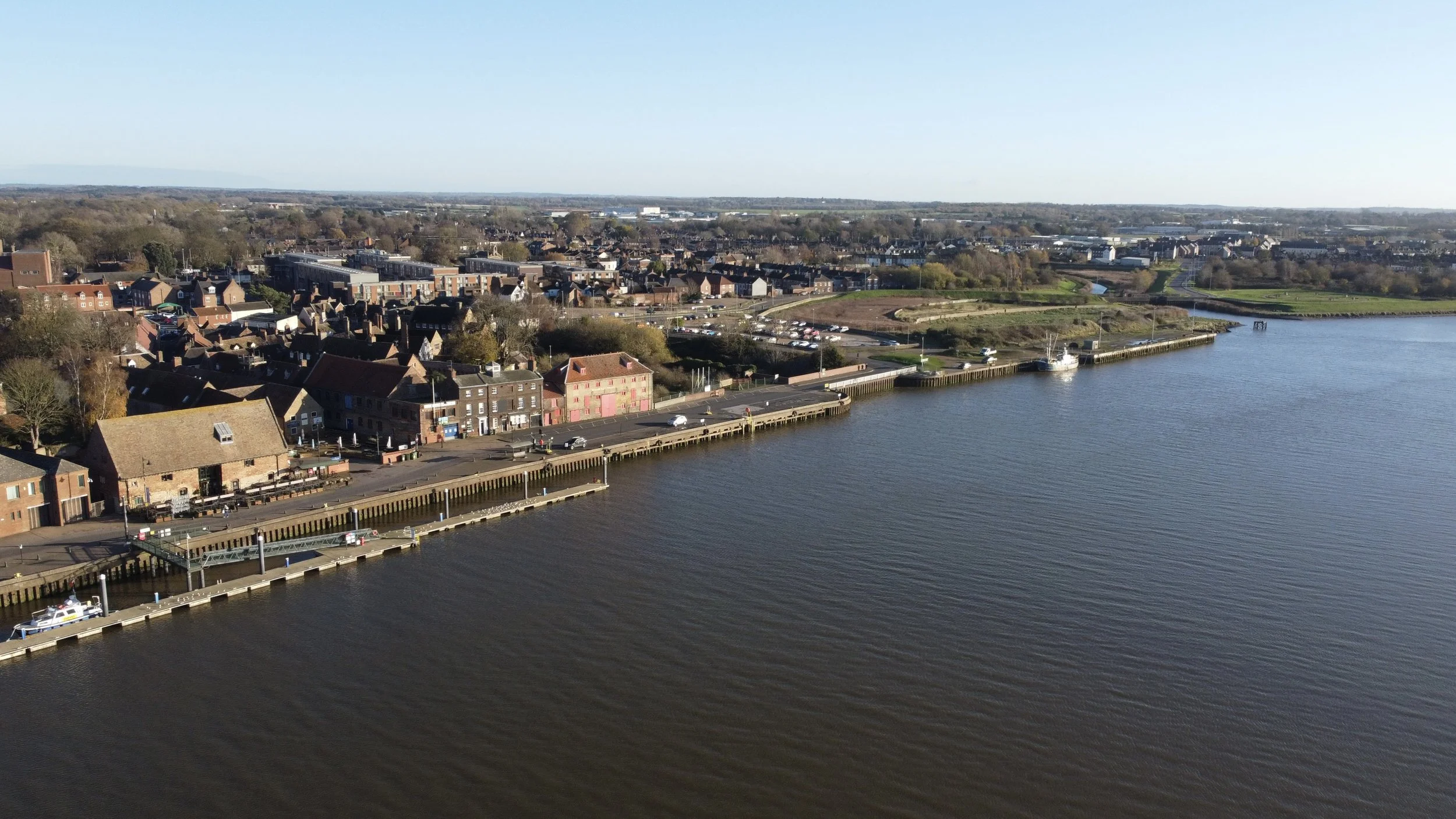
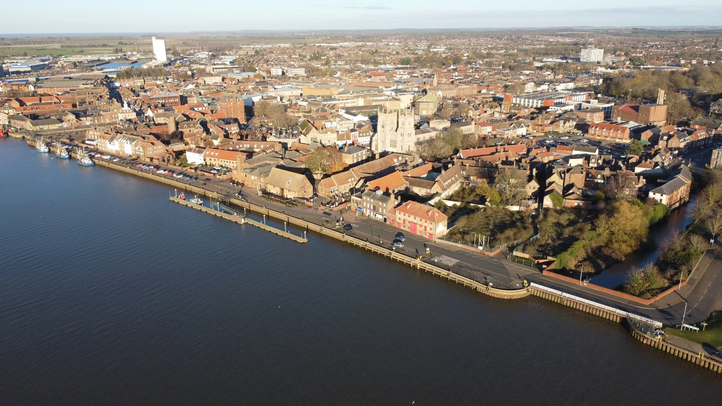
King’s Lynn South Quay Modern day


The River Ouse
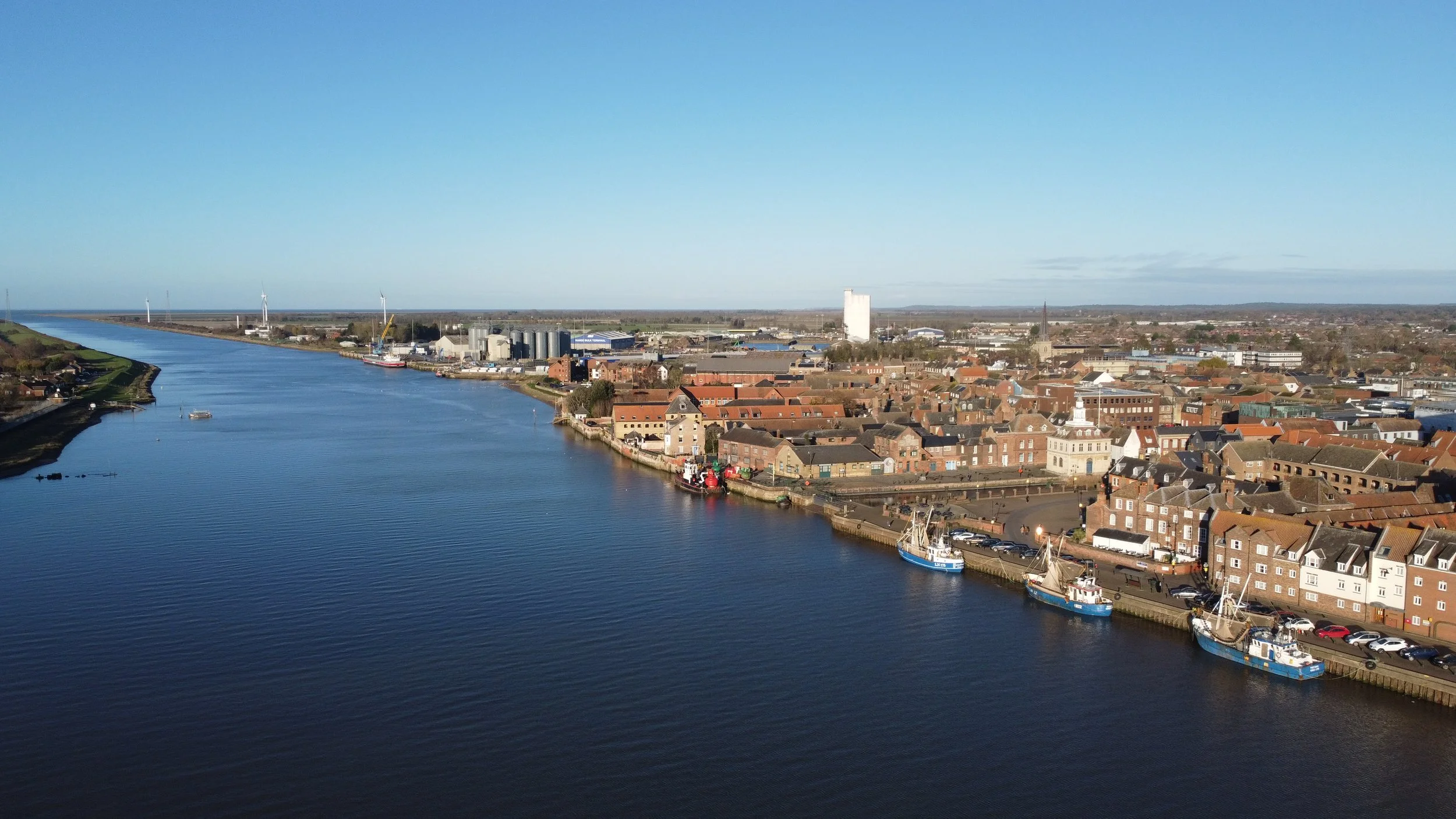
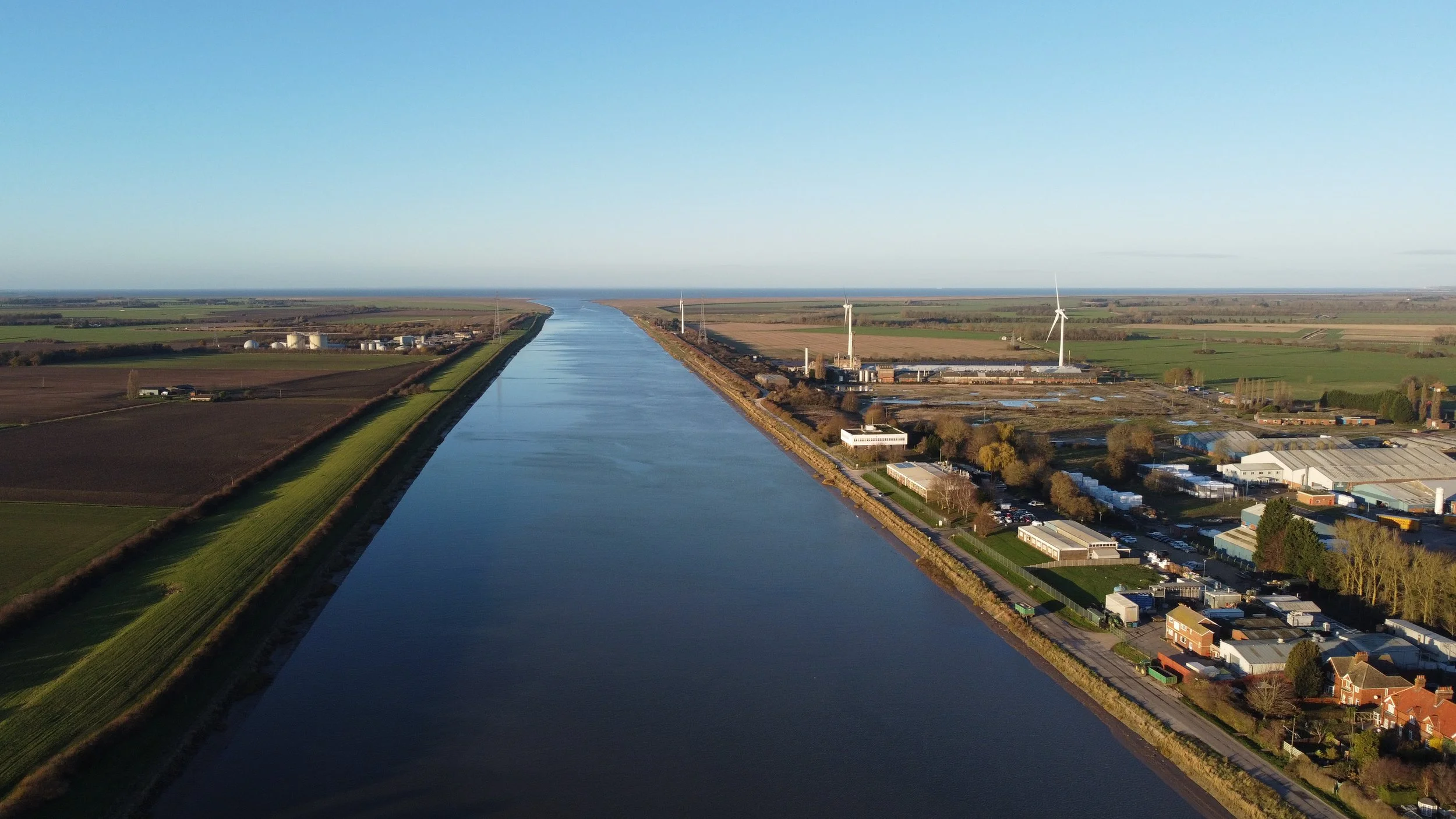
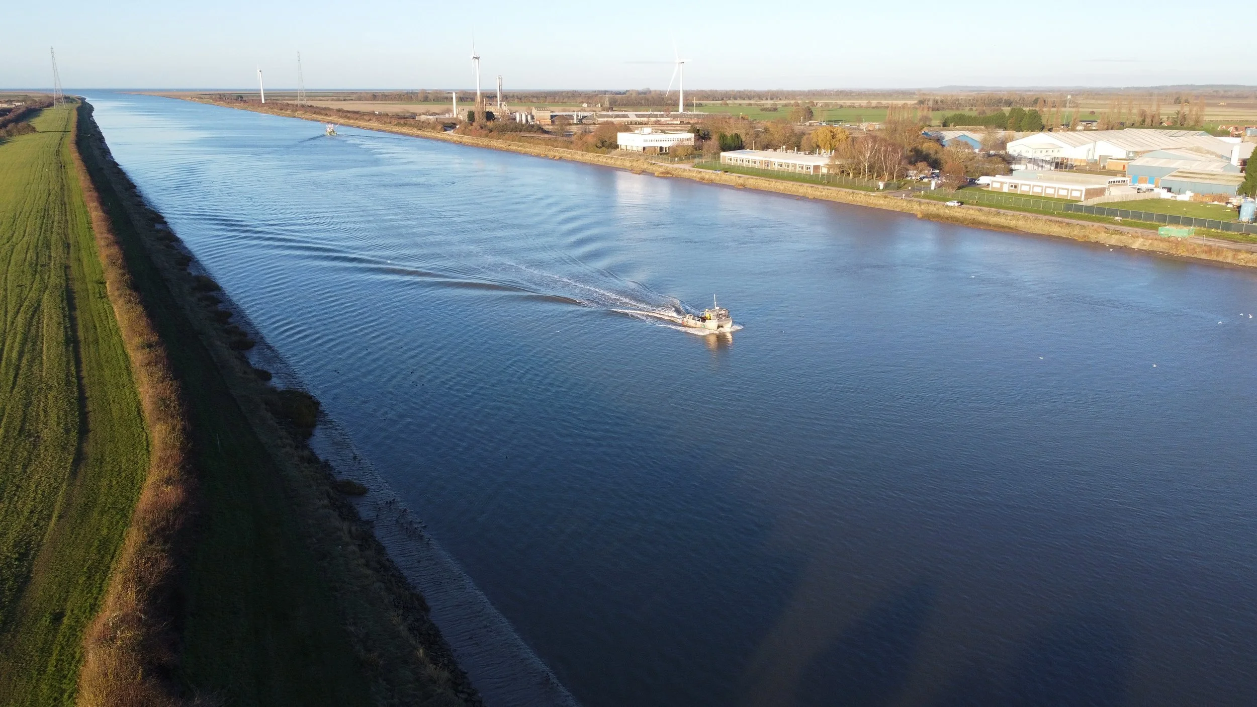
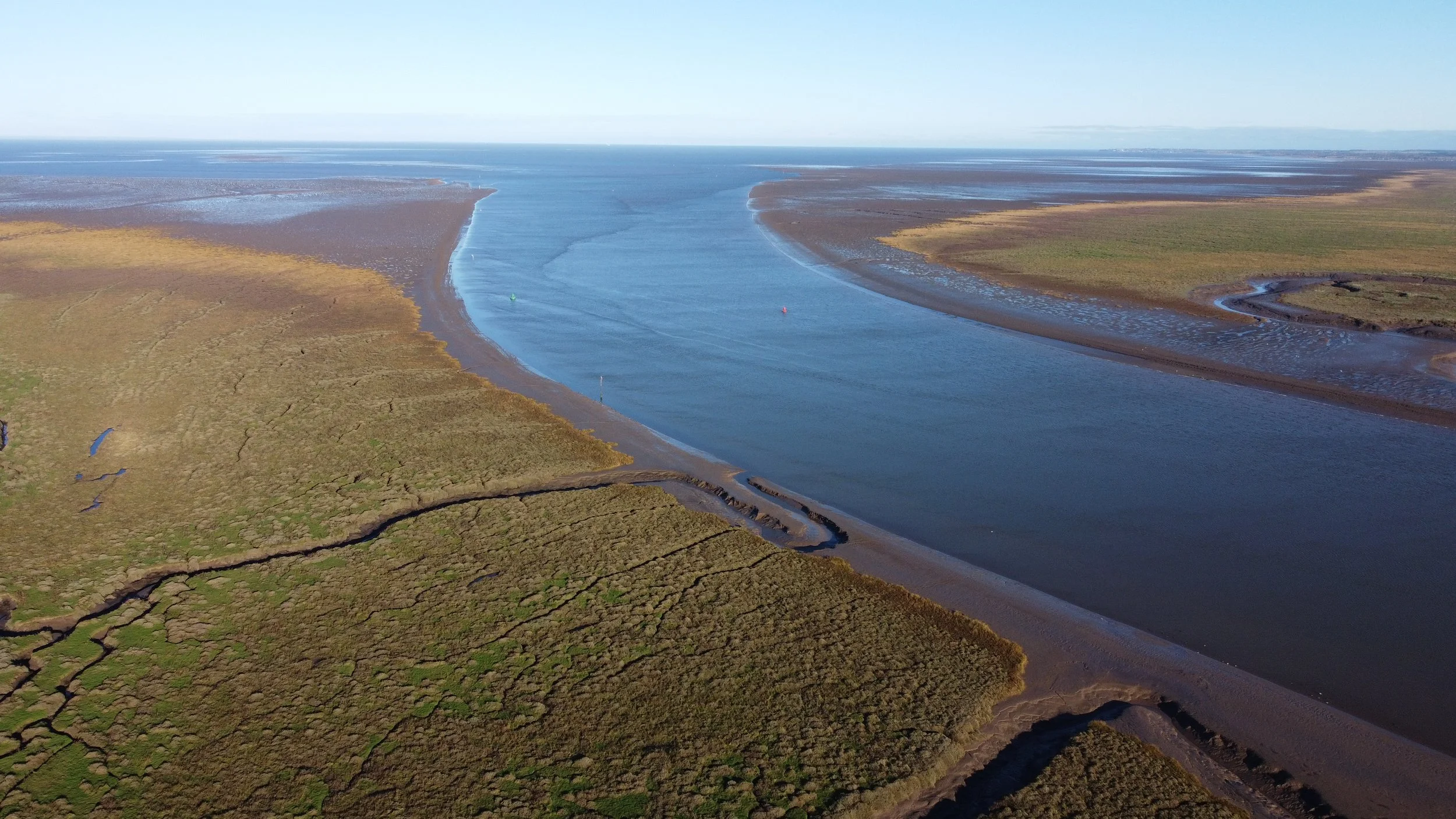
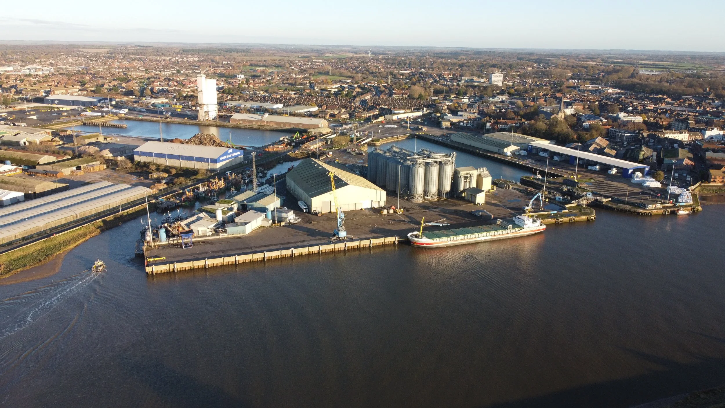
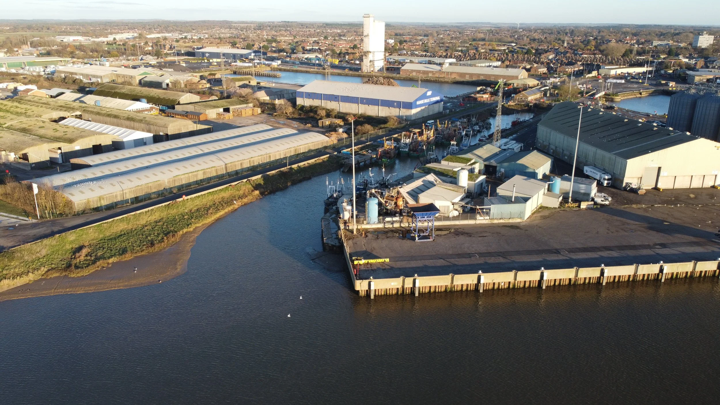
The Harbour railway served the Great River Ouse, seen below, photographed in 2025. Also visible in the drone coverage are the other Docks at King's Lynn, which had its own dedicated railway line.
The Alexandra Dock (1869) and the larger Bentinck Dock (1883) still operate to this day.
The railway line that serviced these docks began service in 1870, roughly 21 years after the Harbour branch, which opened in 1849.
The Docks railway line can be followed by clicking the link below.
King’s Lynn Docks
Welcome to the final stop of the Harbour branch line that takes us to the South Quay in King's Lynn. It's been quite a journey, but we've finally reached our destination.
I traced this short line in March 2022 and never started putting the pictures online until early 2023.
As I looked more closely at my research on the line, I realised how much I had overlooked, notably the concrete walls in the abandoned marshland area at the south quay.
I realised that I had misjudged the location of the railway entrance at South Quay and had to return in February 2023 to take more pictures of the forgotten line.
In 2025, I returned once more to capture some drone footage.
Following the path of this forgotten railway was quite effortless since there were no parts entangled in thick vegetation or confined within private premises.
The Harbour Junction land is the only area that cannot be accessed. This is due to its location on an electrified main railway line, which understandably prohibits entry.
In 2023, the old signal still stands and is now enclosed by a fence. The South Lynn M&GN Railway Heritage Group, present on Facebook, has devised a plan to convert this signal into a heritage centre. The aim is to preserve and display its history, including installing a history board, so that this remarkable relic can remain in its original location in South Lynn.
However, now construction has stopped for this current time, the signal is now free to visit.
The Quay is easily accessible, and although some old buildings remain derelict, they still stand. The Quay is still present but no longer used, as the river tides have been blocked.
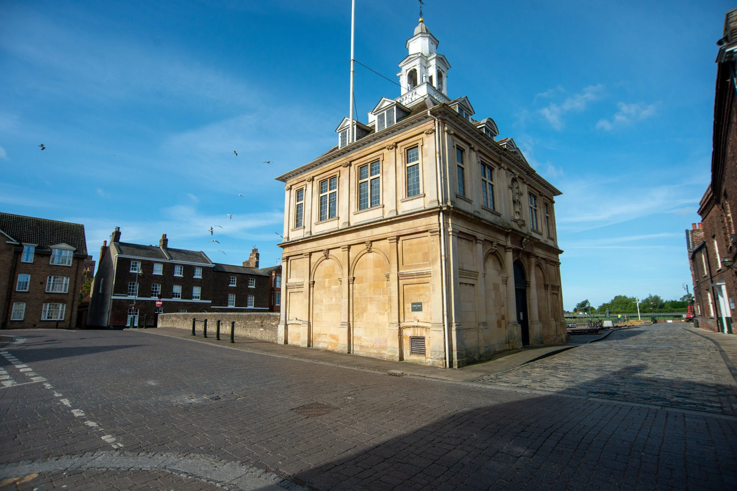
At the bottom of South Quay are the customs house and other significant historical buildings.
The buildings' historic appearance has made them a popular location for filming, including TV and film productions.
I enjoyed tracing and photographing this forgotten railway track. However, the area is undergoing much redevelopment, and it's hard to say how long many of these remnants will survive. The railway wall is still standing near the riverbank. I can’t see them being built over because of the flood risk and the land's stability. Sadly, they might be replaced by yet another park or recreational area. Only time will tell. I don't think they will be built over in the foreseeable future.
If anyone wants to visit some of these places, please message me using the icon below.
Once again, thanks for reading my humble webpage. If you have any pictures you’d like to add, please send them through, and full credit will be given to the owner.
I want to express my sincere gratitude to Lewis Collard, the South Lynn M&GN Railway Heritage Group on Facebook, John Fielding, Tony Watson, the National Library of Scotland, Historic England,simonslittlelocos Flickr page ©H M Littleworth Simon’s late Father and King's Lynn Forums.
Thanks again