HEACHAM TO WELLS
THE WEST NORFOLK BRANCH

License All rights reserved by simonslittlelocos
We recommend viewing this page on a desktop pc-laptop or tablet for a better viewing experience.
In the early days of the King’s Lynn to Hunstanton railway, the line was initially planned to extend towards Holme, passing through Thornham. From there, it would turn eastward towards Brancaster and then continue to Burnham Market and Wells.
Additionally, plans were then made to extend the railway to Cromer and Norwich, but none of these came to fruition. This alternative route would have required the line to pass through the newly developed town of Hunstanton, which could have upset hotel and tourist attraction owners. Furthermore, it would have had to cross a chalk ridge just after the station, making construction very difficult and expensive.
John Sutherland Valentine, the engineer responsible for the King’s Lynn to Hunstanton railway, ultimately selected a different starting point, two miles away from Hunstanton at Heacham. As a result, it was agreed that the new branch line would begin at Heacham station and run eastward towards Wells. This connection would also grant access to Dereham, Fakenham, and Wymondham via a connection at Wells station. The purpose of this route was to create a more straightforward and cost-effective railway.
On the 23rd of June 1864, the line was given royal assent.
The total cost of the railway would be £100,000, £20,000 more than the King’s Lynn to Hunstanton railway, which at the time cost £80,000 to build. The Hunstanton branch was also regarded as a low-cost railway. However, the King’s Lynn to Hunstanton railway required less extensive infrastructure since it was built on relatively flat land, unlike the West Norfolk branch. The West Norfolk branch proved more challenging to construct than the Hunstanton branch, requiring cuttings, bridges, and other engineering works along the route. In contrast, the Hunstanton branch required less engineering. For instance, Docking station was approximately 250 feet above sea level, while Wells and Heacham were only 20 feet above sea level.
This challenging elevation also necessitated powerful locomotives.
By October 1864, construction had begun, and by January 1866, the line was completed. However, due to the Board of Trade inspector's request for more signalling and other issues, the line opened on 17 August 1866.
In the early days of the railway, it showed slow growth and usage.
The stations along the line were relatively simple, with Holkham and Stanhoe being basic stations without goods lines and just one platform. Docking and Burnham Market, however, had goods yards and station masters’ houses.
After World War II, the Lynn to Hunstanton branch regained popularity as many tourists returned to normal and took holidays along the Norfolk coast. However, the Heacham Wells line never achieved significant success; some stations were located far from the villages they served, and the line also had numerous crossings that required housing for staff, wages, and maintenance. BR said the line was unprofitable even long before the Beeching report. British Rail closed the line on Saturday, 31 May 1952, operated by a Class 4-4-0 engine driven by A.W. Dowdy from Wells. The line officially closed on the second of June.
Many locals hoped the line would remain open as a diversionary route.
The line remained open for freight use, except for a special pilgrim passenger service from Kettering to Walsingham. This would be the last passenger train on this route.
In 1953, Norfolk was hit by floods that damaged the line between Holkham and Wells. British Railways deemed this section unprofitable due to the significant cost required to repair the washed-away track. In 1955, the line just past Burnham Market was lifted, and a buffer stop was installed at Burnham Market station. Stopping any chances of this staying open as a diversionary route. The remaining 11 miles, 43 chains of the line between Burnham Market and Heacham continued to operate for another 11 years for freight before closing entirely in 1964.
Until the end of its passenger services, the line remained one of the last where travellers could experience gas-lit clerestory coaches pulled by Victorian locomotives.
The stations along the line were:
Heacham
Sedgeford
Docking
Stanhoe
Burnham Market
Holkham
Wells
Heacham Station
Heacham station, the starting point of the West Norfolk branch line, also provided services to Hunstanton and King’s Lynn.
Heacham station boasted three platforms, with two dedicated to services to King’s Lynn and Hunstanton.
A passing loop was strategically placed to serve these two platforms, as the line between Snettisham, Heacham and Hunstanton operated on a single track.
The third platform at Heacham was a bay platform, where the Well’s services originated and terminated.
The main station building reflected the distinctive L-shaped design of the King’s Lynn to Hunstanton railway.
In addition to the station, Heacham also had its station hotel and a public house known as the West Norfolk.
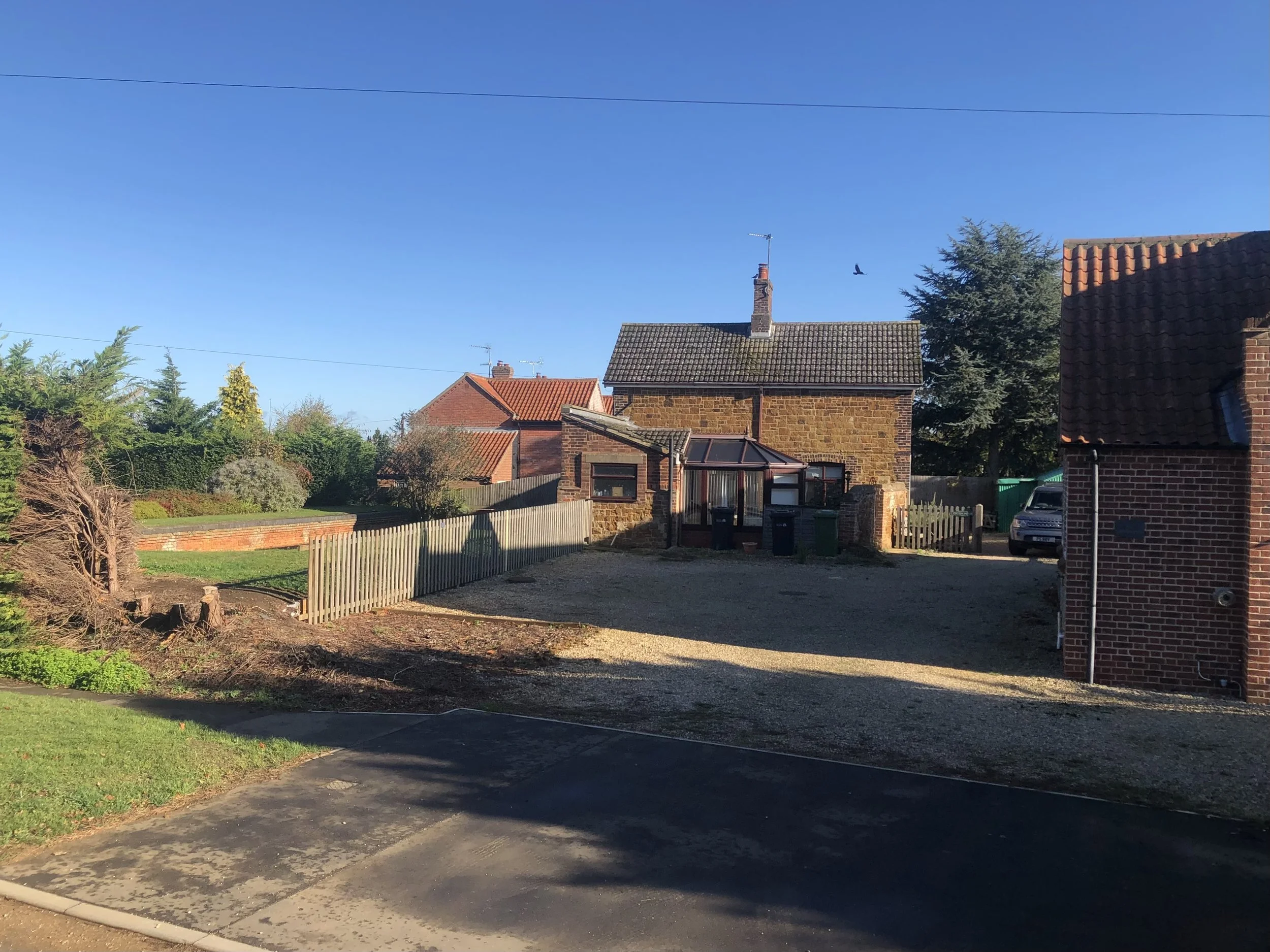
Unfortunately, Heacham station closed down in 1969 with the closure of the Hunstanton branch line. Today, it stands as a charming holiday accommodation venue.
Moreover, the station grounds are home to an old British Railways Mark One first-class carriage, which is also available for guests to enjoy as holiday accommodation.
Maps
Modern Google Maps.
Heacham dated 1798-1978
Way before the railways ever existed.

©National Library of Scotland
Heacham station maps.

©National Library of Scotland

©National Library of Scotland
The map below depicts Heacham station in its later days, with a simple layout featuring the passing loop and turntable removed.
This map would have been drawn close to the closure of the station.

©National Library of Scotland
Heacham Station past photos.
I would like once again to give a personal thanks to King's Lynn and area Model by J T Colquhoun for the use of the three pictures used below.
These pictures came from his dad's collection; please do not reuse them without permission.
The first two were by R. Booth, and the last by G. Pring.
The first photo shows a busy Box, the second with a DMU passing the box, and the last shows the sad remains of the Wells line junction after closure, with a Derby Lightweight.

©King's Lynn and area Model by J T Colquhoun

©King's Lynn and area Model by J T Colquhoun
In the final days of the Lynn Hunstanton line, the track layout was simplified to a single line, and the West Norfolk branch’s track was lifted when this picture was taken.

©King's Lynn and area Model by J T Colquhoun for the use of the three pictures used above.
The following three pictures and information were donated in 2025, with thanks again to King's Lynn and the area, courtesy of Model by J T Colquhoun.
The first photo shows the rear of the station in the 1880s
©The Lens of Sutton Collection.

Railway photographer ©Douglas Thompson took these Photographs.
With the first shot being a 1959 view facing the King’s Lynn end, whilst the second is circa 1924

©King's Lynn and area Model by J T Colquhoun

©King's Lynn and area Model by J T Colquhoun
The following photos have been kindly shared with permission from a Flickr account named simonslittlelocos.
All photos are credited as ©H M Littleworth, Simon‘s late Father.
I truly appreciate your permission to use these images. Please ensure that you do not reuse them without explicit consent.
Please click on each photograph below for the source page.
Heacham Station
Heacham Station c1962-3

License All rights reserved by simonslittlelocos
DMU Approaching Heacham Station

License All rights reserved by simonslittlelocos
Brush Type 2 coming off the Wells branch at Heacham Station, c1962

License All rights reserved by simonslittlelocos
Pullman Camping Coaches at Heacham

License All rights reserved by simonslittlelocos
Footbridge at Heacham Station c1962

License All rights reserved by simonslittlelocos
Front view of Heacham Station c1962-3

License All rights reserved by simonslittlelocos
Heacham station, date unknown, showing the Lynn and Hunstanton platforms with a passing loop, as well as the Heacham Wells Bay platform.

©KL Forums
Looking towards Hunstanton with Heacham junction to the rear.
Thanks to Norfolk Orbital railway.

Heacham Junction in the 1950's, photographer unknown.
The last passenger train to Wells-next-the-Sea from Heacham

©Norfolk orbital railway| Photographer unknown
Heacham station present
Photographed 2020

Photographed 2025


The West Norfolk Station Hotel

License All rights reserved by simonslittlelocos

Departing Heacham for Wells.
Leaving the station, the railway mainly diverged from the dedicated bay platform for the West Norfolk Branch Junction.
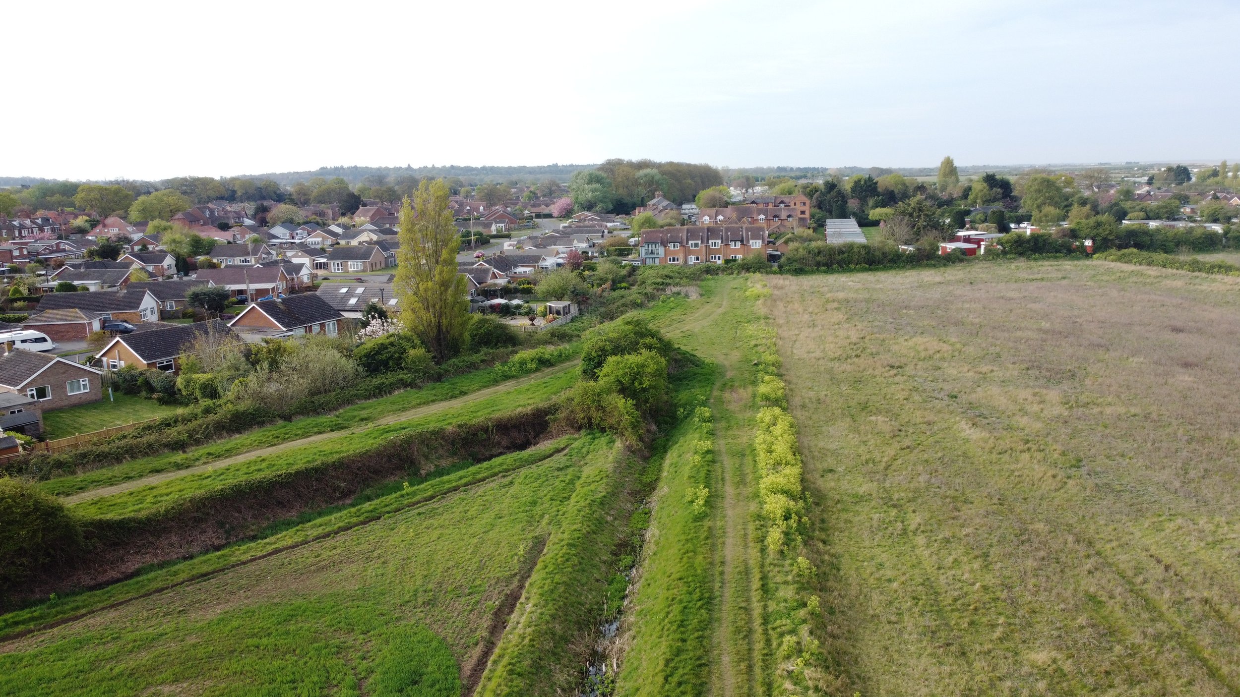
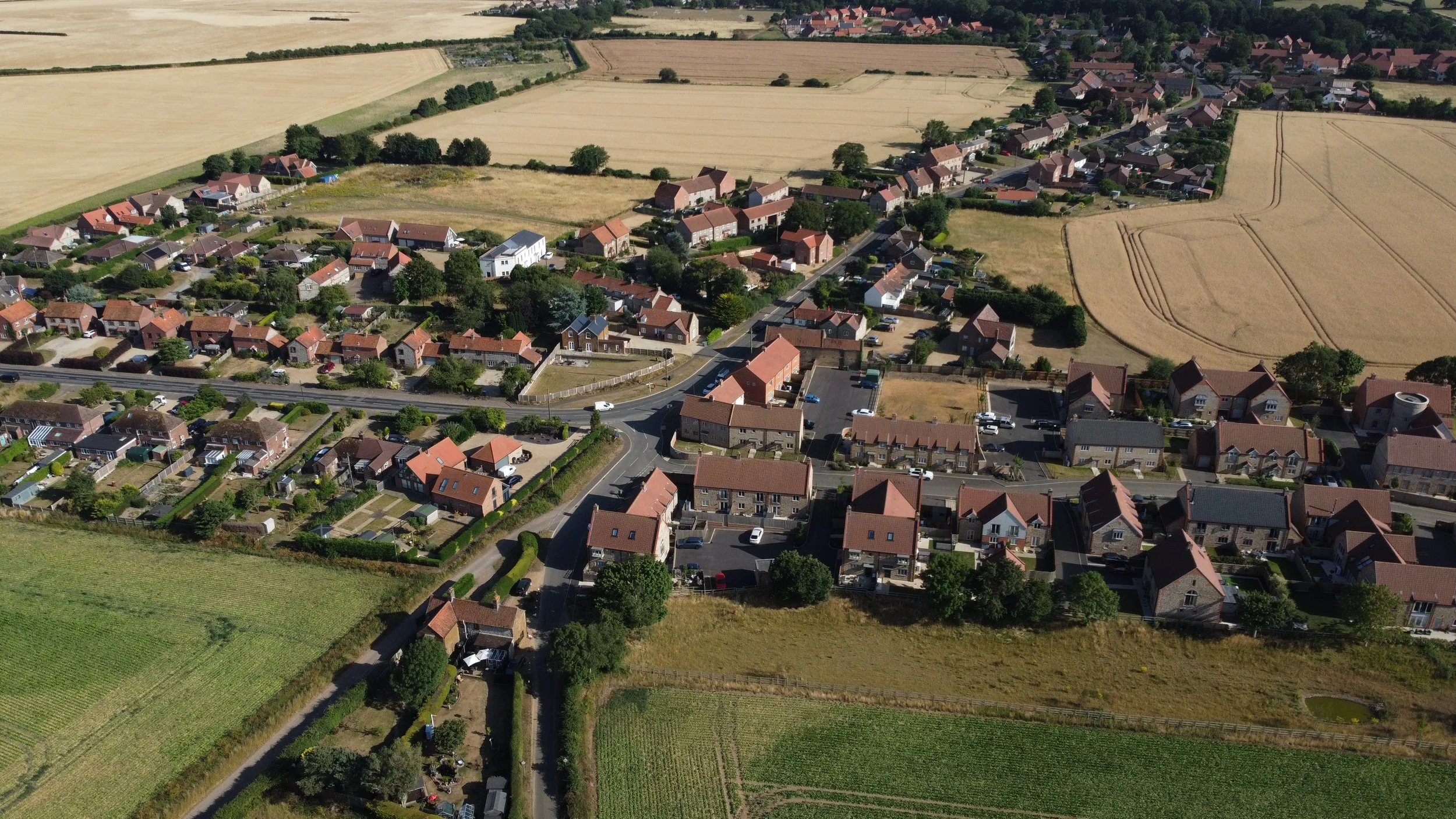
The Leaside estate has since been developed over the area where the old track bed from the Lynn and Hunstanton railway and the Heacham Wells track bed once lay.

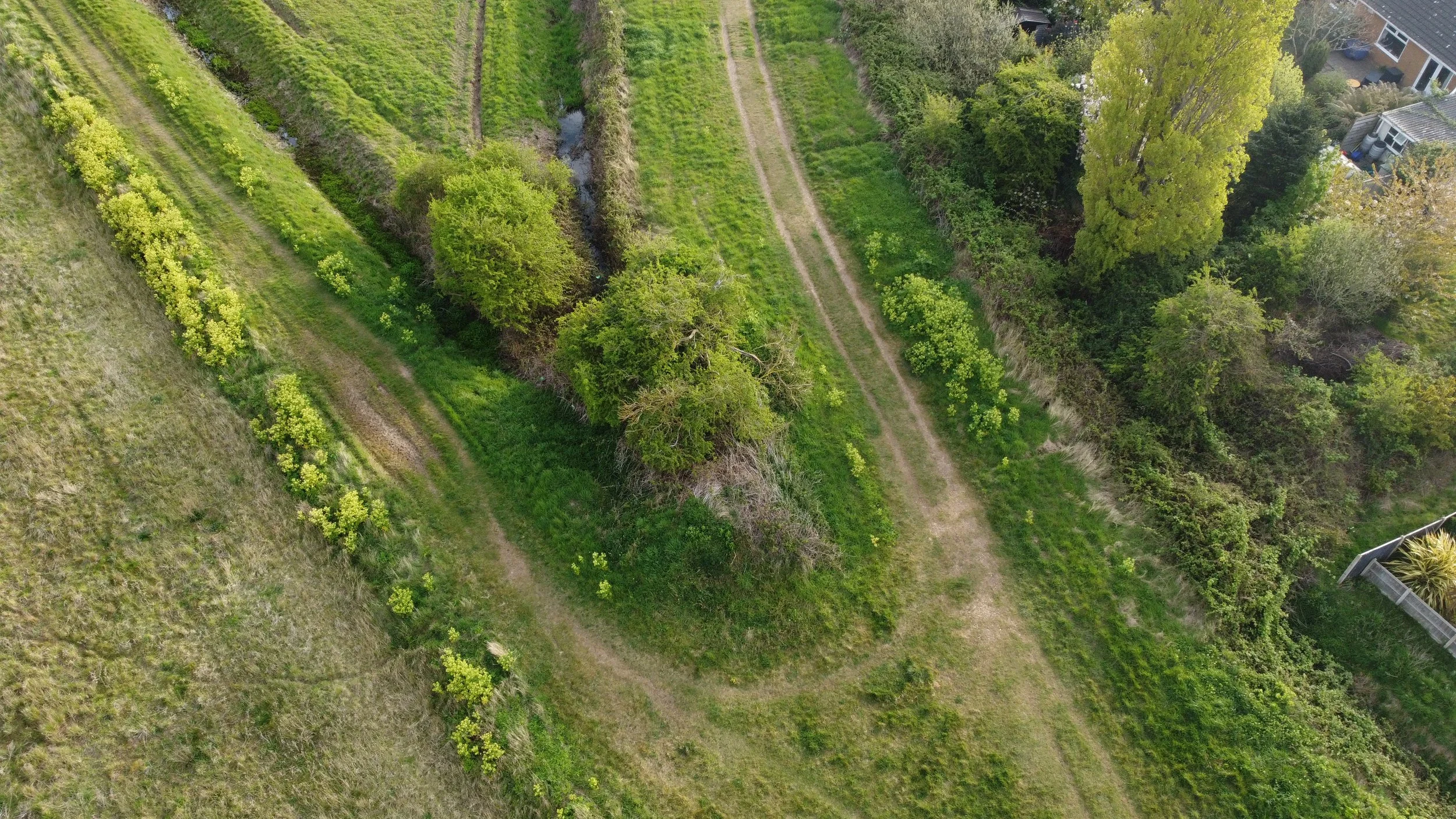
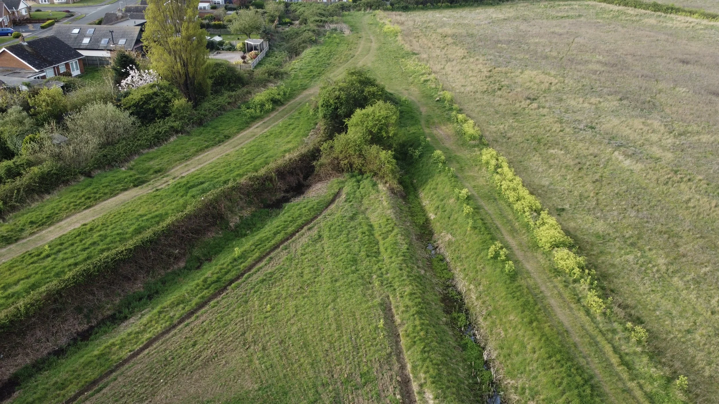
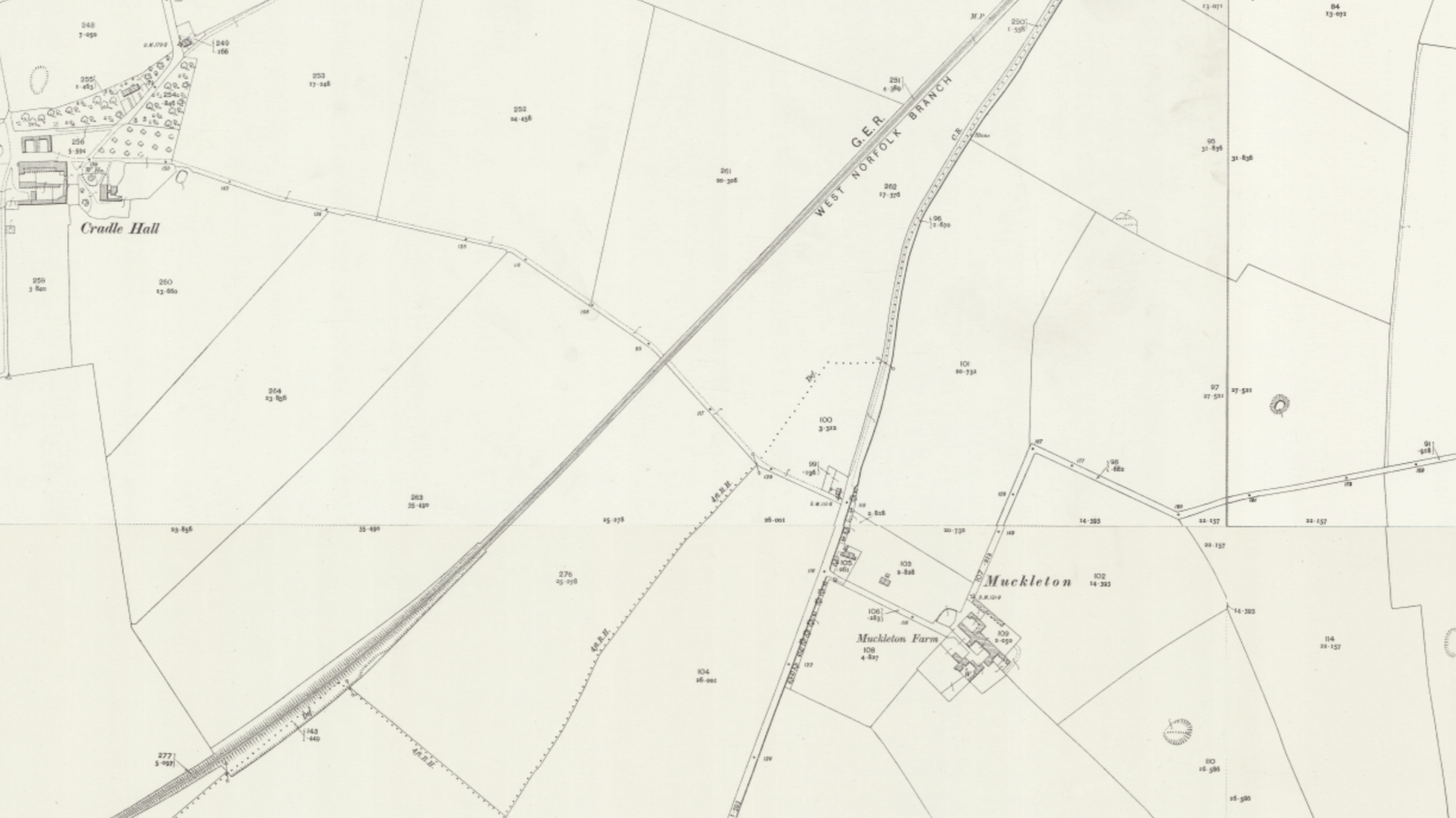
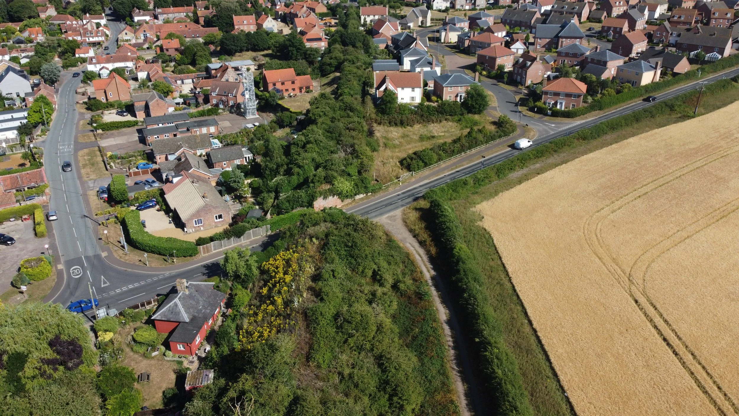
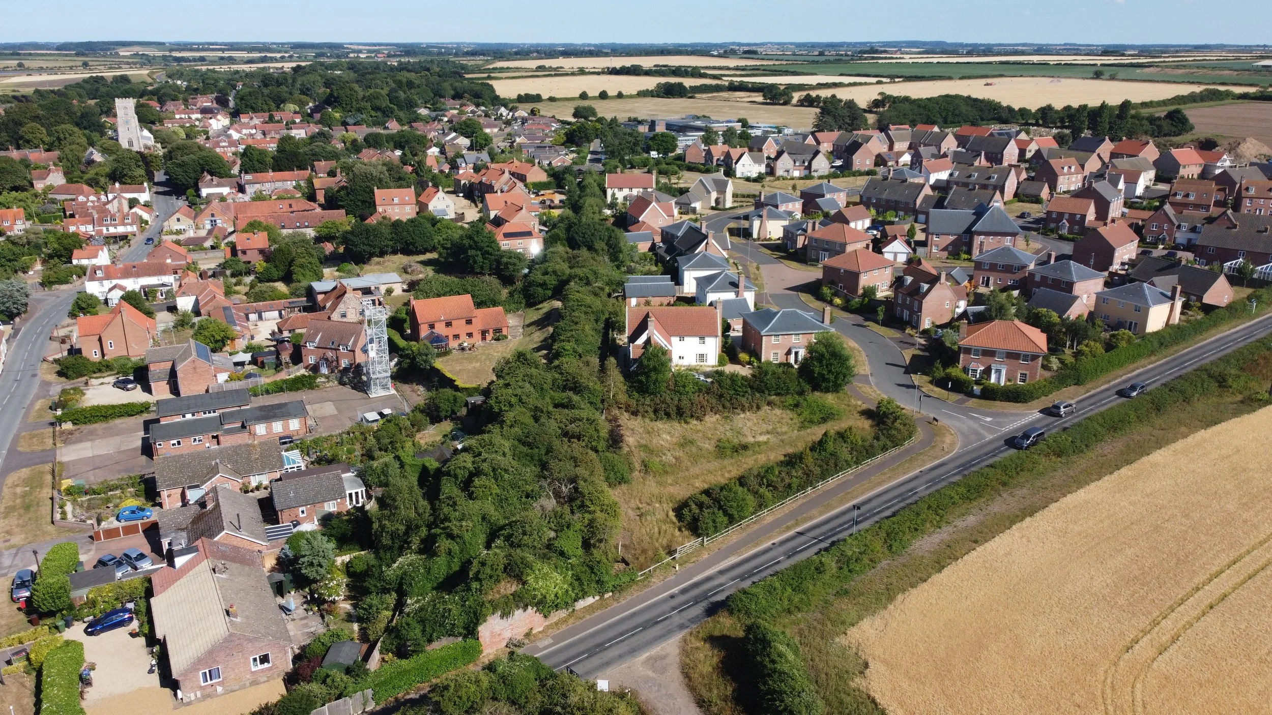
The West Norfolk Junction.
The West Norfolk Junction was situated just outside Heacham station to the north of the station and left the Hunstanton line and beared to the East on a right-hand turn before running straight and then off towards its next stop, Sedgeford.
I first visited this site in 2020, and again in 2025, for additional photos and drone shots.
West Norfolk junction Maps

©National Library of Scotland

©National Library of Scotland
The maps below show the West Norfolk junction long after closure.

©National Library of Scotland

©National Library of Scotland
The map shows 50-50 coverage, indicating that although the railway has been closed for a long time, the track bed still remains undeveloped.

©National Library of Scotland
Heacham Junction historic aerial views.
©Historic England
Please click on each image for the source page.

Heacham, 1953 © Historic England. Aerofilms Collection EAW050972 flown 30 July 1953

Heacham, 1953 © Historic England. Aerofilms Collection EAW050937 flown 30 July 1953
After closure
Heacham junction shortly after the Wells branch was dismantled. This image was taken from a film called Future Uncertain, made in 1968, one year before the Hunstanton line was closed. Filmed from inside a train heading towards Hunstanton.

©Credit Edward Thorp Future uncertain
West Norfolk junction modern photos.
Looking towards Hunstanton to the north and the east, you can see where the Wells branch diverged.

The line straight ahead was the track bed to Hunstanton

Standing on the Hunstanton track bed, looking towards Heacham Junction.

2025 Drone Revisit


Off to Sedgeford
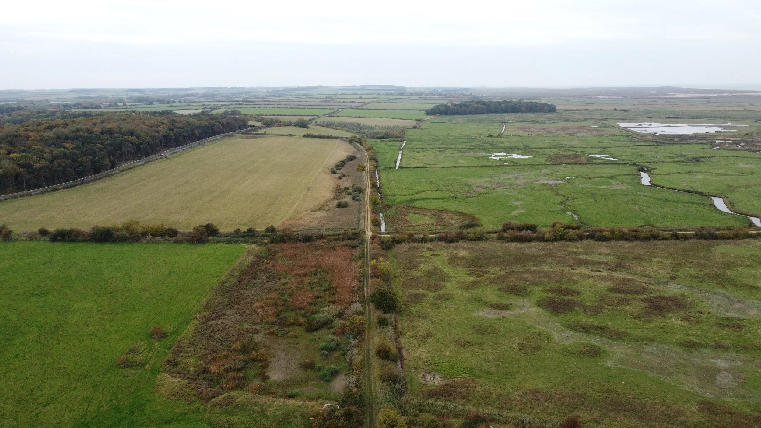
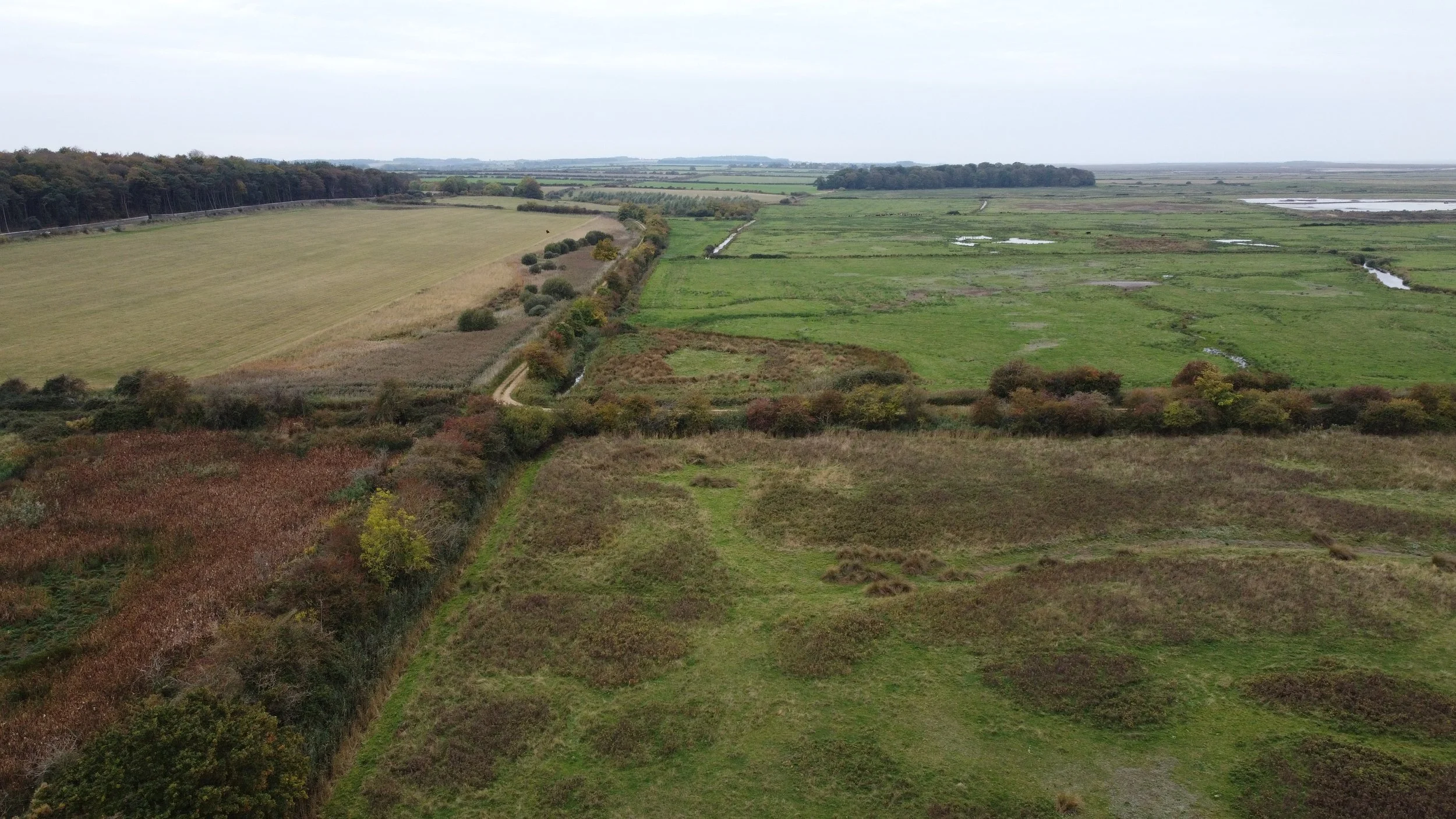
Veering off to the right, eastbound, the Wells Branch left the Lynn Hunstanton line behind and headed towards Wells and its next station, Sedgeford.


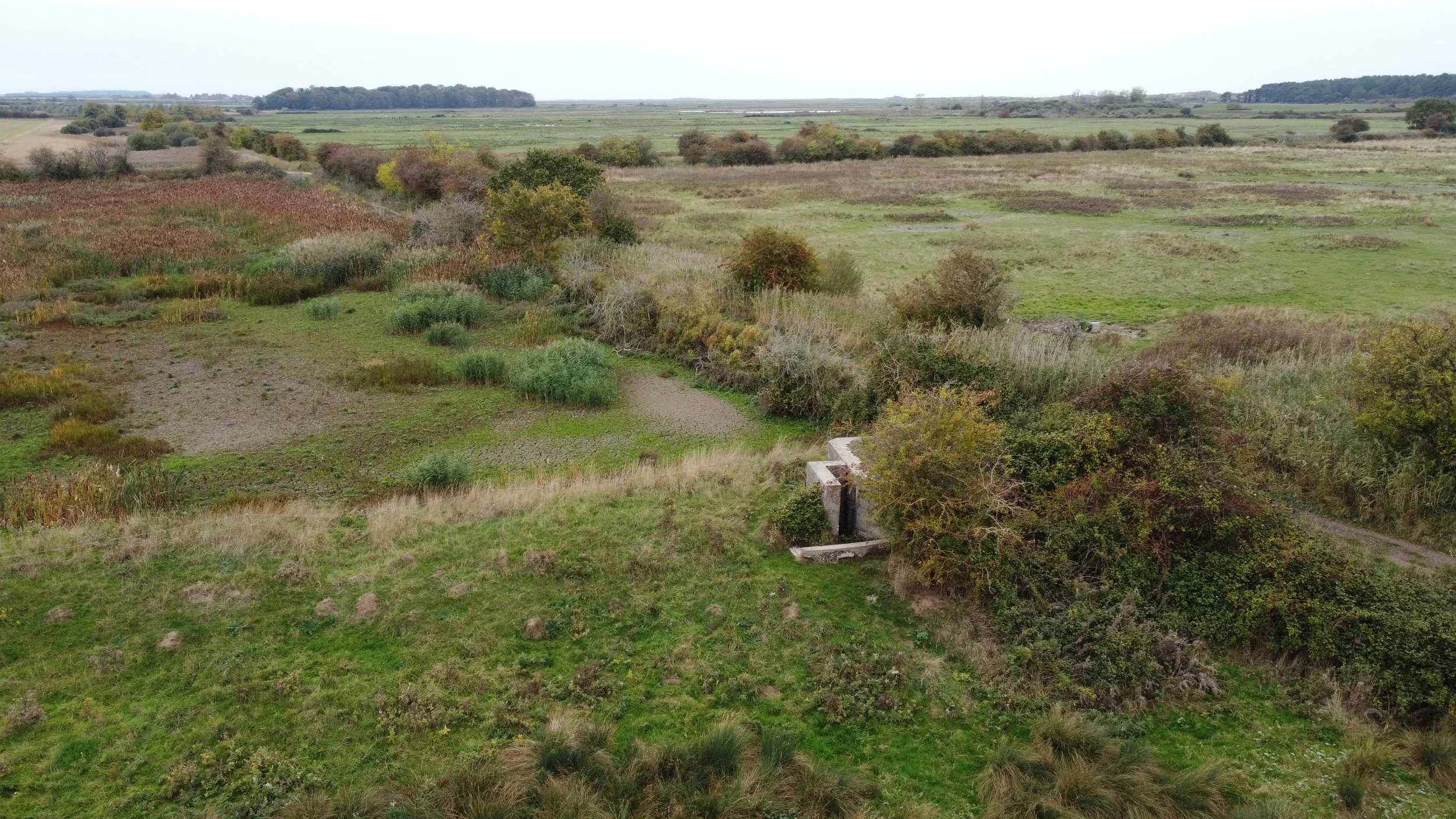
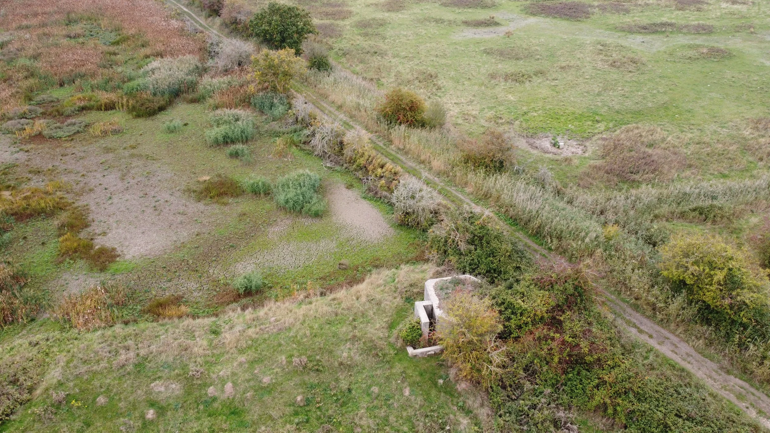
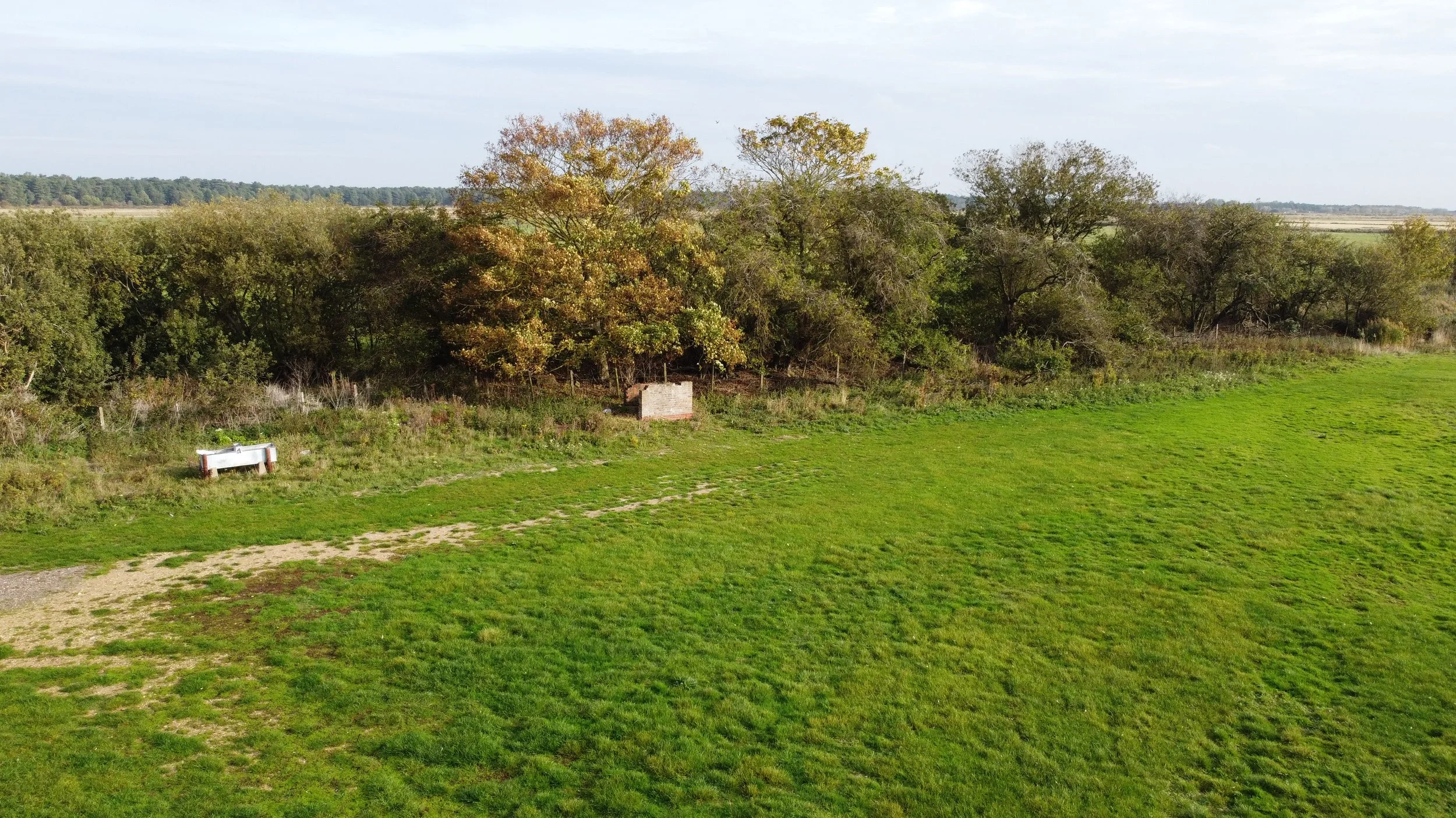
Parts of the old railway infrastructure can still be found along the old track bed like this old concrete fence post.

Just after the curve of the railway, I found this old buffer stop, once part of an old siding, still standing in place after all these years.

©National Library of Scotland


Heading roughly straight, the West Norfolk Branch now headed eastbound towards Wells.


Whilst walking along the old track bed, I found what possibly looks like some old railway sleepers.


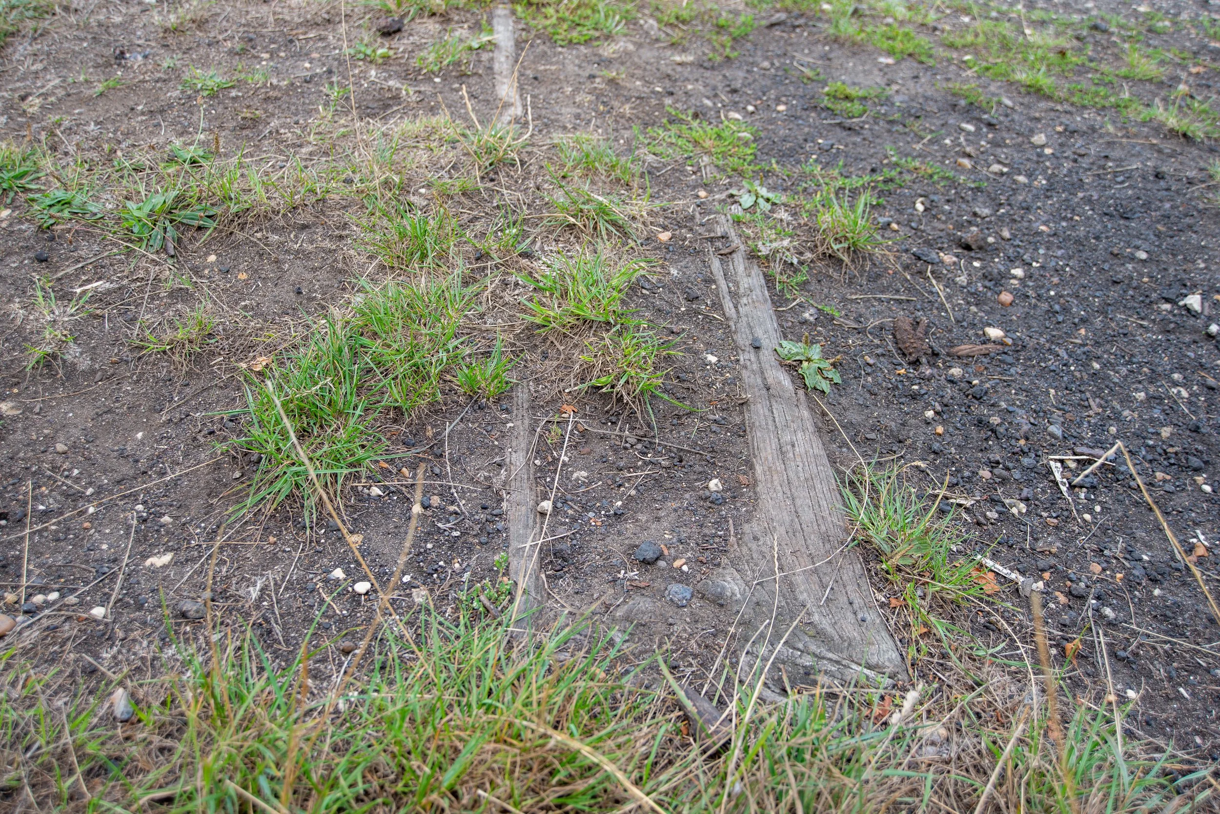
Back off towards Hunstanton Road crossing.


Heacham River Crossing.


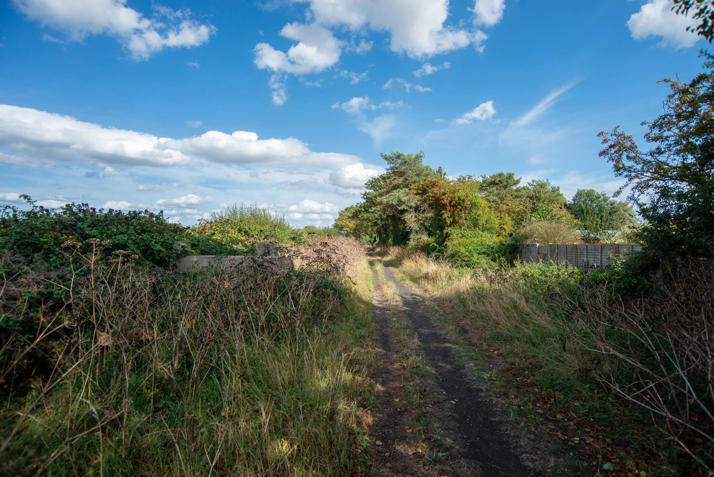
The walk ends close to the site of the old Hunstanton road crossing.
This short walk is one of the very few parts of the old line accessible on foot.

Drone footage taken in 2025 showing the old track bed facing towards Heacham station, photographed from the Hunstanton road crossing area.
Drone footage from the Hunstanton Road area looking towards Sedgeford, showing where the line has now been built over, but if you look at the top of this photograph, you can see in the distance where the line is now used as a farm track.
Hunstanton road crossing.
On the first of many crossings the railway took to reach Wells, we first arrive at the site of the first crossing at Hunstanton Road.

©National Library of Scotland
Hunstanton road crossing during the railway’s open days.

Year and Photographer unknown

Year and Photographer unknown
In August 2025, the site where the old level crossing once existed.
Ringstead road crossing
Shortly after the crossing at Hunstanton Road, the railway once again crossed over another level crossing at Ringstead Road.
The crossing cottage remains to this day, although it has now been extended.

©National Library of Scotland
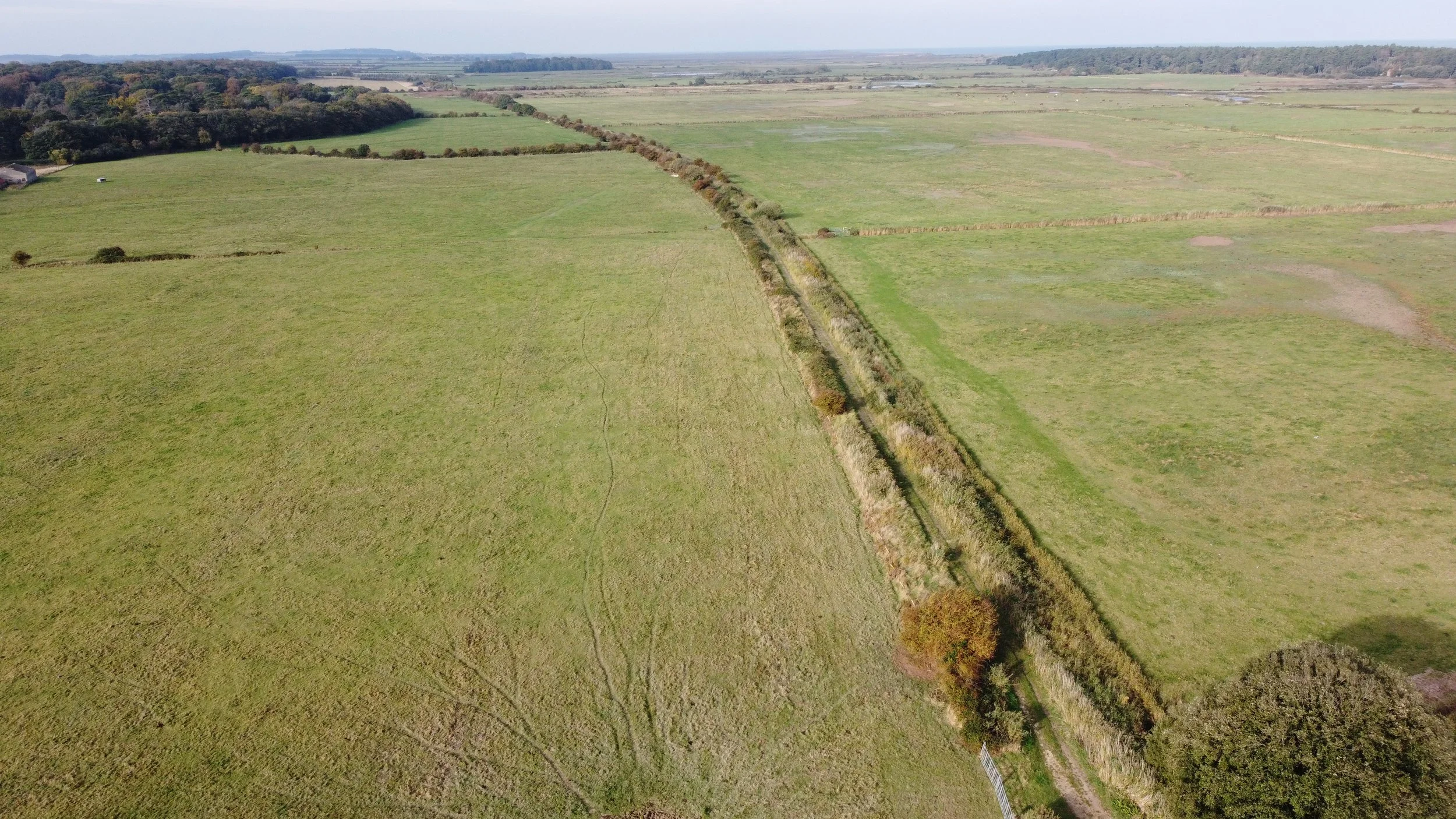
The railway now headed off through the countryside towards Sedgeford across open fields, then along a short part of a raised embankment that’s now still in use as a private farm track.

©National Library of Scotland
Sedgeford Station
Sedgeford station opened on August 17, 1866, and closed on June 2, 1952, for passengers. On December 28, 1964, it closed for freight.
Sedgeford station, situated 2 miles and 64 chains away from Heacham station, was once a small station with a single platform, a level crossing, and a signal box. These facilities were reportedly abolished in the 1920s, and in their place, a three-lever ground frame and a gatekeeper’s hut were constructed.
Sedgeford was one of the smaller stations on the defunct railway line, with only a small goods siding on the down side of the track. Consequently, access to the station was challenging for passengers, and its primary use was for agricultural freight rather than passenger services.
Sedgeford also had a small RAF base, RAF Sedgeford, located some distance from the railway station.
The RAF base was relatively small, and it’s uncertain whether the railway provided any assistance in constructing the airfield.
Today, the airbase is used for agricultural purposes.
This line, further up in 1953, was affected by floods at Holkham, but Sedgeford was also frequently hit by harsh winters.
In 1867, the station was shut down for several days due to a snowdrift.
In 1927, another train got stuck at Sedgeford because of snowdrifts.
Finally, during the arctic winter of 1947, another snowdrift disrupted the station’s operations. That year, three engines were blocked by snow, and the crossing gates were buried under it. One engine was reportedly covered in over 8 feet of snow.
The station is still in use as accommodation and features a signal box.
It's worth noting that the signal box at Sedgeford is not the original one. I believe it may have originally come from Hilgay, which is on the King's Lynn-to-Cambridge line.
Many thanks to the owner who let me photograph his property and chat with them about the old railway.
Thanks again, it’s lovely to speak to like-minded people.
Modern Google Maps.
Historic Maps.

©National Library of Scotland
Sedgeford station past.

Year and Photographer unknown

Year and Photographer unknown
Photographed June 2020

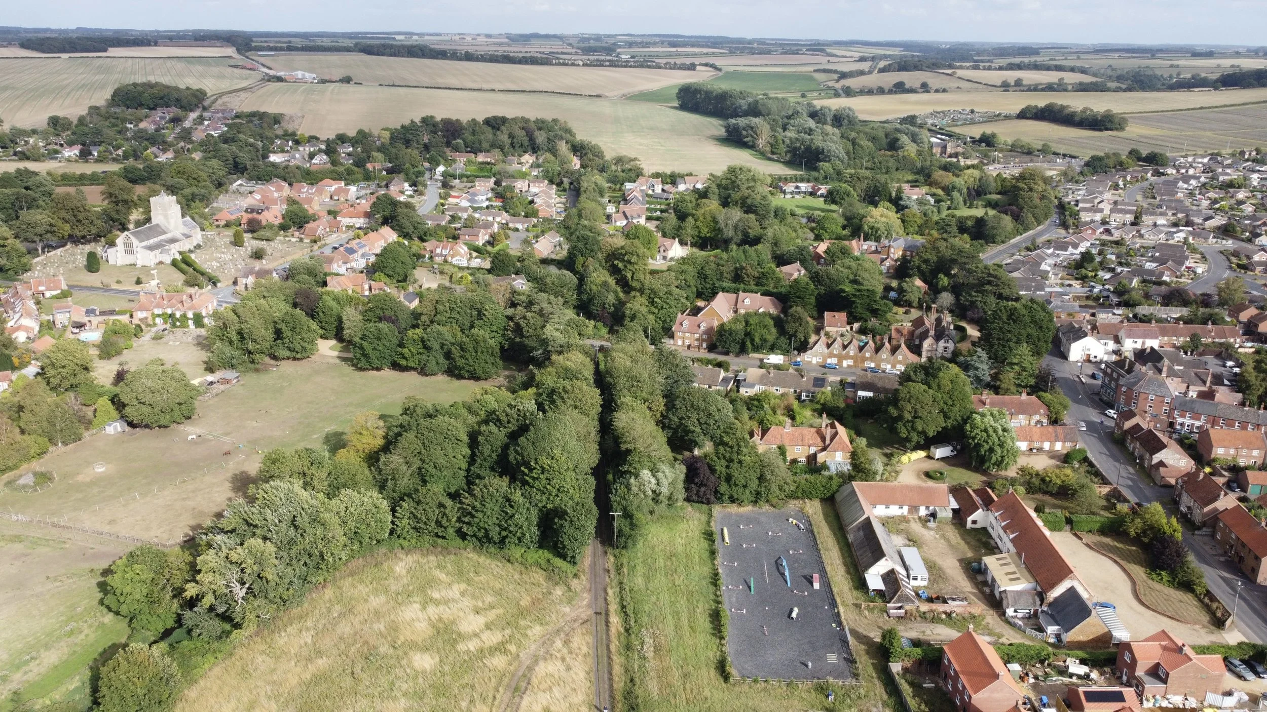
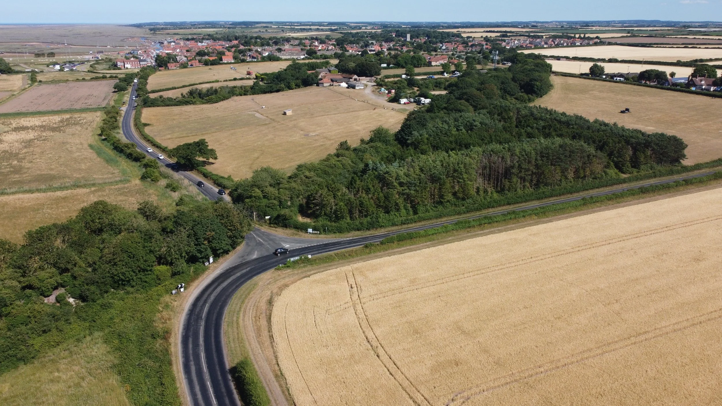
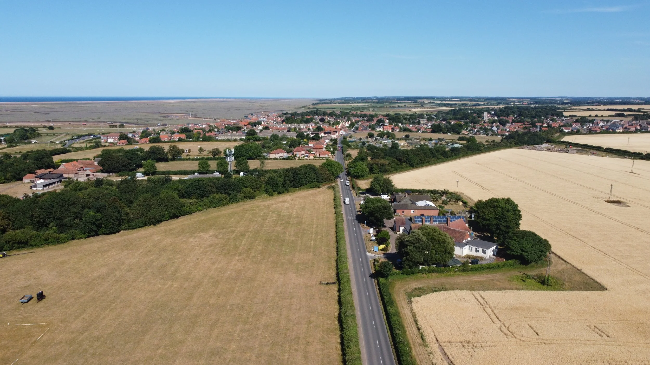
Leaving Sedgeford, the railway journeyed through the open countryside before reaching Docking.
Drone footage shot between Sedgeford and Docking, facing towards Sedgeford, taken from the site of bridge HWS1798
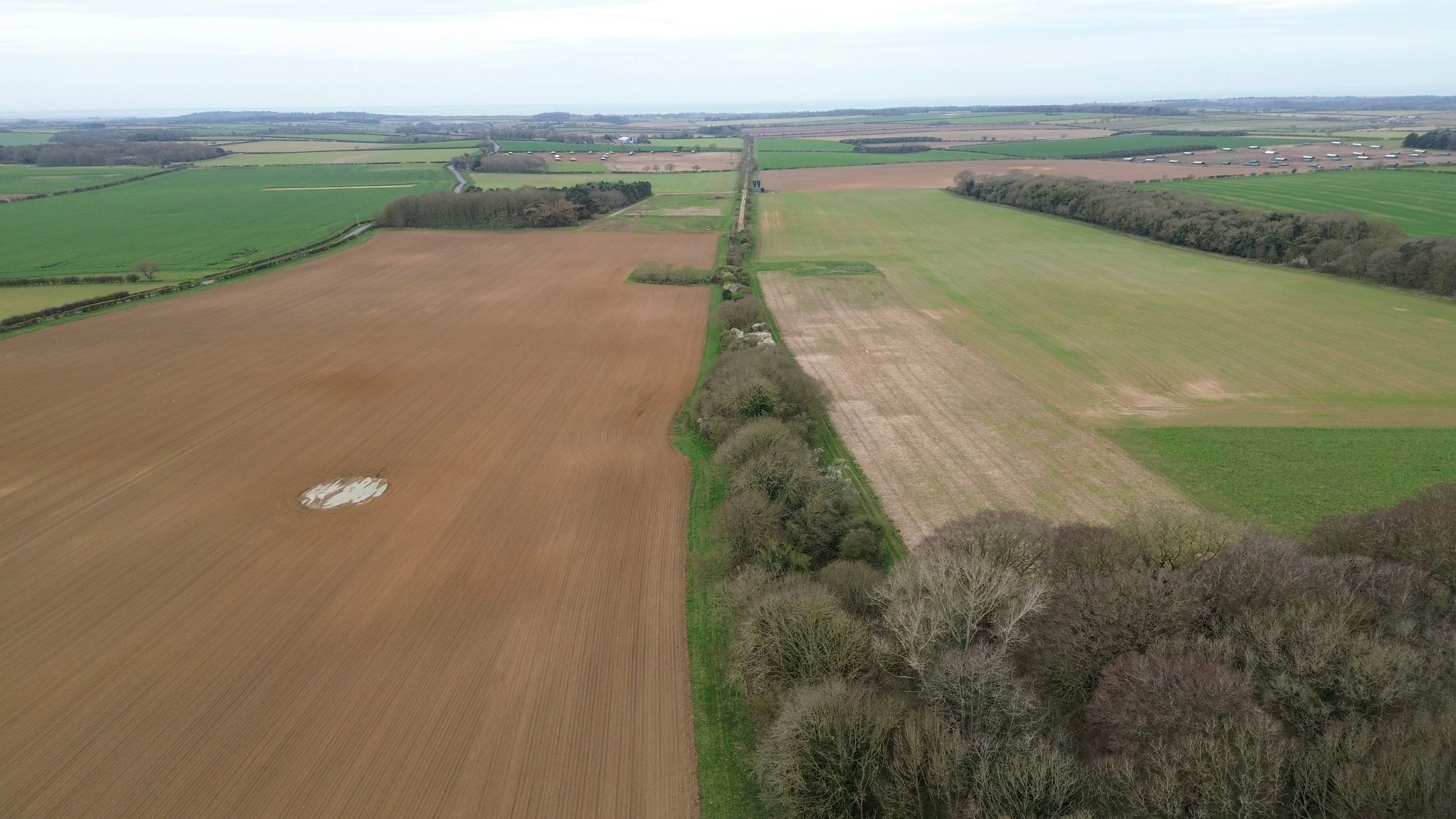
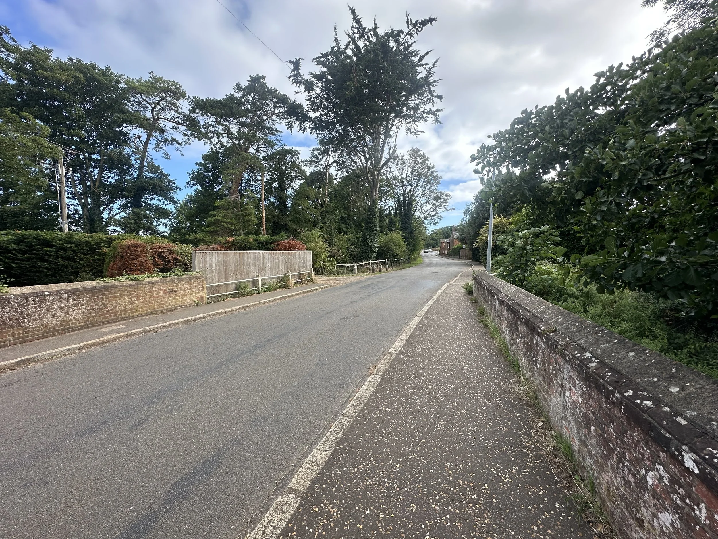
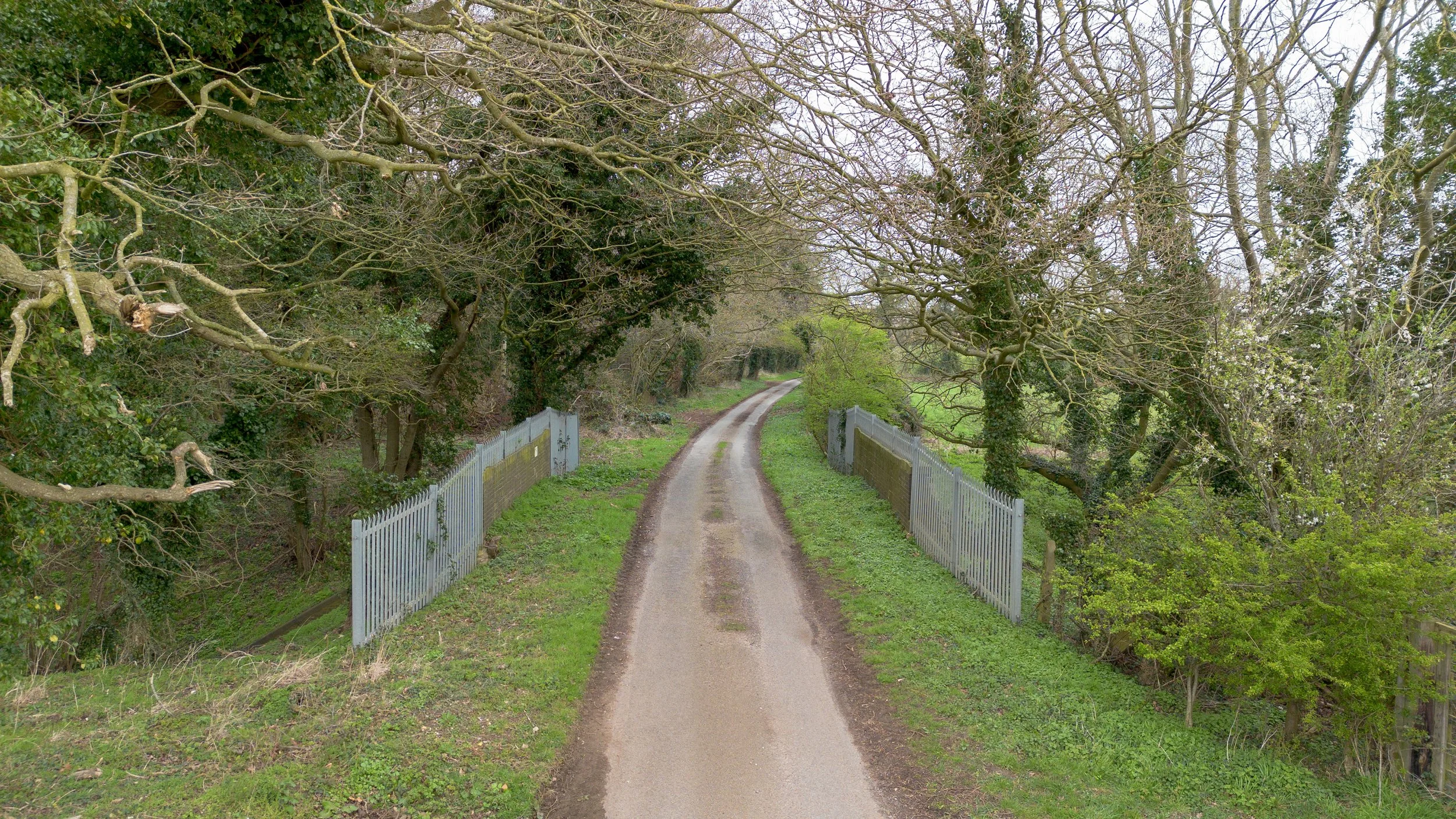
Between Sedgeford and Docking, I discovered this road bridge, still in excellent condition and in use as a crossing.
Regrettably, this bridge has been used as a dumping ground for general rubbish.
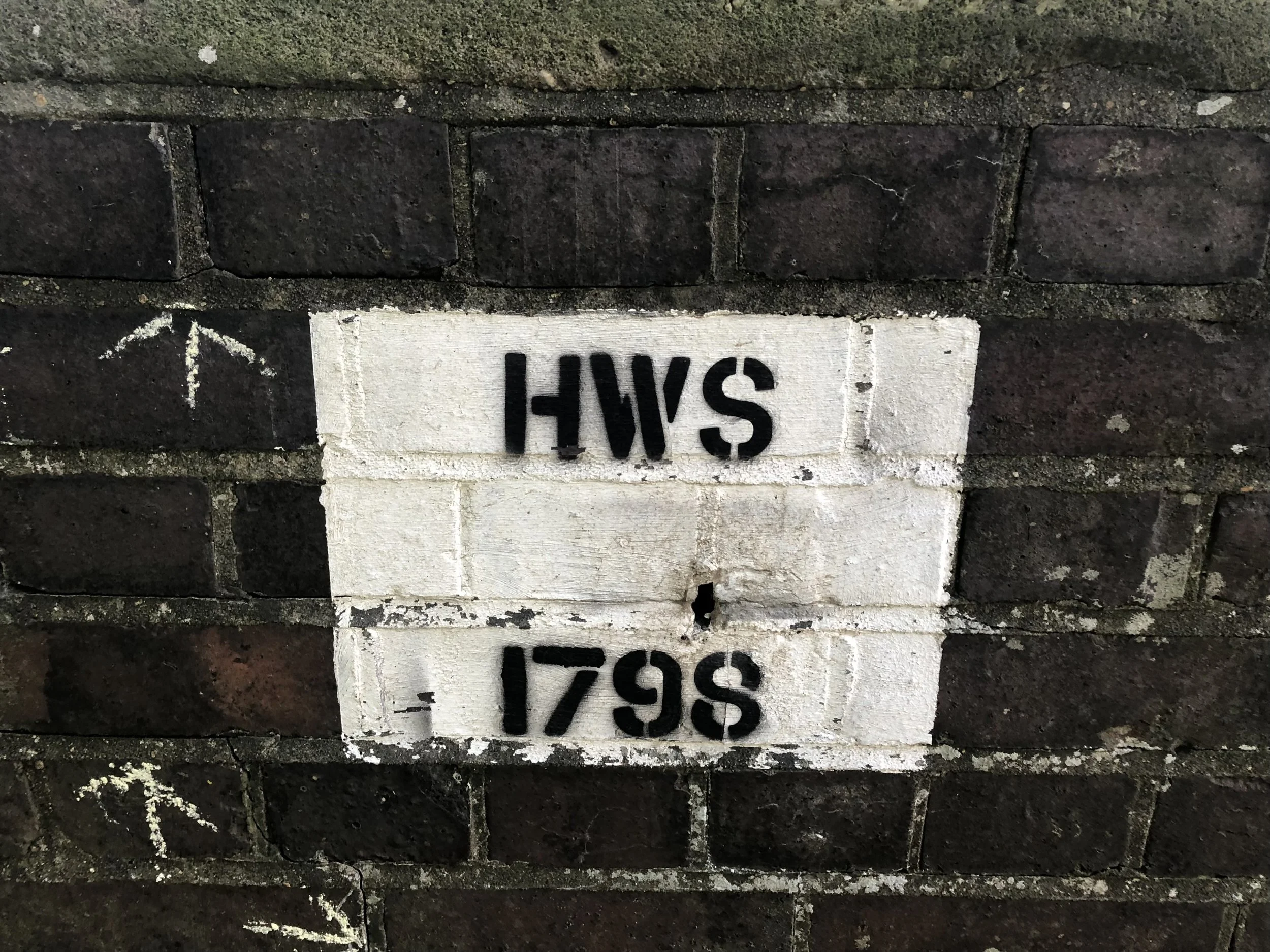
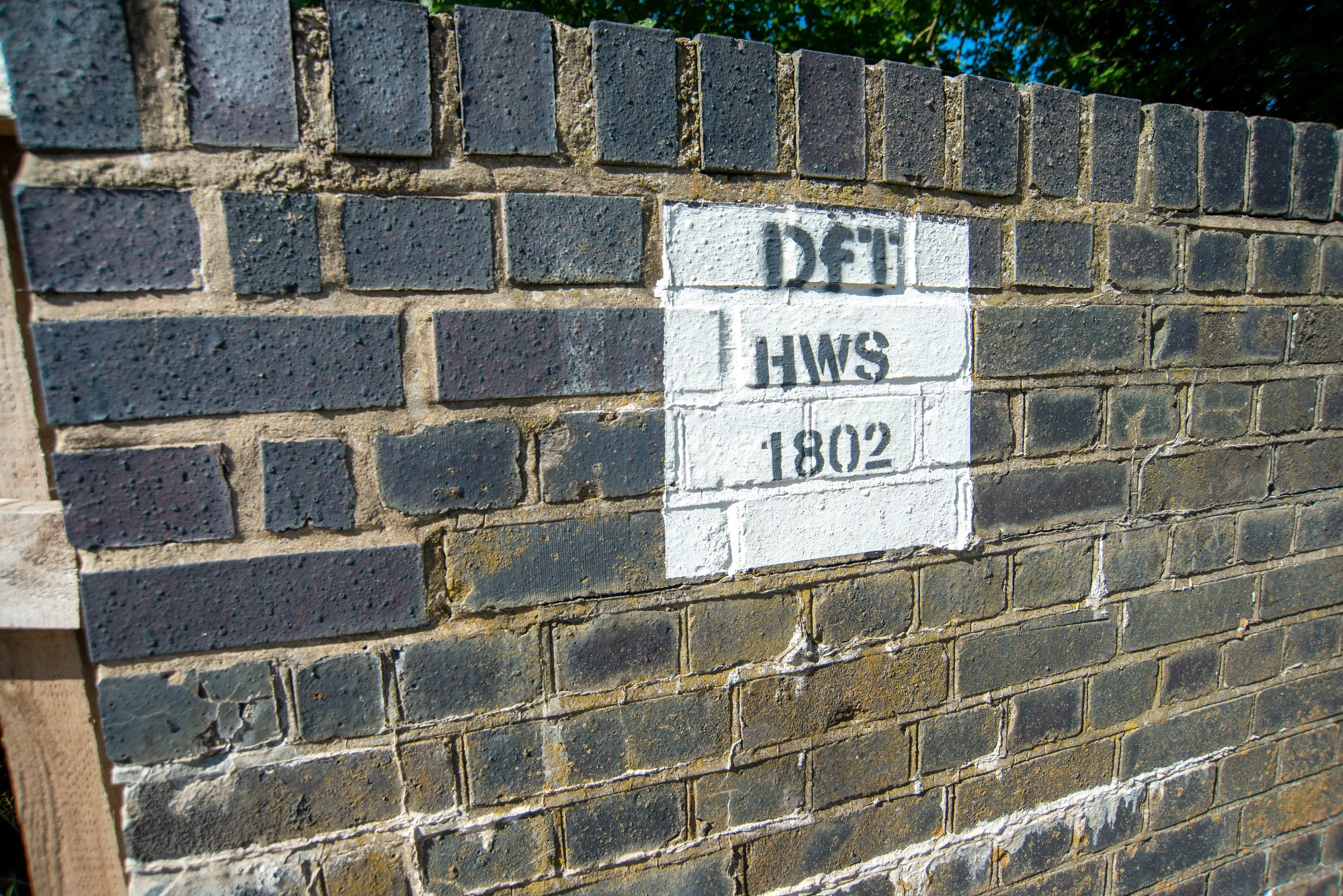
Bridge HWS 1798
HWS code stands for Heacham to Wells-Next-The-Sea Branch (West Norfolk Line)

©National Library of Scotland
Photographed 2020


2026 revisit
Steel fencing has since been erected to stop fly-tippers dumping rubbish over the side.
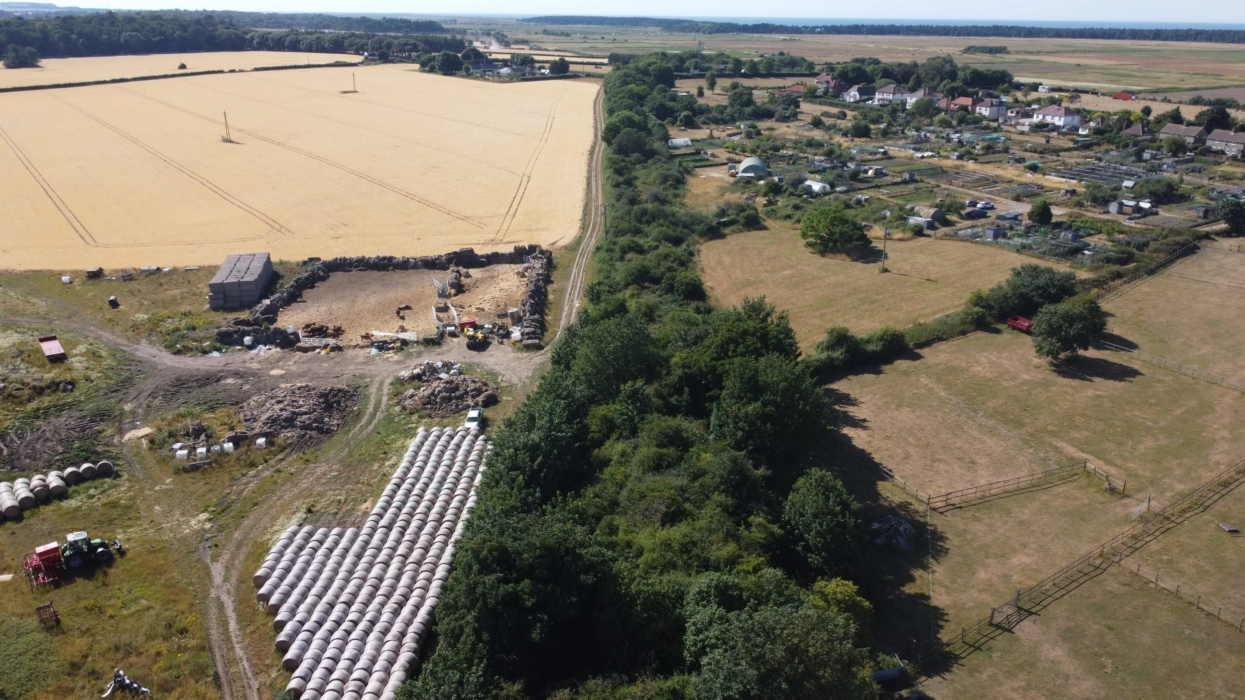
Drone footage taken from Bridge HWS 1798 looking towards Bridge 1799 and Docking.
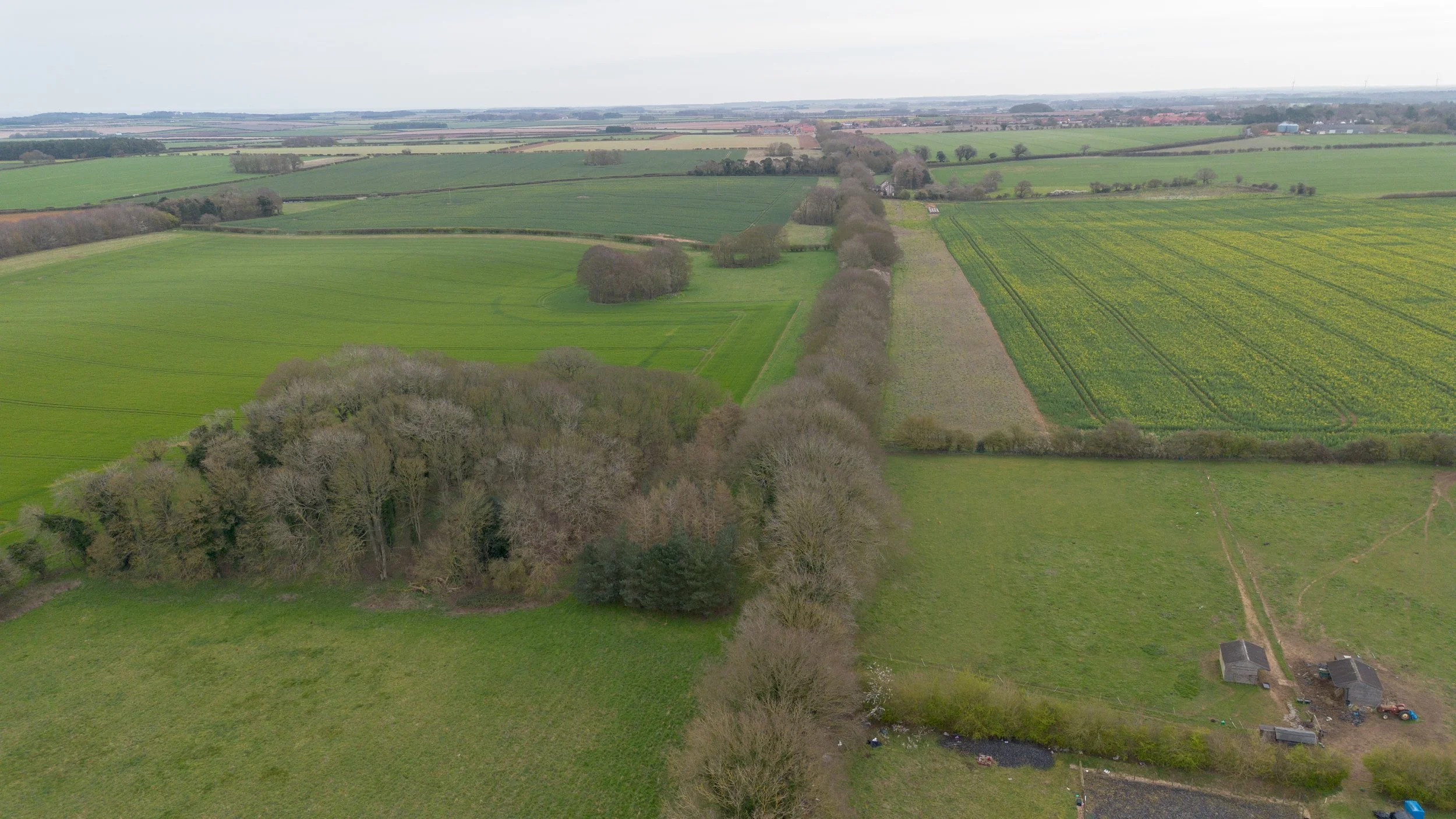
Bridge HWS1799
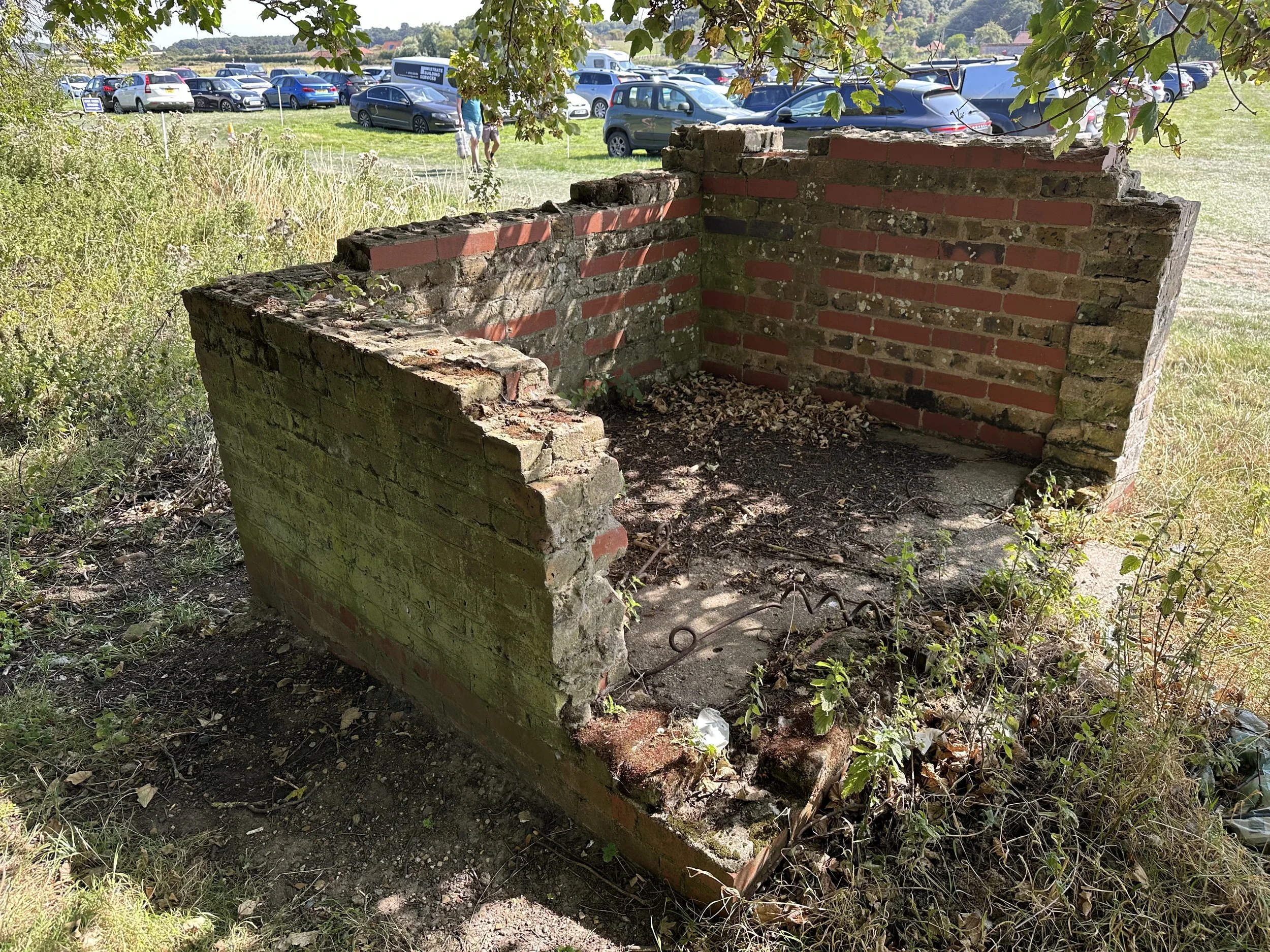
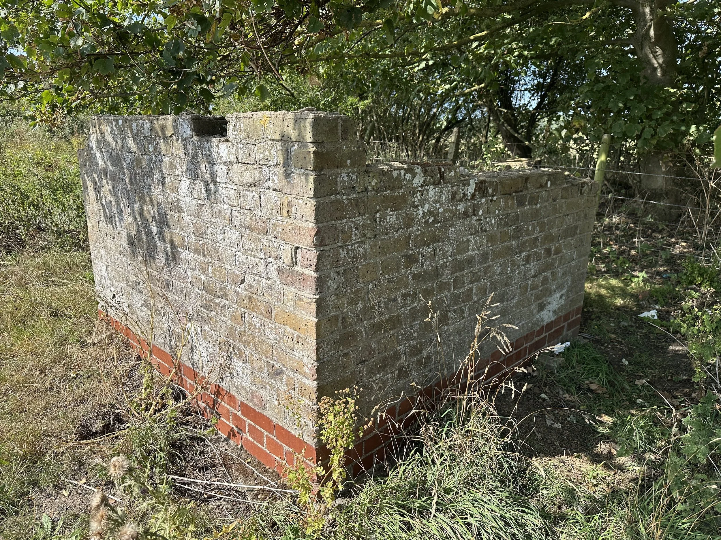
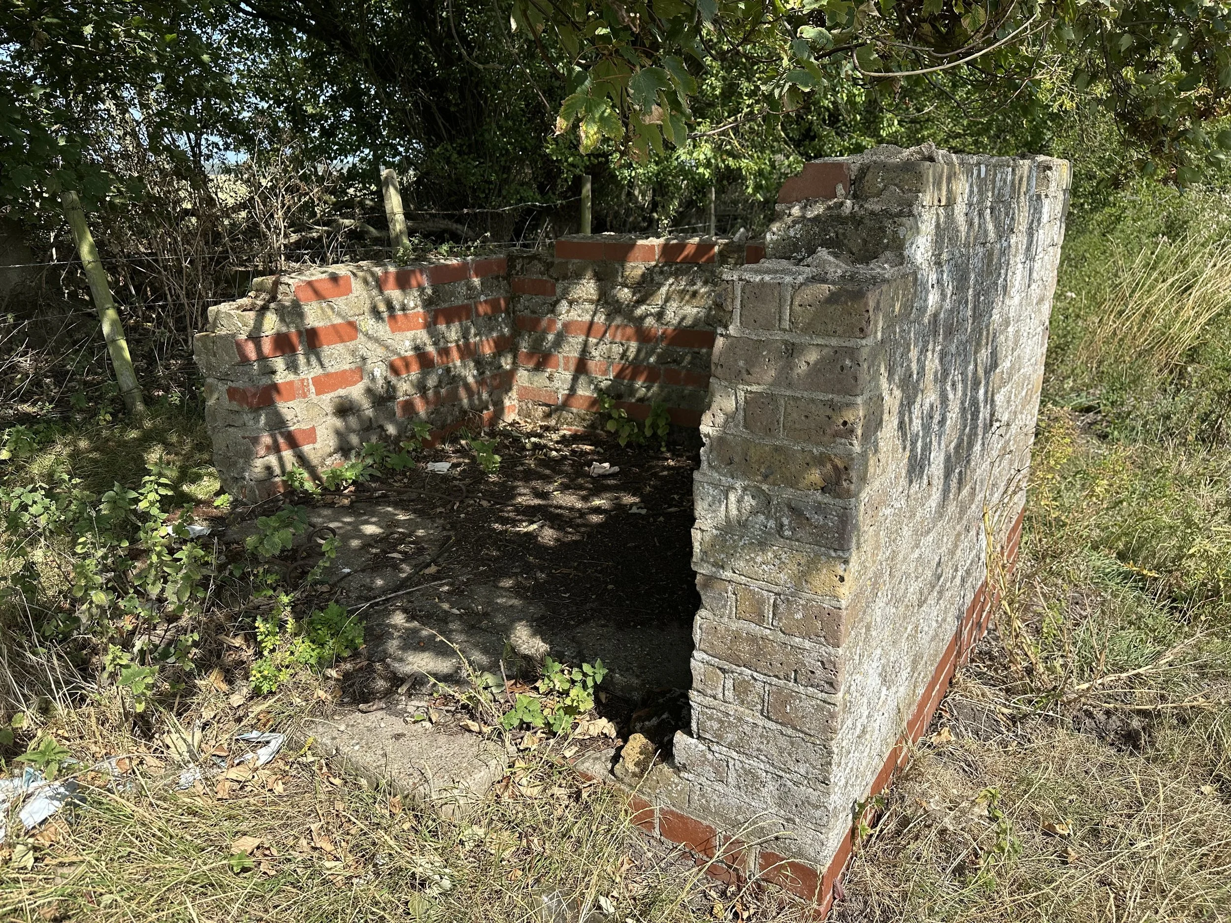
Shortly after bridge HWS 1798, one buttress of another bridge remains just outside of Docking. This buttress is easy to miss, as it can at times be overgrown and hidden away.
Thanks to Norfolk Orbital railway for the information about the location

©National Library of Scotland
Photographed March 2026
I had driven past this buttress countless times and never noticed that one remained. The first time I looked at this location, it was so overgrown that the buttress was hidden.
Drone footage looking towards Docking from just past
HWS1799
A very short distance from the Ringstead Road bridge, the railway then arrived at Docking
Docking Station.
The station at Docking, which opened on August 17, 1886, closed to passengers on June 2, 1952, and to freight on December 28, 1964. It was located 6 miles and 21 chains from Heacham, standing 250 feet above sea level, making it the highest station along the route. A map indicates that Heacham is approximately 20 feet above sea level; Sedgeford is around 100 feet; Docking is about 250 feet; Stanhoe is roughly 170 feet; Burnham Market is about 30 feet; Holkham is approximately 10 feet; and Wells is 20 feet above sea level. This steep gradient along the route required powerful engines.
Docking was unique, as it was the only station with two platforms and a passing loop. It was also the largest intermediate station on the West Norfolk railway line, featuring loops and sidings on both sides of the platforms. On the western side of the platform, a level crossing was situated, while on the eastern platform's upside, there was a signal box containing a 32-lever frame. The downside platform housed a brick-built, gable-ended waiting room with a canopy. The goods yard at Docking was substantial, featuring a large shed on the line's downside. Marsters’ granary, located by the railway line, also had private sidings. Today, Docking railway station still stands. The platforms remain intact and are part of the old station's garden. However, the railway goods shed has been demolished and replaced with housing, and new houses have been constructed over the site where the old trackbed once lay. The site of the former granary is now occupied by a housing estate. Next to this new estate, there are old buildings that appear to be remnants of the original granary structures. According to online sources, the original granary buildings were destroyed by fire and replaced with a new structure, which has since been demolished.
Modern Google Maps.
Historic Maps.

©National Library of Scotland

©National Library of Scotland

©National Library of Scotland
Docking station historic photos.

Year and Photographer unknown

Year and Photographer unknown ©Facebook Norfolk Orbital

Year and Photographer unknown
Docking station photographed in November 2022
Docking from above.
The C.W. Marsters Ltd. factory, Docking, from the east, 1949. This image has been produced from a print. © Historic England. Aerofilms Collection.
Please click on the aerial photo for the source page.

The C. W. Marsters Ltd factory, Docking, from the north-west, 1949. This image has been produced from a print marked by Aerofilms Ltd for photo editing. © Historic England. Aerofilms Collection EAW025873 flown 10 August 1949
Please click on the aerial photo for the source page.

This modern aerial photo, taken in 2025, shows Docking railway station at the centre-left of the picture and the new-build housing estate that was constructed over the site of the old Marsters’ granary to the right-hand side.
Docking Goods shed.
_1991_geograph-3413193-by-Ben-Brooksbank.jpg)
©Docking station (remains) 1991 geograph-3413193-by-Ben-Brooksbank
Remains of Docking Granary taken August 2025
Leaving Docking, the next station on the route was Stanhoe, which was located just a short distance away from Docking. Once again, the railway travelled through the picturesque rural countryside of Norfolk during this brief journey between the two stations. The route crossed only one minor road, where the crossing cottage still stands.

©National Library of Scotland
Stanhoe station.
Stanhoe, located eight miles and twenty-six chains from Heacham, was positioned over a mile away from the main village, making it the most rural station along the route. It featured a simple layout with a single platform and had no goods sidings. The only structure was a small waiting room made from local flint. To the west of the station, there was a level crossing.
Today, the station still exists and is used as a private residence.
Historic Maps.

©National Library of Scotland
The historic map below illustrates the distance from the station to the main village, highlighting how secluded some stations were along this route.

©National Library of Scotland
Stanhoe Station.
Year and Photographer unknown.

Photographed 2020

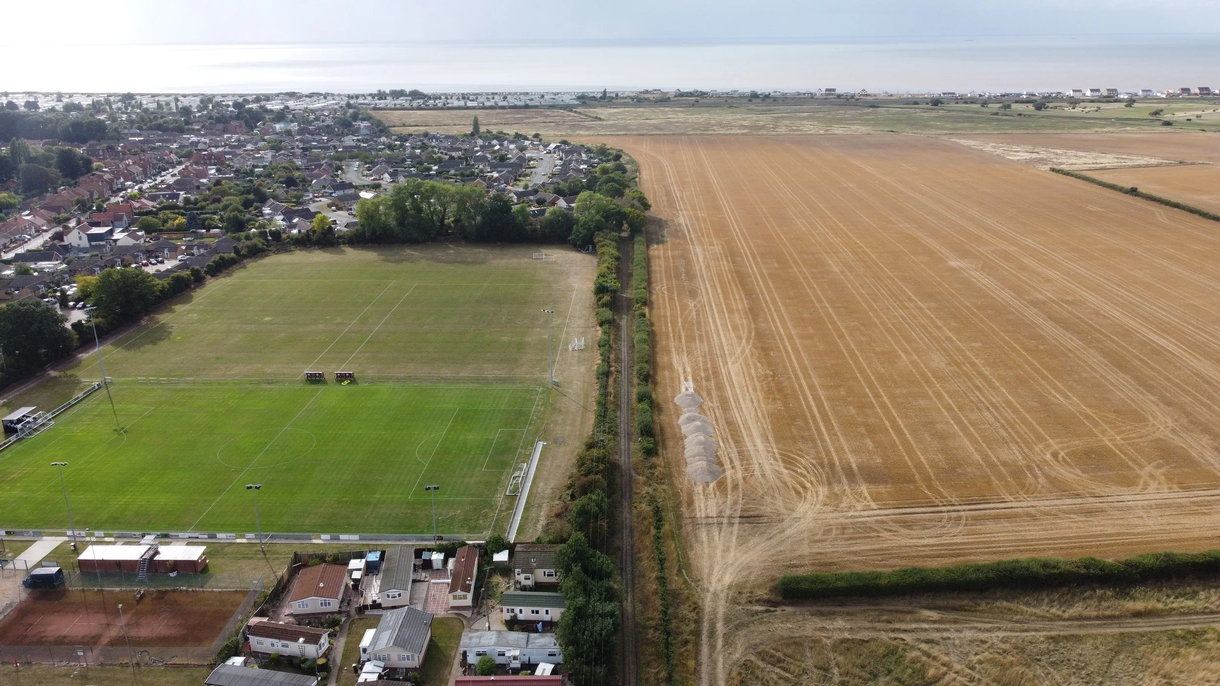
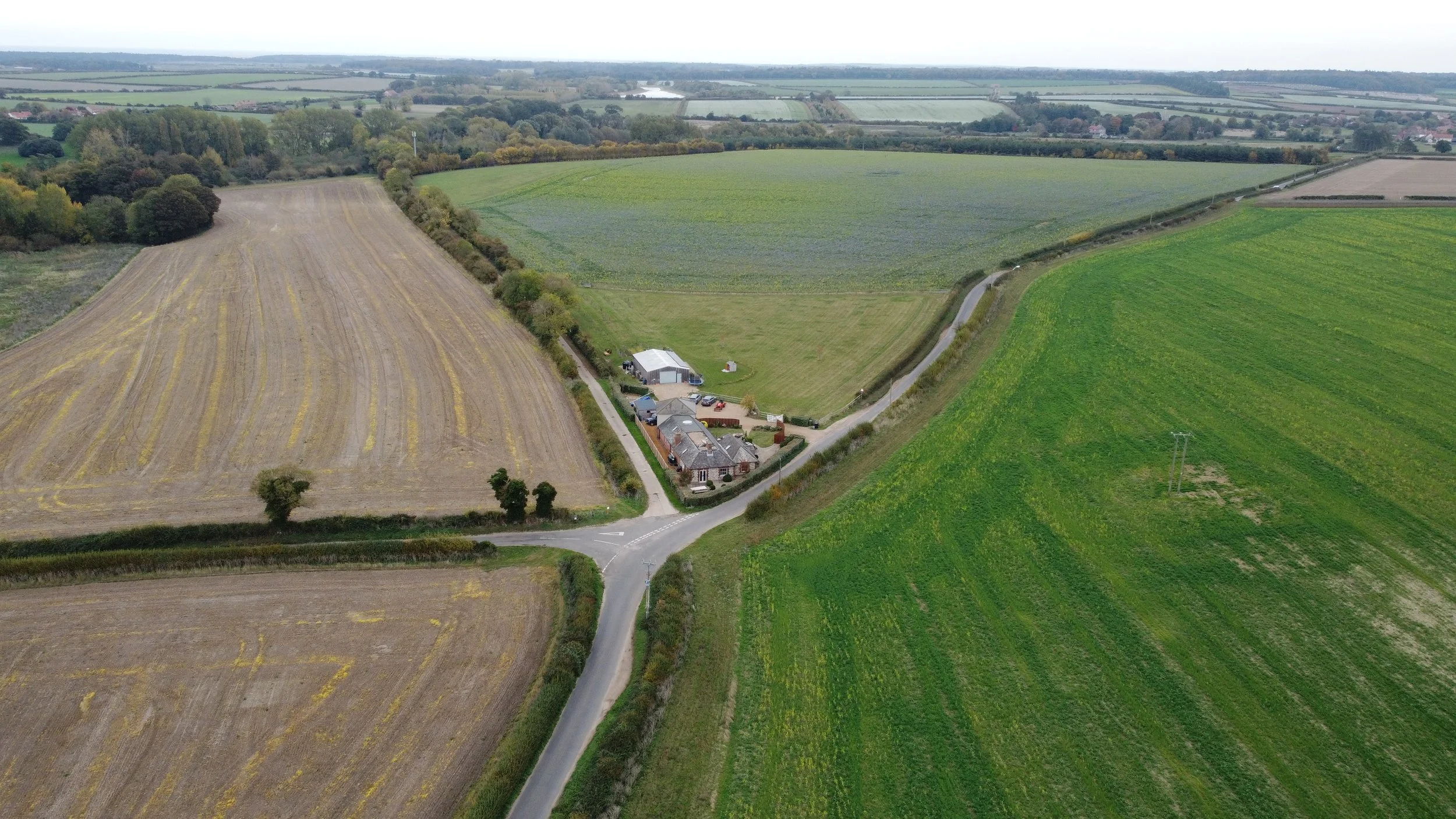
Leaving Stanhoe, the railway traveled toward Burnham Market station, passing through the rural Norfolk countryside alongside a road near the hamlet of Muckleton.
Approaching Burnham Market
Approaching Burnham Market, we see what appears to be a crossing cottage.

©National Library of Scotland

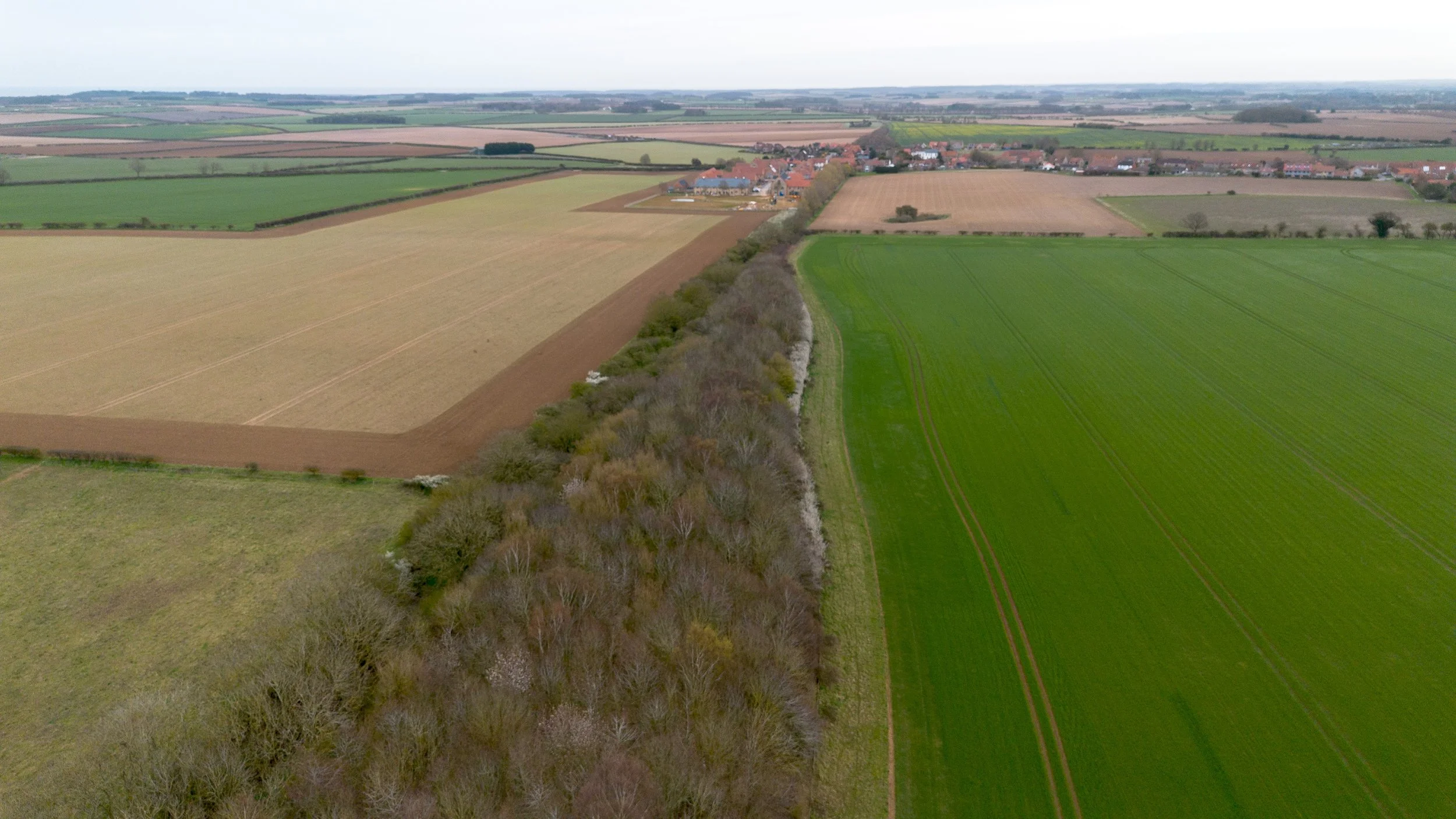
Burnham Market approach aerial view.
The aerial view seen below shows Burnham Market village in the distance.
You can see that the village at this point has not been constructed over the old track bed.

50/50 map coverage of the old track bed leading into Burnham Market.

©National Library of Scotland
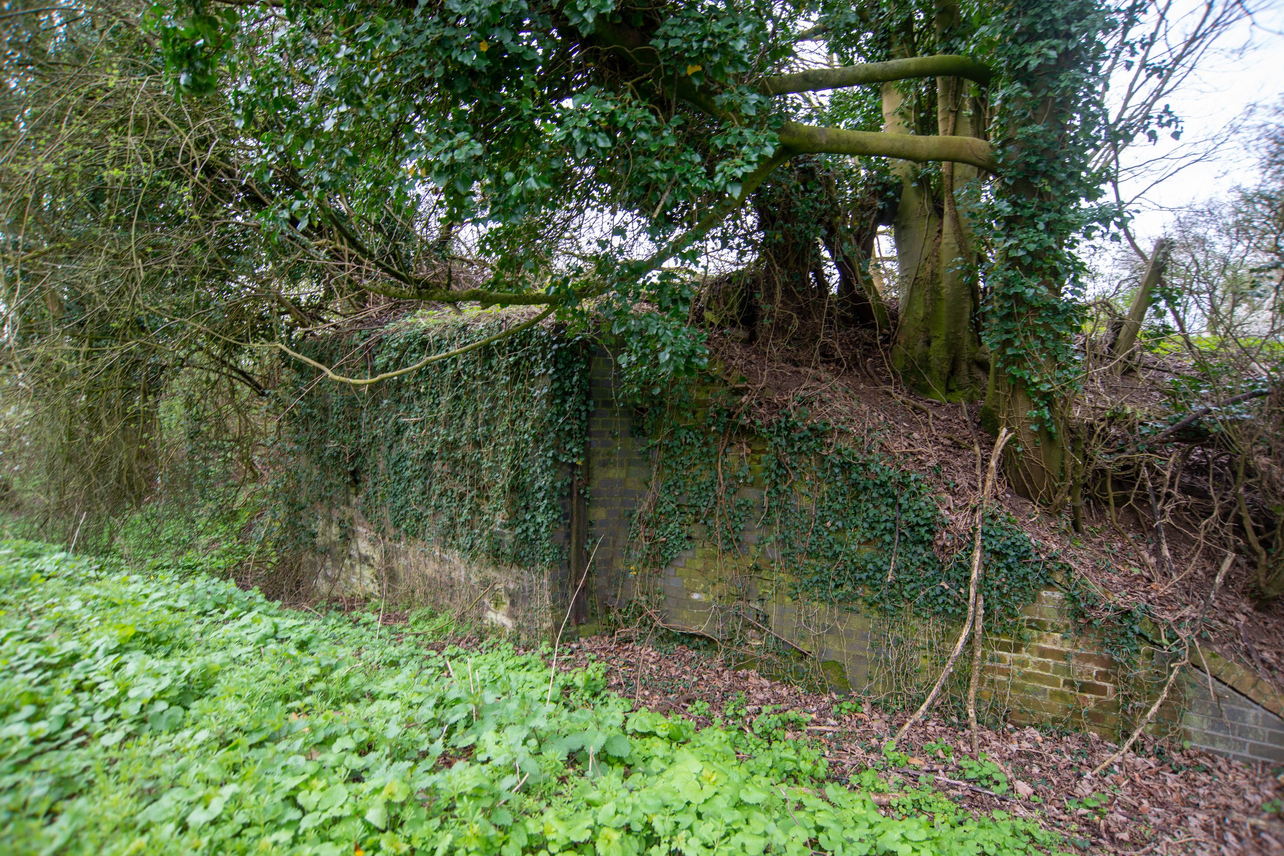
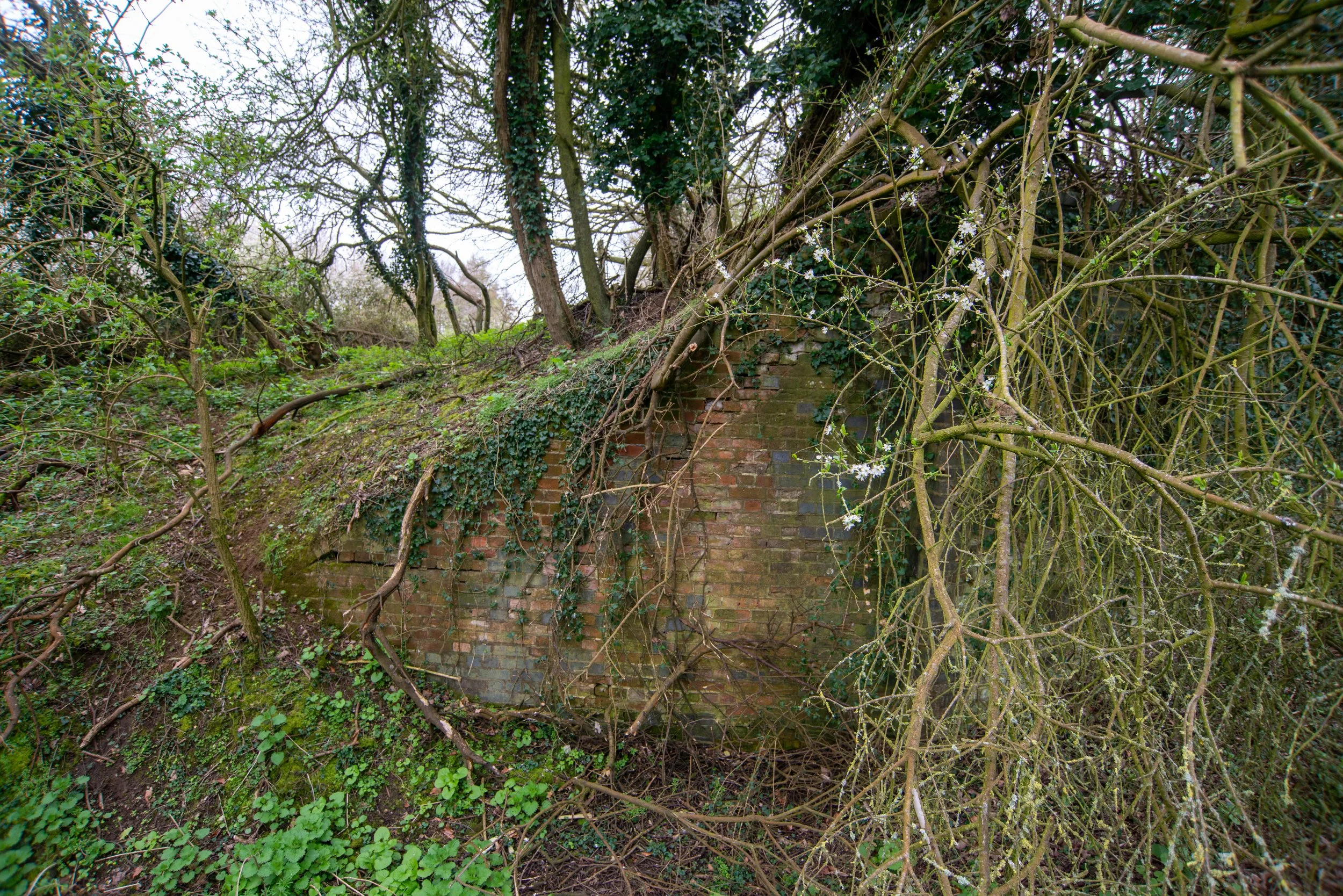
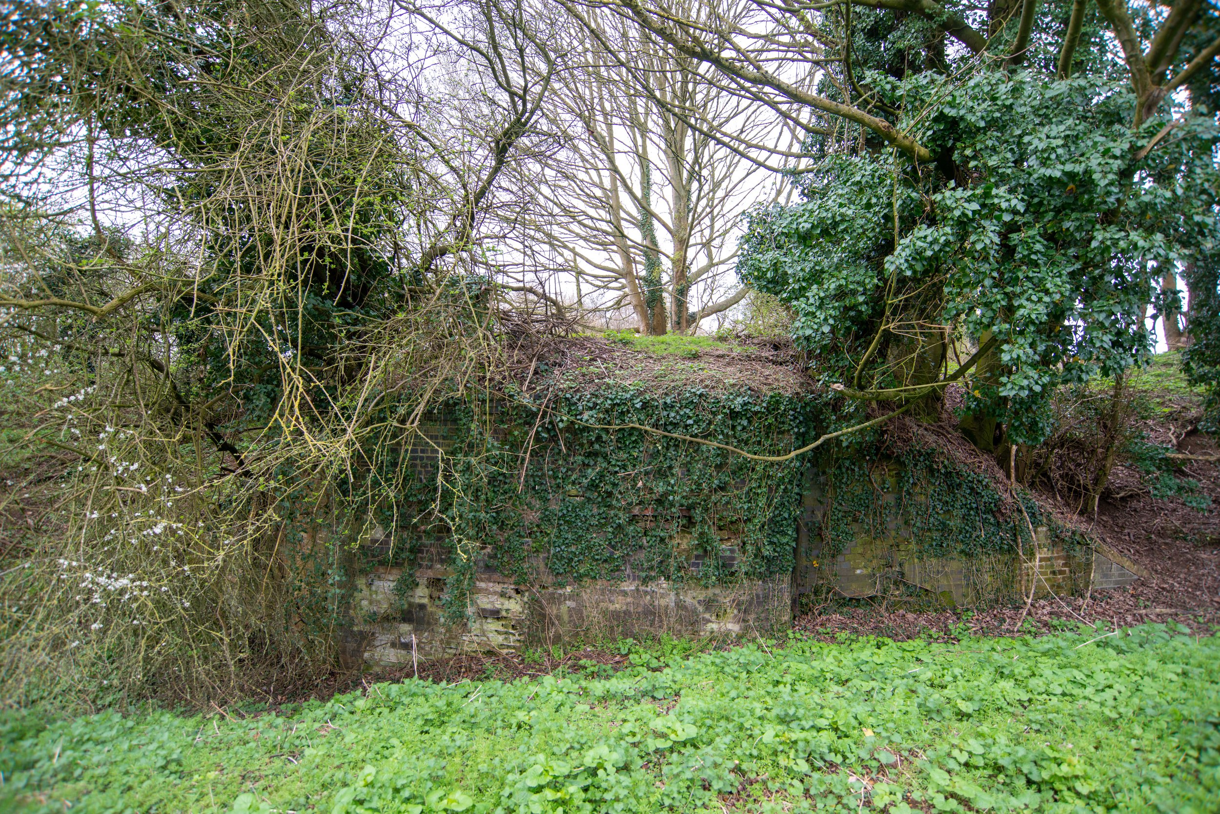
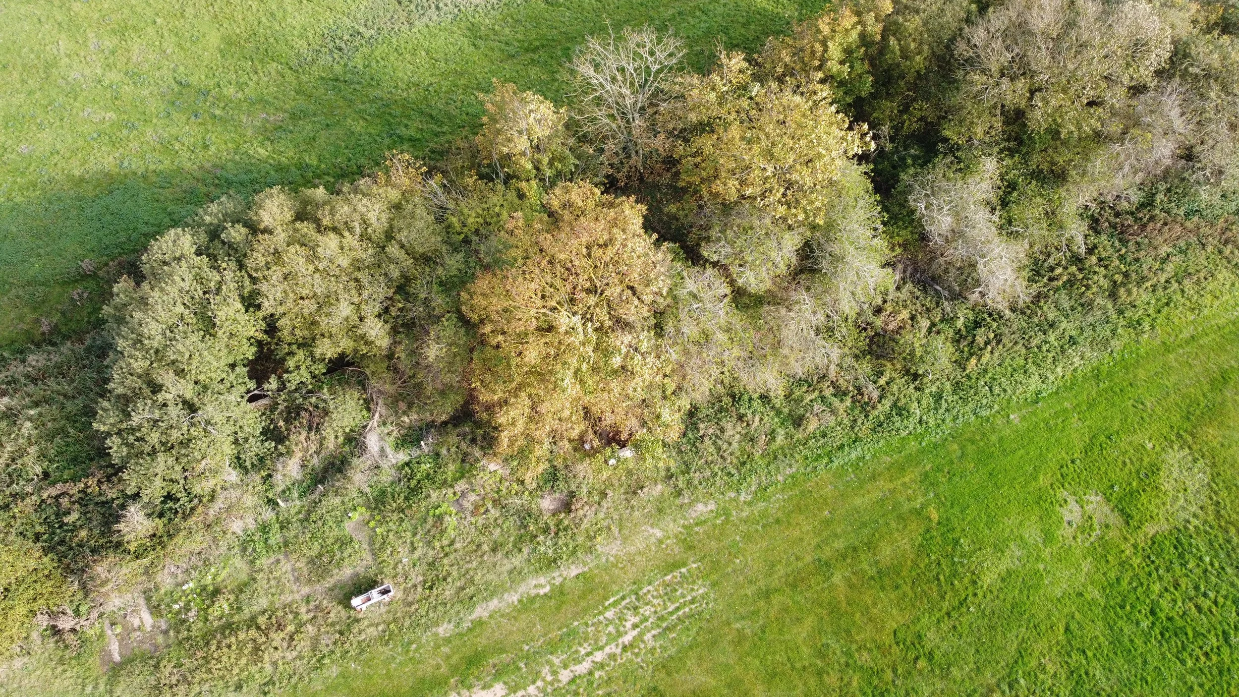
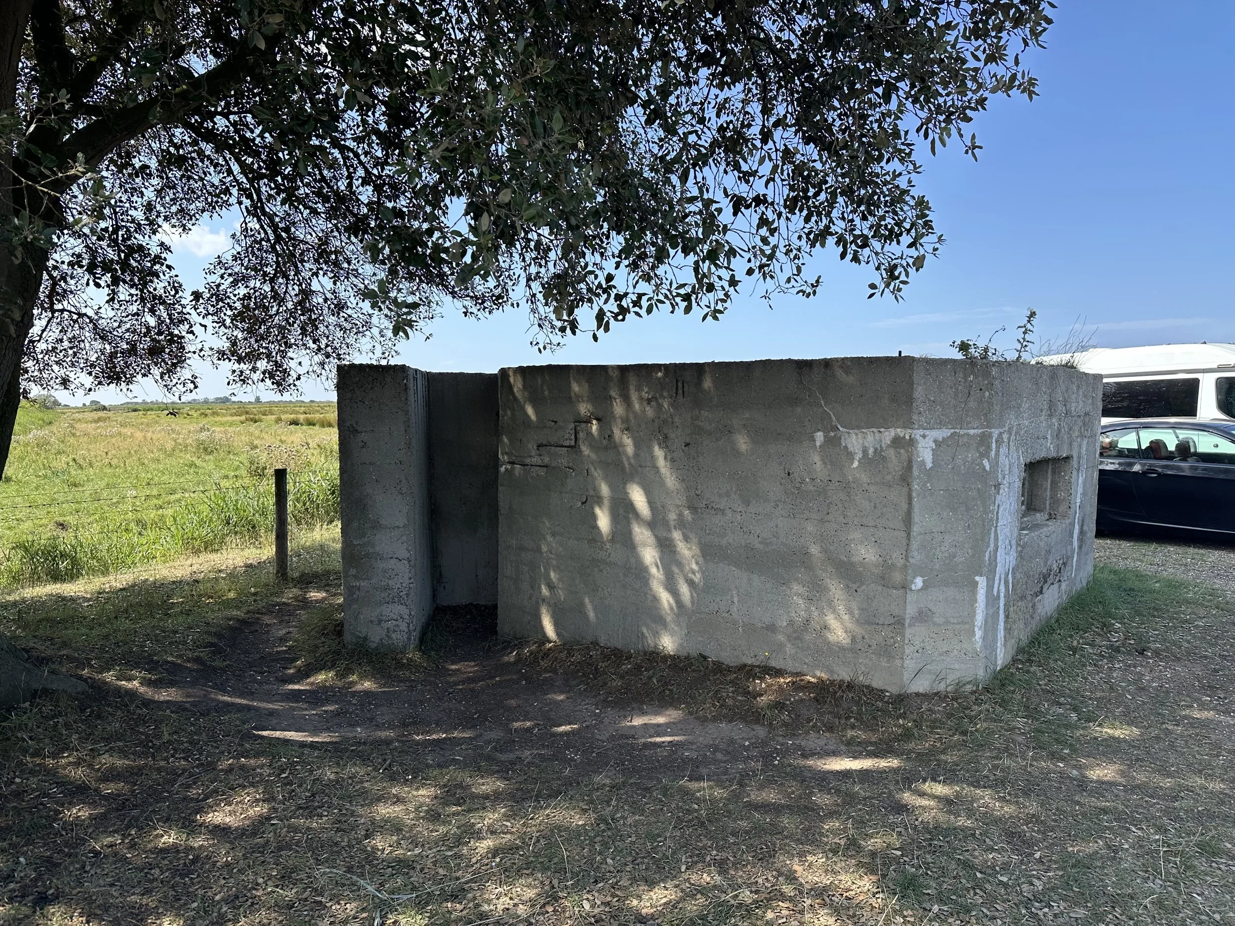
One of the line side pill boxes left behind from the war defences on the outskirts of Burnham Market.
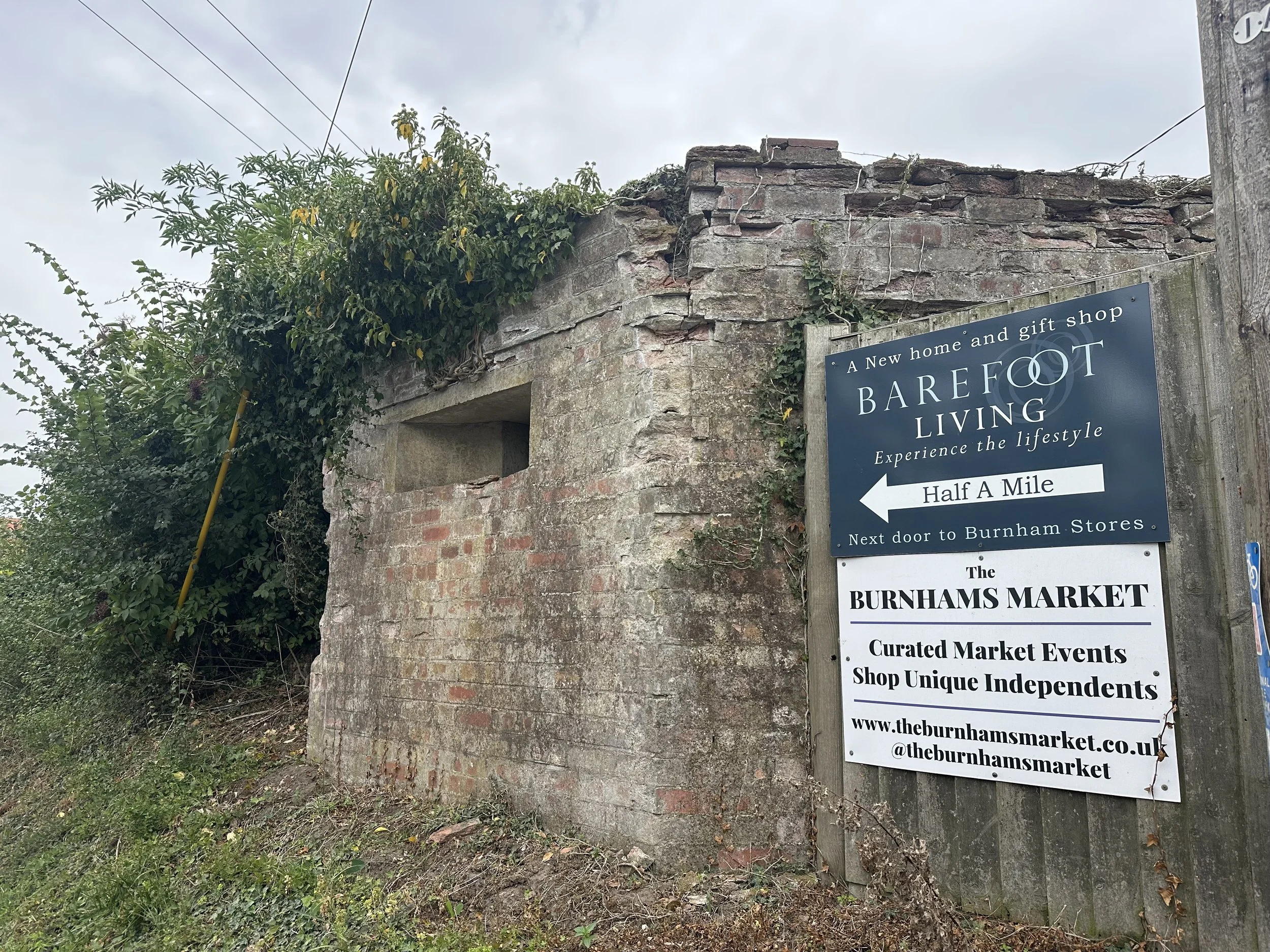

Just before Burnham Market station, an old gate post stands on Station Road near the housing estate called the Old Railway Yard. Looking at historical maps, this was a gate post set quite far back from the line itself; this was most likely a vehicle entry gate into the goods yard.

©National Library of Scotland

Burnham Market station
Burnham Market 11 miles 43 chains from Heacham. Opened on the 17th of August 1866 as Burnham, the station was renamed Burnham Market in June 1883, and this name remained until its closure in 1964. Burnham Market closed to passenger services in 1952 and continued to operate for freight use only. During the floods of 1953, the line between Burnham Market and Wells was severely damaged; British Railways decided it was not financially viable to replace the track there. In 1955, the railway track was lifted, and a buffer was placed at Burnham Market, leaving only the 11 miles and 43 chains between Burnham and Heacham in use for freight traffic.
Burnham Market featured a two-storey, brick-built station building situated on the downside of the platform, which included a single-storey ticket office. The station's structure was designed in an L-shaped configuration, similar to many others along this line and the King's Lynn to Hunstanton line. To the west of the station, there was a passing loop exclusively for freight trains, as this loop lacked a second platform for passenger services. To the east of Burnham Market station, a level crossing was positioned at the end of the platform. Additionally, Burnham Market had four sidings branching off from the passing loop on the downside of the line, accompanied by a goods shed constructed like the one at Docking. Burnham Market's signal cabin was located to the west of the platform on the upside and was a small cabin fitted with a 20-lever frame.
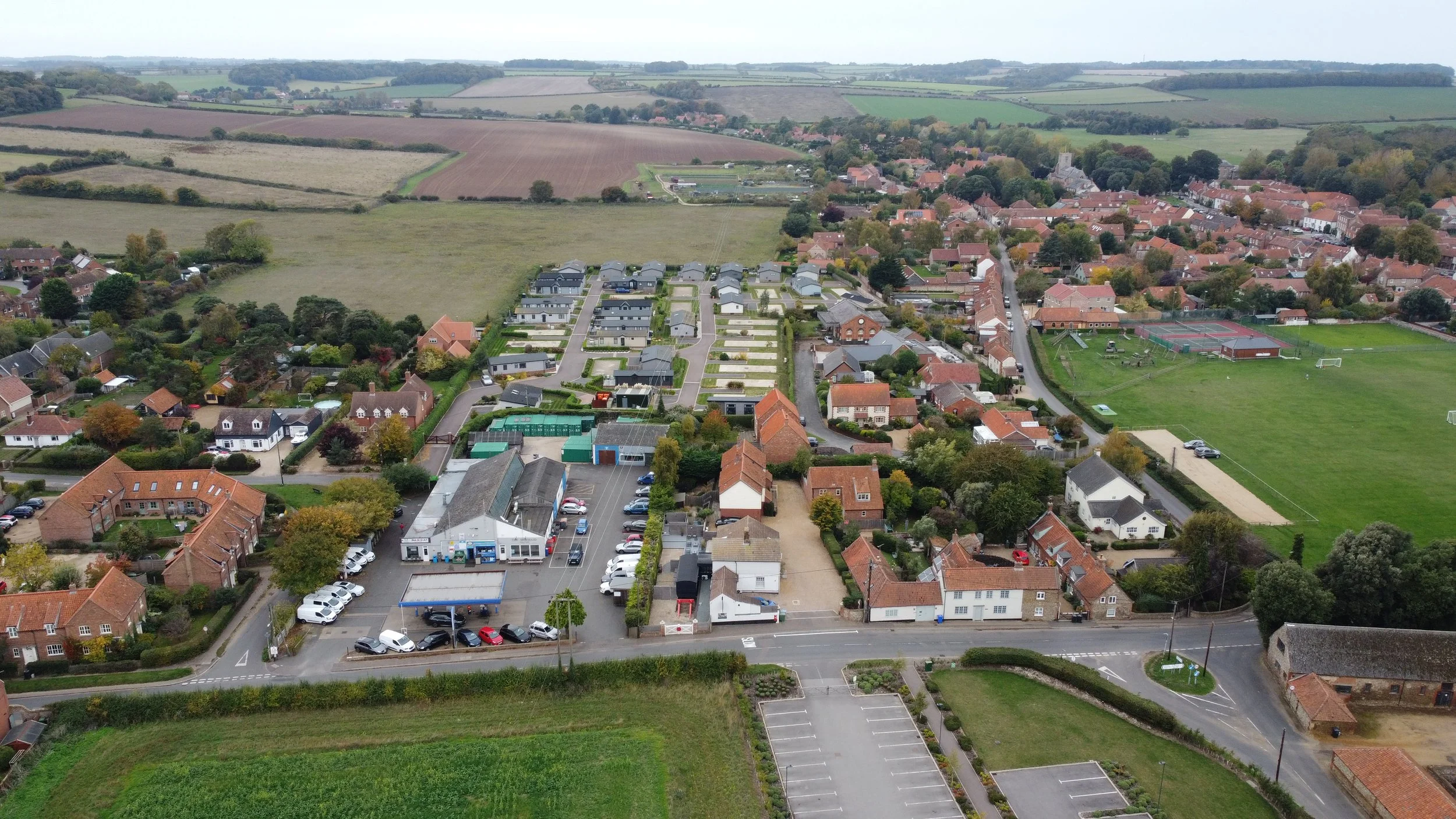
At the time of writing, the layout of Burnham Market village has remained largely unchanged, but its character has undergone a significant transformation. Locals now refer to Burnham Market as "Chelsea by the Sea," as city dwellers have purchased many properties and often use them as second homes. As a result, numerous houses are occupied for only half of the year, a significant shift from the village’s historical roots as an agricultural and fishing community during the days of the railway.
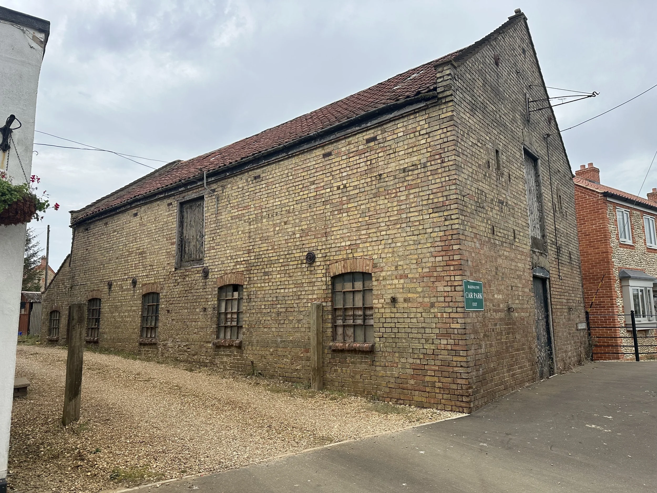
The railway station still exists and has been well-maintained by its owners. It is now used for holiday lets, along with a short segment of railway track and an old railway carriage on this section.
The goods shed in Burnham Market also remains, and thanks to its owners, this historic structure has been beautifully preserved.
Modern Google Maps.
Historic Maps.

©National Library of Scotland
Burnham Market historic photography.
Burnham Market station is reported to have been photographed here in 1952, near the end of its operation as a passenger station.

©Ian L.Wright

©Year and photographer unknown.

©Year and photographer unknown.

©King's Lynn and area Model by J T Colquhoun
Burnham Market in 1959, visited by members of the Loco Club of Great Britain.
Also seen to the rear of the track is a buffer, indicating that, at this stage in the railway's life, the line from here was closed after the great floods.
All information and the photo were sourced from

Photograph ©B Wilson
Burnham Market level crossing, year unknown.

©Year and photographer unknown.
Burnham Market station modern photographs.
Burnham Market station, photographed in 2020, is now used as holiday lets.


This aerial photo shows Burnham Market with the old station and carriage at the bottom of the photograph and the old goods shed located further up the line
Leaving Burnham Market, the railway headed off towards Holkham, weaving through the Norfolk countryside.
After the 1953 floods, this point was where the railway terminated, as British Railways had declared the line unprofitable and too costly to maintain. Many locals said the flooded part was only a small section of the line, which they then used as an excuse to start the closure of the entire line.
At Joan Shorts Lane, just outside Burnham Market, the railway crossed over one of many crossings before arriving at Holkham.
This aerial view of the crossing cottage at Joan Shorts Lane shows no trace of the line left between the old station and this crossing, whereas afterwards we can see a farm road where the railway once ran.
Historic and Google Map coverage.

©National Library of Scotland
The railway shortly crossed over the Small River Burn.

©National Library of Scotland
Shortly after the river Burn the railway crossed over Leith House crossing.

©National Library of Scotland
Peterstone Brick works.
Peterstone Brick Works was situated between Burnham Market and Holkham. In the railway days, it had a small railway siding at the works.
The works were said to have been established by Thomas Coke, who commissioned Holkham Hall and William Kent, the architect of Holkham Hall.
The hall was said to have been completed using local clay bricks in 1764, long before the railway arrived.
The brickworks shown before the railway arrived, maps dated from 1798 to 1878

©National Library of Scotland
Peterstone brickworks sidings.

©National Library of Scotland
Shortly after Peterstone cottages, the railway crossed over this Level crossing. To this day, the cottage still stands.

©National Library of Scotland
Close to Holkham, this last level crossing is called, according to historic maps.
Dale Hole Crossing..

©National Library of Scotland
Holkham Marshes
The next area we come to is the marshland stretch at Holkham, which, during the great floods of 1953, flooded this area and caused significant damage, making the line unprofitable and leading to its closure up to Burnham Market by British Rail.

Parts of the track bed between Holkham and Wells after the 1953 floods.


©KL Forums
When I first created the page on the Heacham Wells line, it was ironic that, while writing and researching, the 1953 floods anniversary coverage was playing on BBC Radio Norfolk in the background, they were reporting on the 70th anniversary of the Great East Coast floods.
That happened 70 years close to the day that I first wrote this page on my old web provider back in late January 2023
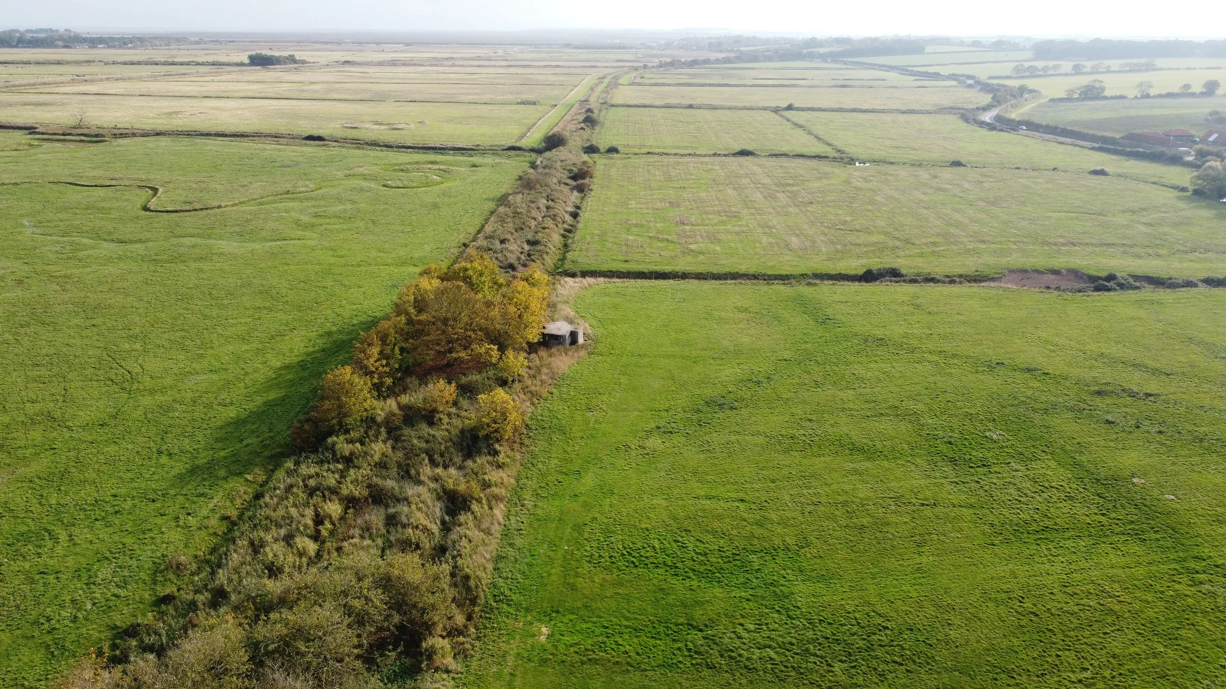
Drone footage taken in October 2025 showing the old track bed leading up to Holkham.
Facing Burnham Market.
Drone footage Shows another old pill box left behind from the war.
This was one of many left along the line.

Facing Holkham.

Taken from Holkham station looking towards Burnham Market.
Holkham station.
Holkham station, along the line, was the line's shortest-lived station, having been opened in 1866 and closed to passengers in 1952. After the 1953 floods, the line was damaged and closed between Burnham Market and Wells station. Even for freight use, the line was closed, and the railway was demolished, most likely along with parts of Holkham station.
Holkham was 15 miles and 64 Chains from Heacham and had one platform, no sidings and a level crossing. Holkham had a small wooden signal box controlling the single line. The station was within walking distance of the Earl’s mansion and roughly half a mile from Holkham beach.
Holkham would have been one of the last stations built along this line, since Wells station had already been constructed for the Wells to Fakenham, Dereham, and Wymondham lines.
When the line was to be constructed, the Earl opposed the station's construction, expecting an influx of tourists to the area.
To this day, all that remains of Holkham are tiny fragments of the station buildings, and the station platforms are hidden away behind the overgrowth.
Modern Google Maps.
Historic Maps.

©National Library of Scotland
Thanks to King's Lynn and area Model by J T Colquhoun
a photo of Holkham from 1924
( Lens of Sutton)

Holkham station, year and Photographer unknown.
Holkham station remains..

Possibly the old toilet block.
Thanks to Norfolk Orbital Railways Facebook page for permission to reuse the photos of the remaining platforms at Holkham taken in 2023.
Please click the facebook icon for the original post


To the east of the old station site, another of the many old military pillboxes sits in the now Holkham car park at Lady Anne's Drive.
Here we see more drone footage of the old line at Holkham, heading towards Wells, taken near the site of the old Holkham station.
Also seen in this aerial image is another war remnant: another pillbox.
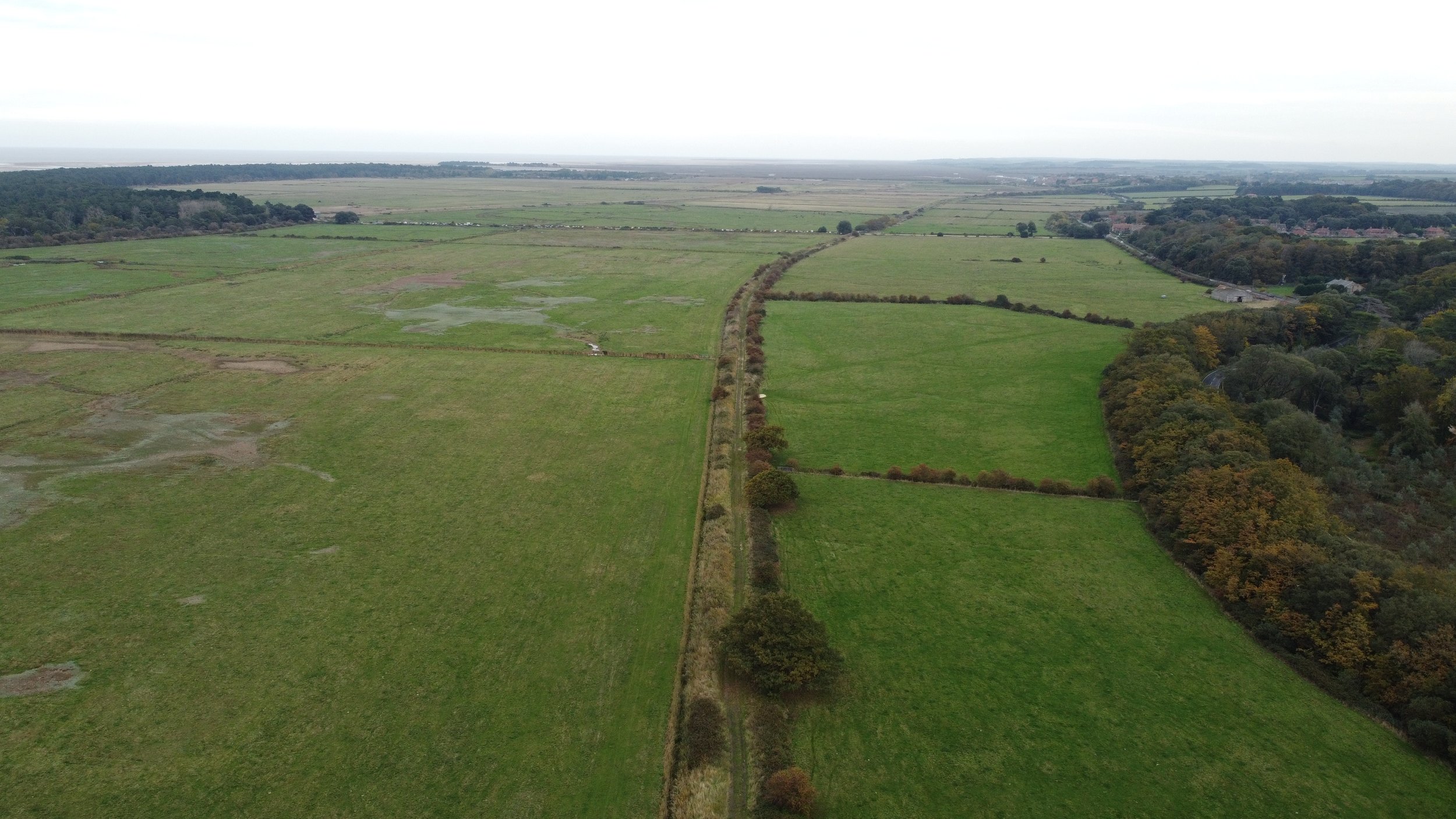
Leaving Holkham for the short distance to Wells, the railway headed through open marshland passing what’s now two farm tracks. Then, close to Wells, the line became the most complex part of the route, with bridges, cuttings, and crossings needed to access Wells station.

©National Library of Scotland
Close to Wells, this old embankment remains on the outskirts of the town.
Holkham can be seen in the distance.

Aerial photograph showing the old track bed approaching wells with Holkham in the background.
This area was flooded in 1953. In the distance, you can also see the coastline, illustrating how easily this part of the railway could have flooded.

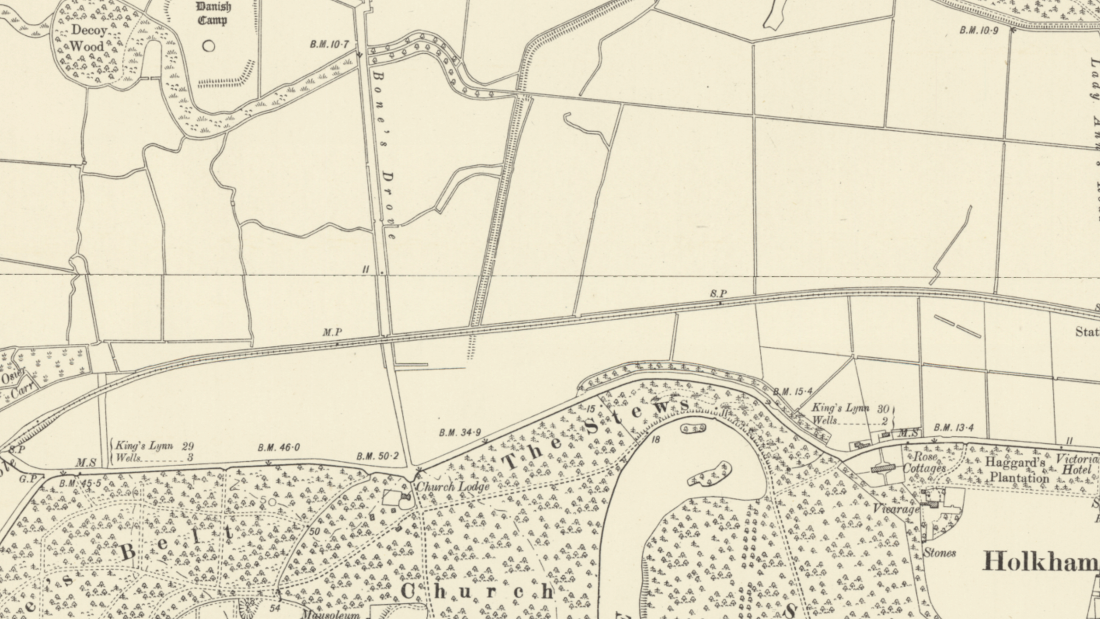
As mentioned earlier, the entry route to Wells was the most complex part of the entire Heacham to Wells route, as shown on the historical maps below. The first two maps depict Wells town when the railway was operational, and the third map shows the town after the railway's closure. The maps also illustrate the beginning of the Wells to Wymondham line that went via Fakenham and Dereham, as well as the Wells Harbour line.


©National Library of Scotland
Bridge HWS 1801
After the embankment, the railway would have crossed over this first road bridge at the start of the complicated approach to Wells.

Bridge HWS 1801 in the 1950s
©E.A Millar
When the bridge was taken down, I'm not sure again, I'm sure it would have been shortly after the 1953 floods; all that remains are the abutments, as seen in the picture below.
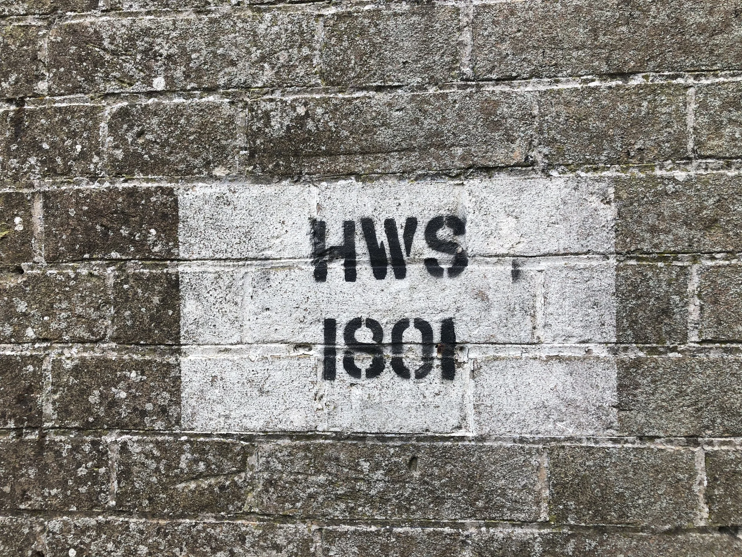

HWS 1801 track line and the bridge position from above.
Road bridge HWS 1802
After this overpass bridge, the railway entered a cutting heading towards Wells and passed underneath a road bridge.
HWS 1802

©National Library of Scotland


Aerial footage of the tree line where the Heacham Wells line ran under the road.
Bridge HWS 1803
Heading off again towards Wells, the railway crossed over this next bridge on the B1105, once again, when this bridge was taken down, I can not say, but guessing close after the closure of the railway line in the 1960s

©National Library of Scotland
Aerial shots show the tree line where the line ran up to and over HWS 1803
The remaining buttresses photographed from the main road.


After the railway crossed over this bridge, it crossed over Market lane via what looks to have been a level crossing near where the Alderman Peel High School now sits the railway then started to bear to the left passing under whats now the A149 Warham Road, then approaching wells station and converging with the wells Fakenham Dereham Wymondham branch and entering Wells station, where this train had completed its journey 18 miles 19 chains from Heacham and 31 miles 34 chains from King's Lynn.
Market Lane crossing.

©National Library of Scotland

Warham Road, Stiffkey Road underpass.
The railway here passed beneath the road. The bridge has been infilled, but the deep cutting survives to the south of the road. It is now within the grounds of the school.
Thanks to Steve Heywood for the information.

©National Library of Scotland

Approaching Wells station.

The map below shows the old railway route in its dismantled state.

©National Library of Scotland
Here, we see a steam locomotive leaving Wells, heading towards Holkham, on what is said to be the curve just before Wells station.

©P.B.Whitehouse
A Steam loco on the curve close to Wells station.
Thanks to King's Lynn and area Model by J T Colquhoun
Writing on the back of the photo credits R Harrison.

Wells station

©Geoffrey Skelsey CC BY-SA 4.0 Wikipedia
Wells next to the sea is a coastal town in Norfolk, the final destination of the Heacham to Wells railway line, located 18 miles and 19 chains from Heacham and 31 miles and 34 chains from King’s Lynn. Here, the journey on the west Norfolk branch came to an end.
Wells station was opened some nine years before the arrival of the West Norfolk branch from Heacham it was originally opened by the Wells & Fakenham Railway company in 1957. Later, in 1862, the Great Eastern Railway company took over services to Fakenham, Dereham, and Wymondham, where the line joined the Norwich line. By 1866, Wells saw services arriving from Heacham.
Wells had three platforms and a two-storey brick station building. Unusually, the Dereham line had a platform on both sides, giving travellers the choice of alighting from either side of the train. With the Heacham branch services, the outer edge of the island platform was used. Goods facilities at Wells consisted of a small goods yard north of the passenger station, with four additional sidings to the south. There was also a 45-foot turntable sited at Wells station.
Wells had a combined freight and engine shed, and this closed in 1955. Unfortunately, the freight engine shed was also demolished soon after the closure.
Sited close to the station was Dewing & Kersley's mill, which also had its own sidings.
Wells also had a very short freight line down to Wells Harbour.
Wells, unlike Hunstanton and Cromer, was never a tourist destination; it was, to some extent, a working port with quays instead of gardens, promenades, and seaside tourist attractions.
In 1953, the great flood soon hit the East Coast. Gale-force winds, heavy seas, and floodwaters soon hit Norfolk.
Wells harbour was awash; the water soon overlapped the platform at Wells station, and the stationmaster and his family were trapped in residential quarters on the station's first floor. The signalman was stuck in the signal box until the following morning.
Services stopped to Heacham in 1953 after the floods.
In 1964, the line between Wells and Dereham closed to passengers; it continued from Dereham to Wymondham, closing to passengers in 1969. The line remained open for freight use for several years as far as Fakenham.
Wells station after closure
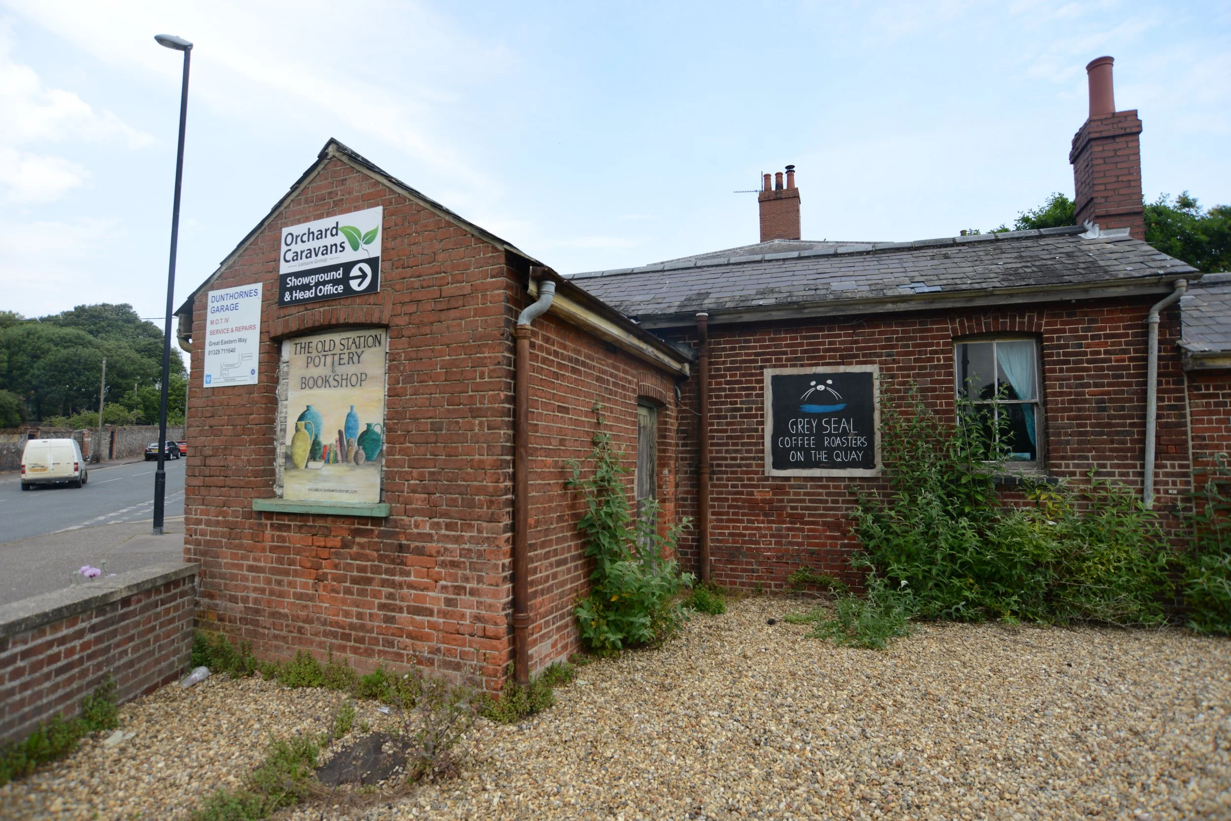
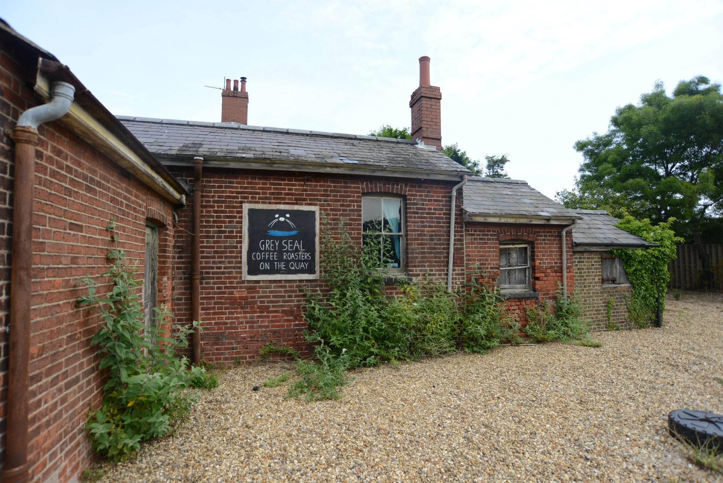
Well’s Station building still exists. The platforms have been demolished, along with the goods and freight shed, and the area where the sidings once sat is now a cul-de-sac and industrial estate called Great Eastern Way. The station building currently functions as a bookshop and remains in excellent condition, as shown in the pictures below. However, there is no trace of where the platform once stood. Close to the station building, a granary that was once Dewing & Kersley's still exists in superb condition and is now used as flats and small businesses. This mill was not part of the railway, but from what I can read, it had its private sidings.
Wells also had a light railway line linking the town to the beach. This line has also ceased to exist, having been closed, demolished, and replaced by a bus service. There is a page dedicated to this old, closed line on Norfolk's disused railways.
A link can be found at the bottom of this page.
Wells now is a very different place. The harbour still looks quite similar to how it did years ago, and even though there is no visible trace of where the railway once ran on the Quay, you can still see where it would have been, as the Quay at Wells is still used for fishing boats and remains undeveloped.
Wells town has changed and is now heavily influenced by tourism, with many city house owners purchasing second homes there, similar to Burnham Market. In the summer, it becomes a bustling tourist hotspot, attracting visitors to the Quay, the beach, and town centre attractions like the amusement arcades, Norfolk coastal chip shops, and novelty shops.
Modern Google Maps.
Historic Maps.

©National Library of Scotland

©National Library of Scotland

©National Library of Scotland
Wells Station 1963
Seen below is Wells station seen in 1963 ©Geoffrey Skelsey CC BY-SA 4.0 via Wikipedia
Thanks to King's Lynn and area Model by J T Colquhoun
1936 H C Casseley shot of D13 Heacham-Wells local service.

Wells station during the 1953 flood aftermath.

©Photographer unknown
Photo supplied by King's Lynn and area Model by J T Colquhoun

©Norfolk orbital railway-Photographer unknown
Wells Station in the present day.
When photographed, the old station at Wells had been repurposed into a bookshop.
Photographed 2020


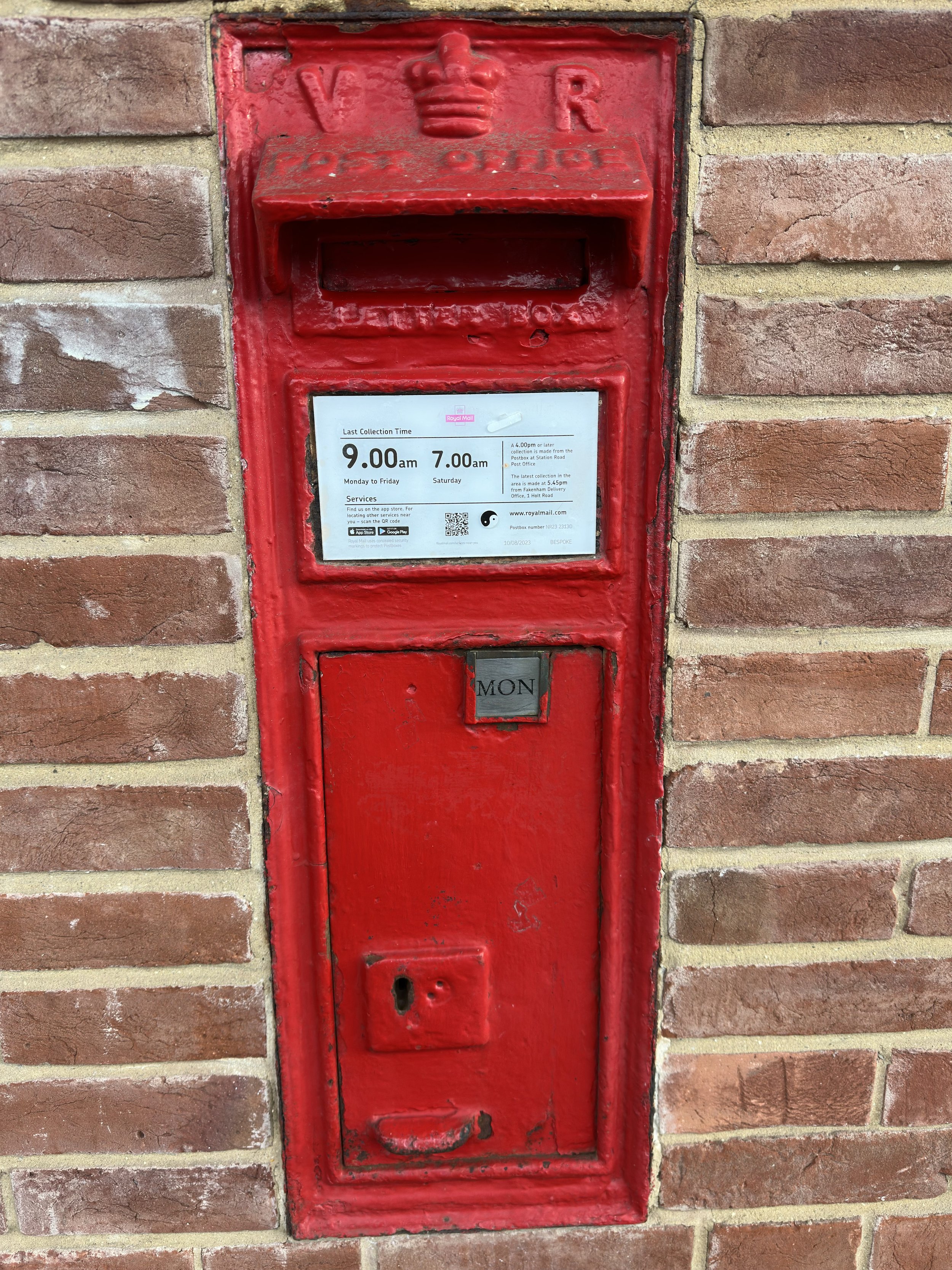
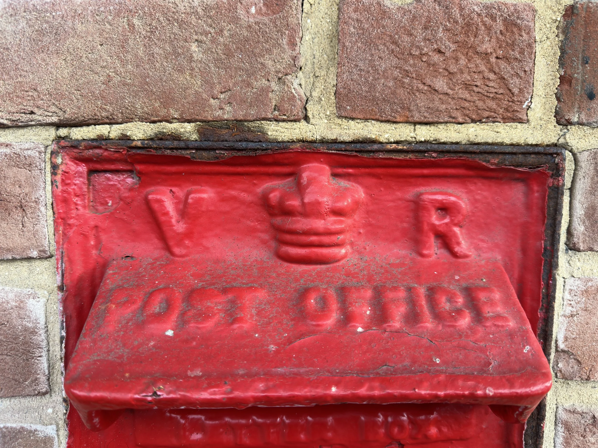
At the front of the old station, I found this old postbox with the VR cypher.
Queen Victoria, reigned for 64 years from 20 June 1837 to 22 January 1901
Dewing & Kersley's
Dewing & Kersley's factory was photographed in 2020, although this building was not directly related to the railway, it did have its own sidings.

©National Library of Scotland

©National Library of Scotland

Wells Harbour Branch
At Wells, other railway lines also existed. The other main line went off towards Fakenham, Dereham, and then Wymondham. One of the other lines was the Wells Harbour branch, which is said to have been open from the late 1800s until 1964. Additionally, there was a light railway at Wells that linked the town to Pinewoods holiday park. This railway has also closed down and was replaced by a bus. There is also a page dedicated to this long-lost line, with a link provided below.

©National Library of Scotland

Year and Photographer unknown
Wells Quay after the floods

Year and Photographer unknown
My Google Maps.
I want to extend a personal thank you to
King's Lynn and Area Model by J T Colquhoun
for supplying historical photos
Simon's Little Locos Flickr account photos are credited as ©H M Littleworth, Simon‘s late Father.
for supplying historical photos.
Norfolk Orbital railway for supplying photos of Holkham and many others, and also the Kl forums for historical Photos provided.
And to the Oakwood Press, King’s Lynn to Hunstanton and the West Norfolk Branch book.
See the links below for pages dedicated to the Wells Harbour Light railway, and also the King’s Lynn to Hunstanton Line