KING’S LYNN DOCKS BRANCH

We recommend viewing this page on a desktop pc-laptop or tablet for a better viewing experience.
Welcome to my page about the long-lost Docks railway, the second railway line in King’s Lynn to serve the River Ouse.
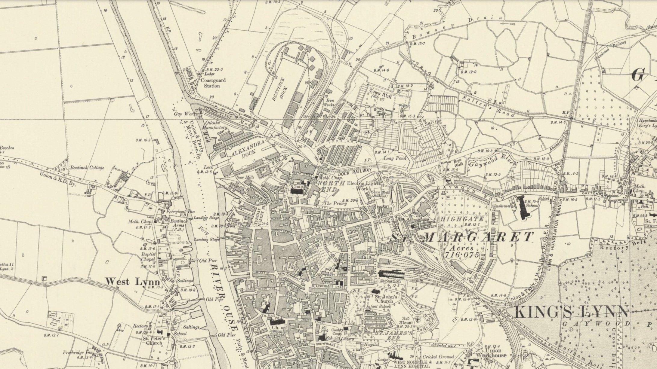
In 1865, the King’s Lynn Dock Company was established, and by 1869, construction of the Alexandra Dock was complete. By June 1870, the docks railway branch was open, helping the new dock quickly become popular, with over 500 ships using it annually by 1876.
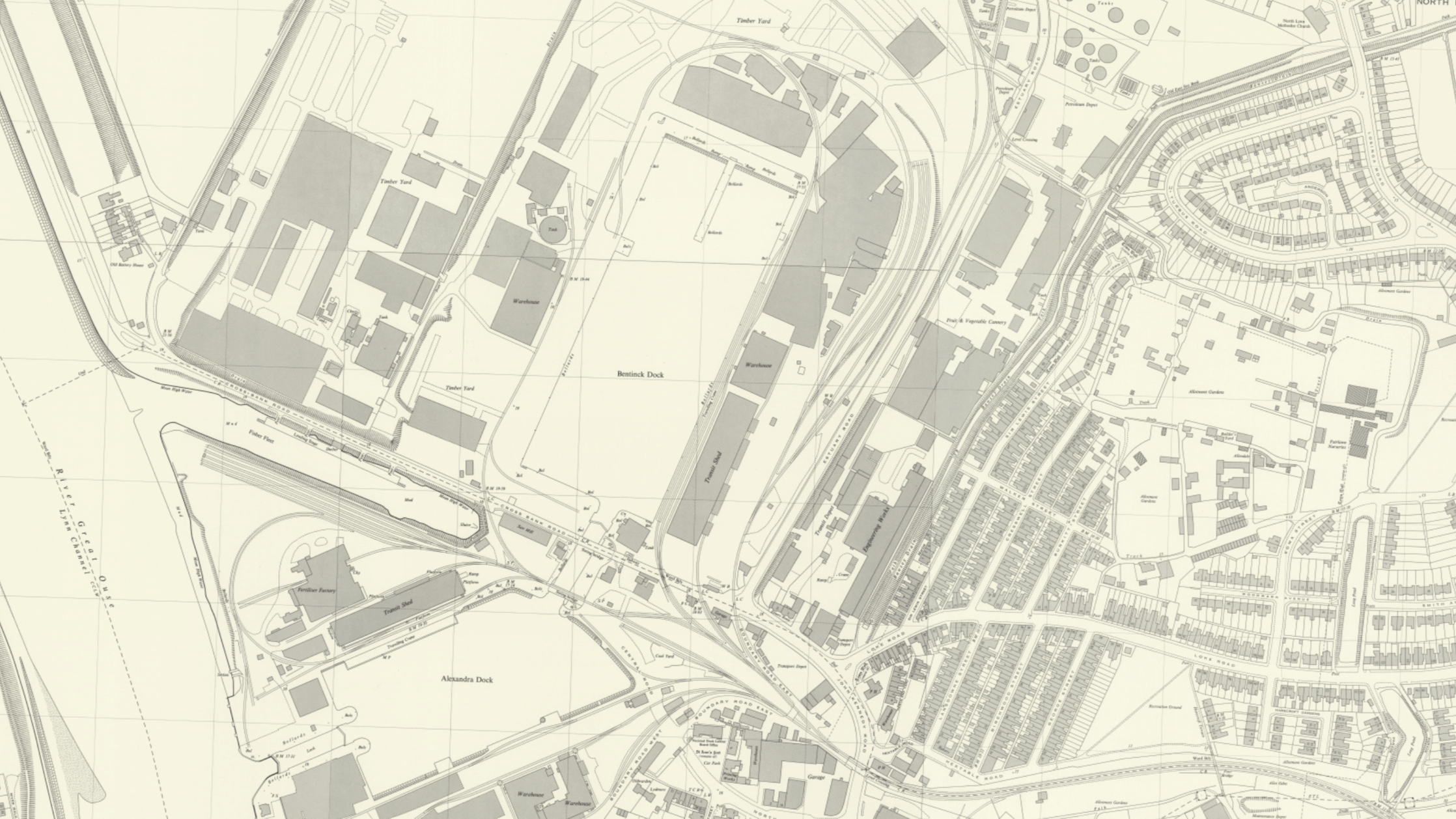
By 1883, the railway was extended with the opening of the second dock at King’s Lynn, the Bentinck Dock, which spans 800 meters in length. During the 1960s, Dow Chemicals established a presence in King's Lynn, and an extension to the existing rail line was constructed to serve the new Dow Chemicals facility.
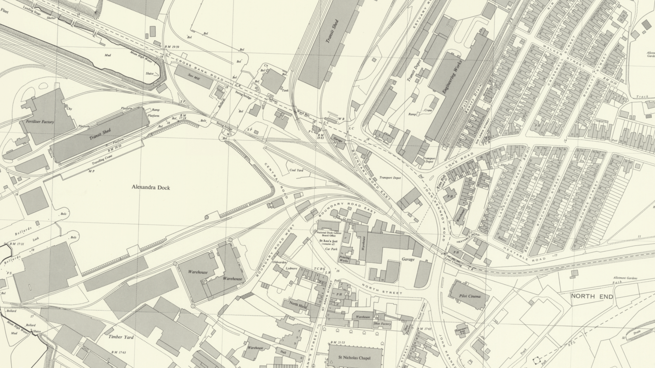
Trains entering the Docks branch left the main line at King’s Lynn Junction and headed north towards the River Ouse, passing an extensive goods yard and engine shed. The route then passed a minor freight siding serving Dodman’s Iron Works. It shortly passed beneath Dodmans Bridge and veered west, reaching the site of the current Austin Fields industrial estate. Finally, it crossed what was then called Pilot Street, now John Kennedy Road, and entered Alexandra Docks.
Whilst to the south of King's Lynn, at Harbour Junction, there was once a junction with two lines spurring off the main Lynn to Ely line. One led to the River Ouse via the harbour branch (1849-1968), and another could have linked the Docks branch to South Lynn and the M&GN network, including South Lynn's vast freight yard. South Lynn closed in 1959, and Harbour Junction was kept open for freight services to the sugar beet factory, which closed in the mid-1990s. A small freight siding serving the Campbell's Soup factory was also close to Harbour Junction.
Road traffic was increasingly used for freight, and the A1078 bypass was constructed after the closure of the Hunstanton branch to divert more road traffic from the port. With tonnage slowing at the railway, the last trains ran in May 1993, except for a few instances of clearance stock.
At one time, the Dock line was also intended to be part of an incomplete railway that would connect a new station at Austin Street in King's Lynn to the M&GN via a triangular junction off the Hunstanton line near Salters Road. This railway would run for half a mile before briefly using the dock railway, then diverge southwest towards an unfinished station at Austin Street. However, this line never saw any traffic and remained unused for some time. By 1906, the line had been repurposed into allotments.
Today, a small portion of the Docks Branch is still in use as far as Dodmans Bridge, serving as a turnaround point for freight services serving Middleton Towers from the old Dereham Branch.
The old goods yard at King’s Lynn has been redeveloped into commercial units and a supermarket.
The old bridge that crossed the Gaywood River still stands and is easily visible.
Small parts of the track at one point from a siding were once visible on my first visit, but have now been covered over by tarmac.
The gates at the now-called John Kennedy Road, formerly Pilot Street, still exist and are primarily covered in Ivy on the dock side, just visible but not in brilliant condition.
Regrettably, as of June 14th, 2023, the gate on the opposite side of the Docks has been replaced with a steel fence by Network Rail.
There are some remnants of the railway track at both the Docks and Dow Chemicals locations. Additionally, a river-crossing bridge previously used for trains is now utilised as a swing bridge for road traffic.
The line to this day remains obstructed by any form of construction.
MAPS
I would like to express my gratitude to the National Library of Scotland for providing the maps used in the following content.
King’s Lynn junction.
King’s Lynn Junction handled services from King’s Lynn to Ely, Cambridge, and London. It also served Hunstanton, Dereham, and the Docks branch.


Historic maps covering King’s Lynn Docks.


50/50 Map Coverage from the Docks Branch.


Many photographs on this page have links to their original sources.
Please feel free to click on the photograph for the original webpage.
Aerial photography.
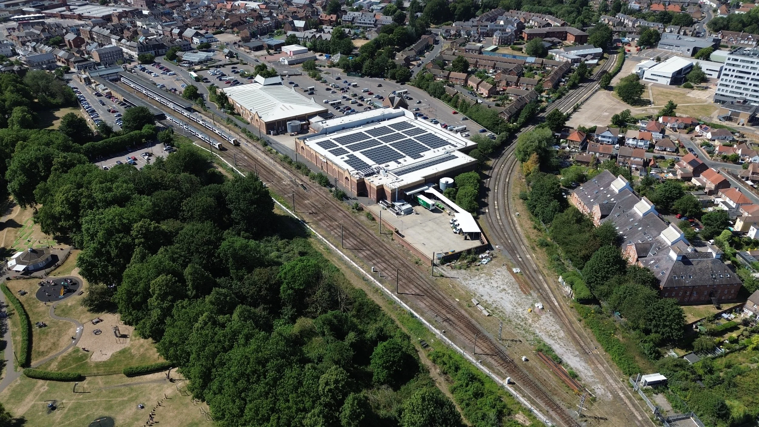
King's Lynn Junction served as the starting point for services to the Docks. In the photo below, you can see the extensive goods yard at King's Lynn, with the Docks branch extending to the bottom right.
Thanks to Historic England for the aerial photo. Please click on the photo for a link to the source page.
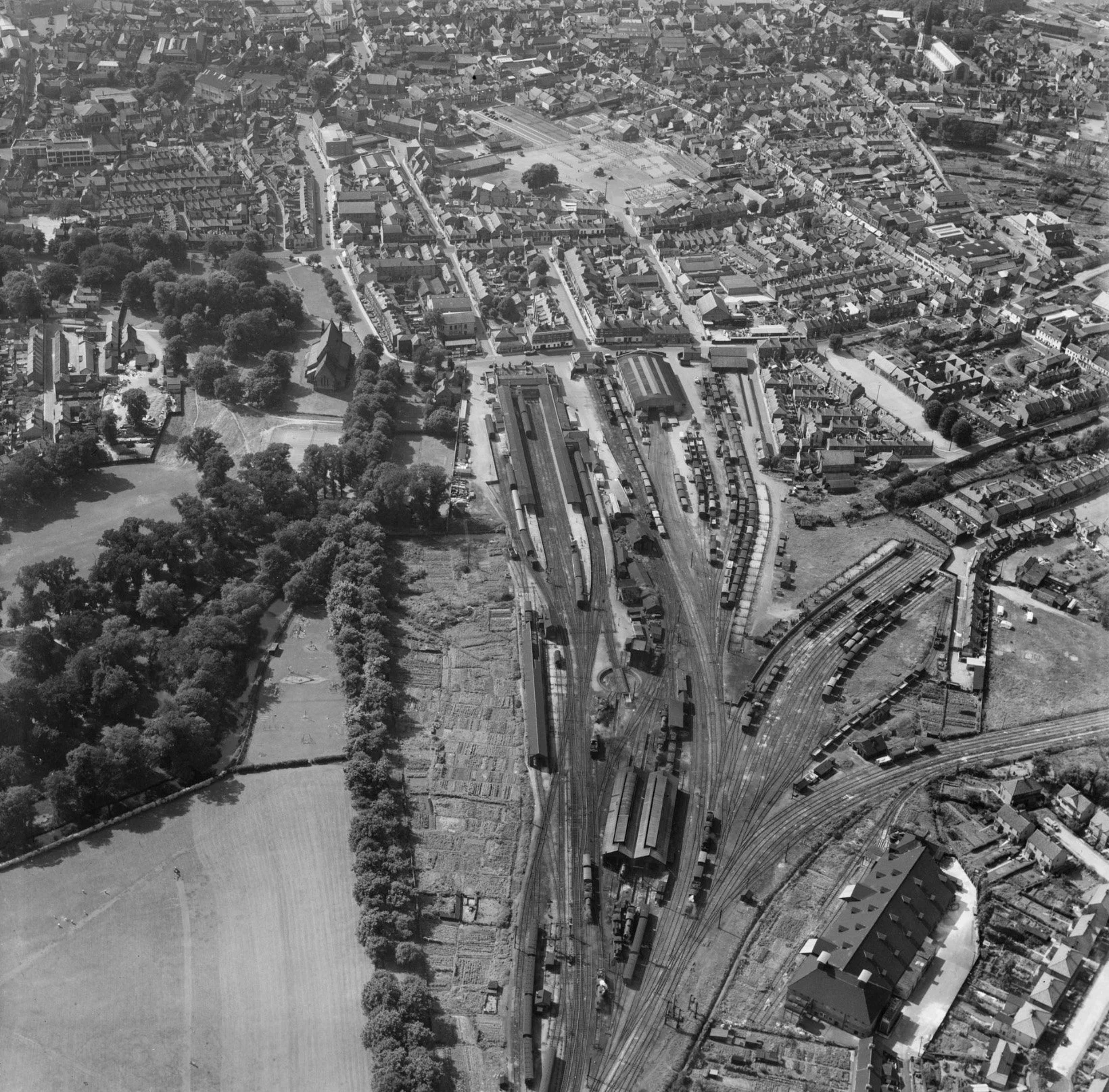
King’s Lynn Junction with the Docks sidings to the Left.

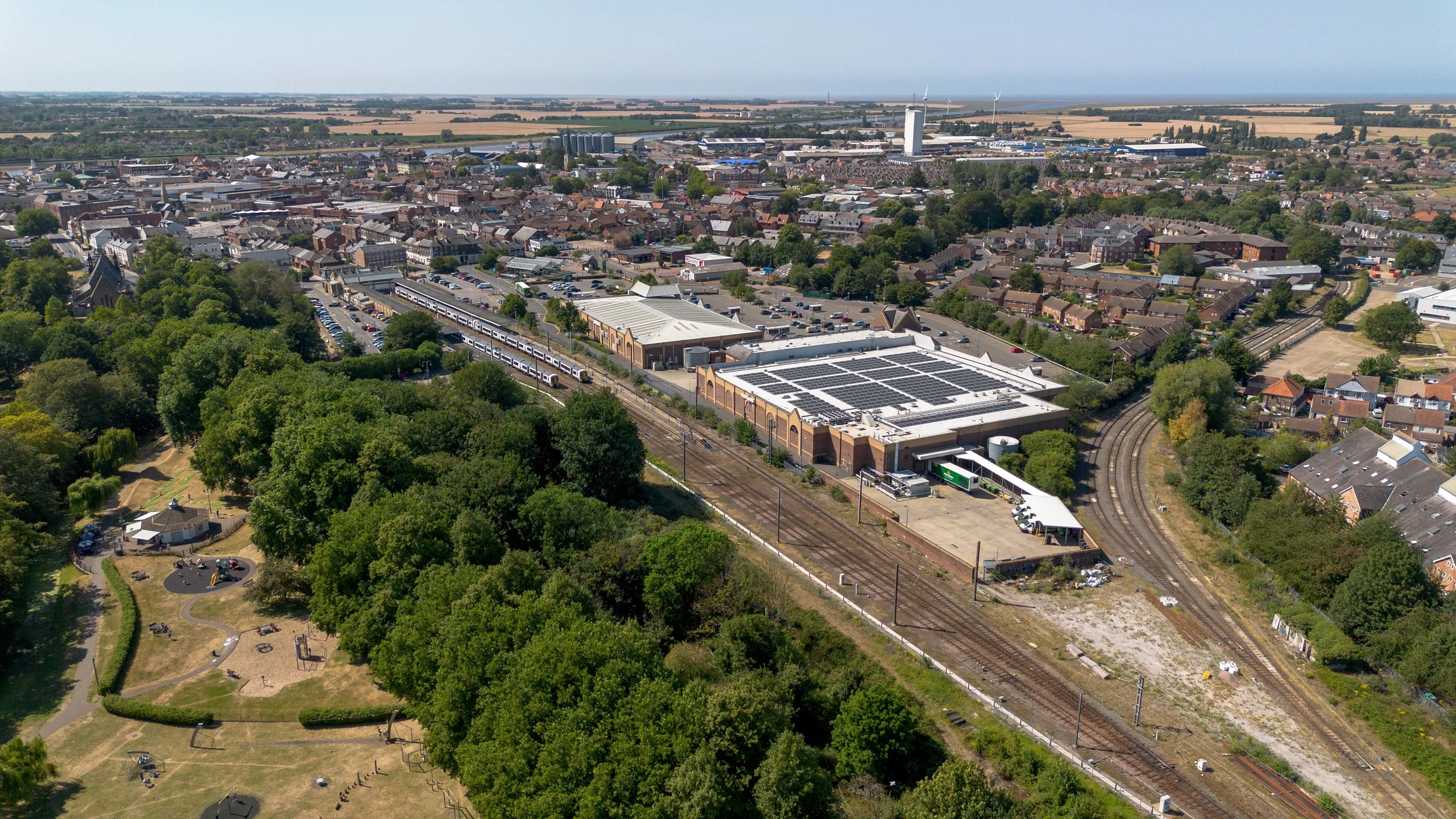
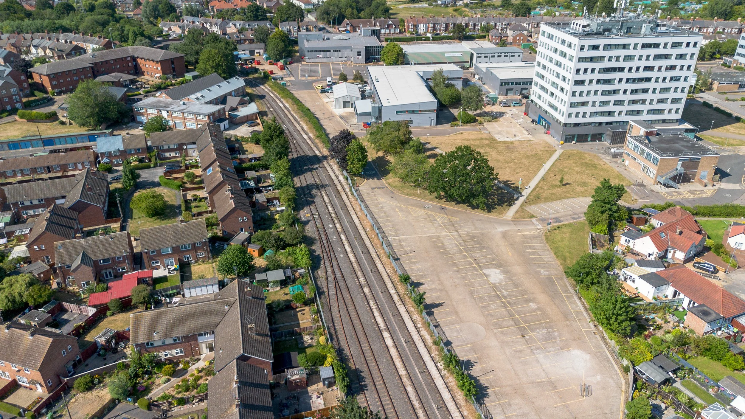
In this 2008 aerial photograph of King's Lynn Junction, the former goods yards have been replaced with a supermarket and commercial units. The remnants of the Docks line are visible at the bottom left and now serve as a turnaround point.

Taken in 2026
Taken from the walks in King’s Lynn, we see the Docks branch with the River Ouse and the Docks in the background.
Taken from the walks in King’s Lynn, we see the Middleton Towers service awaiting departure on a Sunday during the weekend engineering works.
King’s Lynn Junction.
King’s Lynn Junction, with the main station in the distance and the Docks line heading off to the right.
If you look closely, you can see the blue freight wagons from a Middleton Towers service.
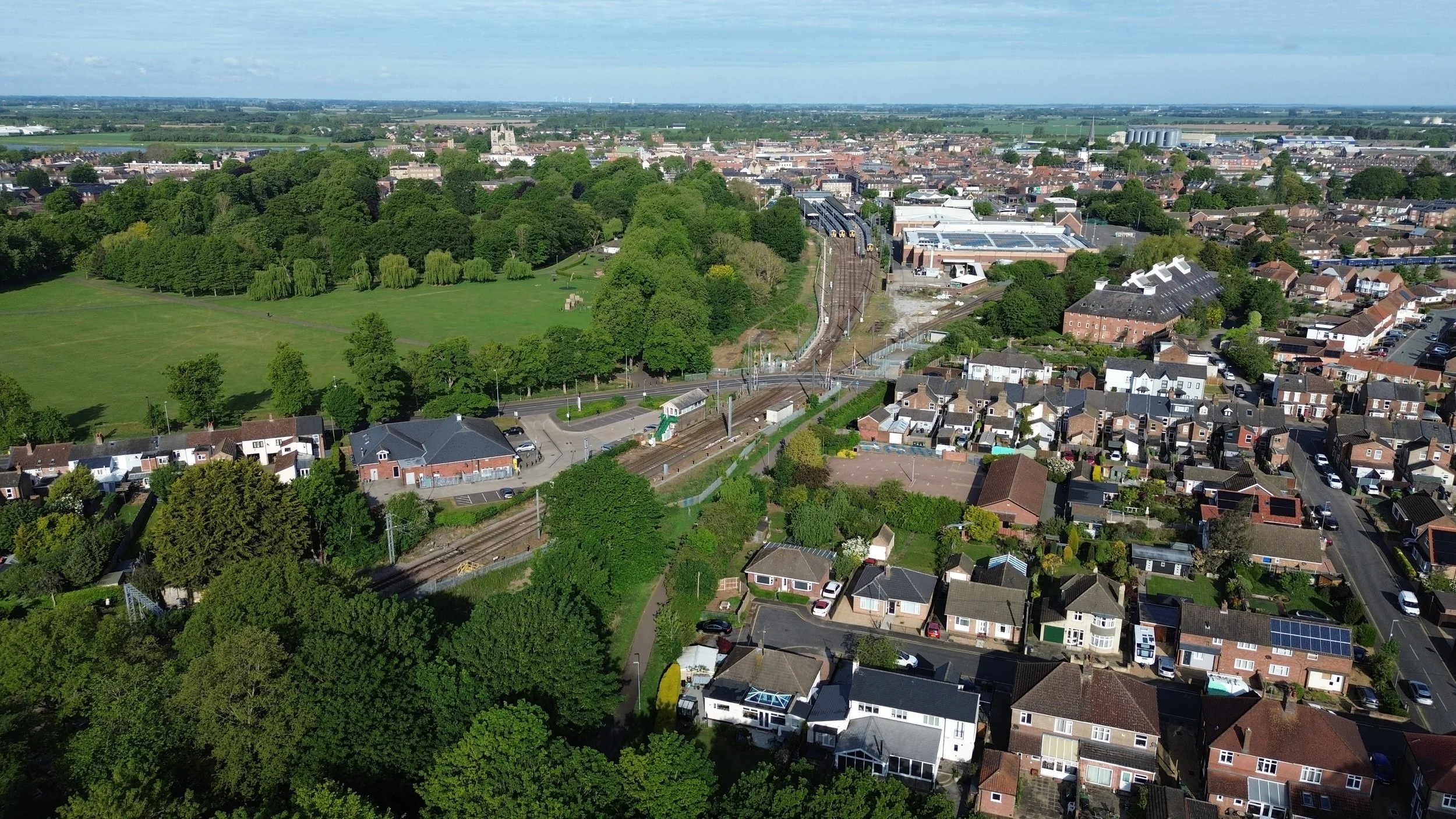
King’s Lynn Junction, with the old Hunstanton line to the left, the Dereham line ahead and the Lynn Ely line to the right.
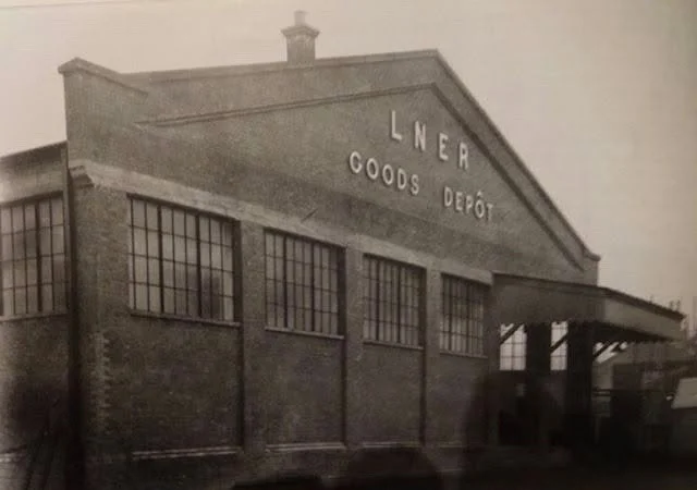
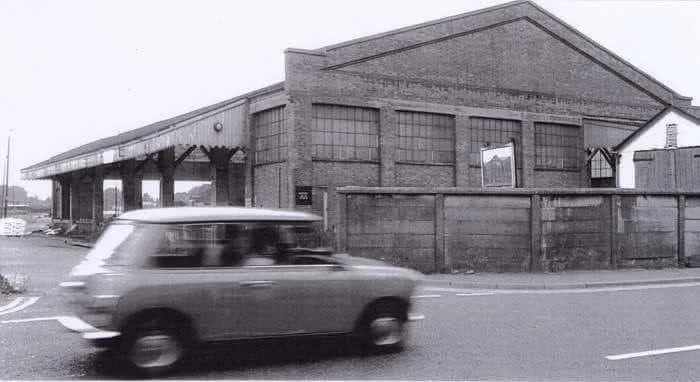
King’s Lynn Goods Yard.
King's Lynn goods shed was sited where the supermarket now stands.
King’s Lynn goods shed, year and Photographer unknown.
All photos were sourced from social media.
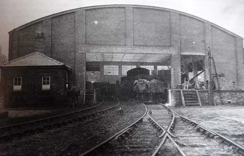

King’s Lynn engine sheds with the Docks line seen on the right-hand side.
Two Class 08 shunters, 08713 and an unidentified stablemate, wait in the sidings at King's Lynn in 1991.
Attribution: Paul Miller, Wikimedia Commons.

08713 shunter at the goods yard in King's Lynn, photographed in 1991
Attribution: Paul Miller, Wikimedia Commons.
.jpg)
Author ©Martin Addison via Geograph.
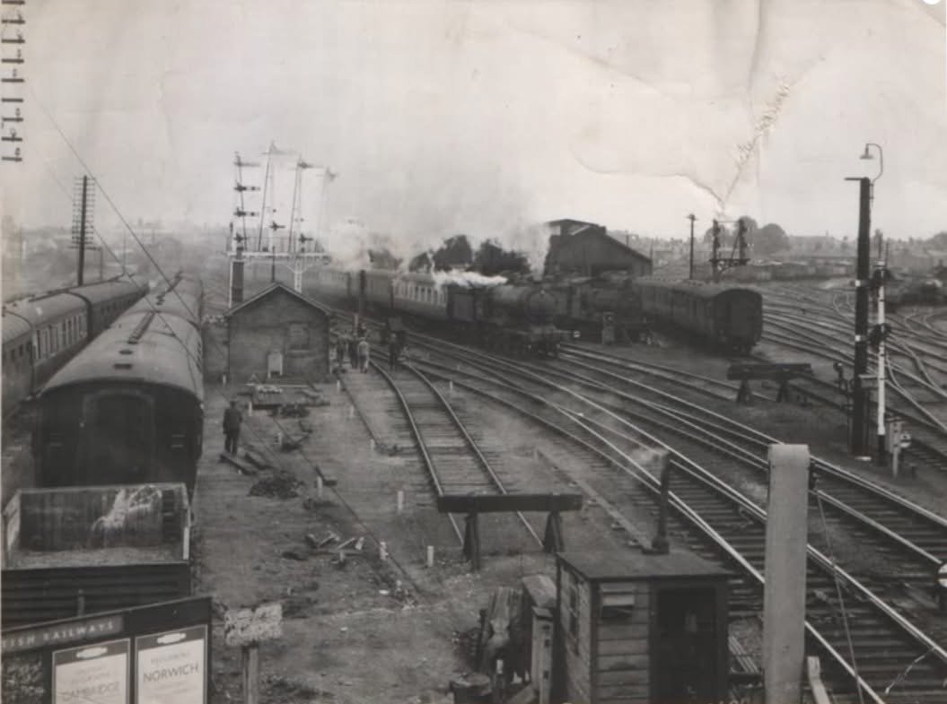
King’s Lynn. Having run around its train, 37023 departs the sidings at King’s Lynn with a load of sand for the Rockware glass factory near Knottingley. King’s Lynn station is visible on the right.

Heading off towards the Docks.
King’s Lynn junction, taken in 2020, with the docks branch to the right and the line to the left, is used for the Lynn London services.

Class 66 photographed from the supermarket loading bay on the old dock's trackbed.
The class 66 here will be running around its wagons.

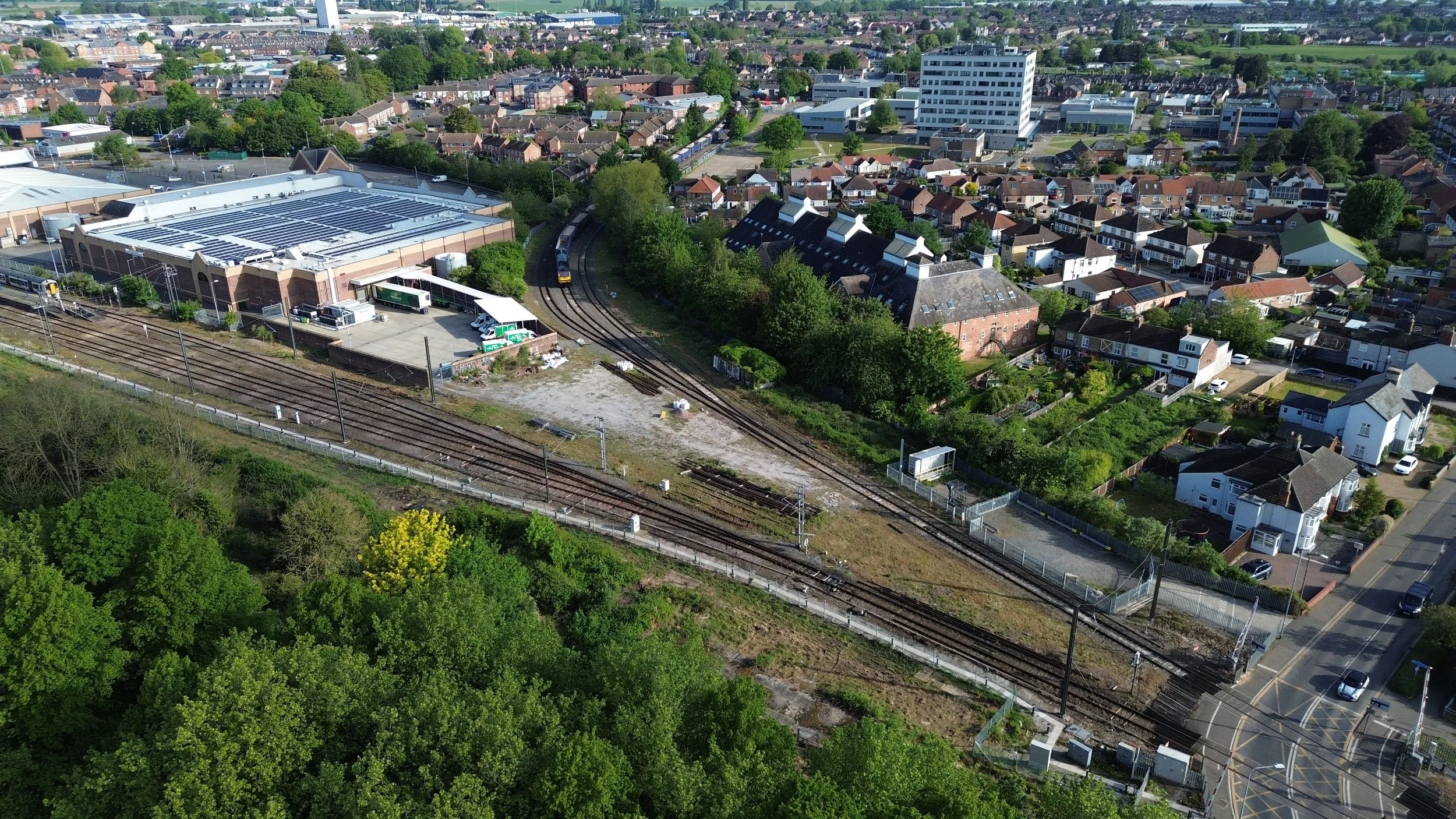
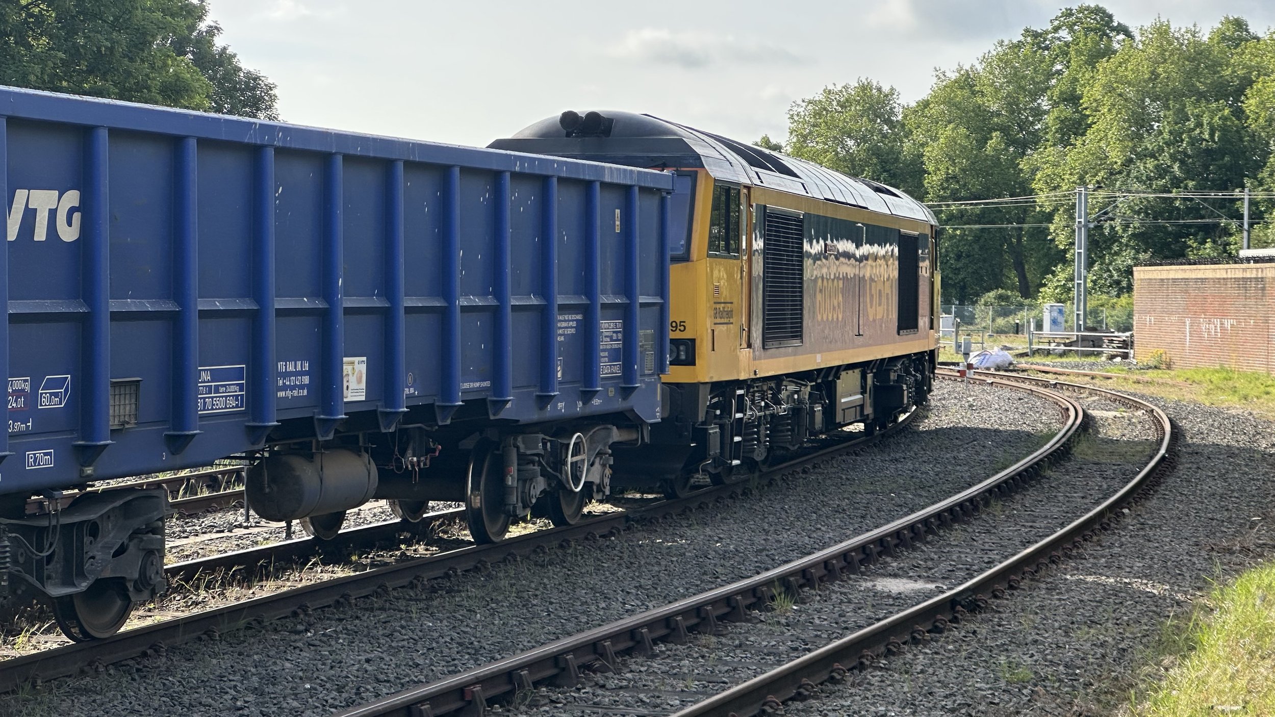
The Docks Railway track shown below is still in use as a turnaround point and can be photographed with ease from the local supermarket car park.


60095 Awaiting departure in May 2026
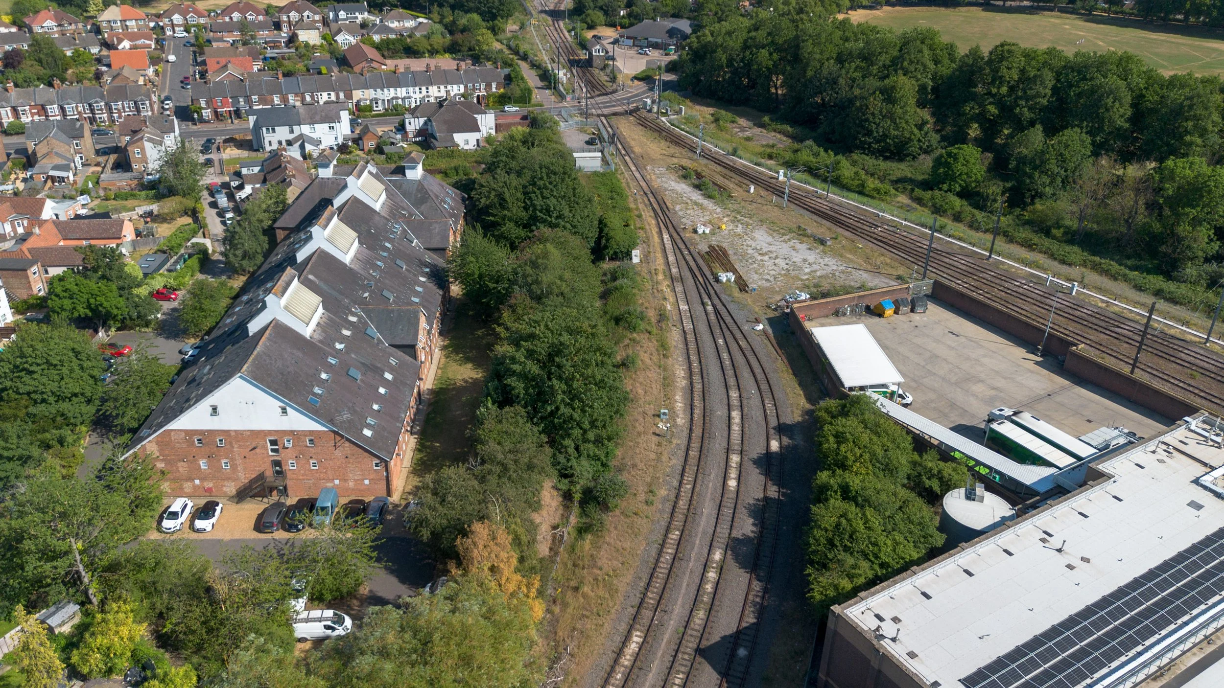
Drone footage of the old docks track bed.
The first photo faces towards King’s Lynn Junction whilst the second photo faces towards the docks and Dodman’s Bridge.
Bearing around heading towards the docks, the railway shortly came to Dodmans Foundry.
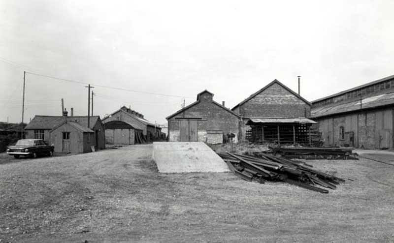
Dodman's Foundry
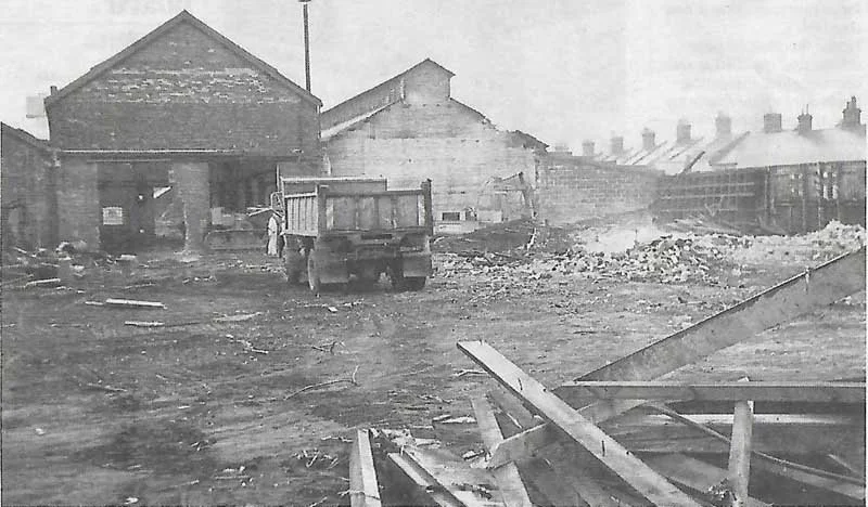
The old Dodman's Foundry, established by Alfred Dodman in 1875, was a renowned iron foundry located on Highgate Field. It specialised in engineering work, particularly in the production of boilers, and even created several traction engines and steam locomotives. Following World War II, the foundry shifted its focus to designing and manufacturing pressure vessels, heat exchangers, and storage tanks for the petrochemicals and North Sea industries. Unfortunately, the site was demolished in 1977 and replaced with residential housing. However, the road bridge that previously spanned the Docks branch is still known as Dodman's Bridge in honour of the former foundry. The site also had its own small sidings that were connected to the Docks branch.


©National Library of Scotland.
Dodman’s factory on the ©KL forums website page.


In May 2023, the former foundry site was now used for social housing.

The present end of the Docks railway line.
At this point, the remaining part of the dock railway that's still in use ends; this is the end of the turnaround point.
Beyond this point, the railway remains unobstructed, but unfortunately, it is overgrown and unsuitable for walking.
Workmen on the Docks railway
Workmen on the King's Lynn docks railway line, at work constructing the buffer stops where the line is now cut off. Beyond that point, it is now fenced off, and the track has been lifted.
Attribution: Paul Miller, Wikimedia Commons.

End of the Docks branch
Attribution: Paul Miller, Wikimedia Commons.

Taken at Dodmans Bridge, the line from King's Lynn Junction
On the right side of the picture, you can see flats that now occupy the space where Dodmans Foundry was formerly situated.

Photographed in 2020 and 2023, the last part of the Docks railway and the buffer stop.

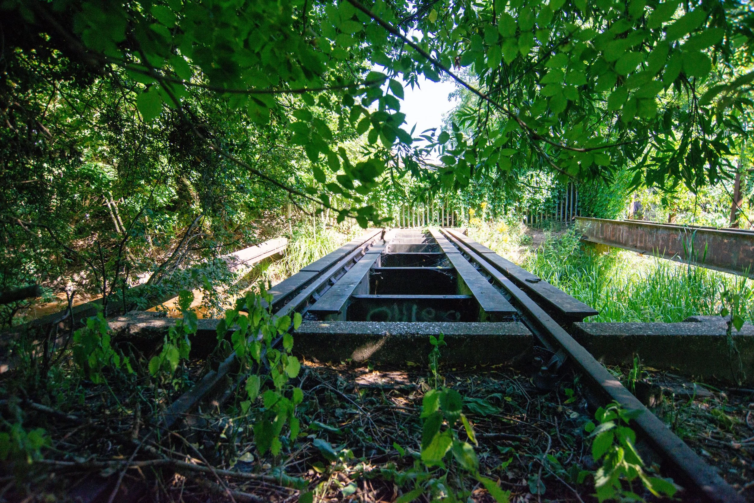
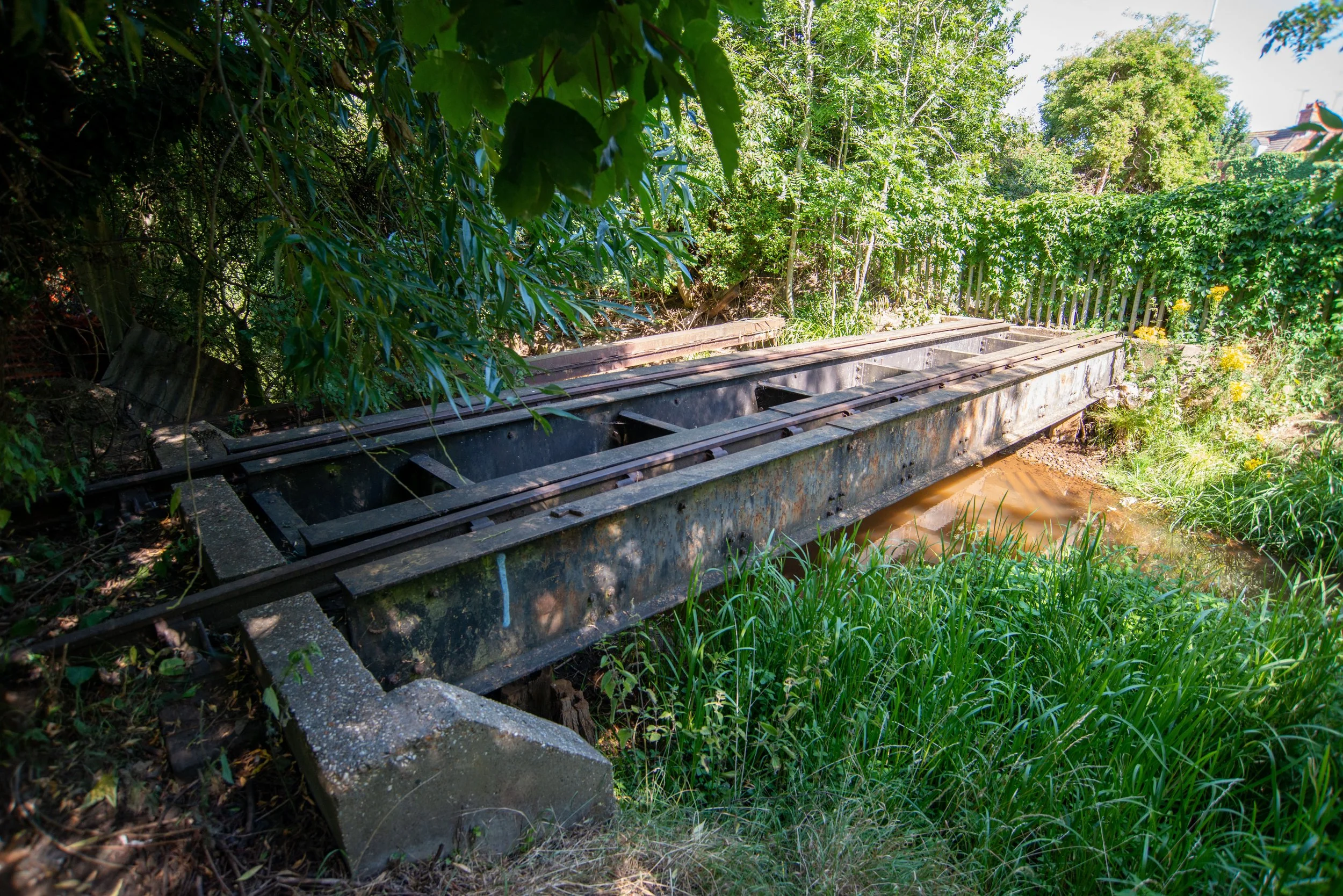
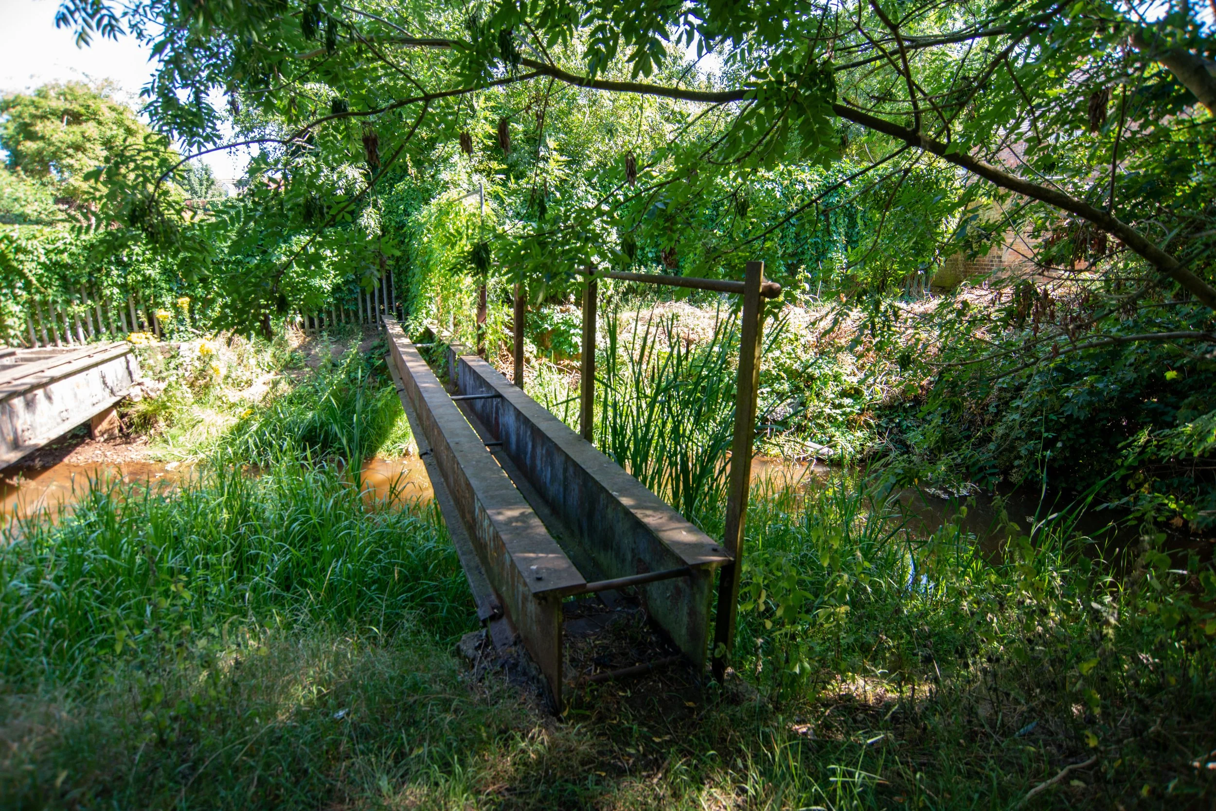
Gaywood river crossing.
The Docks railway used to cross the Gaywood River via a small bridge located just past the buffer where the railway currently terminates. Thanks to a tip-off from a member of the Middleton Towers restoration team, it was discovered in 2023 that this bridge was still present; on my first visit, I completely missed it.

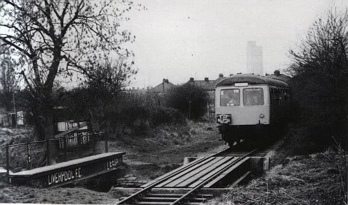
Cravens Dmu close to the River Gaywood crossing.
West Norfolk Freight Lines Raitour organised by the Fakenham & Dereham Railway Society
Year and photographer unknown.
Please get in contact with any information or who to credit.
Sourced from social media.
A small bridge on the Docks branch in King's Lynn; the track is now lifted beyond this point.
Attribution: Paul Miller, Wikimedia Commons.

The King's Lynn docks railway before closure. There are now buffer stops this side of the camera from the bridge.
Attribution: Paul Miller, Wikimedia Commons.

Looking towards the main line on the Docks branch in King's Lynn, the line now stops a few yards in front of the small bridge visible here.
Attribution: Paul Miller, Wikimedia Commons.

In May 2023, I received a tip from Alex, a member of the Middleton Towers Restoration group, about the Gaywood River crossing bridge in King's Lynn.
Unfortunately, only remnants of the bridge remain, as shown in the photo.
During my first visit, I overlooked the bridge and was surprised to discover it later.
I can't believe I missed it.


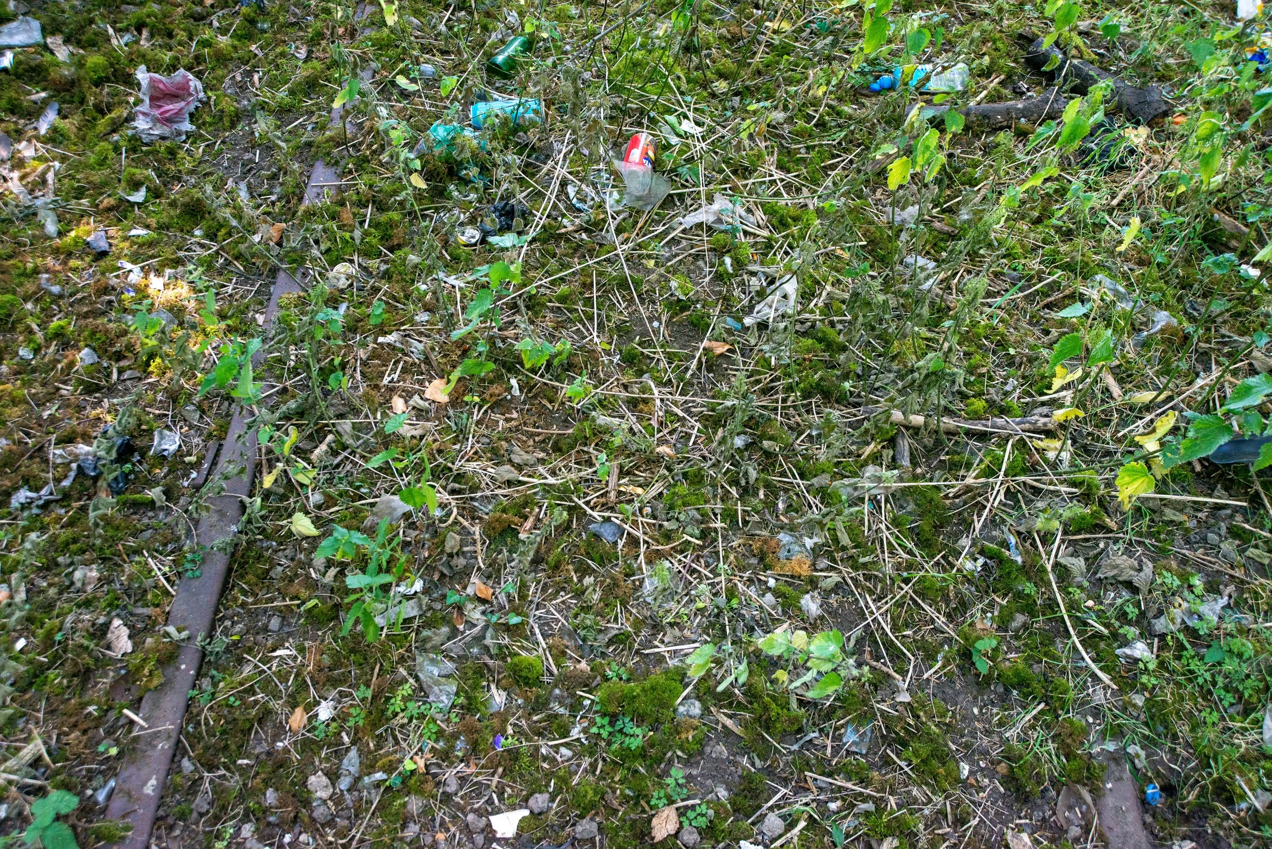
Small sections of track remain on both the bridge and the track bed.


2026 revisit.
In 2026, I revisited this site in a better light, and access to the bridge was available, allowing me to take more photographs of this old, disused bridge.
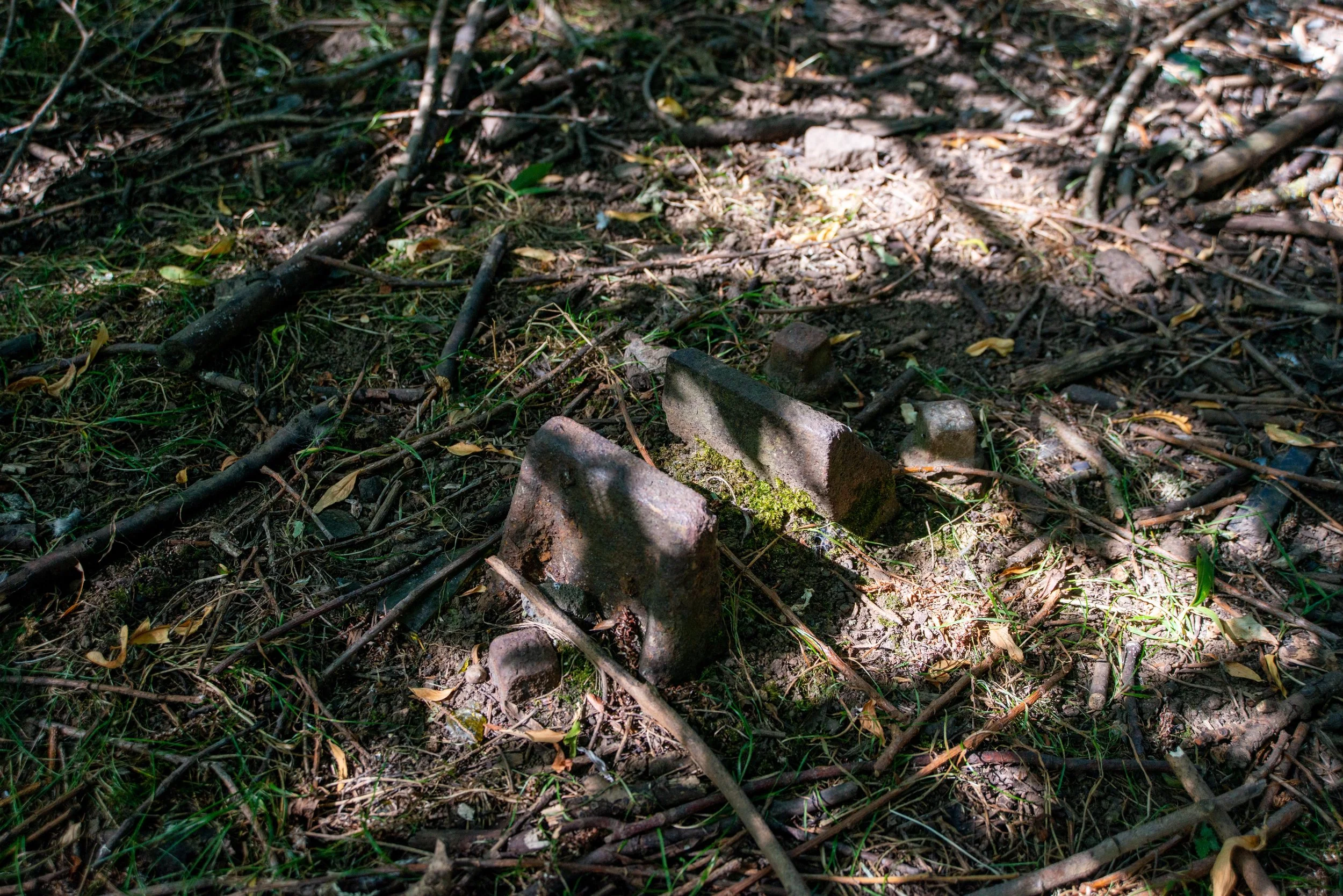
Near the bridge, I found this old railway-track chair.
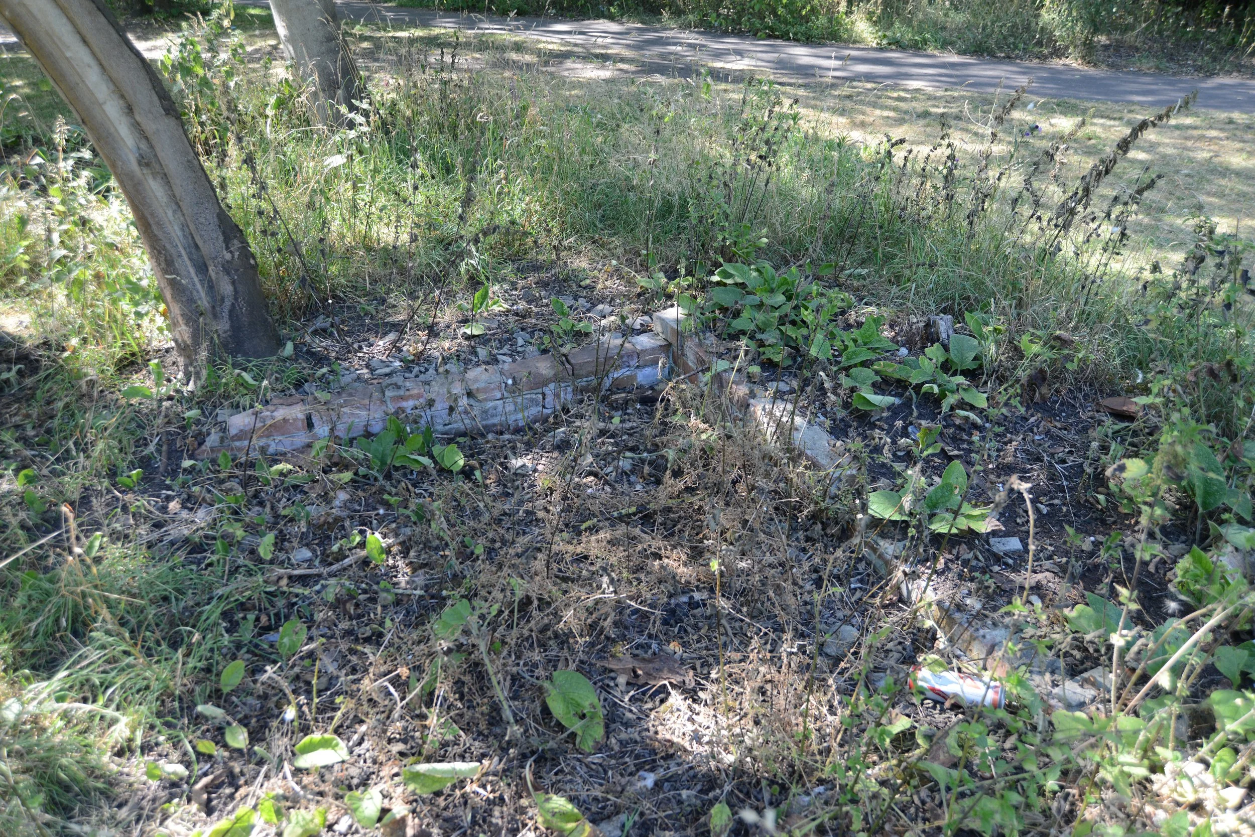
Unknown brick work.
Close to the old bridge, I found this old part of brickwork. At first, I wondered if it was part of a pedestrian crossing, as it was close to the foot crossing, but I'm sure the foot bridge was located further down the line, closer to the docks.
Please, if anybody has an idea, feel free to get in contact.
King’s Lynn Docks railway sidings.
In the early days of the Docks railway, there were sidings located not far from the Gaywood River crossing. They would have run along the public walkway down Kettlewell Lane, close to where the Austin Fields industrial estate now stands. It is unclear when these sidings ceased to be used, as I could not find any information on the matter. However, during my visit in 2020, I found some small remains.
Unfortunately, upon revisiting the area in 2023, I was disappointed to find that the King's Lynn Council had covered up these historic artefacts. As a result, they are now lost to public view.
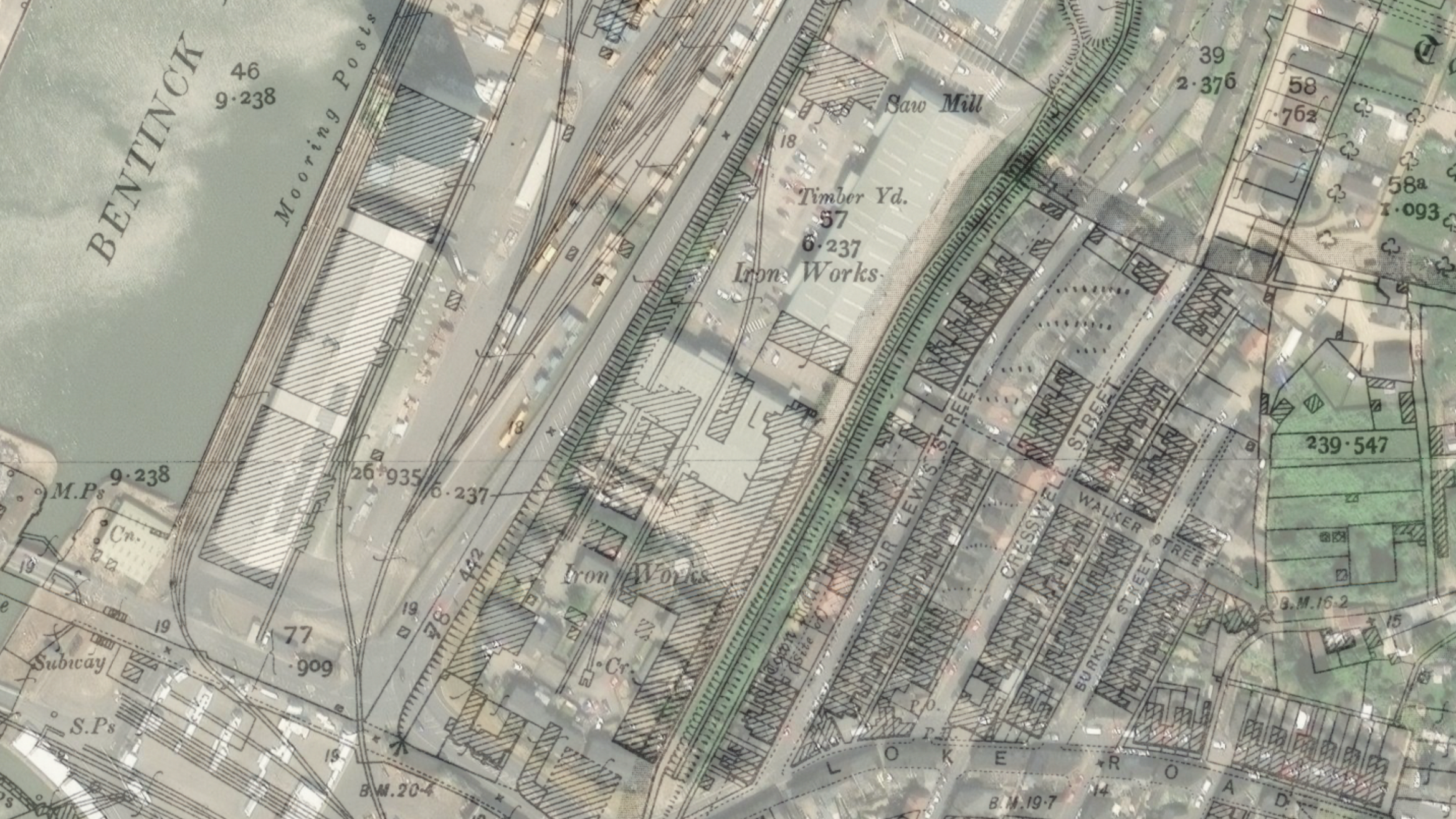
1892-1914 maps show the sidings off the docks railway.
©National Library of Scotland

Photographs of the remains of the Docks railway sidings were taken by me in 2020, but unfortunately they have since been covered over.
The remnants served as a reminder of the railway's history.


A small, unlifted section of an overgrown King's Lynn Docks railway.
Attribution: Paul Miller, Wikimedia Commons.

When revisiting in 2023, at the same point, the old parts of the railway had been covered over.


Pedesterain crossing 1.
Heading towards John Kennedy Road, there were two pedestrian crossings. One, according to historic maps, was a footbridge, and the other was a pathway.
On my first visit, other traces of old railway tracks were still visible, but the borough council has again covered them.
The First crossing is close to Harewood Parade, North Lynn.

On my first visit in 2020, I found these old railway remains that have now sadly been covered over.

When I visited in 2020, I also found this small part of the railway track just visible through the overgrowth.

On my revisit in 2026, I found that the railway tracks were still in place and both sides were intact.
The old track bed, taken from the Crossing, looking towards the Docks, with the grain silo in the distance.
Salters road & Gaywood road Junction
Next along the line would have been the planned line linking the Lynn Fakenham railway to a junction at Bawsey, forming a triangular junction along the Hunstanton Branch. The aim was to extend the Lynn Fakenham railway to a new terminus at Austin Street in King’s Lynn, using part of the Dock railway track; the line never became operational, and today parts of the trackbed in North Lynn remain clear.
At Loke Road, a crossing cottage remains intact, along with what I believe are the buttresses near Lynn Sport, where the abandoned railway would have crossed the Gaywood River.
More information can be found on my page called the Lynn Avoiding Line, with a link at the bottom of this page.
Thanks to the National Library of Scotland for the maps below.

The proposed junction at Salters Road, King’s Lynn.


The old crossing cottage from the abandoned railway at Loke Road in North Lynn.


Pedestrian Crossing 2: Former footbridge crossing.
The second crossing was from Loke Road to Kettlewell Lane, and later to the Austin Fields industrial estate. Historic maps indicate a footbridge crossing over the railway in this area during the railway's early days.


A foot crossing over the old King's Lynn Docks railway branch. The track has now been lifted here.
Attribution: Paul Miller, Wikimedia Commons.

The site of the old crossing captured in 2023

The former trackbed where the Docks Railway operated before its closure. At the time the photographs were taken, the bed was extremely overgrown.
The two pictures below were taken in 2023.


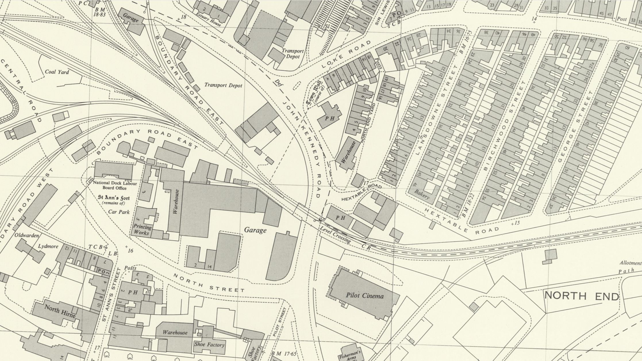
John Kennedy Road Crossing.
John Kennedy Road's level crossing was previously known as Pilot Street. It has existed throughout the railway's history.
Unfortunately, on June 14th, 2023, Network Rail removed one side of the crossing gates and been replaced it with a metal fence. The fence was erected to prevent littering.
The historic maps below show the level crossing.
Thanks to the National Library of Scotland.

Looking at the crossing gates on John Kennedy Road in King's Lynn, on the former Docks branch, with the line overgrown but still in place.
Attribution: Paul Miller, Wikimedia Commons.

Attribution: Paul Miller, Wikimedia Commons.

Looking towards the Docks, the former King's Lynn docks branch crosses John Kennedy Road.
Attribution: Paul Miller, Wikimedia Commons.
.jpg)
After closure.
The crossing gates, long after the railway was closed taken in 2020 and 2021


The remaining railway tracks crossing John Kennedy Road at King’s Lynn

On June 14th, 2023, Network Rail removed one side of the crossing gates and replaced it with a metal fence.


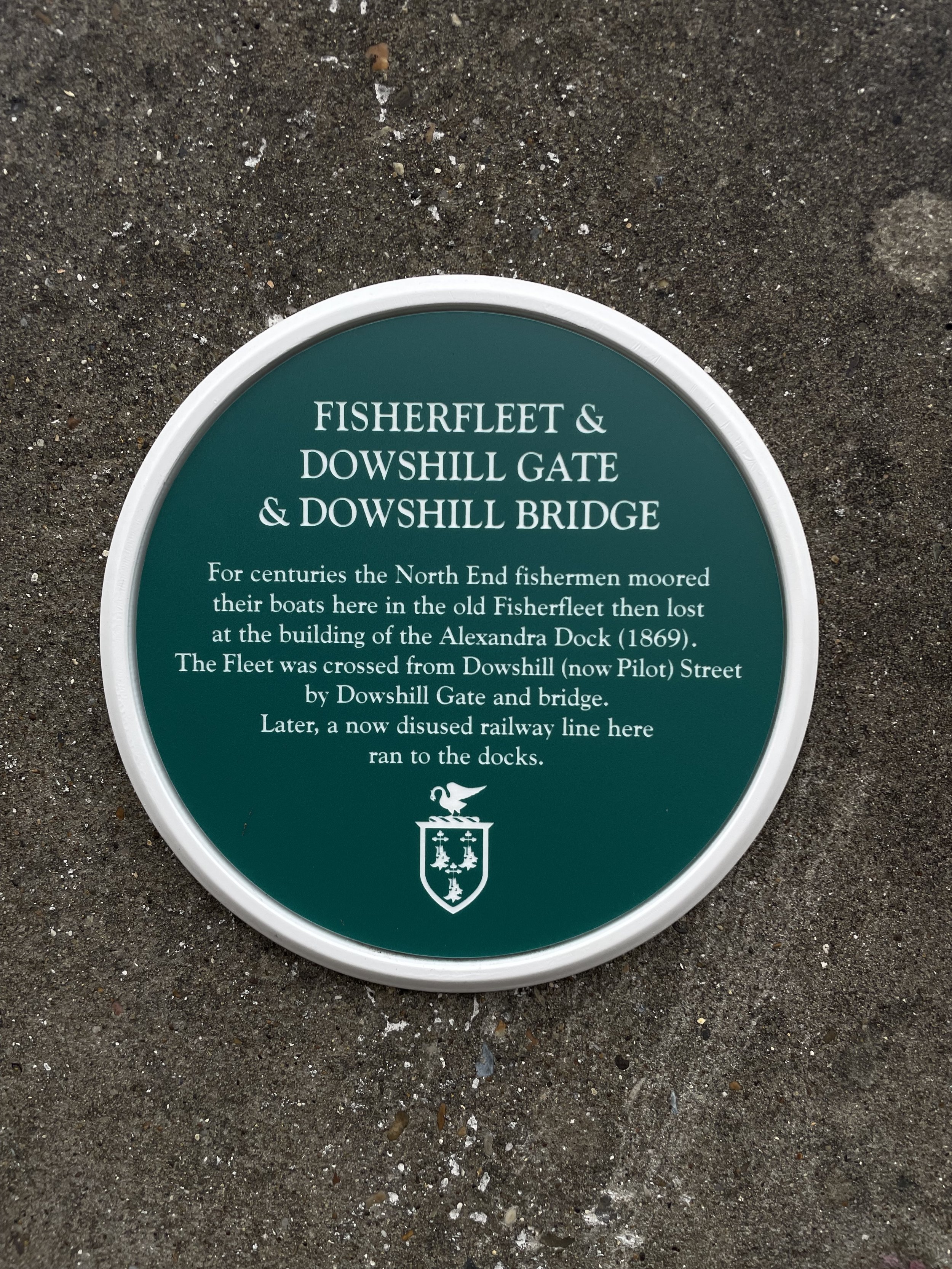
Let over furniture from the old railway.


A memorial plaque has been placed on one of the remaining old concrete supports since the removal of the railway gates.
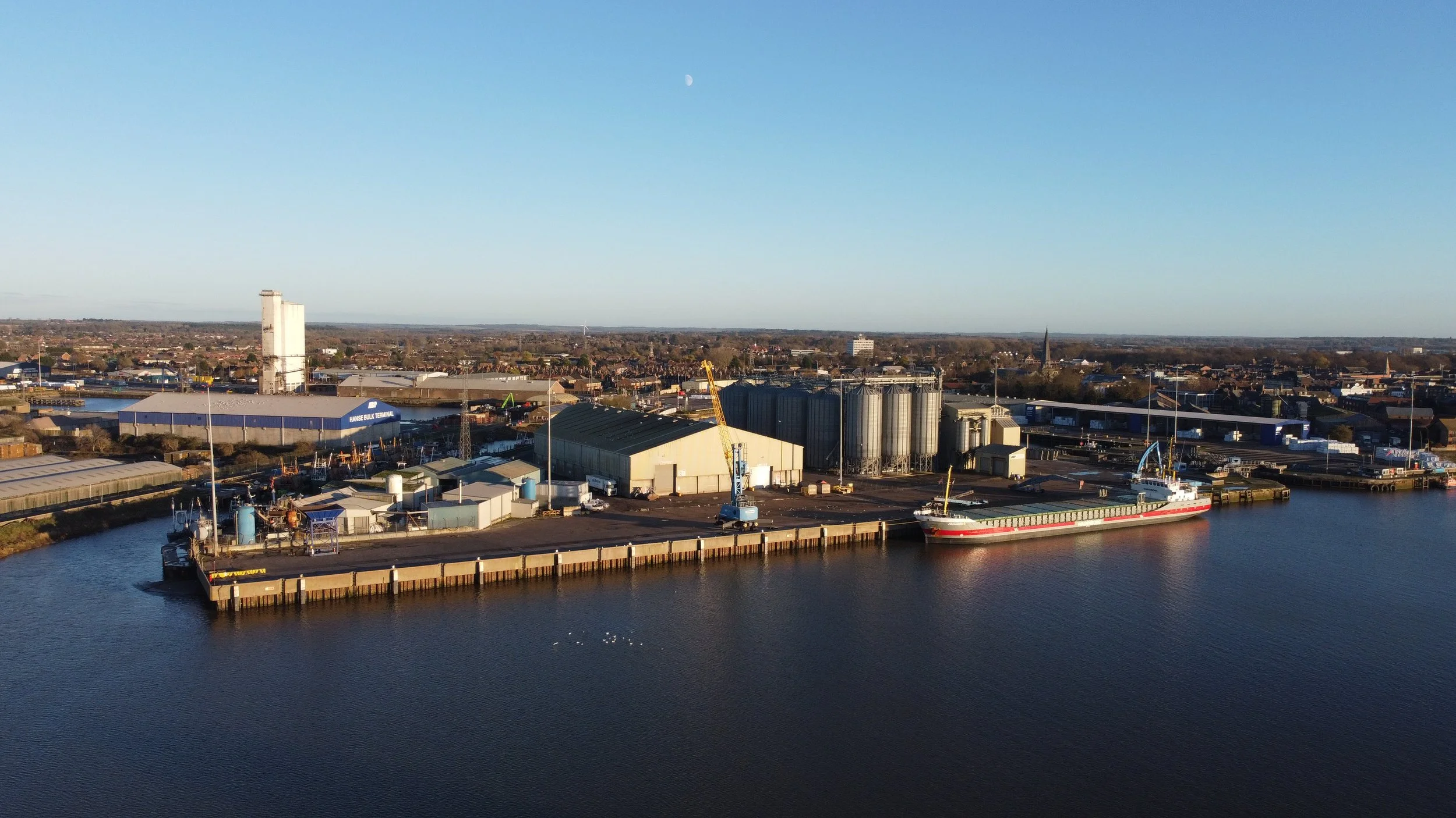
Kings Lynn Docks.
Located on the northern edge of the town, we now arrive at the Docks in King’s Lynn.
The Docks remain operational today, although the majority of traffic is now redirected to the A1078 Northern bypass, as opposed to the previously closed Docks railway.

Historic Aerial pictures from King’s Lynn Docks.
The photos used in this content have been included through an embedded code with permission from Historic England.
Please click on the image below for access to the Historic England page.


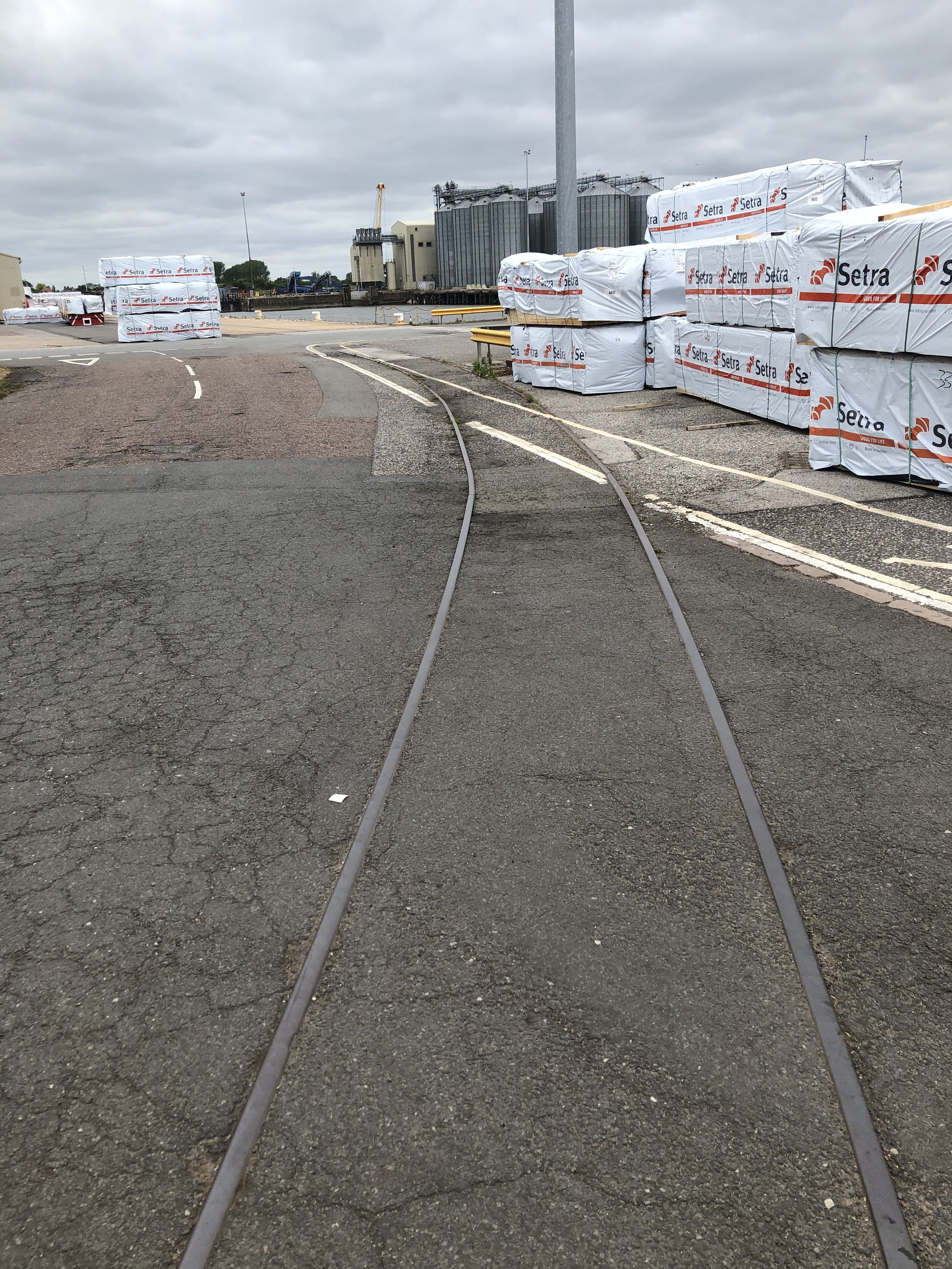
Railway tracks around the Docks.
King's Lynn docks in 1996. The railway lines visible used to run around the Bentinck Dock and branched off towards the Dow Chemical factory.
Attribution: Paul Miller, Wikimedia Commons.

The railway in King's Lynn docks, in 1996, about a year after the last traffic ran over it.
Attribution: Paul Miller, Wikimedia Commons.

Attribution: Paul Miller, Wikimedia Commons.
.jpg)
In June 2020, I was fortunate enough to be delivering on-site and managed to find these old tracks; some of them could possibly have been used for mobile track-mounted cranes.


This bridge was originally used as the railway crossing, but now serves as a road traffic crossing.
Photographed in 2023

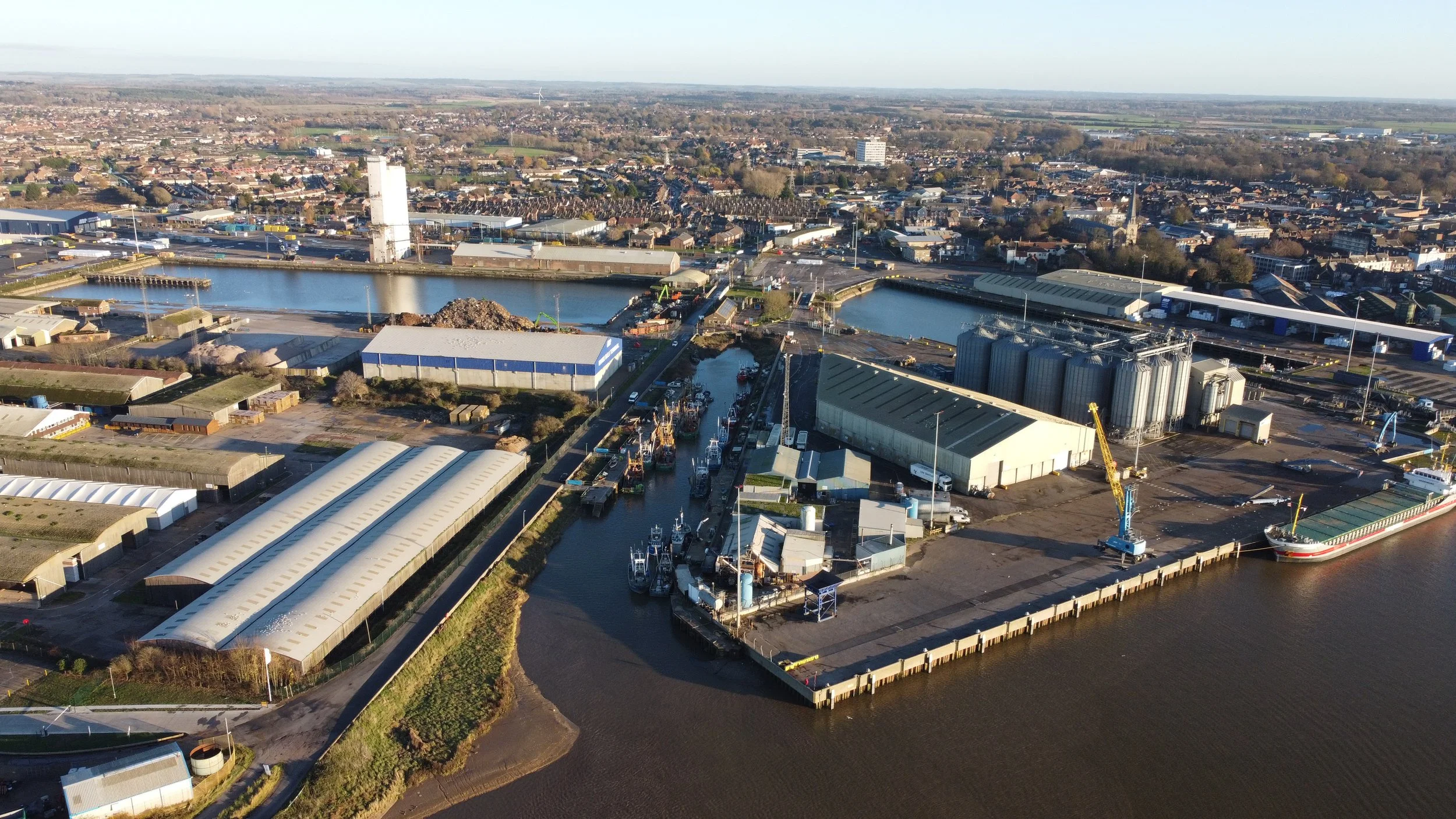
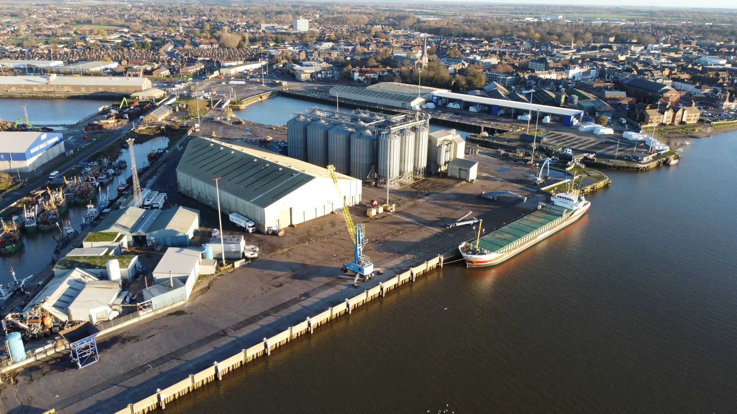
King’s Lynn Bentinck Dock.

King’s Lynn Alexandra Dock.

King’s Lynn Fishing fleet.

Aerial of the Alexandra Dock in King’s Lynn, Norfolk UK
John Fielding from Norwich, UK, CC BY 2.0 <https://creativecommons.org/licenses/by/2.0>, via Wikimedia Commons
.jpg)
Drone footage taken from the West Lynn riverbank.
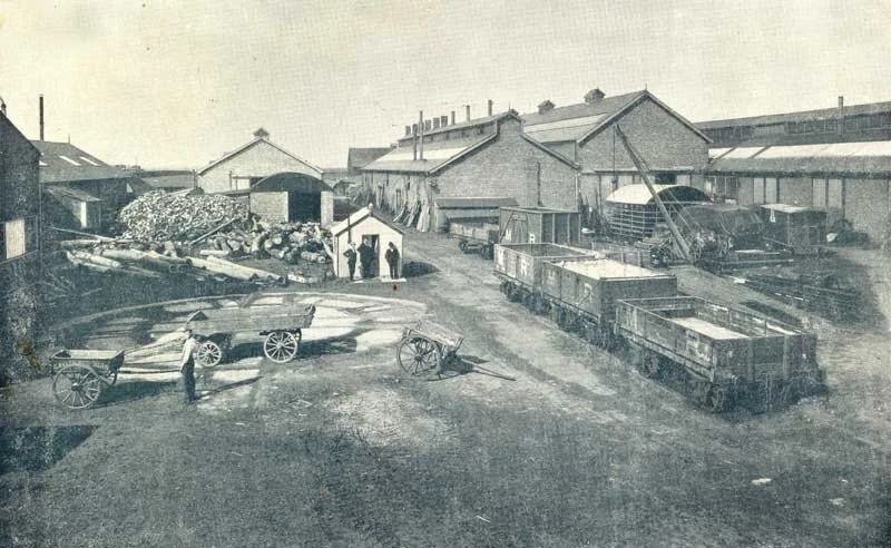
St Nicholas -Savages Works.
King’s Lynn Docks railway also had a short railway spur that served St Nicholas works, which opened in 1872
The company built fairgrounds and traction engines, steam wagons and ploughing engines and was run by Frederick Savage.
The site is now called St Nicholas Retail Park.
Historic maps show the works as ironworks and also show the short railway spur.

Split modern and past maps show where the ironworks once occupied the site where the commercial park now resides.
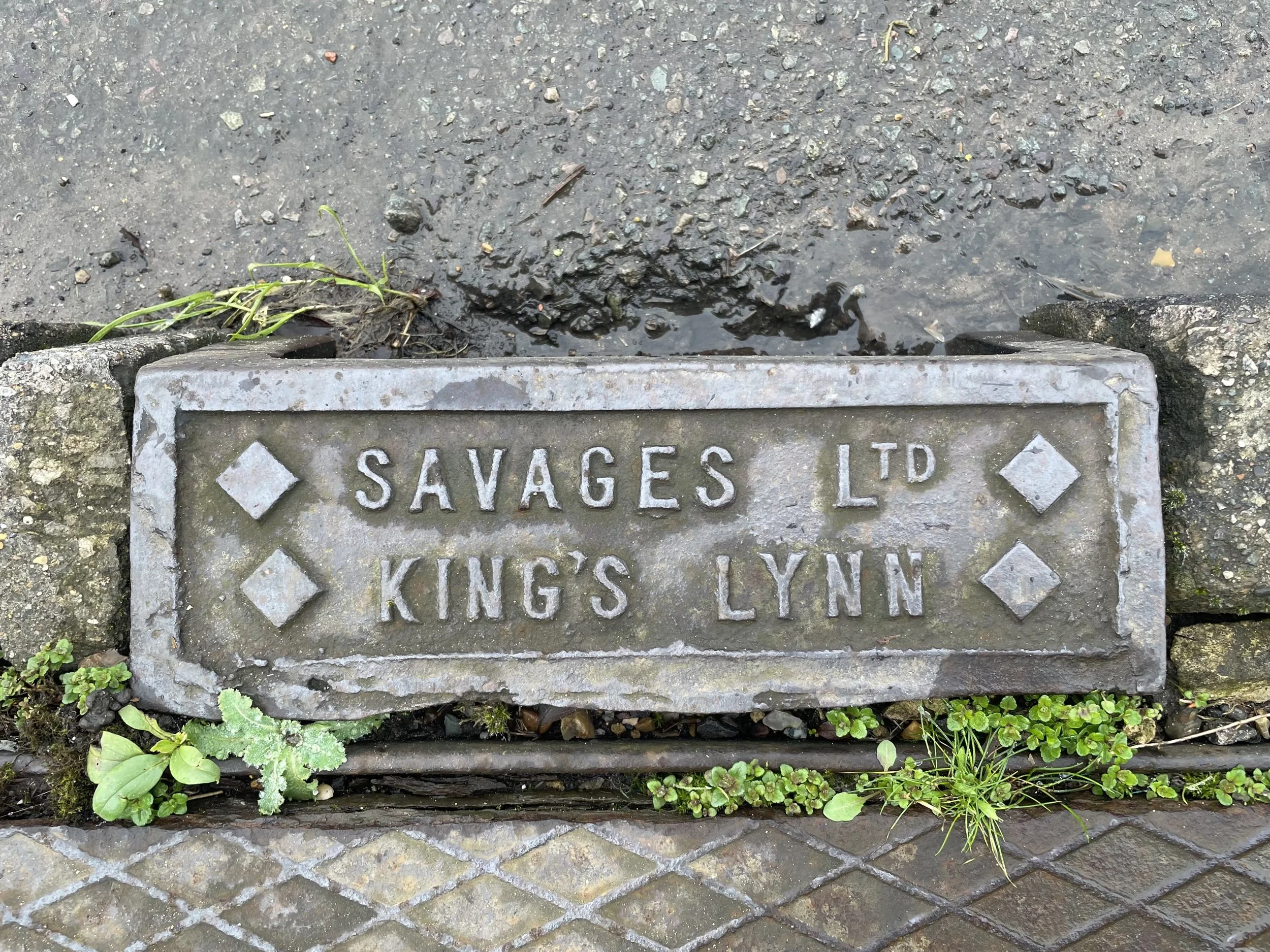
Savages Works
Many drain covers can be found around Norfolk with Savages of King’s Lynn” stamped on them.
Savages had many small sites around King’s Lynn in their time, so the location of these manufacturing sites is unknown.
Found by the Sandringham Visitors Centre.
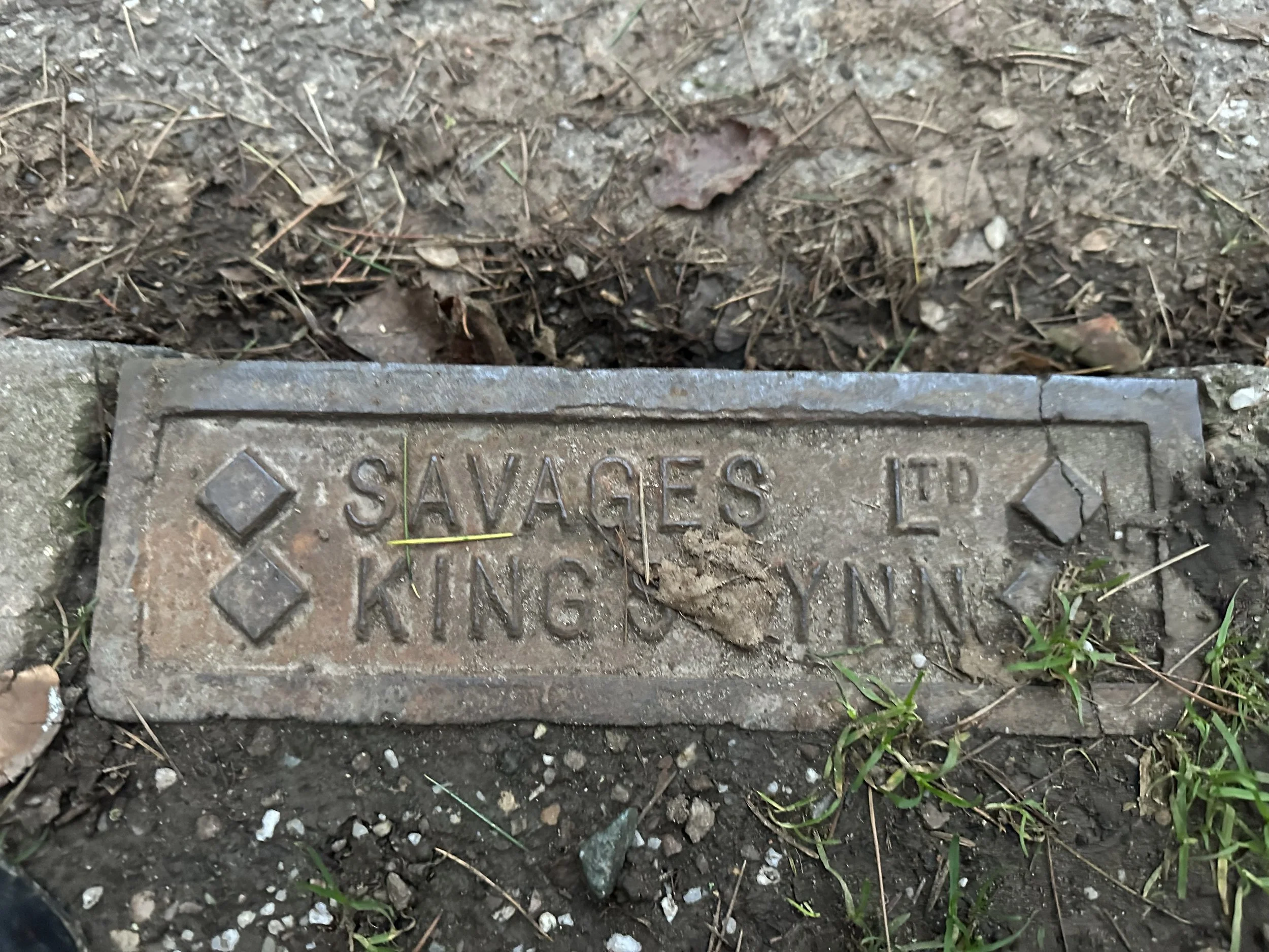
Found by Middleton Towers Railway Station.
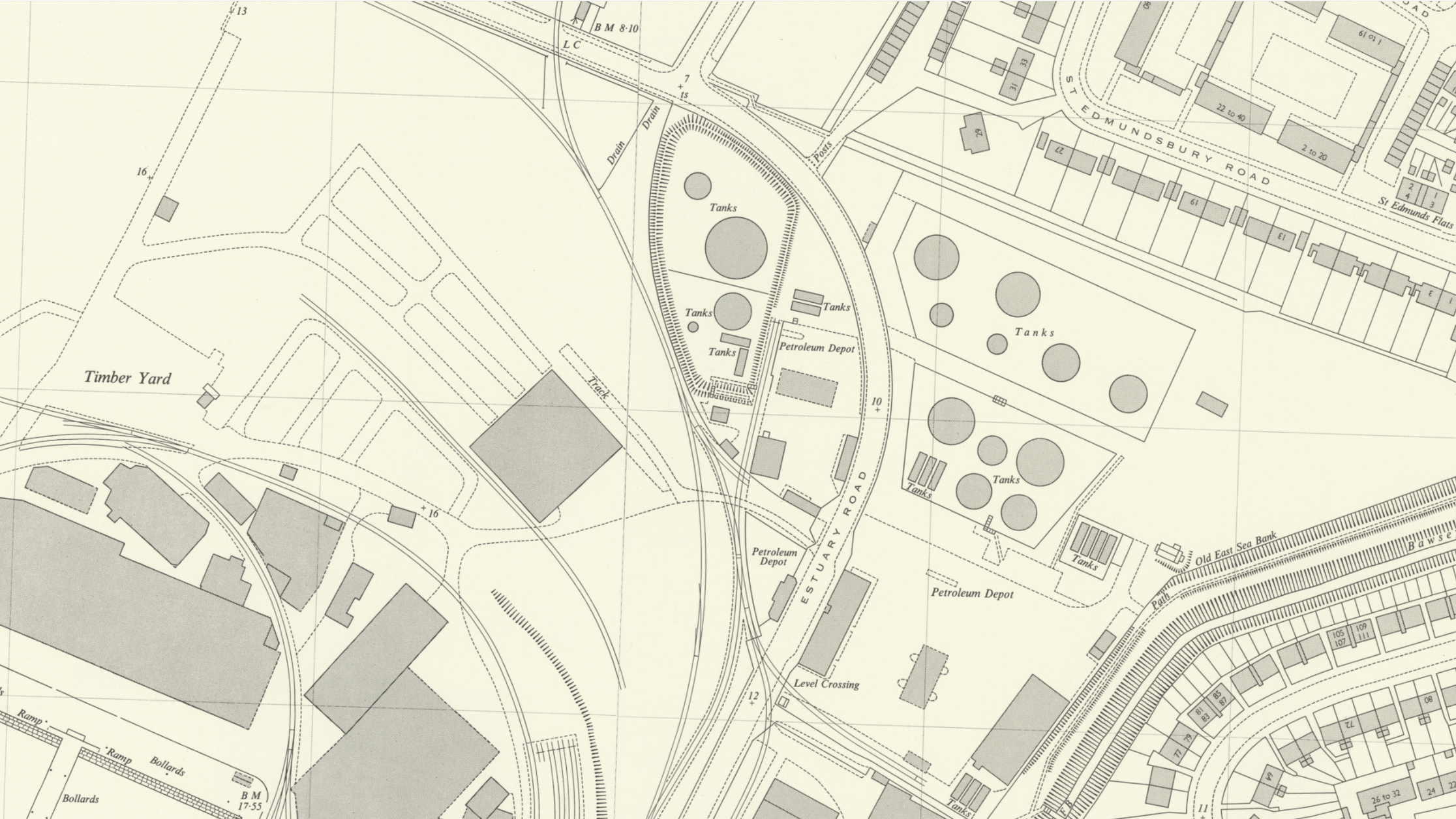
Petroleum branch line.
Located at the North end of the Docks stood the Kuwait Petroleum/Pace terminal, which also had its own railway branch line.
The timeline and history of this site are very limited. Please, if anyone has any information, please feel free to reach out.
Historic maps below, provided by the National Library of Scotland, dated 1944-1975.
I personally remember the terminal being there long after the life of the Docks railway.

Petroleum tankers and a spur of the King's Lynn Docks railway.
Attribution: Paul Miller, Wikimedia Commons.

Dow Chemical’s Branch Line
King's Lynn welcomed Dow Chemicals in the 1960s, well after the establishment of the original Dock railway line. The Docks Line had been operational for a considerable time before merging with the Dow Chemical Factory railway addition.
Historic maps, thanks to the National Library of Scotland.


Historic photos from Dows.
Another view towards the Dow Chemical plant in King's Lynn, along the now-lifted spur from the Bentinck Dock. The Class 07 shunter 07013 can be seen in the distance.
Attribution: Paul Miller, Wikimedia Commons.

The Dow Chemical spur of the King's Lynn Docks branch, looking towards the plant. 07013 can be seen in the distance.
Attribution: Paul Miller, Wikimedia Commons.

Looking towards the Dow Chemical factory on the short, now-lifted spur from the Bentinck Dock branch. 07013 can be seen behind the gates.
Attribution: Paul Miller, Wikimedia Commons.

A Class 07 shunter (07013) at the Dow Chemical plant in King's Lynn. A short spur from the Bentinck Dock section of the former docks railway (both of them now lifted) used to serve the plant.
Attribution: Paul Miller, Wikimedia Commons.

07013, a British Rail Class 07 shunter, at the Dow Chemical complex in King's Lynn.
Attribution: Paul Miller, Wikimedia Commons.

A British Rail Class 07 shunter (07013) behind the gates at the Dow Chemical plant in King's Lynn.
Attribution: Paul Miller, Wikimedia Commons.

During my visit to Dow Chemicals in August 2022, I came across some old railway tracks at the entrance. One of the tracks led to the chemical site and curved towards King's Lynn Docks. It's unclear how long these railway remains will remain intact, as some parts of the site are being demolished and decontaminated, while another section is still being used for storage by a different company. Hopefully, these tracks will survive a little longer before another piece of history is lost.
I cannot say whether they are still on site.


Dow Chemical’s Railway Bridge
During the demolition of Dow Chemicals, this old railway bridge was left behind. Once again, I cannot guarantee whether it still remains or has been demolished.


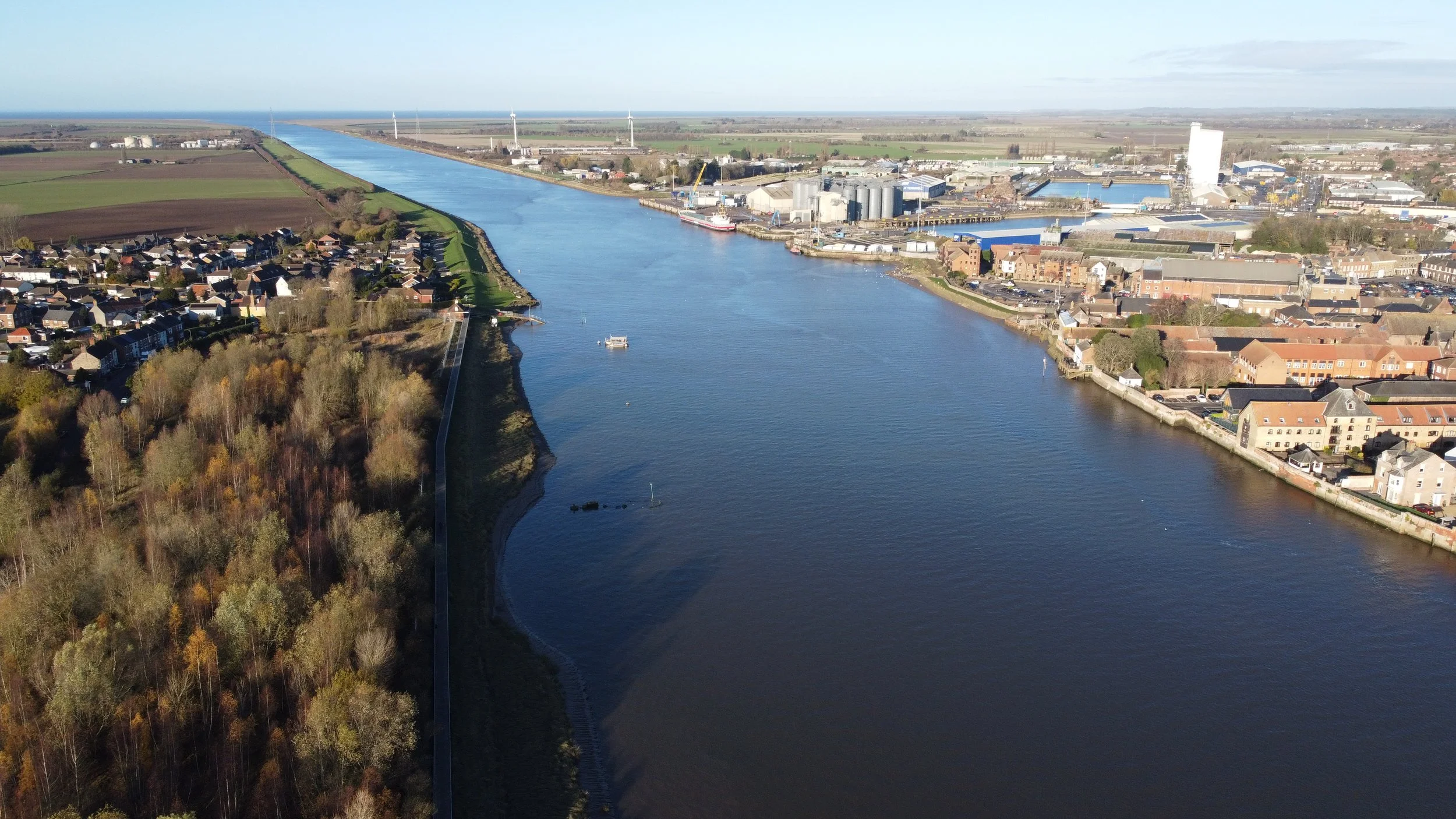
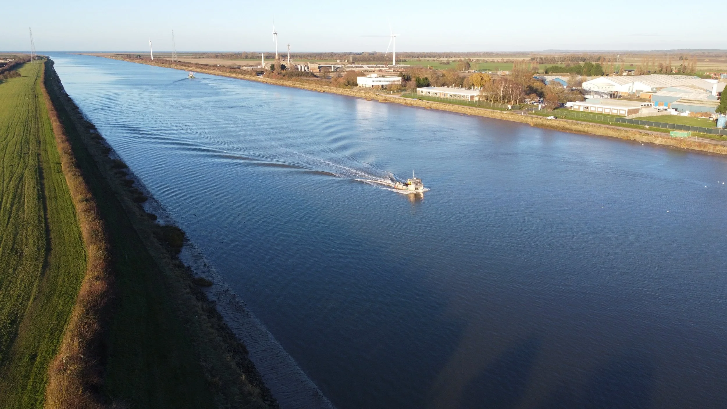
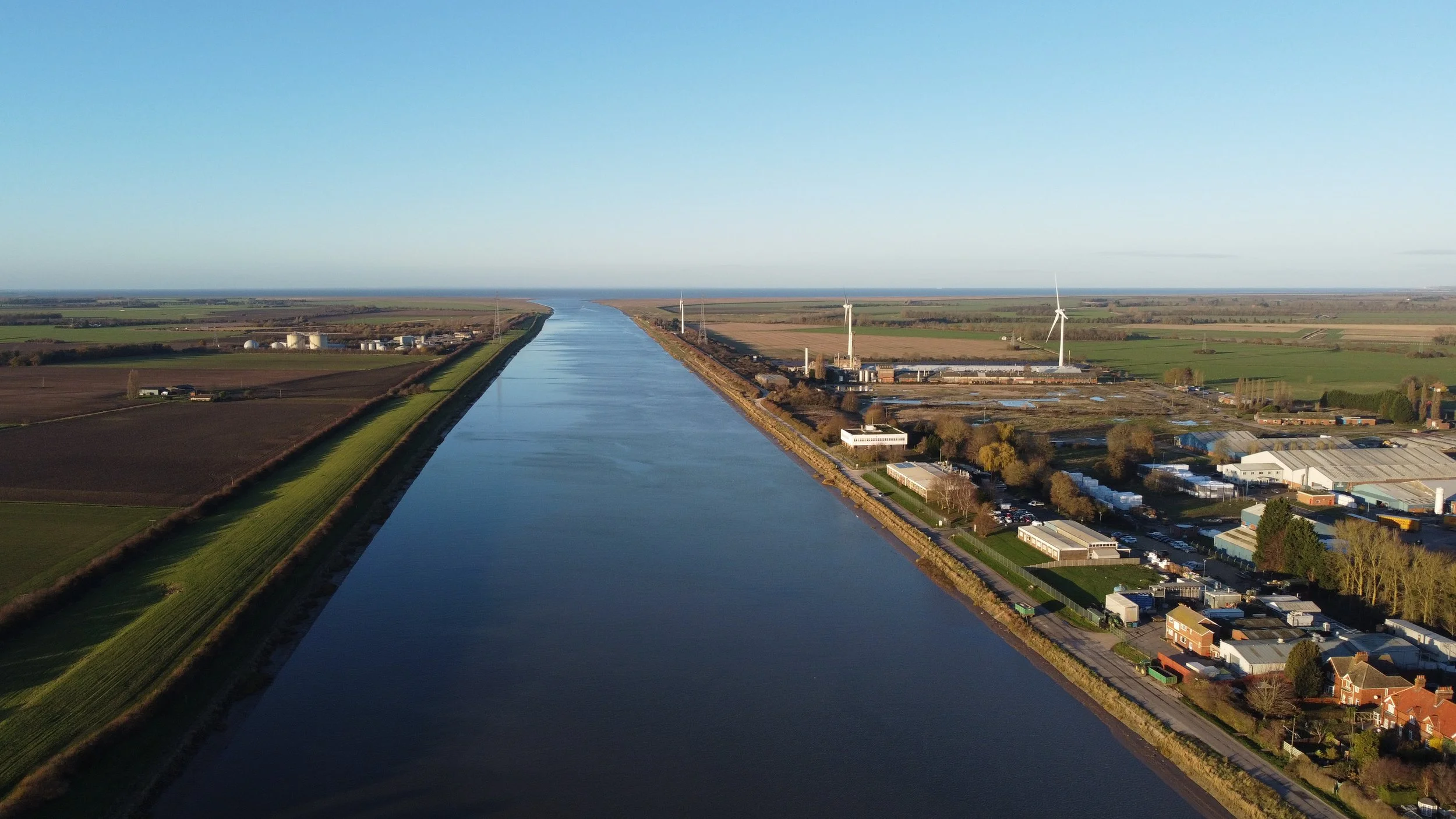
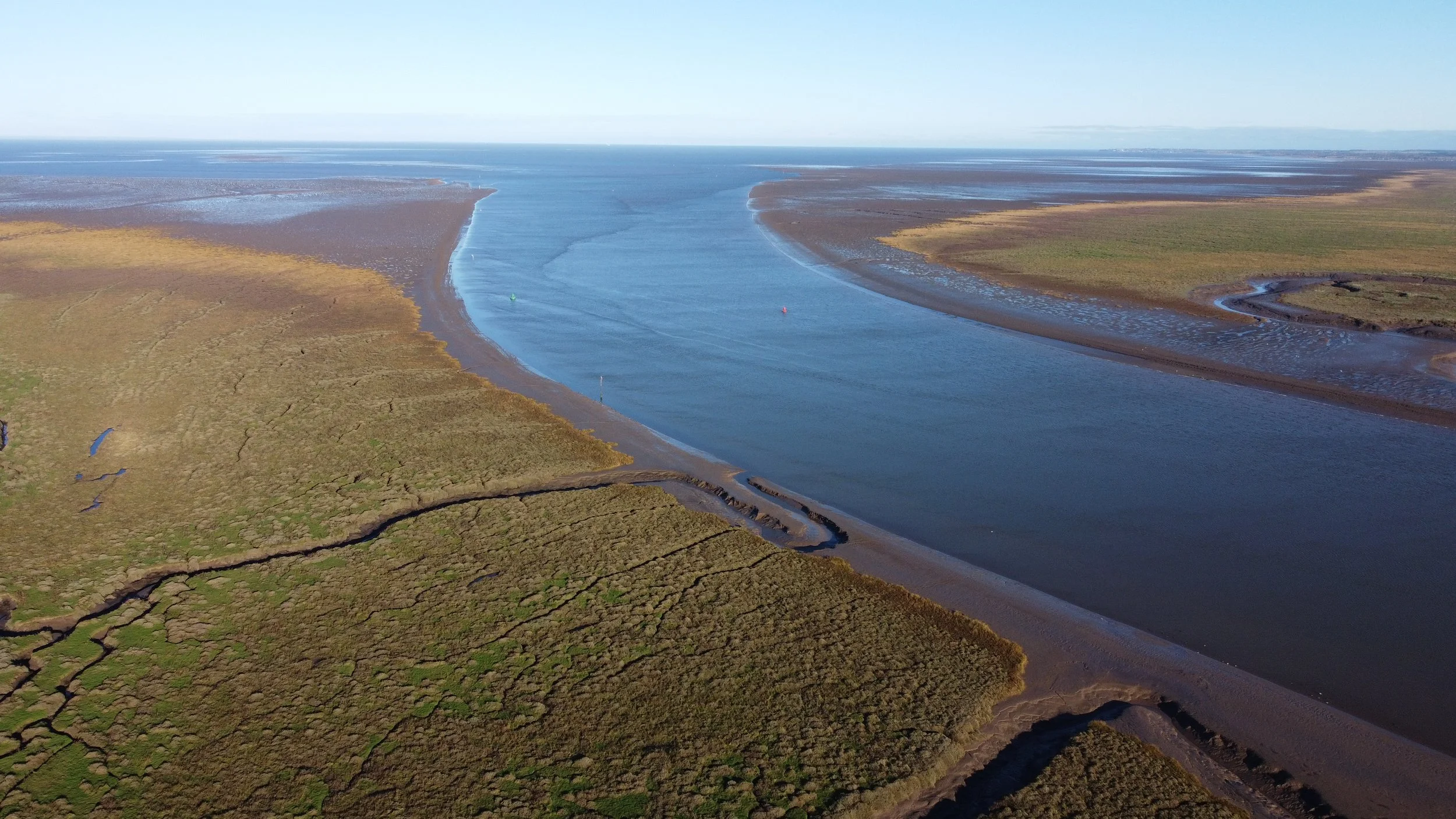
The River Ouse.
The River Ouse connected the Docks at King’s Lynn to the Wash and then to the North Sea.
The River Ouse was also served by the Harbour branch railway on the southern side of the town.

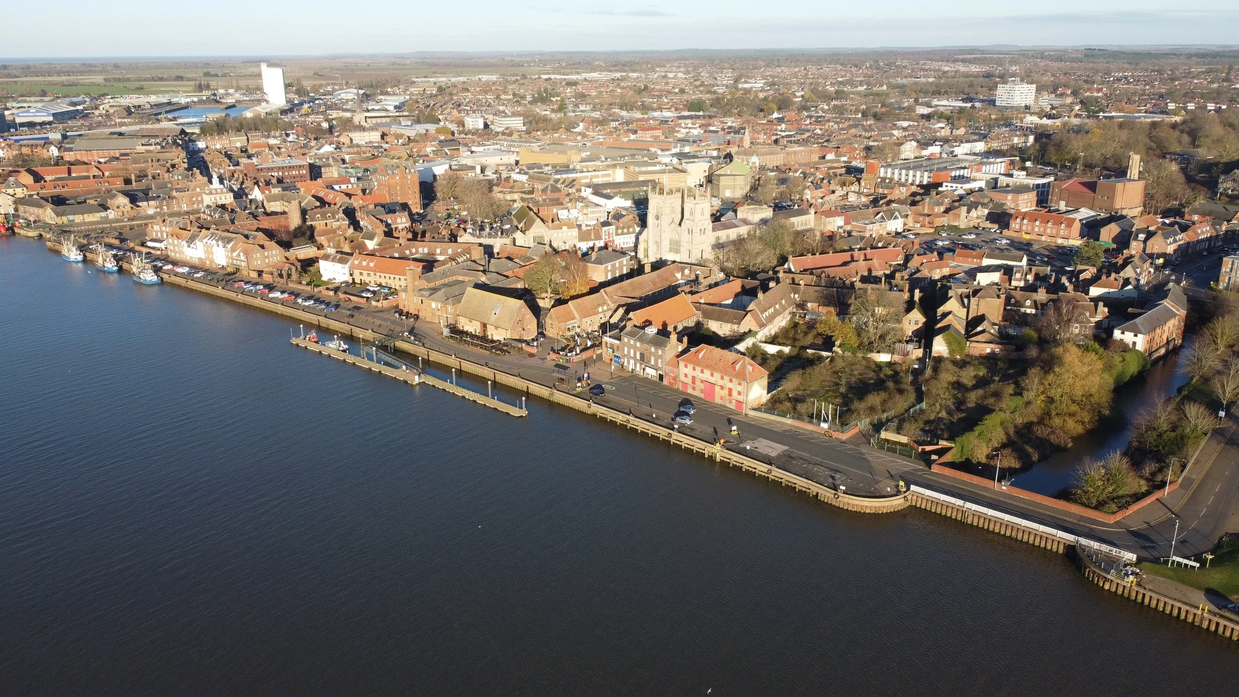
King’s Lynn South Quay.
King’s Lynn South Quay was the site where, many years ago, a second railway served the River Ouse.
The Harbour branch.
Thanks for reading my Humble webpage regarding the Docks railway at King’s Lynn. I would like to add a personal thanks to
Historic England for the Embed codes used.
A massive thank you also to Paul Miller for his photos via Wikimedia
- https://commons.wikimedia.org/wiki/Category:King%27s_Lynn_Docks_Branch
& Lewis Collard for the tip-off for the Wikimedia page.
Alex Brammer at Middleton Towers Restoration group for the tip-off for the Gaywood River Crossing Bridge.
Please also check out this wonderful page about King’s Lynn Docks.
Roger Farnworth Kings Lynn Docks part 1
Roger Farnworth Kings Lynn Docks part 2
King’s Lynn’s second line to serve the River Ouse.
Also, please check out my page on the Lynn avoiding line, which covers the Salters Road-Gaywood Road junction line that was going to use the Docks line.