THE LYNN AVOIDING LINE

We recommend viewing this page on a desktop PC, laptop, or tablet for a better viewing experience.
The Lynn Ely Railway opened in 1846, and in August 1861, the Lynn Sutton Bridge Railway was authorised by parliament and opened in 1864 and is shown on historical maps as the Bourne and Lynn Railway. The Lynn Sutton bridge railway initially operated from the original wooden station in King’s Lynn, which was later replaced by a brick station built by Robert Skipper of Dereham in 1871, which still exists today.
Departing from King's Lynn, the Sutton Bridge railway line utilised the Lynn Ely line and proceeded to the southern edge of the town at Harbour Junction. From there, the line diverted towards Sutton Bridge, with the next station being West Lynn. However, the single-platform station at West Lynn was short-lived, and little historical information is available.
I found that it was estimated to have been only open from 1866 to 1886.
The line after West Lynn called at Clenchwarton, Terrington, and Walpole before arriving at Sutton Bridge.
On the northern side of King’s Lynn, the King’s Lynn to Hunstanton railway line opened in 1862, and the Lynn Fakenham Railway opened in 1879 between King’s Lynn and Great Massingham. This is shown on historic maps as the Eastern & Midlands railway. The Lynn Fakenham line originally ran from a junction that branched off the Lynn Hunstanton Railway at Gaywood, between King’s Lynn and North Wootton. The line was extended to Fakenham in 1880, expanding further to Melton Constable, Great Yarmouth, Cromer, and Norwich City station and in later days, all these became part of the M&GN.
The Lynn Fakenham railway called at Grimston Road, Hillington, East Rudham, West Raynham & Fakenham.
King’s Lynn was becoming very busy with the Lynn Ely Line (1846), the Lynn Dereham Line(1846), the Hunstanton Branch (1862), and the Wisbech-March branch (1848) that branched off the Lynn Ely Line at a junction at Magdalen Road (now Watlington). Freight traffic was also present at King’s Lynn with the docks branch that opened in 1870 and headed towards the docks. Also, from King’s Lynn Junction.
King’s Lynn junction was where the Lynn Hunstanton, Dereham, and Ely-Sutton bridge lines diverged onto their dedicated lines.
An initial plan proposed constructing a new station on Austin Street in King’s Lynn. The envisioned railway line would have diverged from the Hunstanton line at a point known as Salters Road Junction, located near the junction from the Lynn-Bawsey-Fakenham line. The line would have briefly utilised the Docks railway before continuing its dedicated route to Austin Street. However, this line was never completed, no traffic was observed, and it was ultimately abandoned and dismantled.
A new through route was required to link the Lynn Sutton Bridge line to the Lynn Fakenham line and divert traffic from the main King’s Lynn Town station and King’s Lynn Junction. In 1885, the Lynn avoiding line was opened for freight, followed by passenger services in 1886. That same year, South Lynn Station was also opened for passenger use, coinciding with the closure of West Lynn Station.
The new loop line ran from Bawsey and circled around King’s Lynn to the south side of the town, leading to the newly established South Lynn Station.
The Lynn Avoiding Line was the final connection that linked the eastern lines, which reached Norwich in 1882 and Cromer in 1887, directly to the lines west of King’s Lynn
Along this new line, a station named Gayton Road was also constructed and opened in 1887. Also, a new bridge was erected to allow the line to cross over the Lynn-Dereham line between King’s Lynn and Middleton Towers.
The 3-mile and 22-chain route between Gaywood and Bawsey was kept intact for potential diversionary and excursion traffic, but it was ultimately removed as it was never utilised. Part of the old Sutton Bridge line at South Lynn continued to serve as a junction for shuttling trains from South Lynn Station to King’s Lynn Town Station. This included many excursion trains to the Norfolk coast via the Hunstanton branch until the M&GN closed in 1959. The junction remained operational for freight use until the late 1980s or early 1990s, serving the southern side of King’s Lynn and the nearby beet factory.
Starting from Bawsey, the Lynn Loop crossed a small bridge over the Gaywood River, then passed through open countryside, before arriving at Gayton Road station, Gayton Road, a two-platformed station with a waiting room and station master’s house and its dedicated signal box. The line then continued through Bawsey, passing beneath two bridges, and the railway soon after entered a cutting passing under a small farm crossing. The railway continued, passing over the Lynn to Dereham railway. Once past this bridge, the Lynn avoiding line railway passed over a few small drain crossings. Then, the train heading towards South Lynn crossed over another small drain bridge, the Puny drain. At this point, the railway was on a raised track bed, crossing over a farm track and then the Lynn Ely railway.
Shortly thereafter, it would pass over another bridge that spanned the River Nar. After this final bridge, the railway would cross a junction that once connected the Lynn Sutton Bridge railway from the Lynn Ely line at Harbour Junction. Soon after, the railway would head into South Lynn station.
Marking the end of the Lynn avoiding line
The Line today.
I visited the site where the Lynn avoiding line started in 2025; most of the rest of the line has been photographed in various stages since 2020.
Starting at Bawsey, I found no signs of what was once a junction at Bawsey on the ground. However, parts of the track bed from the old Fakenham line were used as a farm track, and the old track bed from the Lynn avoiding line was walkable up to the old Gaywood River bridge, which remains in small parts but is impassable and private land. Leaving the Gaywood River bridge, the avoiding line track bed is now untraceable as it passes through a farm and a scrap metal yard, having changed dramatically over the years. All that can be seen of where the line once ran is where the waste yard now stores skips and parts of a cutting to the side, close to the Gayton road site.
When we arrived at Gayton Road, the bridge that once crossed the road just before the station was now completely gone, and the road levelled. Gayton Road Station itself remains in small proportions, with the buildings gone, apart from a small brick part of the waiting room, and the two platforms remain but look to have been shortened. The land surrounding Gayton is very boggy in the winter and very overgrown in the Summer. Leaving Gayton Road, the railway passed underneath a road bridge that remains in Bawsey Country Park and then passed under a smaller farm crossing bridge that also remains. Before entering a cutting and passing underneath a small farm bridge, all that remains here is one small concrete part of the bridge, and the cutting has been refilled and returned to farming fields. Shortly after, the Lynn Dereham bridge crossing still survives in small parts, and the buttresses remain, with the bridge crossing having been removed. The Lynn Dereham railway below is still used daily, transporting freight services from Middleton Towers station, transporting sand. Passing the bridge, the old track bed remains and is now repurposed as a farm track, with two small drainage crossing bridges remaining. Passing underneath the A47 and bearing around the Hardwick Narrows industrial estate, an old bridge hidden within the industrial estate is said to survive still, but is challenging to get to. The line would pass over the Lynn Ely line; all that remains is one buttress from the railway crossing, which was part of the farm underpass that ran alongside the Lynn Ely line. The raised track bed still exists, as does Bridge PmY2-53, which is accessible via the Nar Valley walk. The bridge that once accommodated the Lynn Sutton Bridge railway and later the Lynn Shuttle services heading towards South Lynn also survives.
This is the last part where anything remains from the Lynn avoiding line. A new bridge was constructed to take road traffic over what was once the Lynn avoiding line, and in later days, the sugar beet freight line could be viewed from Saddlebow Road. The track bed is also visible, and the site of what was once South Lynn station is in the distance.
South Lynn station no longer exists, and the site is now wasteland in most parts, with industrial sites and the A47 bypass constructed.
Much of the track bed from South Lynn to Sutton Bridge is now repurposed as the A17 bypass, and all the intermediate stations are no longer there. All that remains is the Cross Keys swing bridge or Sutton Bridge, which is still in use and carries the A17 road traffic. There is also a small memorial at Walpole.
A link to the Sutton Bridge Railway can be found at the bottom of this page.
Maps
Historical maps
Bawsey
Pre-construction of the Lynn avoiding line.
Thanks to The National Library of Scotland for all the Maps used below
All maps below are dated from the 1830s to the 1880s
Maps from the 1830s to 1880s show the Lynn Fakenham line curving at Bawsey and heading towards King’s Lynn Town station.
The Historic maps indicate the line as the Eastern & Midlands railway.

© 2024 National Library of Scotland
Maps from the 1830s to 1880s show the Lynn Fakenham line curving at Bawsey. A combination of historical and modern maps illustrates the starting point of the Lynn avoiding line, depicting the tree line along which the Lynn avoiding line ran to South Lynn before its closure. Additionally, the bottom of the map shows Gayton Road, where the new station was located.

© 2024 National Library of Scotland
Historical maps
South Lynn
Pre construction of the Lynn Loop.
Thanks to The National Library of Scotland for all the Maps used below.
All maps below are dated from the 1830s to the 1880s
Maps from the 1830s to the 1880s show the line at South Lynn From Kings Lynn town station heading off towards Sutton Bridge at Harbour Junction with no Lynn avoiding line installed.
Also, no station at South Lynn existed at the time of these maps.
Although West Lynn existed on this map.

© 2024 National Library of Scotland
West Lynn Station.

© 2024 National Library of Scotland
Historical maps
Bawsey
After the construction of the Lynn avoiding line.
Thanks to the National Library of Scotland for all the Maps used below.
Maps from 1892 to 1914 show the King's Lynn avoiding line, which took the now M&GN line from Fakenham and Melton Constable off towards South Lynn, eliminating rail traffic needing to use King’s Lynn Town station.
The old Gaywood Junction line here is seen as abandoned.
Also seen on the historic map are some sidings at Bawsey

© 2024 National Library of Scotland
© 2024 National Library of Scotland
Historical maps
South Lynn
After construction of the Lynn avoiding line.
Thanks to the National Library of Scotland for all the Maps used below
All maps below are dated from 1892 to 1914
Maps from 1892 to 1914 show the railway line at South Lynn with the Lynn avoiding line. They demonstrate how the services, now on the M&GN, entered what was formerly the Lynn & Sutton Bridge Railway and then continued into South Lynn Station. This change eliminated the need for trains to enter Lynn Town station.
On the map below, you can also see the location of the curved section in the railway, which was formerly part of the Lynn Sutton Bridge Railway. This section was preserved and then served as a junction for shuttle services between South Lynn and King’s Lynn town bringing many services off the M&gn and off to Hunstanton.

© 2024 National Library of Scotland
Later maps indicate that the area at South Lynn had been more utilised for industrial sidings

© 2024 National Library of Scotland
The Lynn avoiding line was constructed at Bawsey. In the early days, the original Lynn Fakenham track was left in situ for emergency and diversionary traffic, but it was unused and soon removed.
Bawsey junction after both lines were closed.

M&GN Network map


MY GOOGLE MAPS
Bawsey Junction.
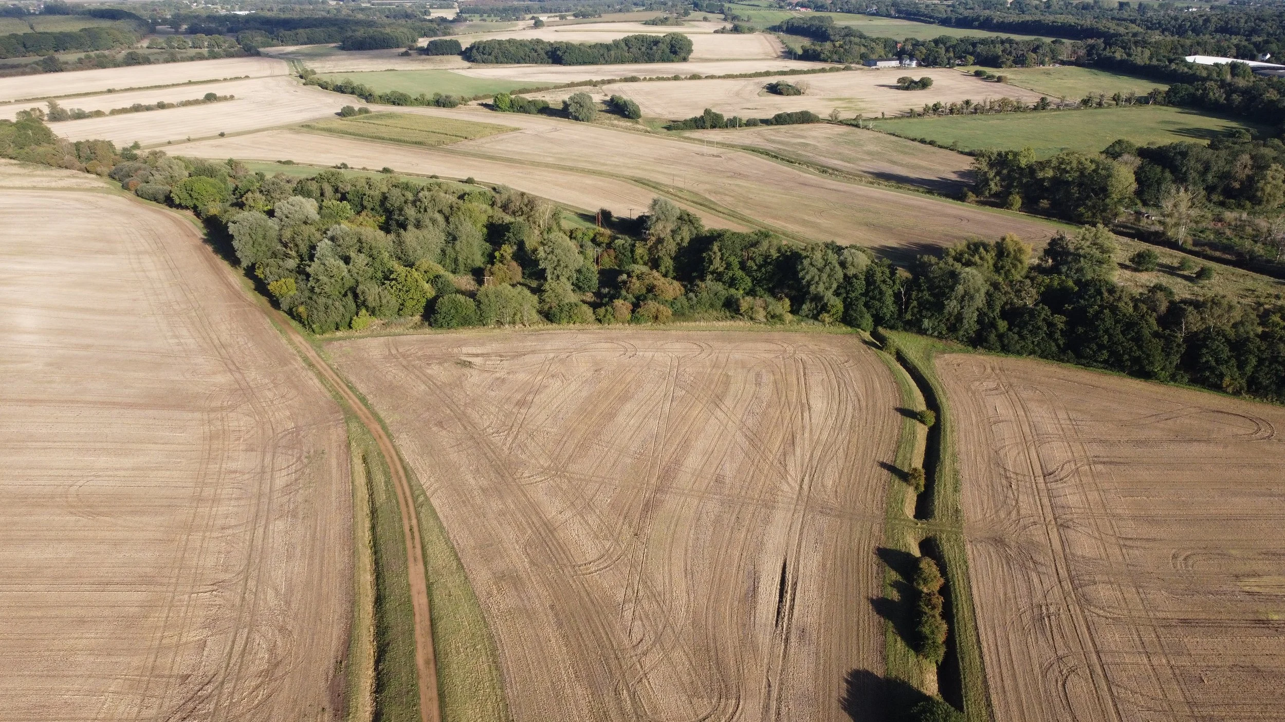
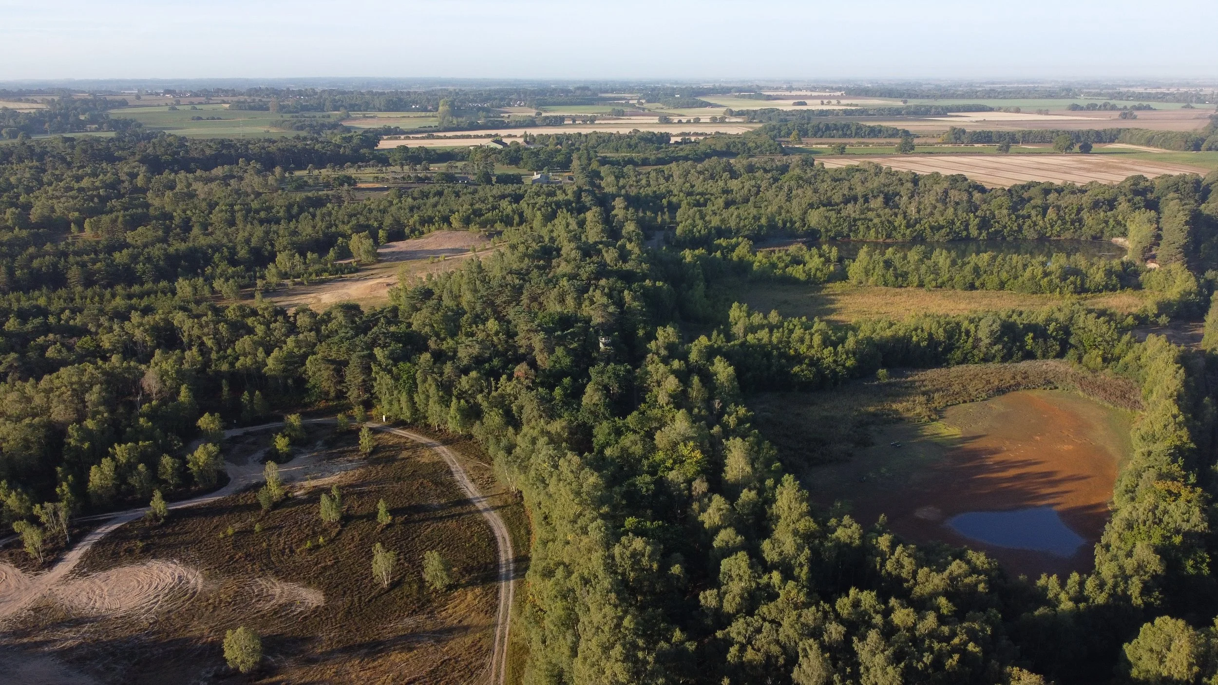
Bawsey Junction aerial view.
Here, we see the tree line in the distance where Bawsey Junction once was. Far away, the tree line heading right was the Lynn avoiding line, while to the left was where the Lynn Fakenham line would have gone towards Grimston Road. The farm track bed at the bottom of the picture was where the Lynn Fakenham line diverged from the Lynn Hunstanton line until 1886, before the Lynn avoiding line was built.
Start of the Lynn avoiding line.
The Lynn avoiding line started here at Bawsey. As seen in the pictures below, very little trace remains of where this long-lost line once ran.
The two photos below show where the junction would have once sat many years ago.


©Norfolks Disused Railways
The Lynn Fakenham line looking back towards Grimston road station just before the old junction.


The old track bed heading off towards Gayton Road.
The Lynn Fakenham line track bed photographed in 2025 just past the Bawsey Junction.

Gaywood river bridge
Heading towards Gayton road, the railway first crossed over the Gaywood river on this small river crossing bridge.


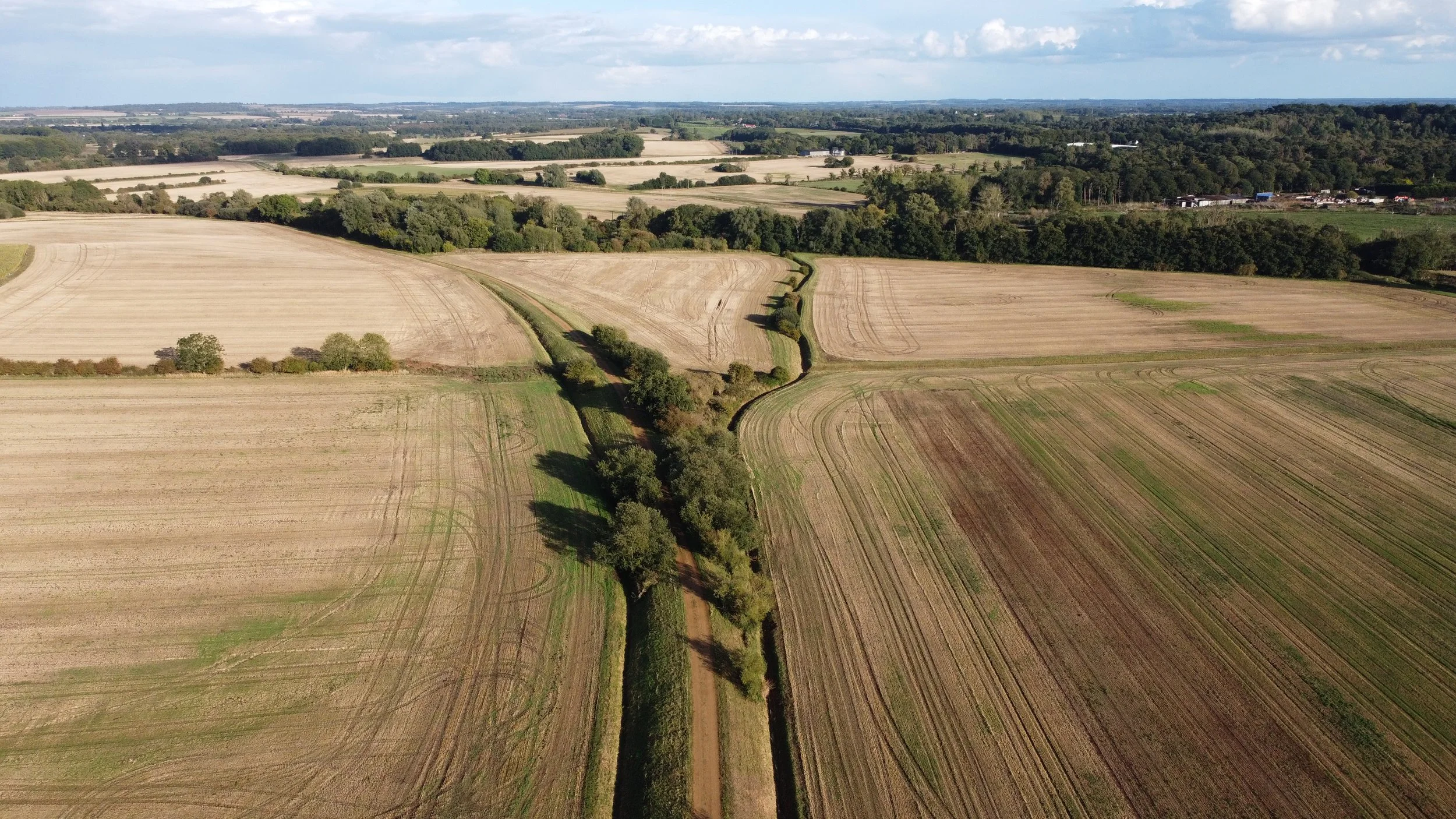
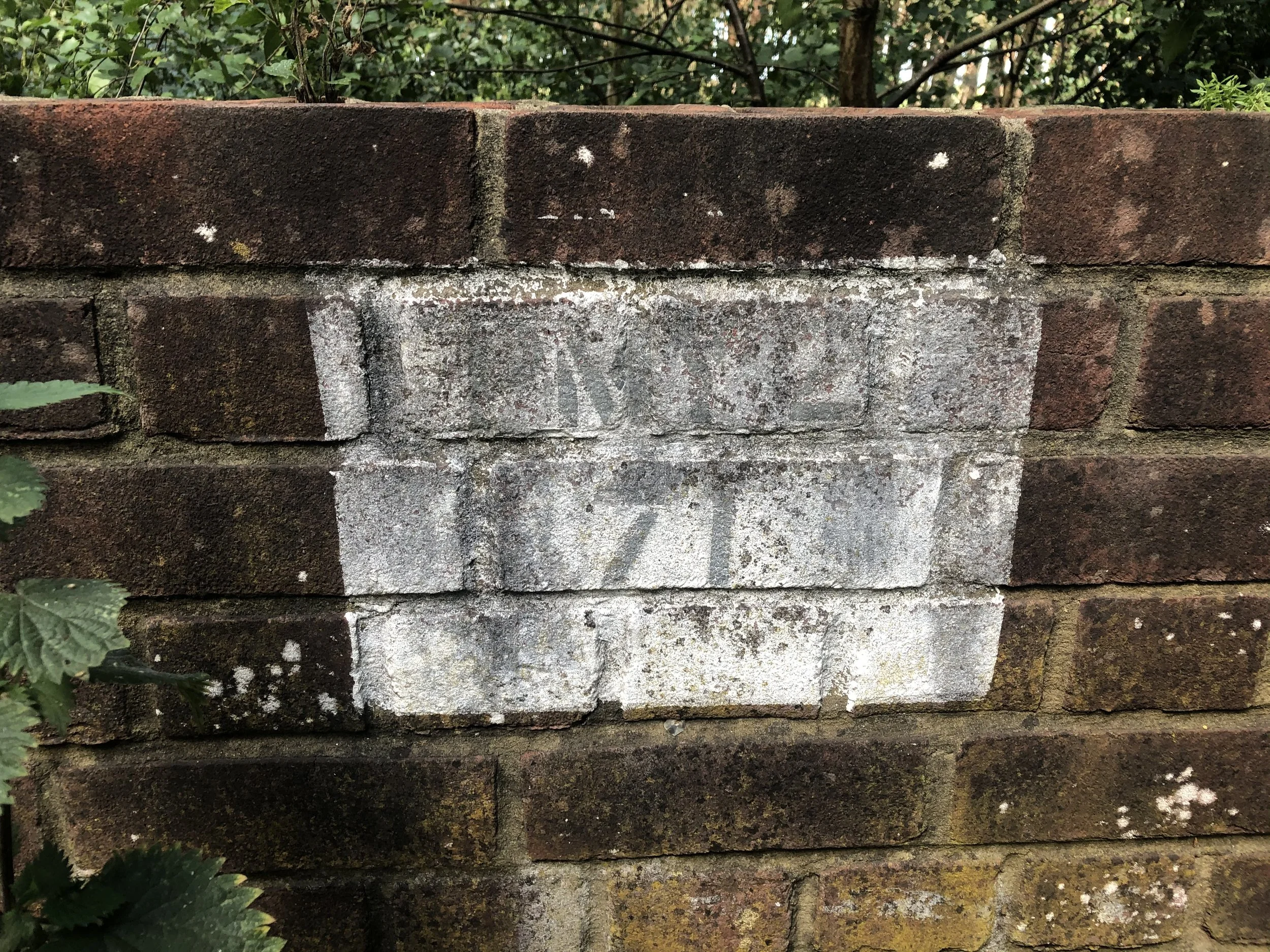
Track bed & Fence at Bawsey.
Heading towards Gayton Road station, the Lynn-avoiding line ran down this track, which is now used as skip storage for a local waste Management company.
Parts of the cutting can be seen on the sides.

Part of the old fence was found on the embankment by the Sandboy pub.
Gayton road station
Gayton Road station was built as part of the Lynn avoiding line and started operating in 1887, one year after South Lynn.
Gayton Road had two platforms, a dedicated signal box, a waiting room, and a station master’s house. At the end of the platform at Gayton Road, the railway passed underneath a road-crossing bridge.
It ceased operating for passengers in 1959.

Credit for the photos above via @Gayton Road Railway Station Regeneration Project (M&GN) Facebook group
Gayton Road station photographed in March 2021


©Norfolk’s Disused Railways
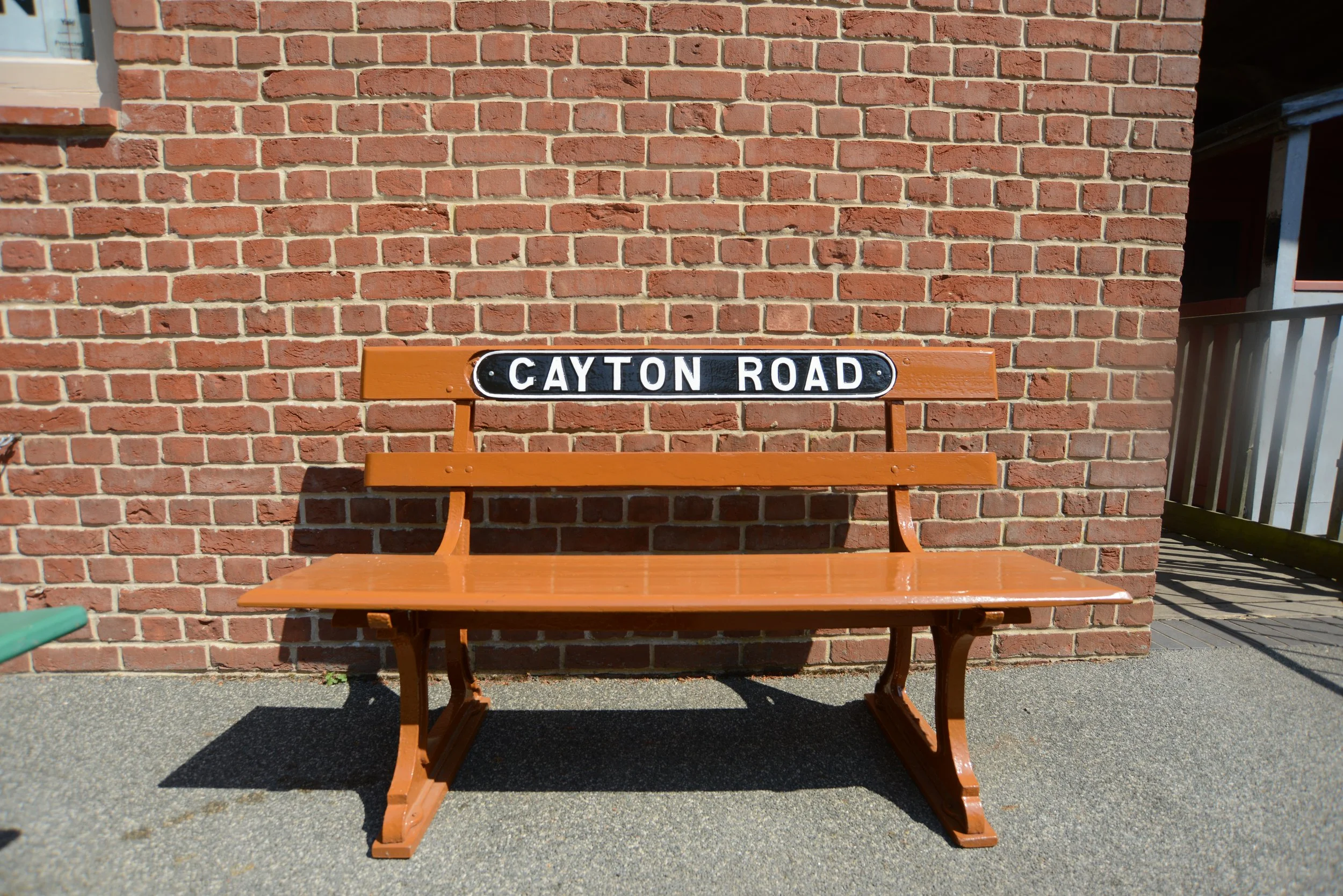
At Holt, this old bench from Gayton Road sits on the North Norfolk Railway.
The authenticity of this bench is unknown to me.
Aerial view
Aerial view of the old tree line that traces where the former Lynn avoiding line left Gayton Road and headed towards South Lynn.
Off to South Lynn
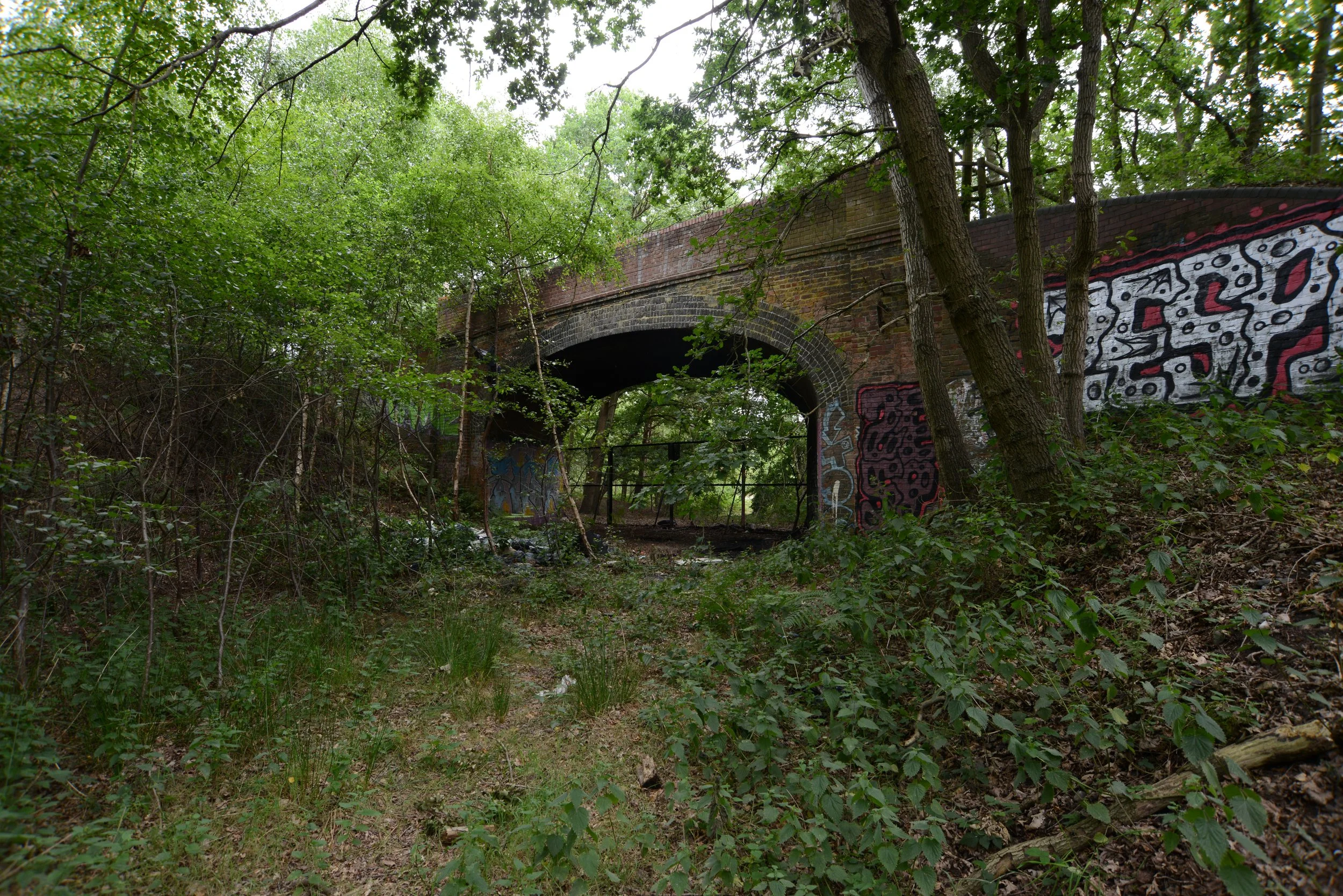
Close to the site of Gayton Road station, hidden in Bawsey Country Park, this bridge was constructed as part of the Lynn avoiding line, which took the railway underneath and the road over the top.
PMY2-71


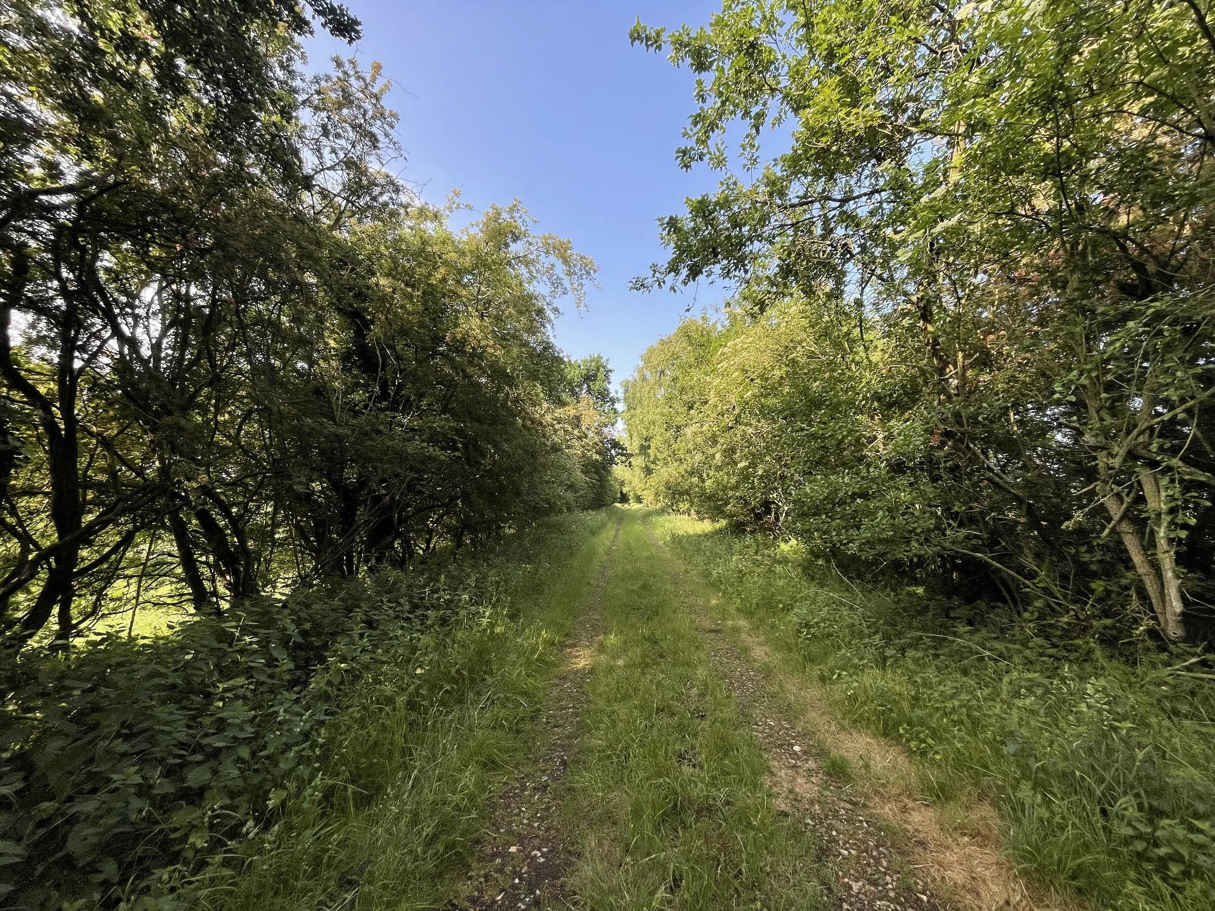
After the bridge PMY2-71, the old track bed becomes very overgrown.

Next, along the Lynn avoiding line, we reach bridge 70.
Thanks to Steve Heywood for the pictures and information about this bridge, Bridge 70, which is located outside Bawsey Country Park. Again, the railway passed underneath this bridge.

©National Library of Scotland


©Steve Heywood
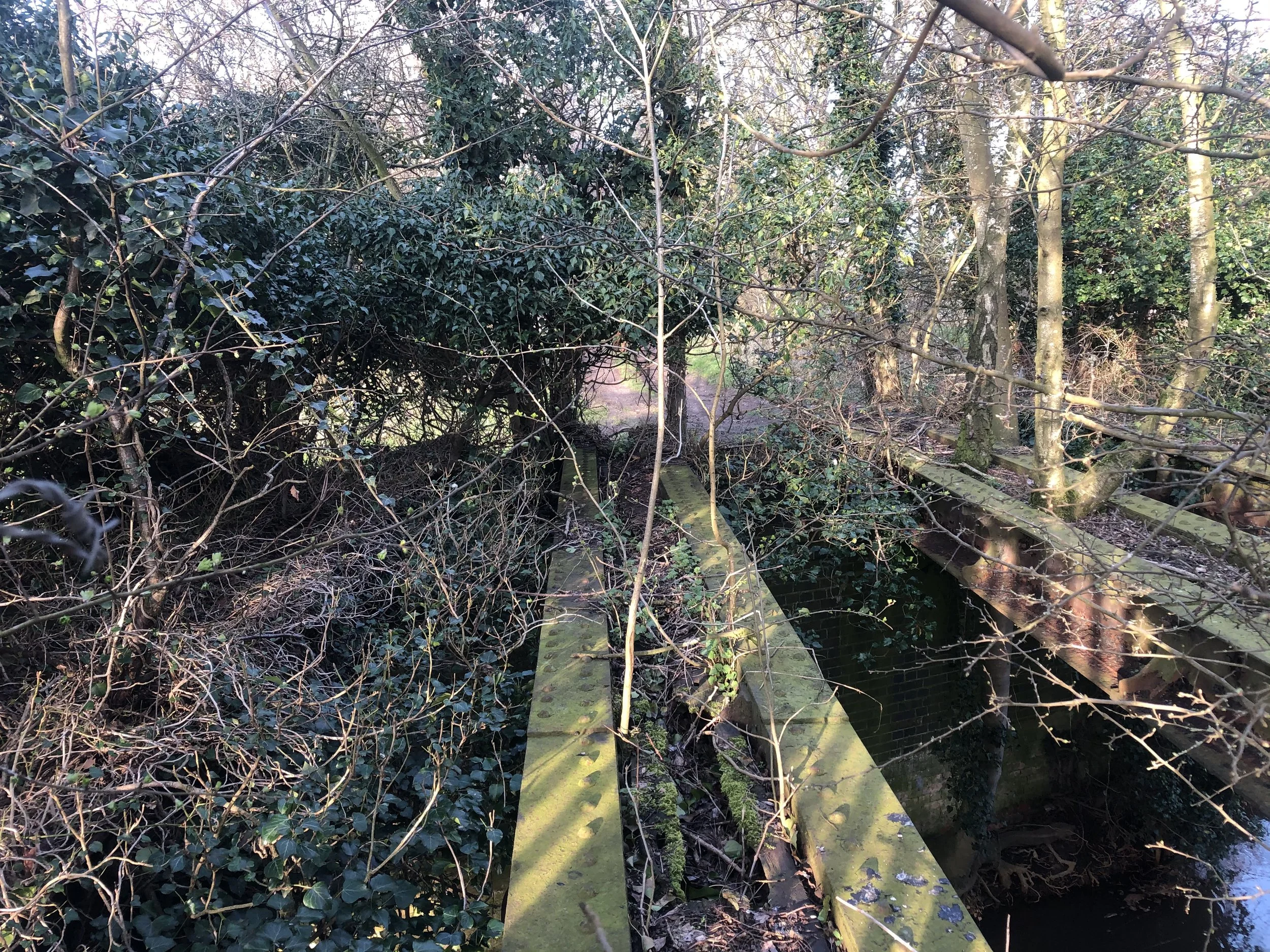
This next small bridge, once part of a farm crossing, was filled in many years ago, along with the track bed and converted back into farmland. All that remains is this small section of the road crossing.


©National Library of Scotland.
The Lynn Avoiding Line, Lynn Dereham railway crossing bridge
The Next Bridge carried the Lynn-avoiding line over the King’s Lynn to Dereham railway and then off towards South Lynn. As seen in the photos below, the Buttresses and a passageway used for farm access remain, while the bridge span has been removed.
The map below illustrates the Lynn Dereham line prior to the construction of the bridge and the Lynn avoiding line.

Historic maps show the Lynn avoiding crossing over the Lynn Dereham line.

The Buttress left behind from where the Lynn Avoiding line crossed over the Lynn Dereham line.
Credit for the photo below goes to Alex Brammer from the Middleton Towers restoration group.

Credit Alex Brammer from Middleton Towers Restoration Group

Steve Heywood from the Midland & Great Northern Joint Railway M&GN Facebook Group provided the following two images.
Thanks, lots, Steve.
Part of this bridge was used as a farm underpass.


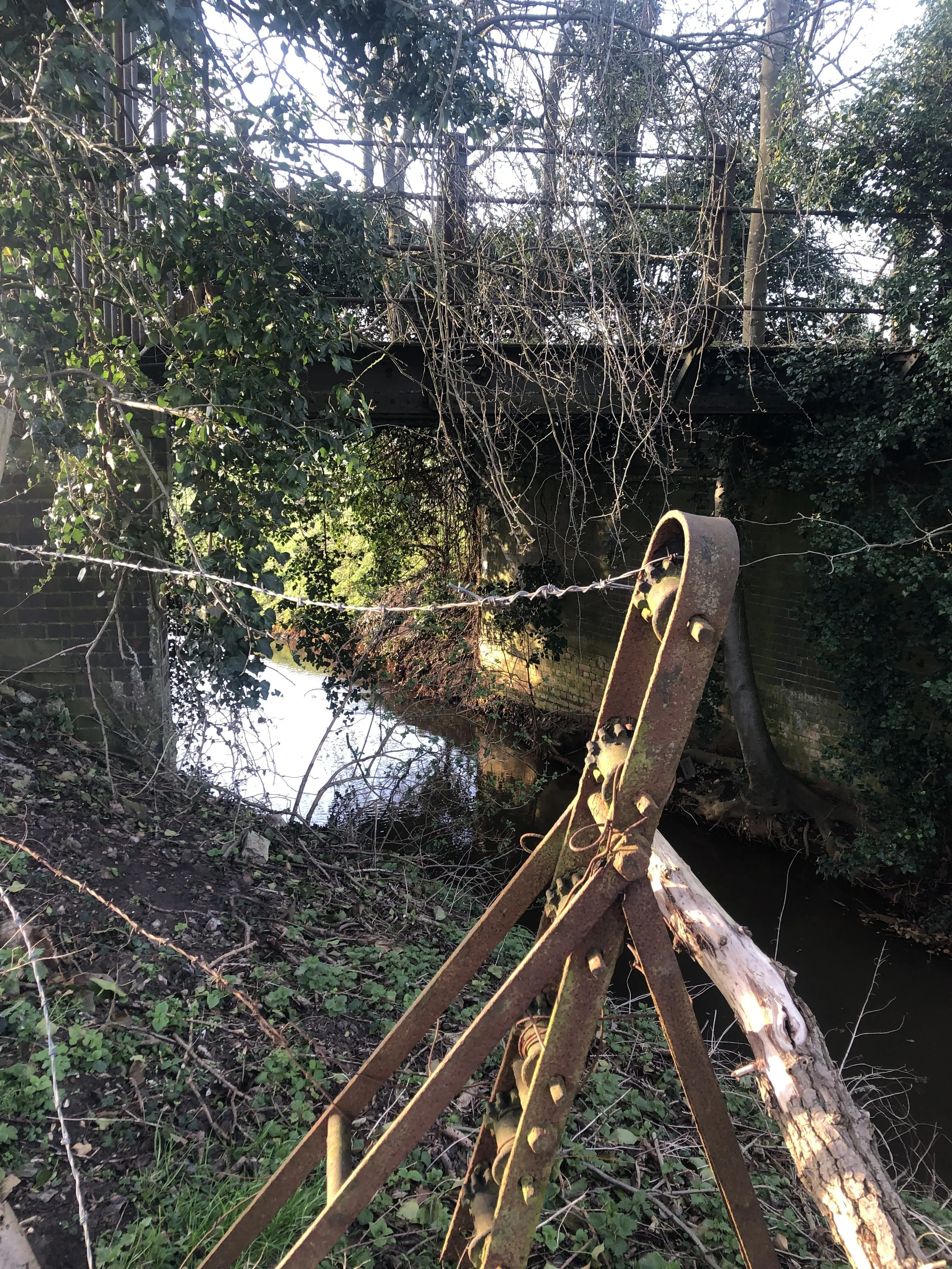
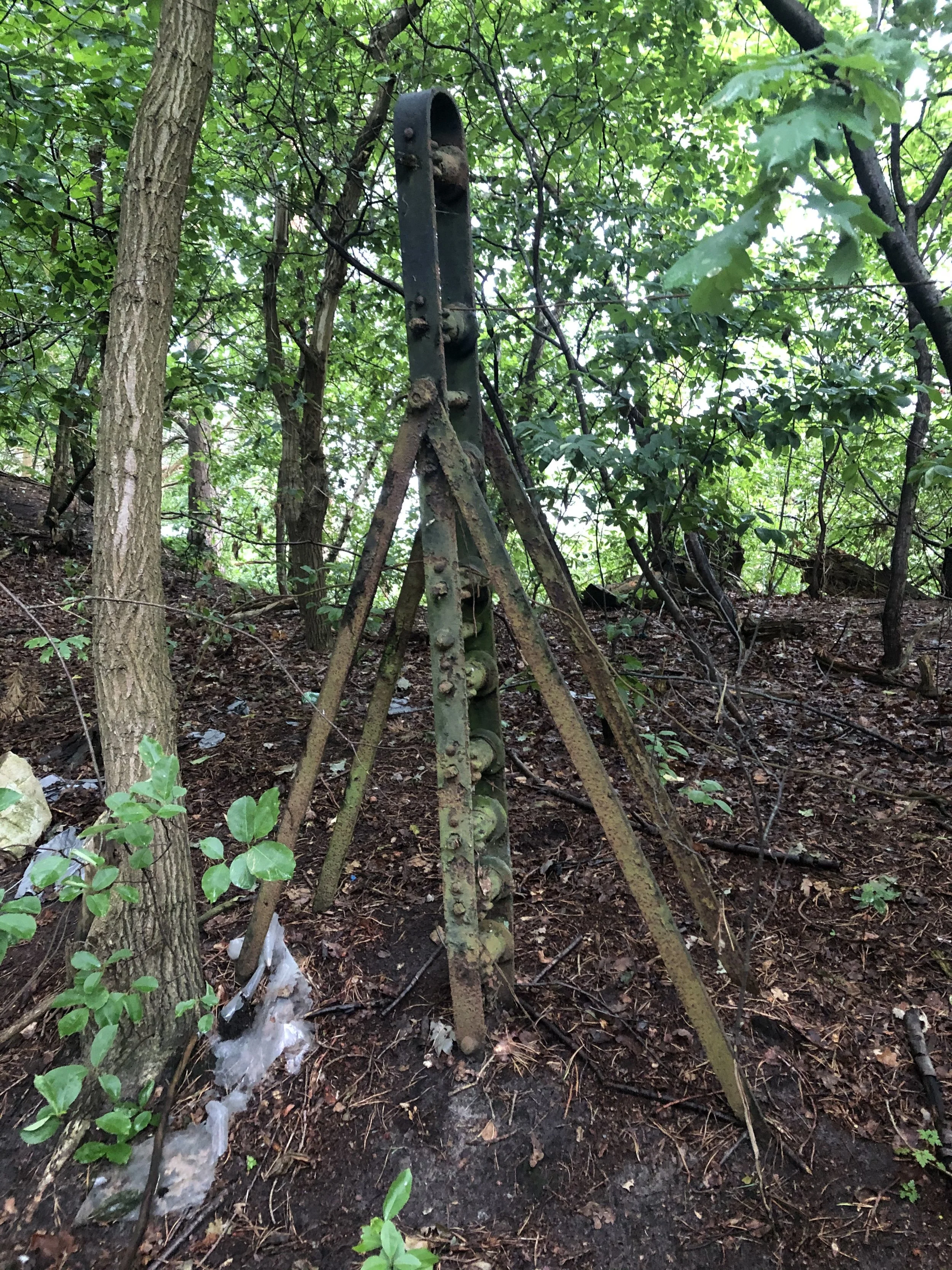
Heading off towards South Lynn, the Lynn-avoiding line crossed over some small bridges before curving around on its approach to South Lynn station.
Thanks once again to Steve Heywood for the pictures seen below.


Hardwick road goods sidings
Thanks again to Steve Heywood for the pictures and information on the Hardwick Road sidings and cattle dock, which are shown below. The sidings were situated approximately one mile east of South Lynn station along the Lynn avoiding line..
These pictures were taken in 2025 following a site clearance by a potential utility company. Once again, many thanks to Steve.


© 2025 National Library of Scotland


©Steve Heywood
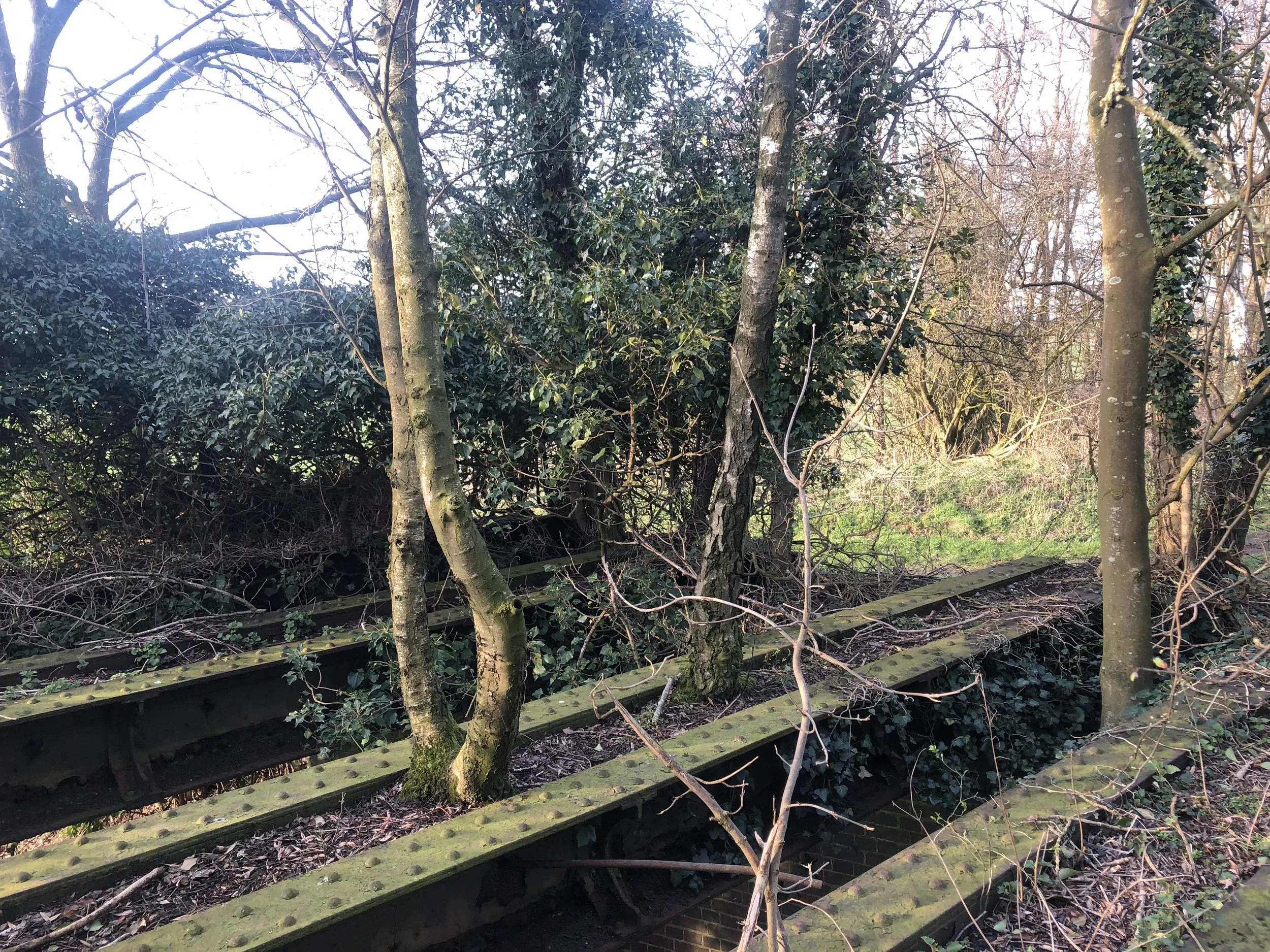
The Lynn Ely line Crossing.
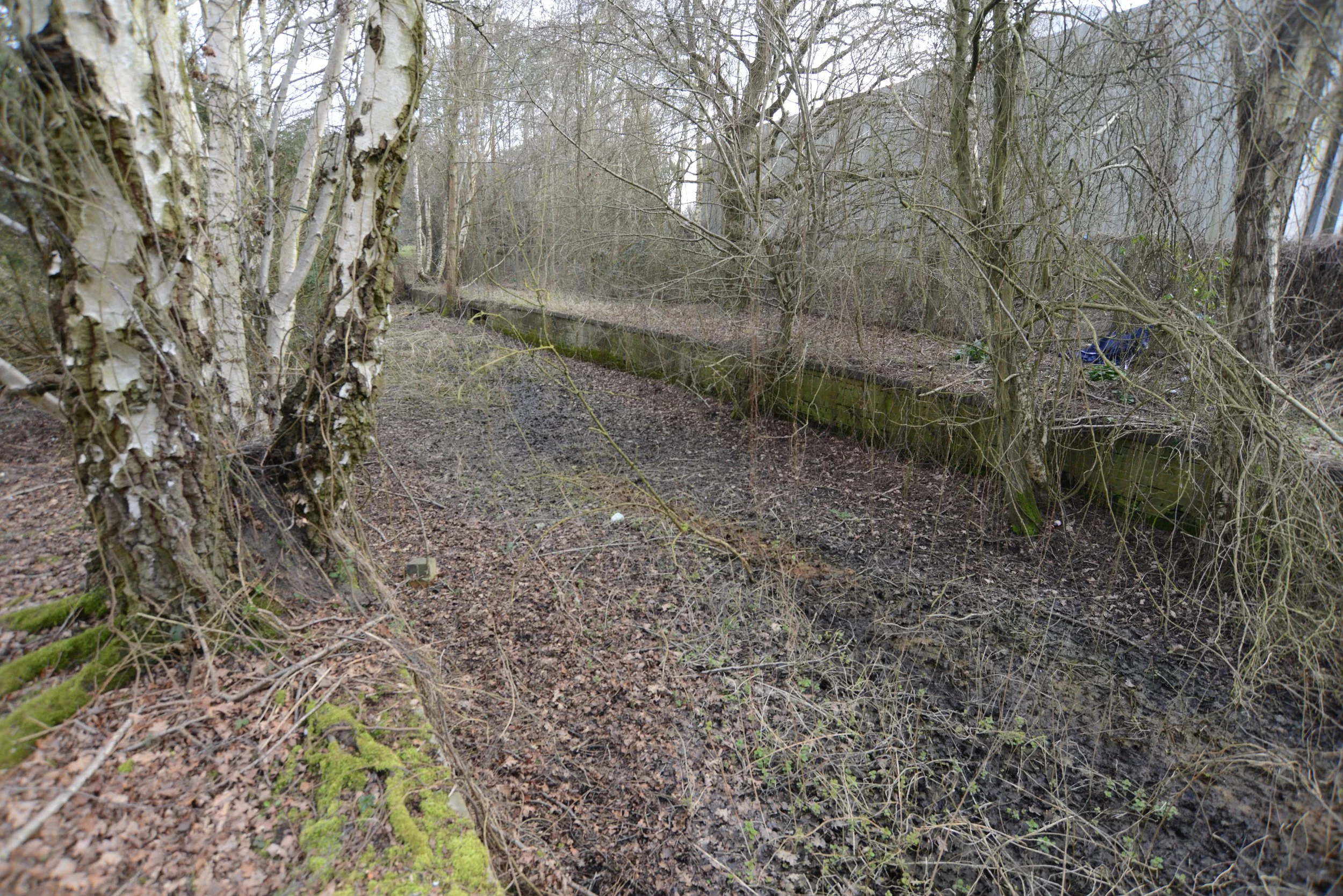
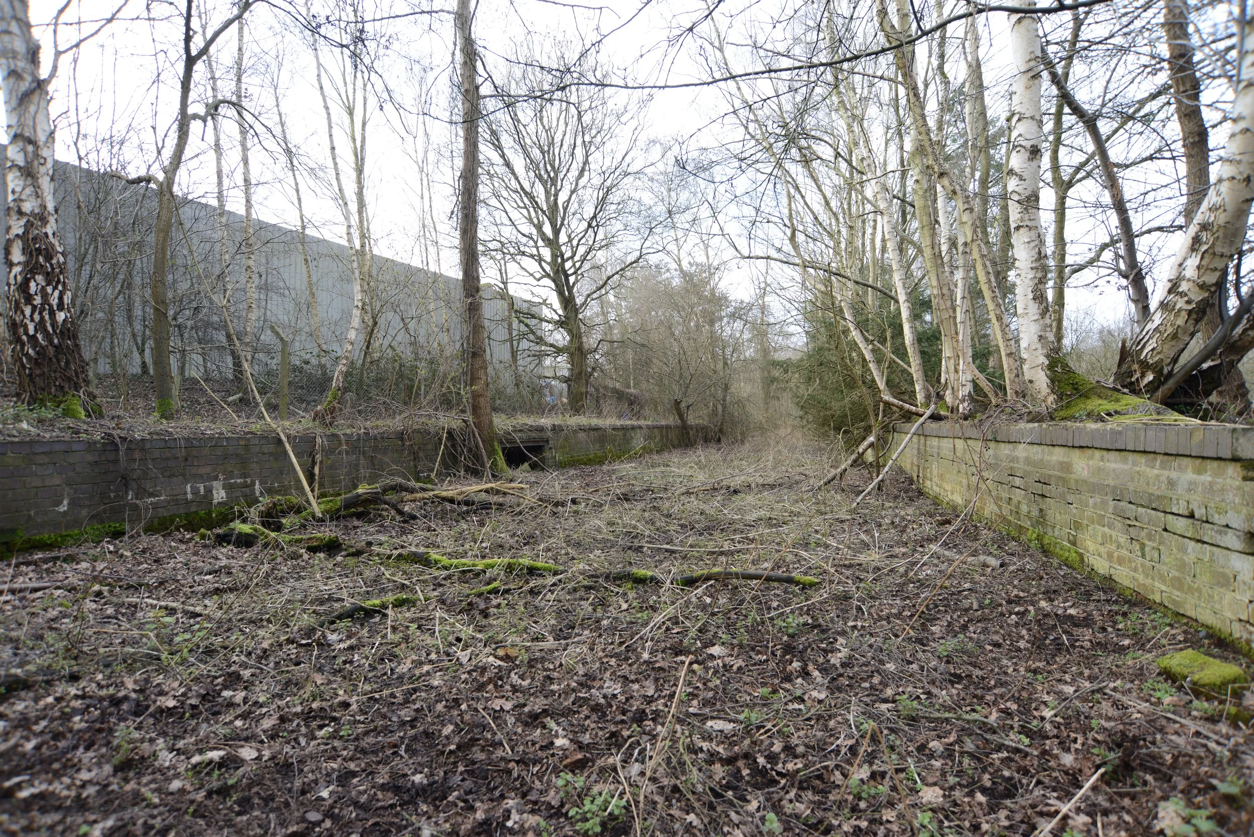
Close to South Lynn station, an overpass bridge was constructed for the Lynn avoiding line and crossed over the Lynn Ely Line. When I visited, all that remained was this one buttress.
The observed buttress was positioned far back from the railway line and was one of three supports that gave this bridge a similar configuration to the one that crossed over the Lynn Dereham line, beneath which a farm road also passed.

The disused buttress was part of a farm track that ran underneath the Lynn avoiding line.

A raised track bed was constructed for the Lynn avoiding just before South Lynn.


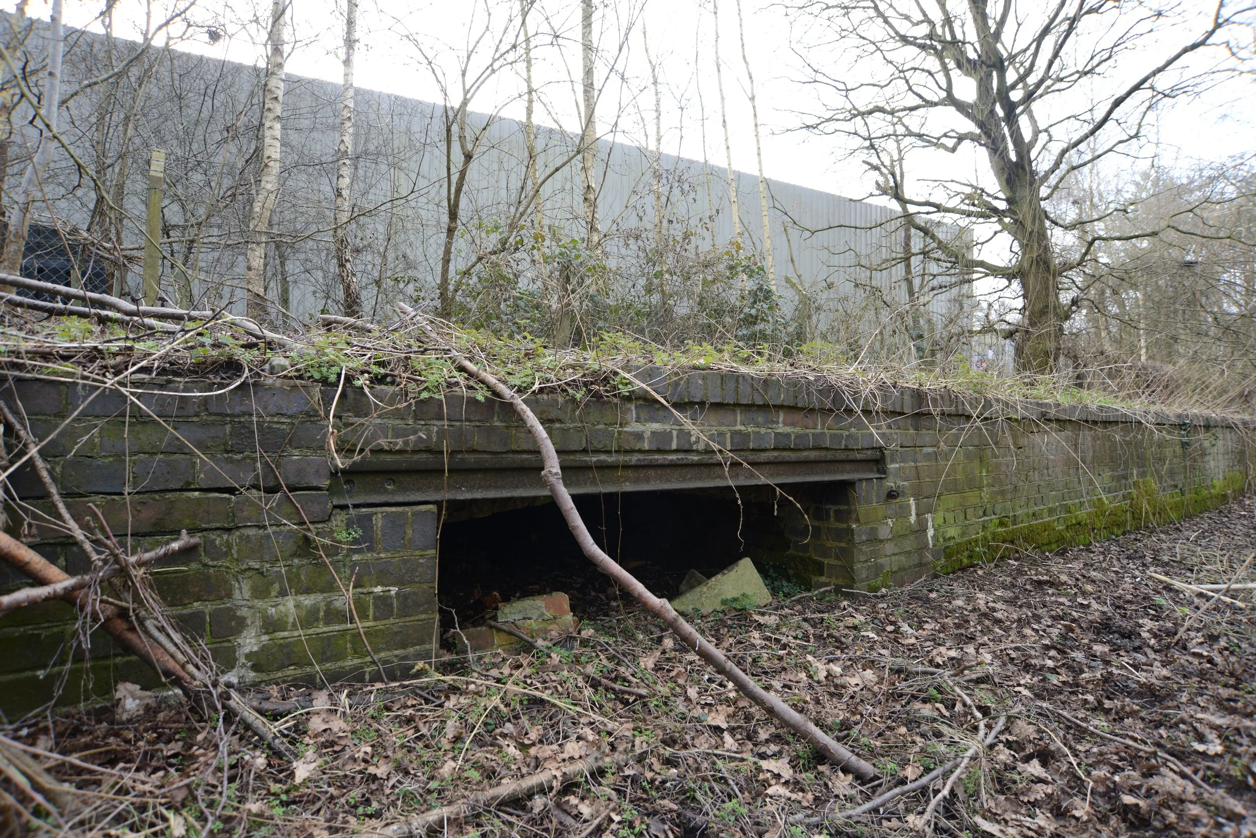
The Last Railway Bridge near South Lynn station was built for the Lynn avoiding line and still exists along the Nar Valley Way walk today.
Credit goes to the construction of these bridges that still stand today.
M&GN Bridge PmY2-53


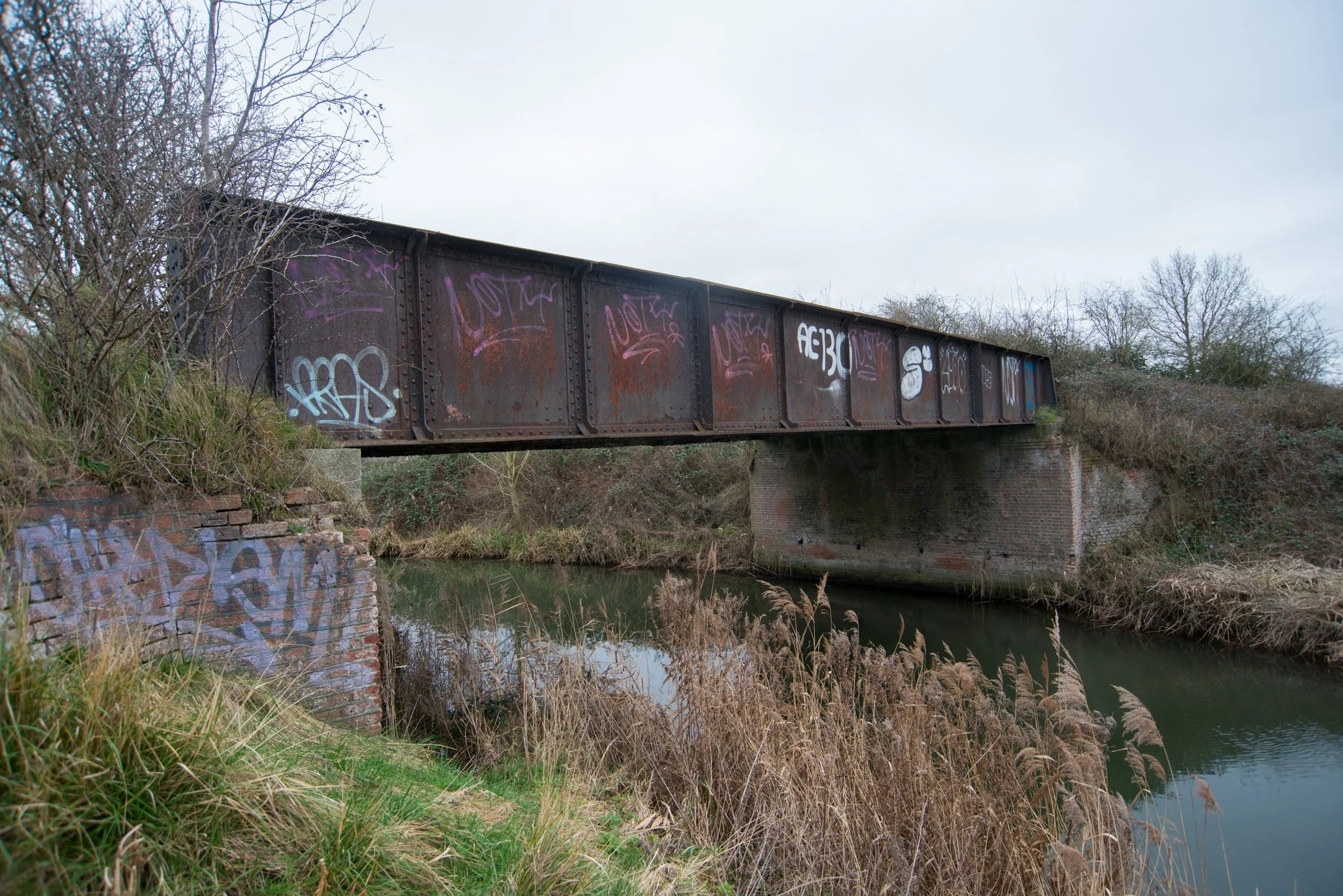


2025 drone revisit.


Shortly after crossing over this bridge, the Lynn Avoiding line reached its destination, South Lynn.
South Lynn station
South Lynn station was built after King’s Lynn town station, which was constructed in 1846. The next station along the Lynn Sutton Bridge railway was West Lynn, located on the western side of the River Ouse. West Lynn station was closed in 1866, and with the construction of the Lynn avoiding line, South Lynn station opened in the same year.
In its later days, South Lynn served M&GN and also had numerous freight sidings constructed over time to supply various industrial companies in the vicinity. South Lynn had two passenger platforms and closed in 1959.
To this day, nothing remains of South Lynn station. Most of the land the station stood on is still wasteland, with a small portion taken up by the A47 dual carriageway.
It has been said that one of the reasons for South Lynn's closure was that the bridge carrying the railway over the River Ouse just west of the station was beyond repair and not financially viable.
Historic maps below show the Lynn Sutton Bridge line before South Lynn station was built.

© 2024 National Library of Scotland
South Lynn station maps


© 2024 National Library of Scotland

The Free Bridge, Railway Bridge and South Lynn Station, King's Lynn, from the north-west, 1932 © Historic England. Aerofilms Collection EPW039193 flown July 1932
Please click on the aerial image for the Source page.

Photographer and year unknown

Photographer and year unknown

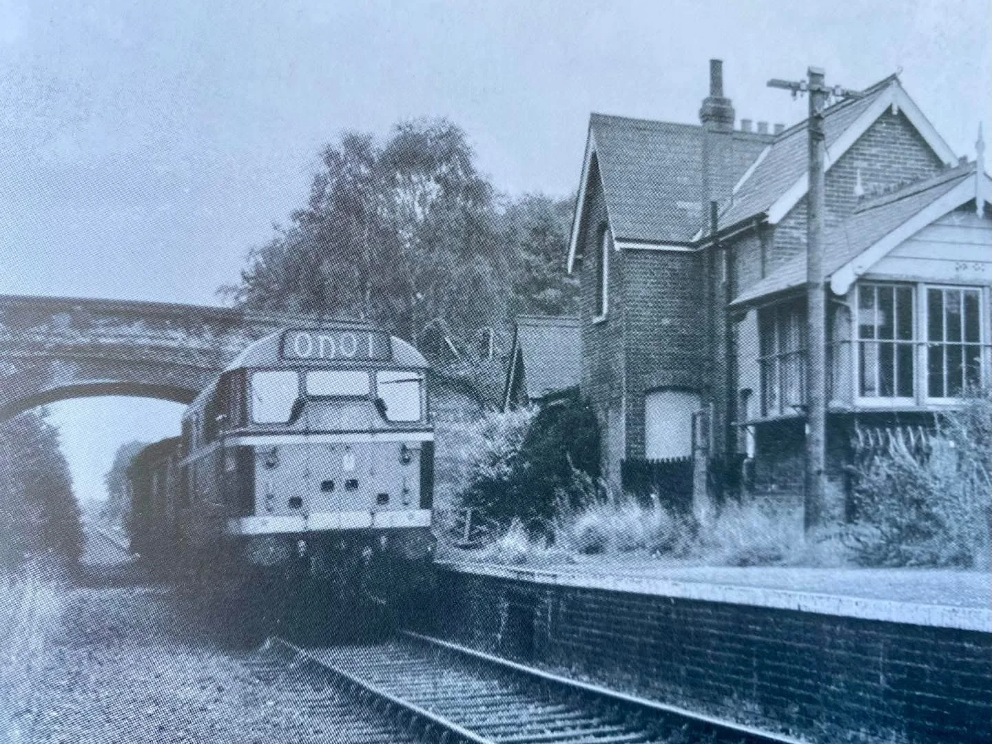
Ben Brooksbank / Ex-GE B12/3 4-6-0 on Rail Tour at South Lynn / CC BY-SA 2.0
South Lynn site 2025
When photographed in 2025, nothing of South Lynn station remained. All that remains are a couple of sheds left behind. One can be seen in the distance: the old locomotive works.

West Lynn station
Once South Lynn station opened, West Lynn station closed immediately after.
There is very little historical information available about West Lynn station.
No trace of West Lynn station remains in any way.
©National Library of Scotland
I want to thank Steve Heywood and Alex Brammer for donating photos to this page and Steve for the information and bridge numbers. Additionally, I would like to thank Lewis Collard for his webpage, which drew my attention to the Bridges of South Lynn back in 2020, when I started making Norfolk’s Disused Railways.
Thanks to you all.
Please click the link below for Lewis Collard’s page.
For more information about South Lynn, please click on the link below to my page dedicated to South Lynn and Harbour junction
THANKS FOR LOOKING.