SNETTISHAM BEACH SHINGLE PITS
We recommend viewing this page on a desktop PC, laptop, or tablet for a better viewing experience.
The shingle pits at Snettisham are believed to have been established in the 1920s by The Etna Stone and Shingle Co Ltd, and operations continued until roughly 1959. Much of the shingle extracted from this site was used by the military to construct runways and other military buildings. It is said that a significant portion of this material was transported via the jetty, which still stands today, while other transport methods included road transport along the concrete tracks evident throughout the Snettisham area.
During World War II, the military (Royal Air Force) requisitioned the entire area, setting up a gunnery range. The US Army and Air Forces operated a gunnery school there, and the location also housed a low-security prisoner of war camp.
Twenty years of normal shingle excavation were taken in three years during the start of World War II.
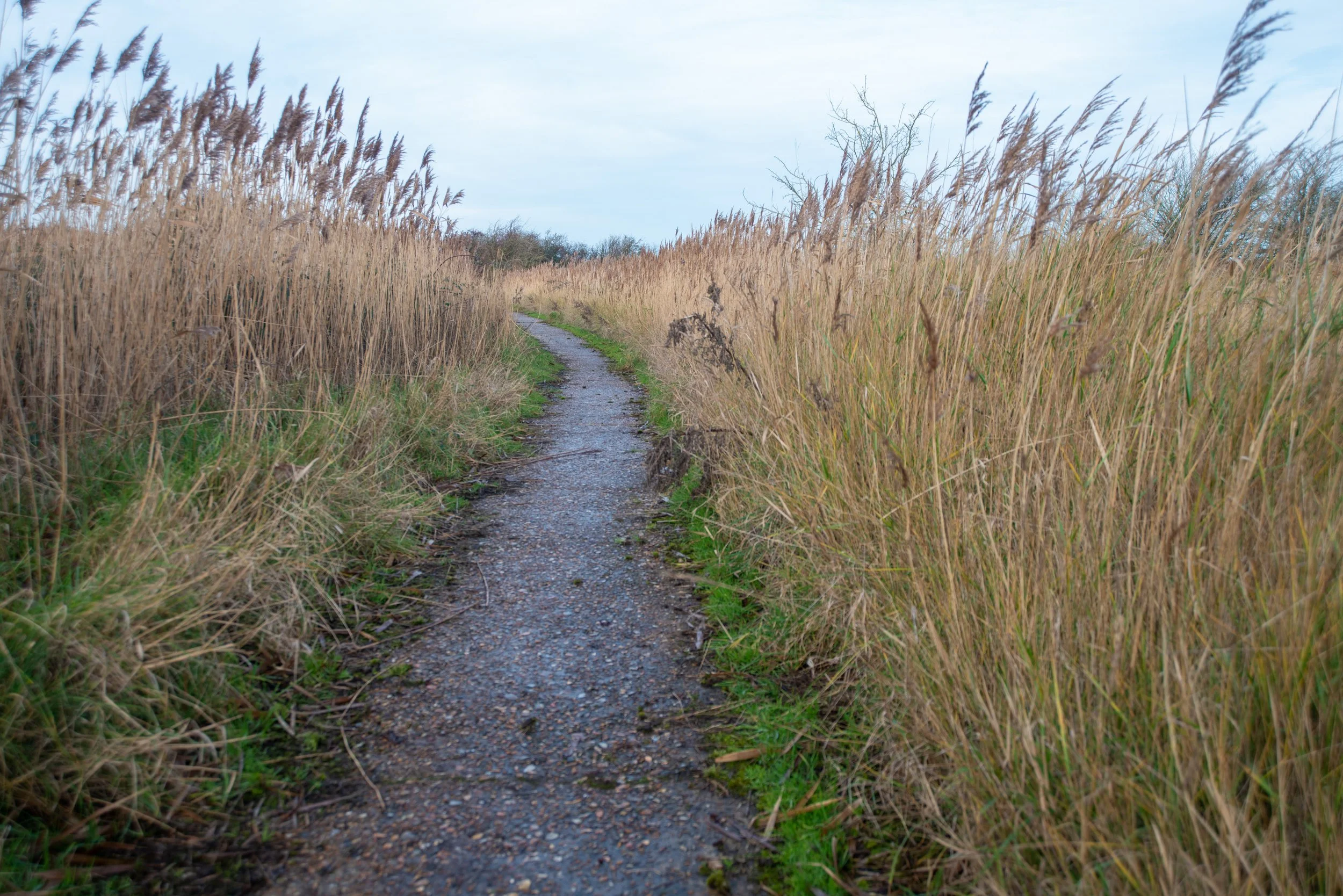
There is very little historical information about the narrow-gauge railway that once operated at Snettisham Beach. Historic maps do not indicate its presence as such; however, some show a track, but it's hard to determine if it's a railway or a concrete track.
However, I have discovered what appear to be possible remnants of an old railway on the jetty; these may also have been part of the jetty's reinforcement, and I also found traces of track near the Snettisham Beach Caravan Park.
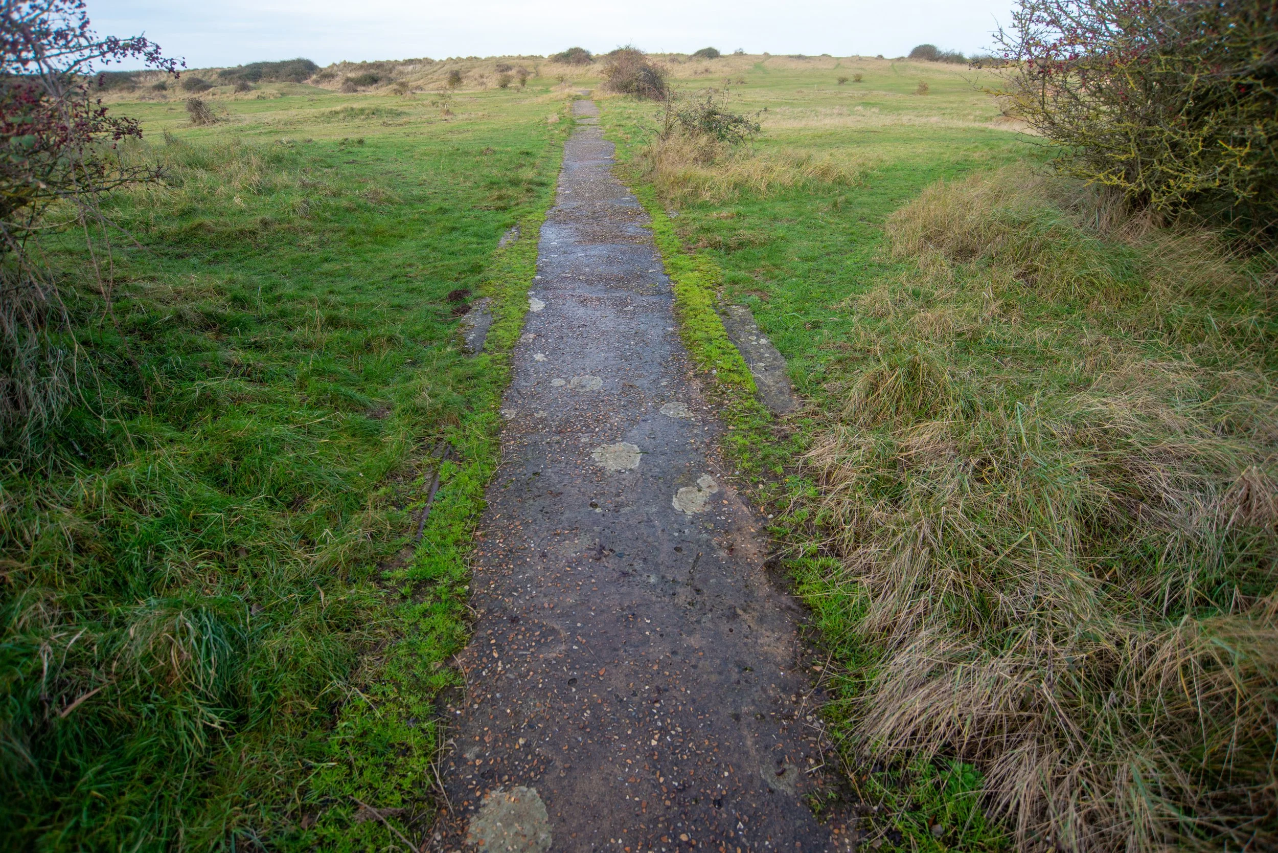
Additionally, there may be parts of the track and a disused concrete path on the opposite side of the road from the caravan parks that once possibly supported a narrow-gauge railway line.
These old possible tracks also could be part of the military gunnery school, given that dragon's teeth reinforcements were found in that area.
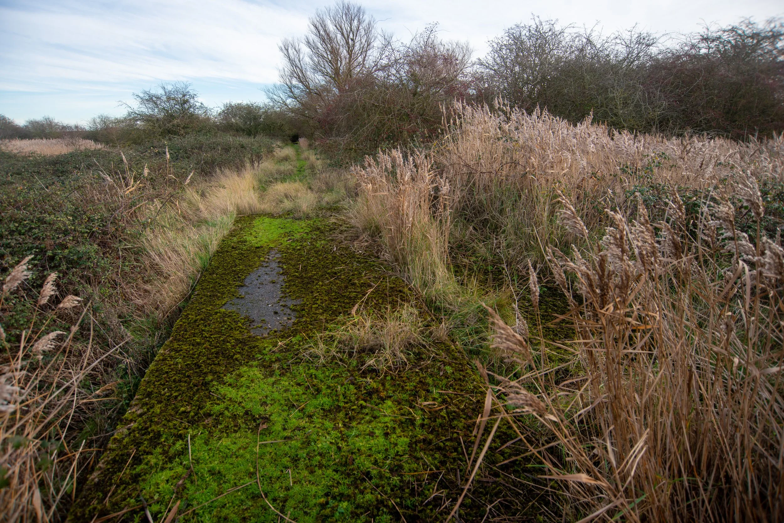
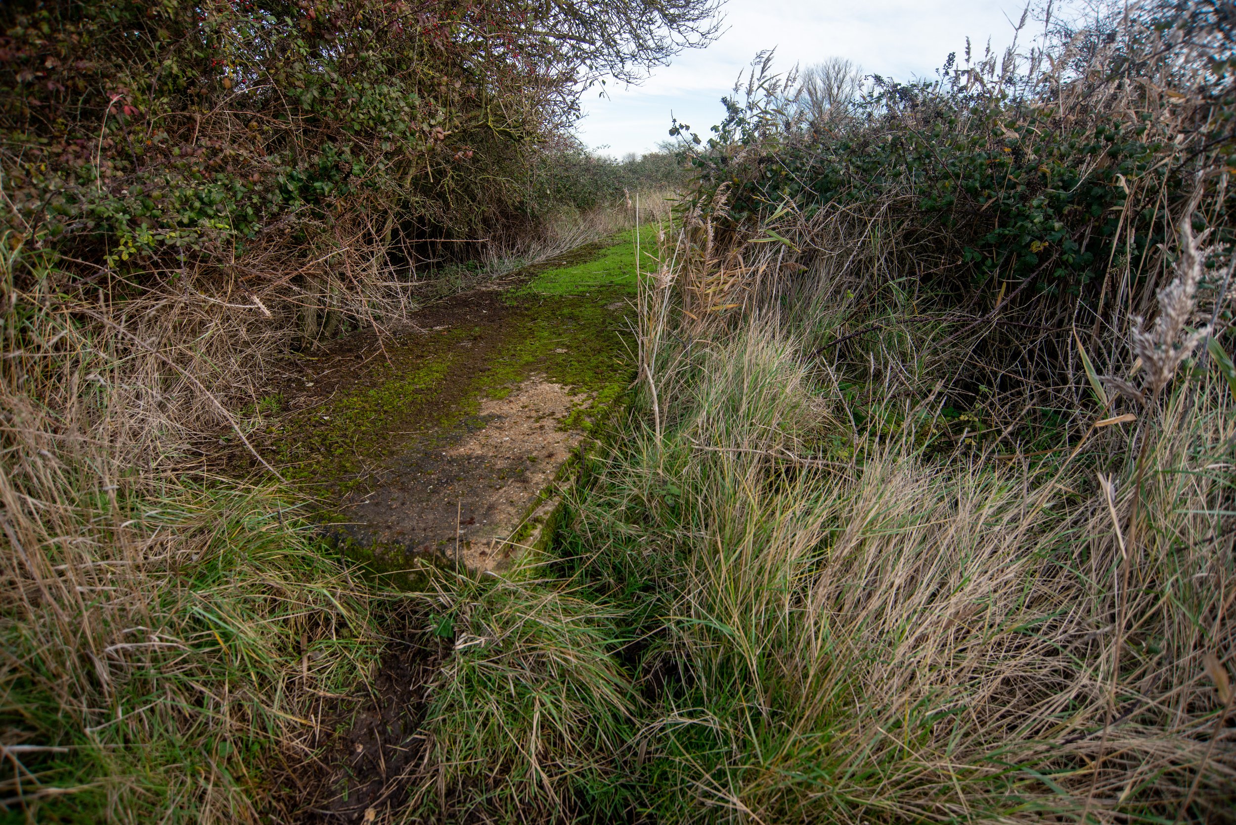
Furthermore, there is a concrete path from the shingle pits to Dersingham Railway Station. This path shows no signs of a railway and was constructed in 1941-42 by the War Agriculture Executive Committee, reportedly with the help of the prisoners of war.
When I photographed the area in 2025, I found remnants of an old track near the Snettisham Beach Caravan Park, along with a hut that might have been part of the shingle works. The old jetty still remains, with what appear to be parts of the track or reinforcements on top. The former shingle pits were flooded during the 1953 floods and were subsequently sold to the RSPB, which now manages the area as a habitat for various wild birds. Meanwhile, the concrete paths left behind sustained significant damage during the 1953 floods.
Many caravans and beach huts now also reside in the beach area.
All information on this website is sourced from many sites across the web and may or may not be correct, as very limited information is available on this subject.
All photographs were taken by me, and any information given with the photographs may also not be correct.
If anyone can help, please feel free to contact me via Facebook or email using the links below.
Full credit will be given.

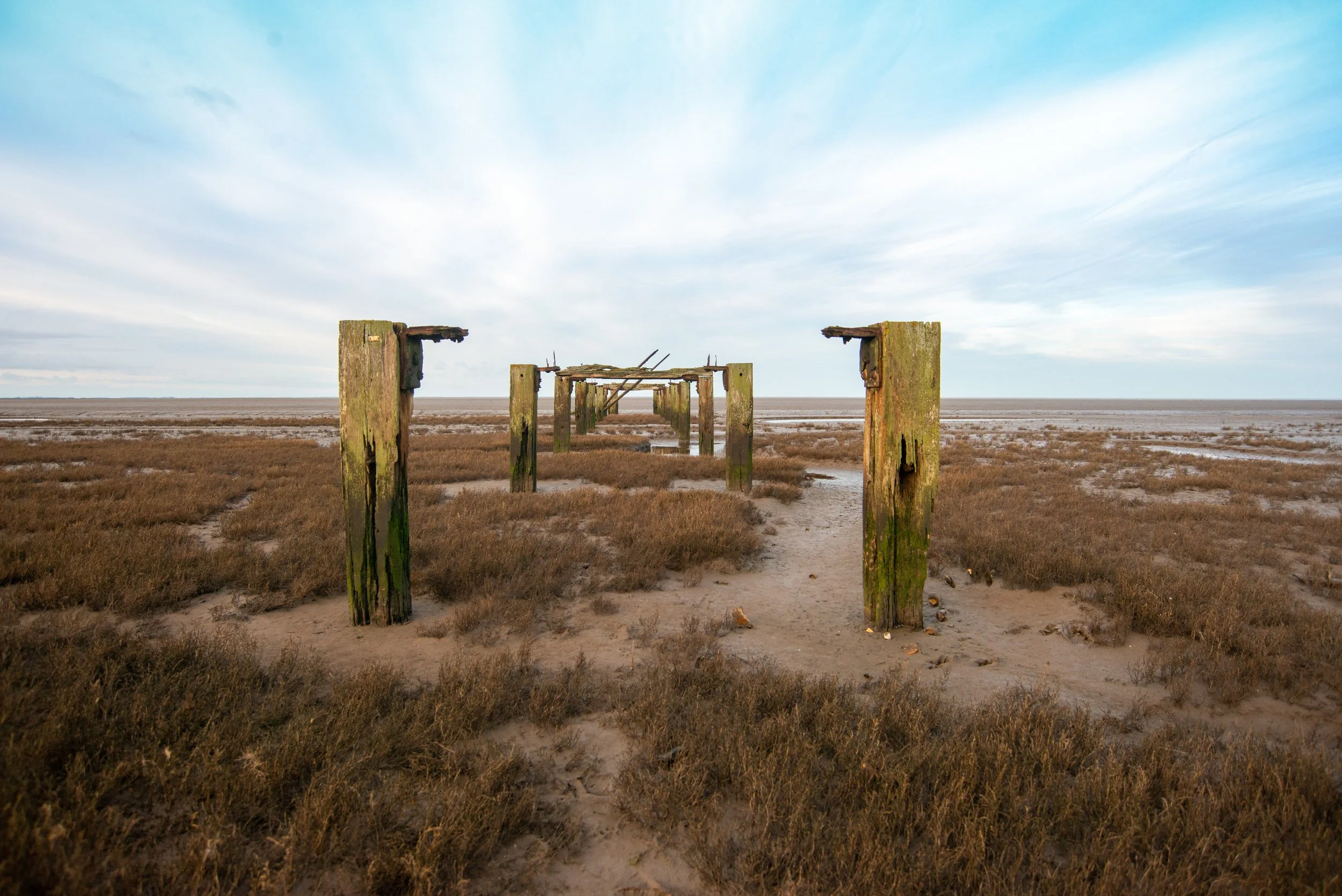
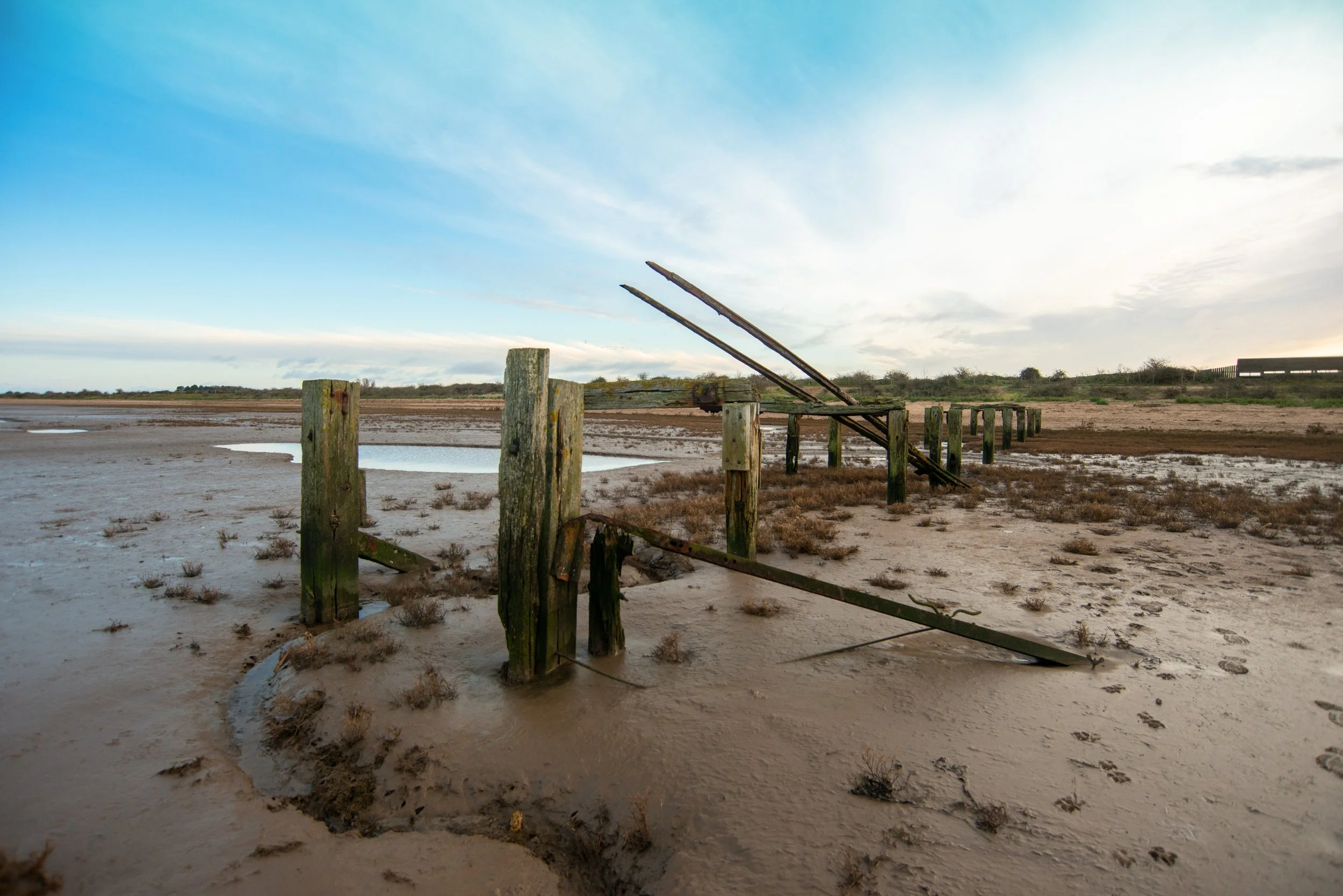
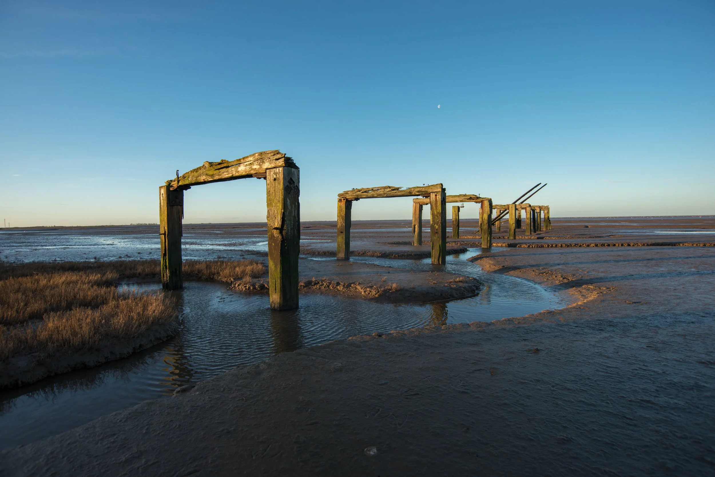
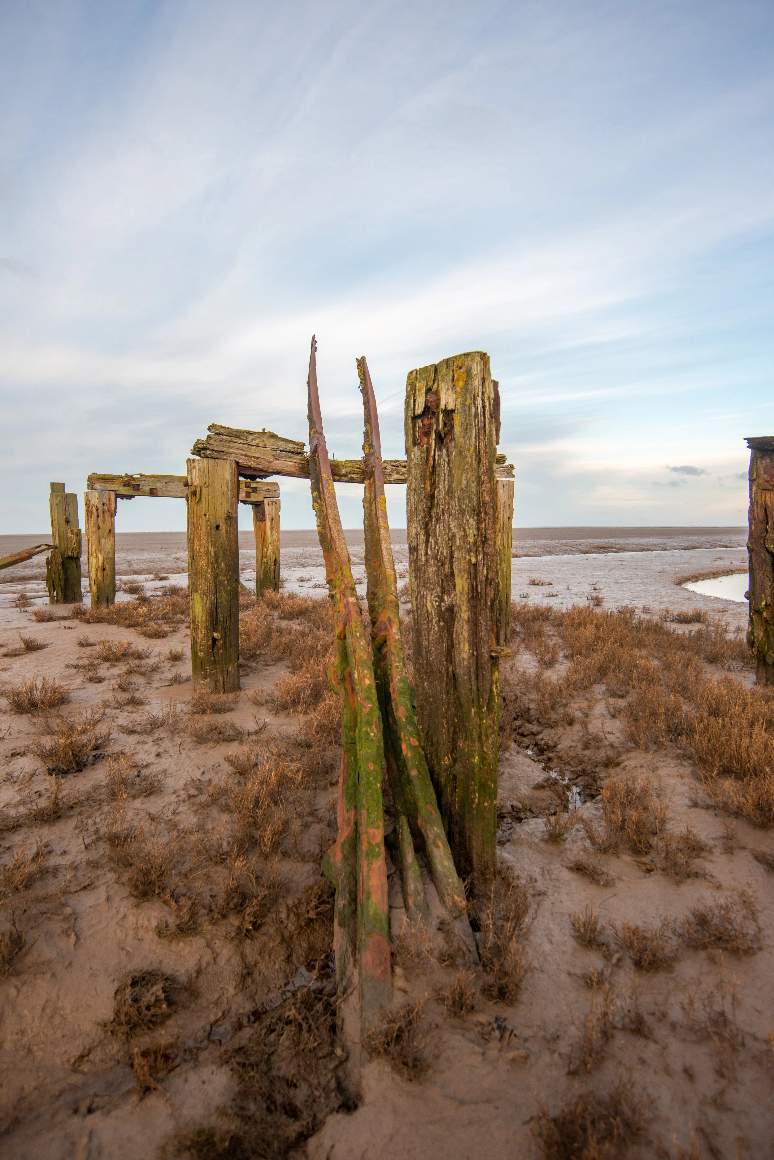
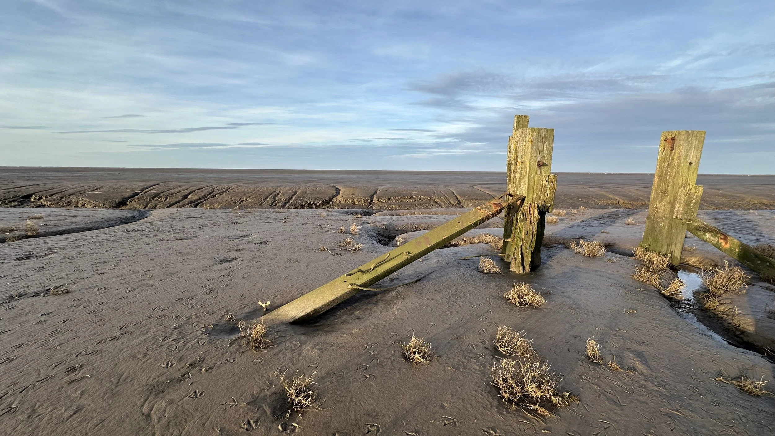
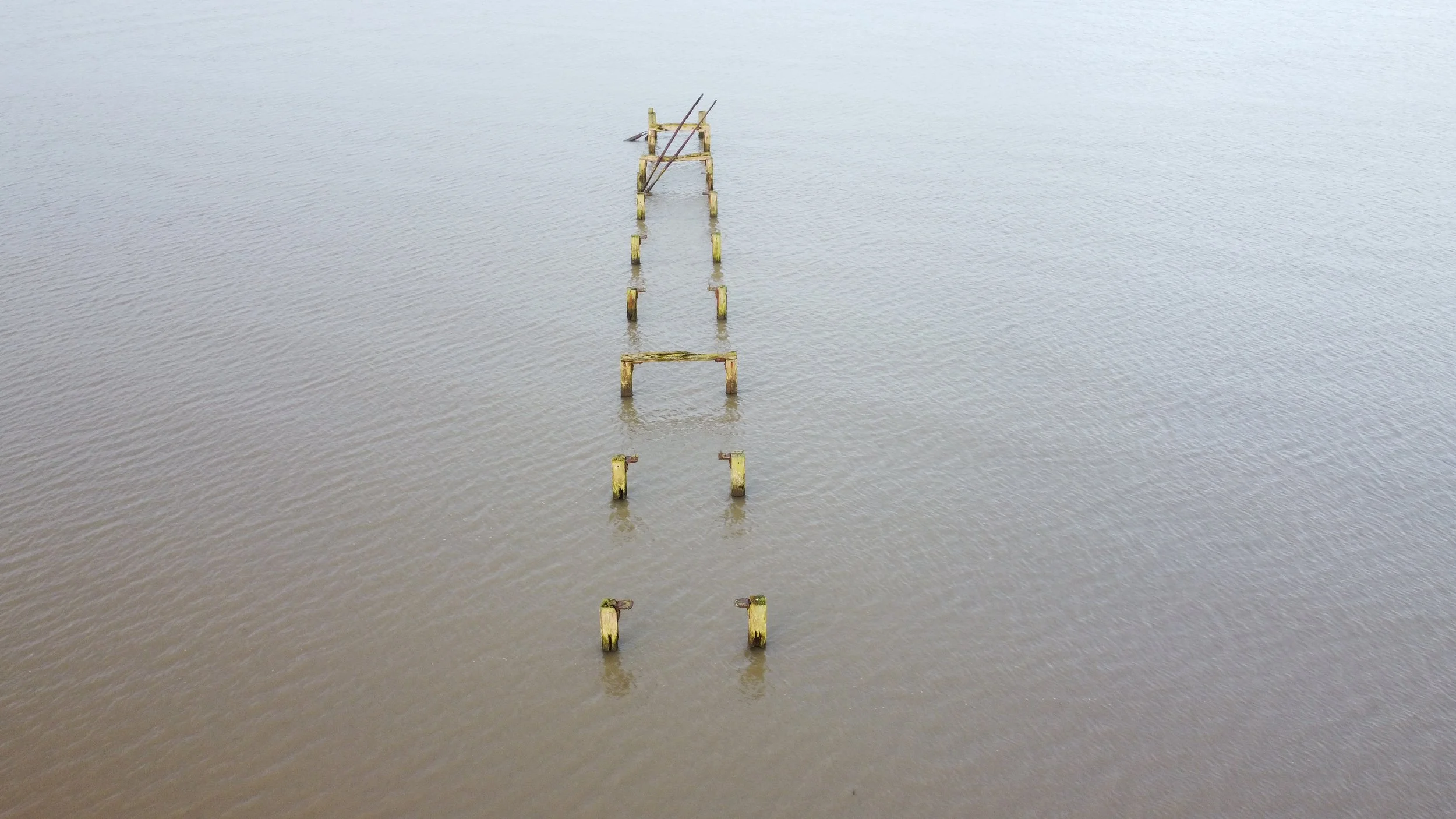
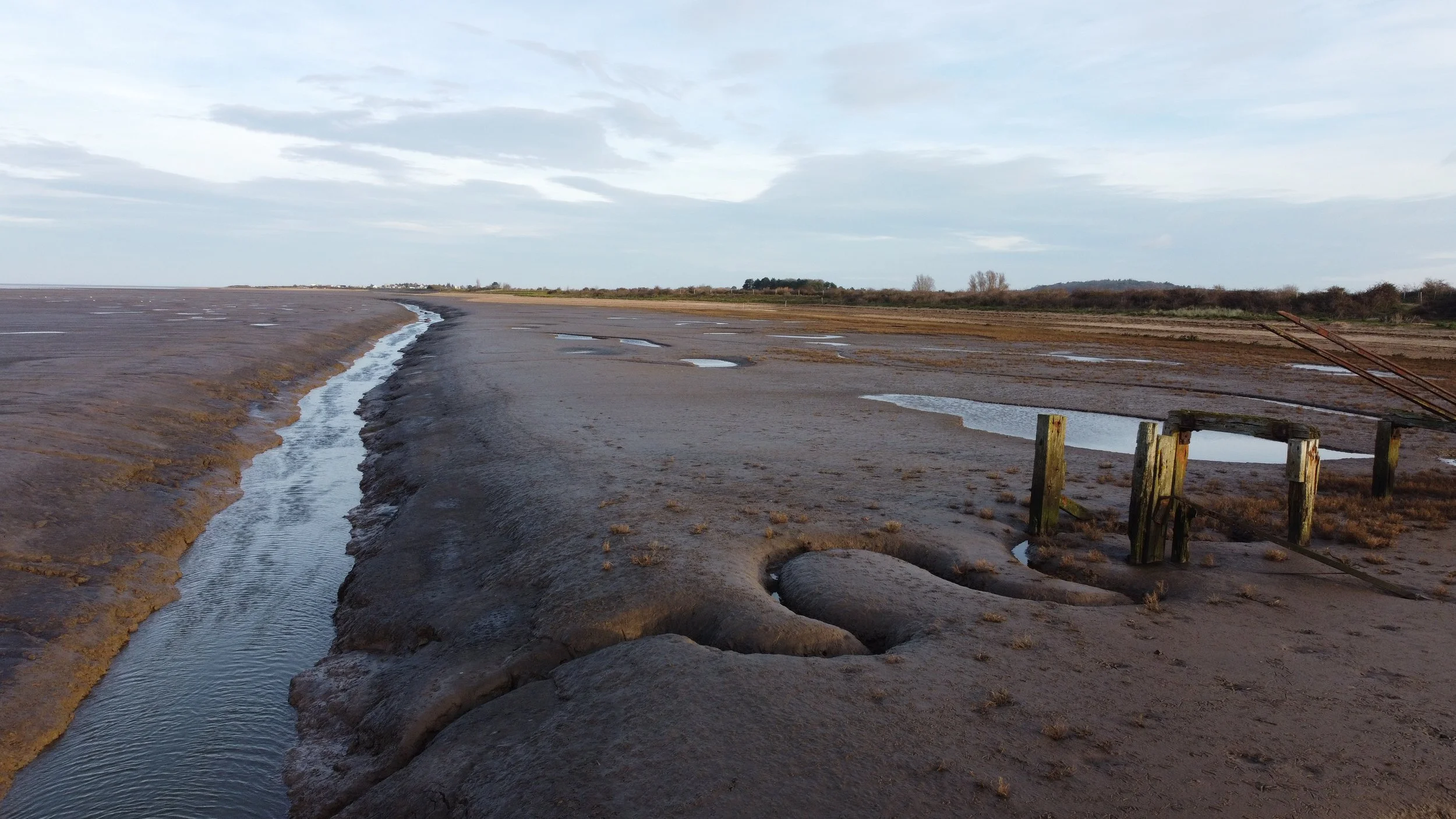
The Jetty.
The iconic jetty at Snettisham has become a popular subject for photography in recent years, appearing frequently on social media, in magazines, and in photographers' portfolios. Originally, the jetty was used to transport shingle from nearby pits, with barges ferrying them across the wash to various locations, primarily for military construction purposes.
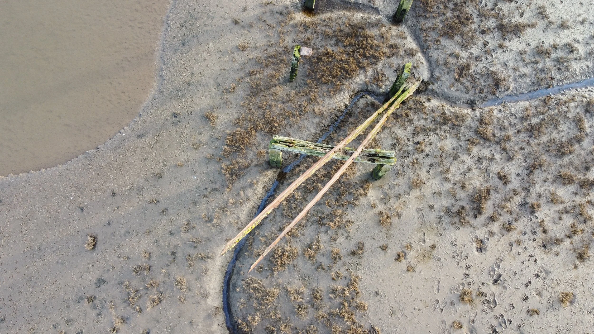
When visiting this landmark, I found what looked like railway tracks by the old jetty.
This old jetty has certainly stood the test of time, having survived both the 1953 floods and the more recent 2013 tidal surge.
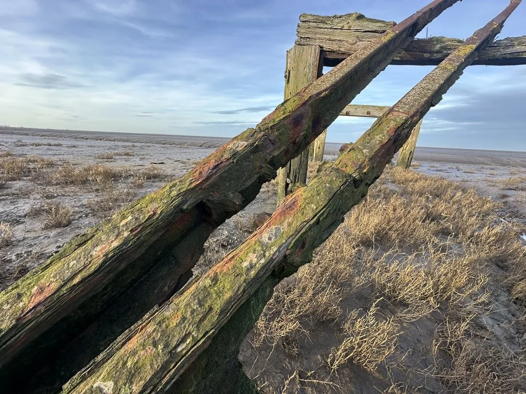
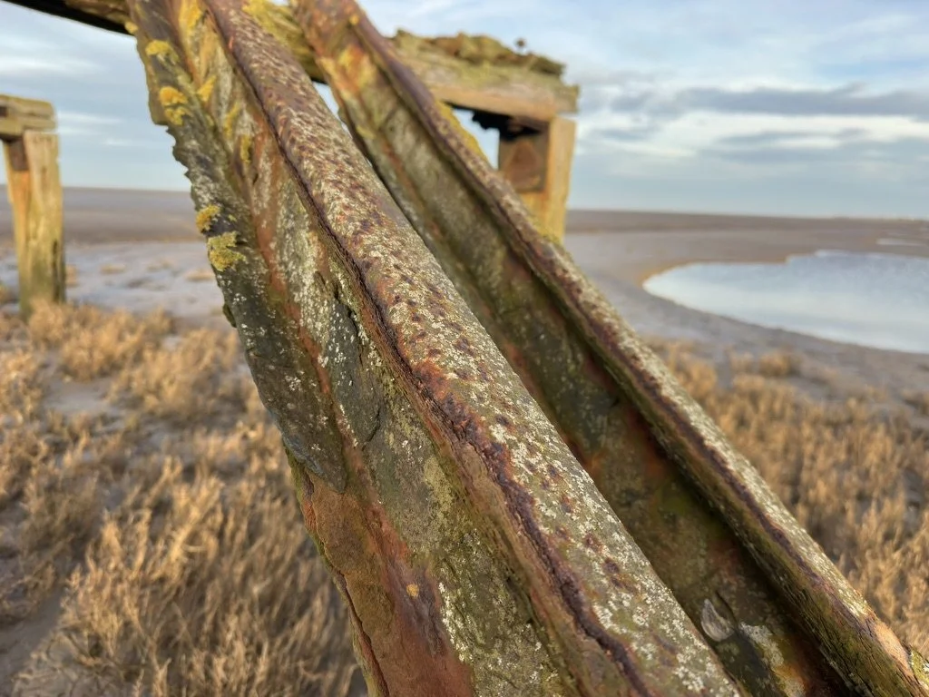
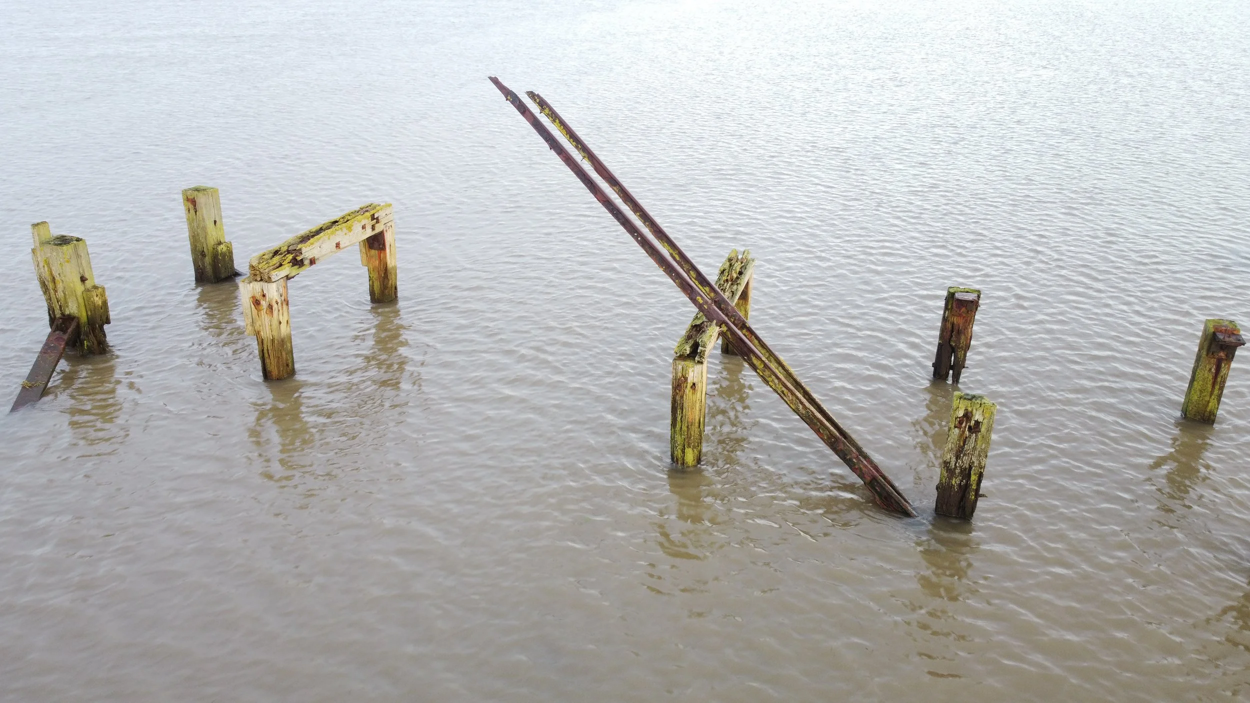
Track sections.
I have visited this site many times for photo shoots and dog walks, and, to be honest, before I became interested in disused railways, I never took any notice of possible railway remains on the old jetty.
Again, given the very limited history, these tracks could have been part of the jetty or part of a reinforcement of its structure.
It's highly likely that they would have been part of the jetty's supports.
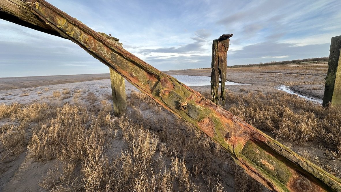
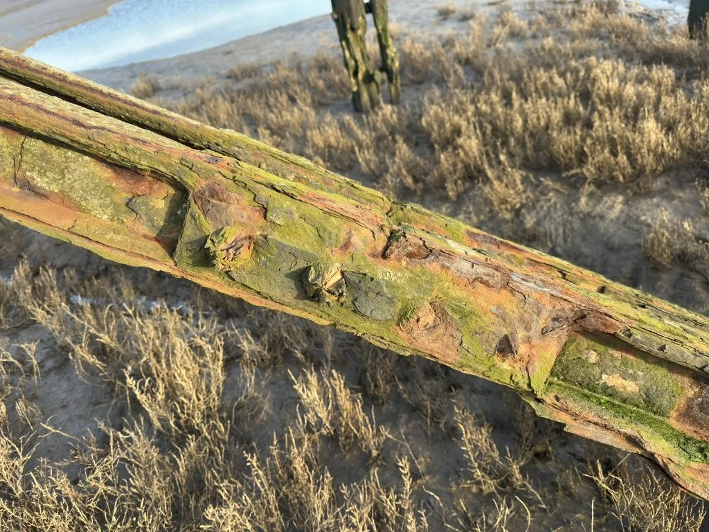
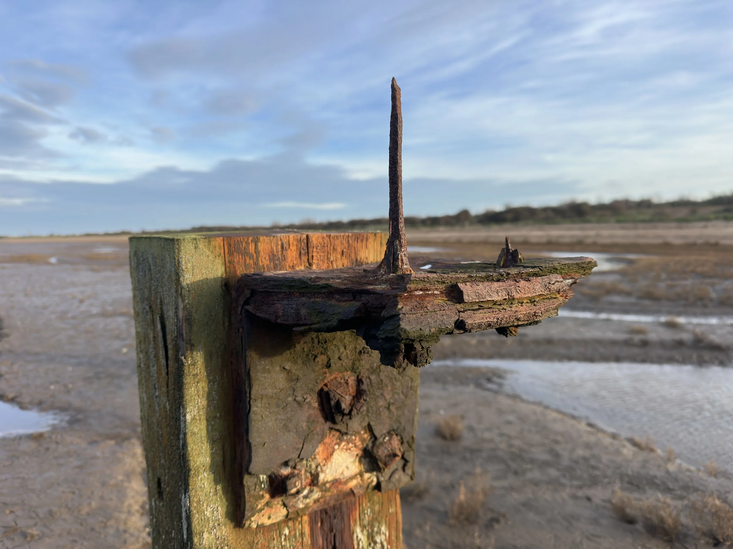
Random parts.
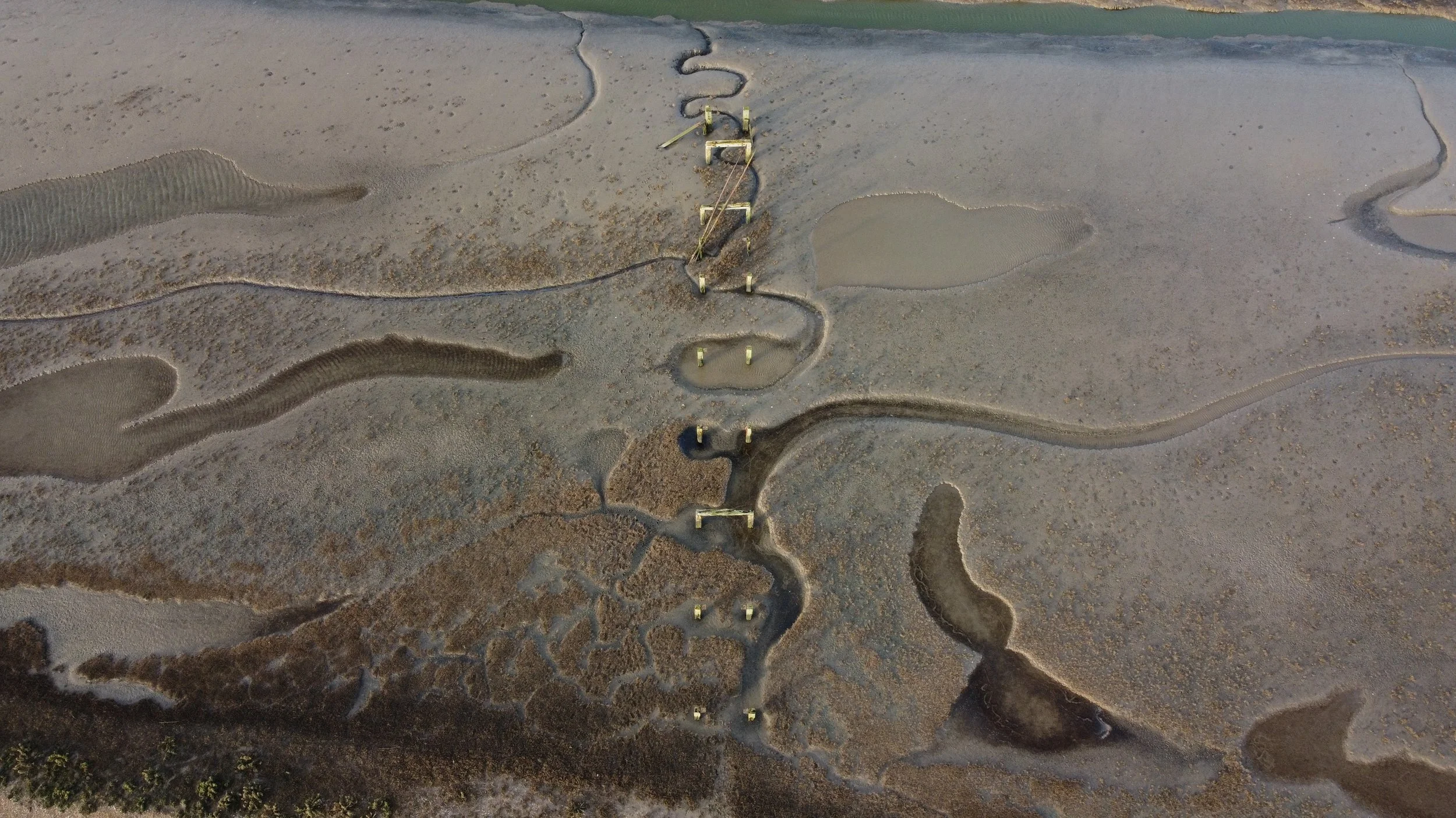
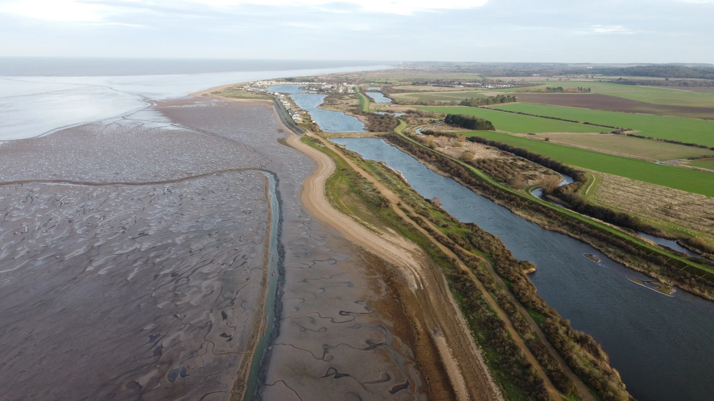
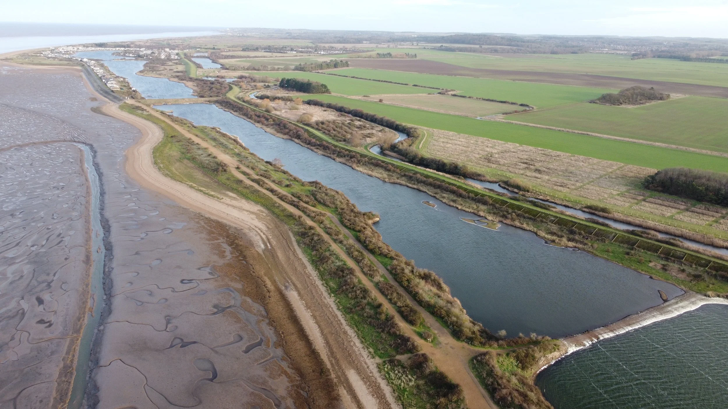
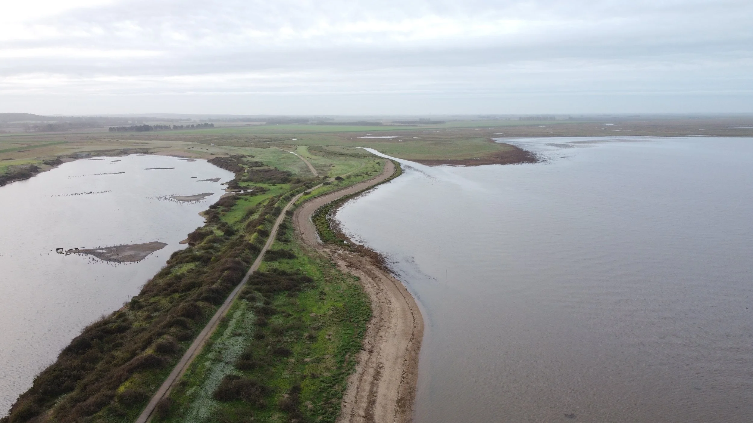
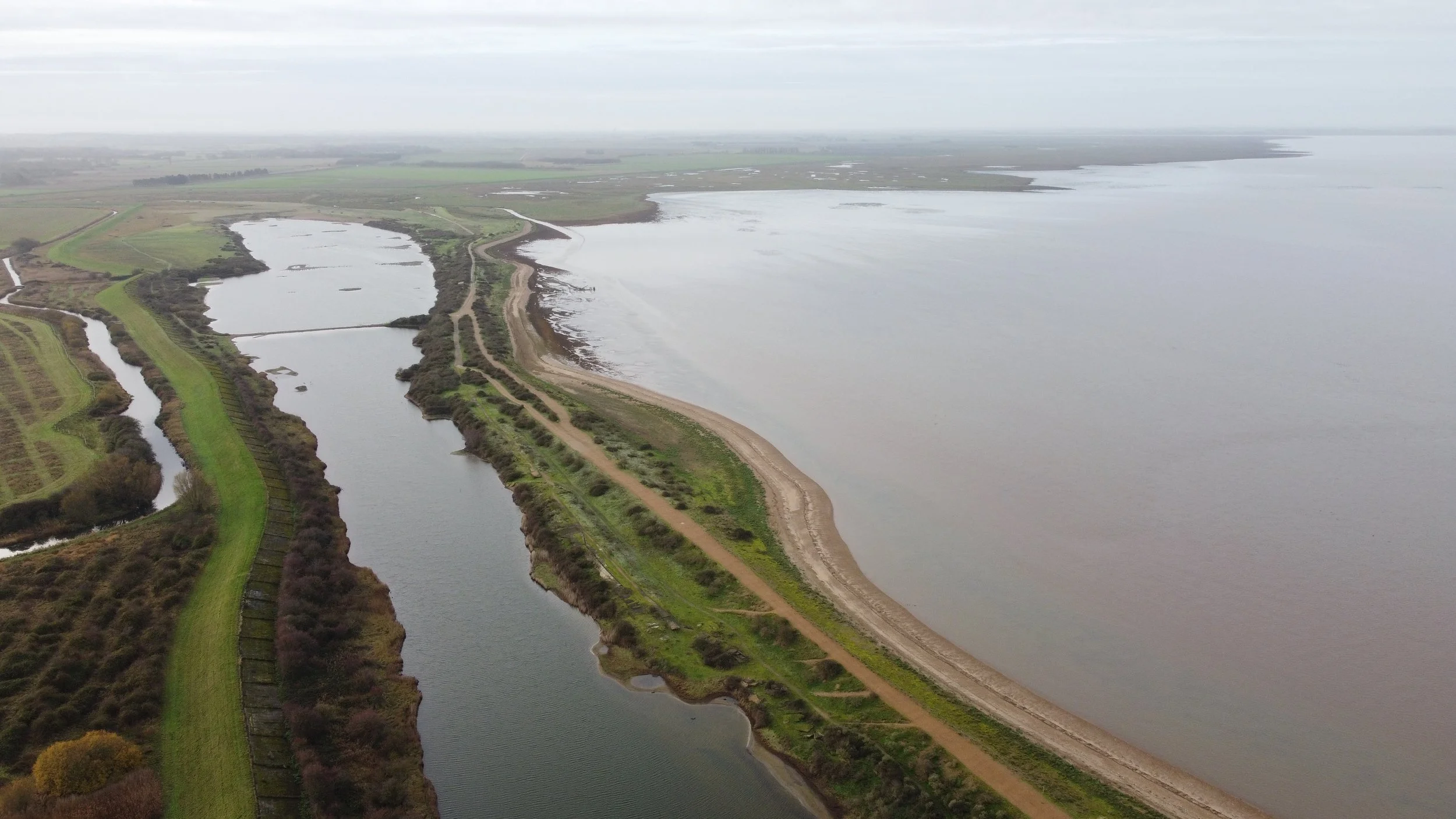
Aerial Shots.

As shown on the historic map (1944-1975) below, the orange pointer indicates the jetty's location.
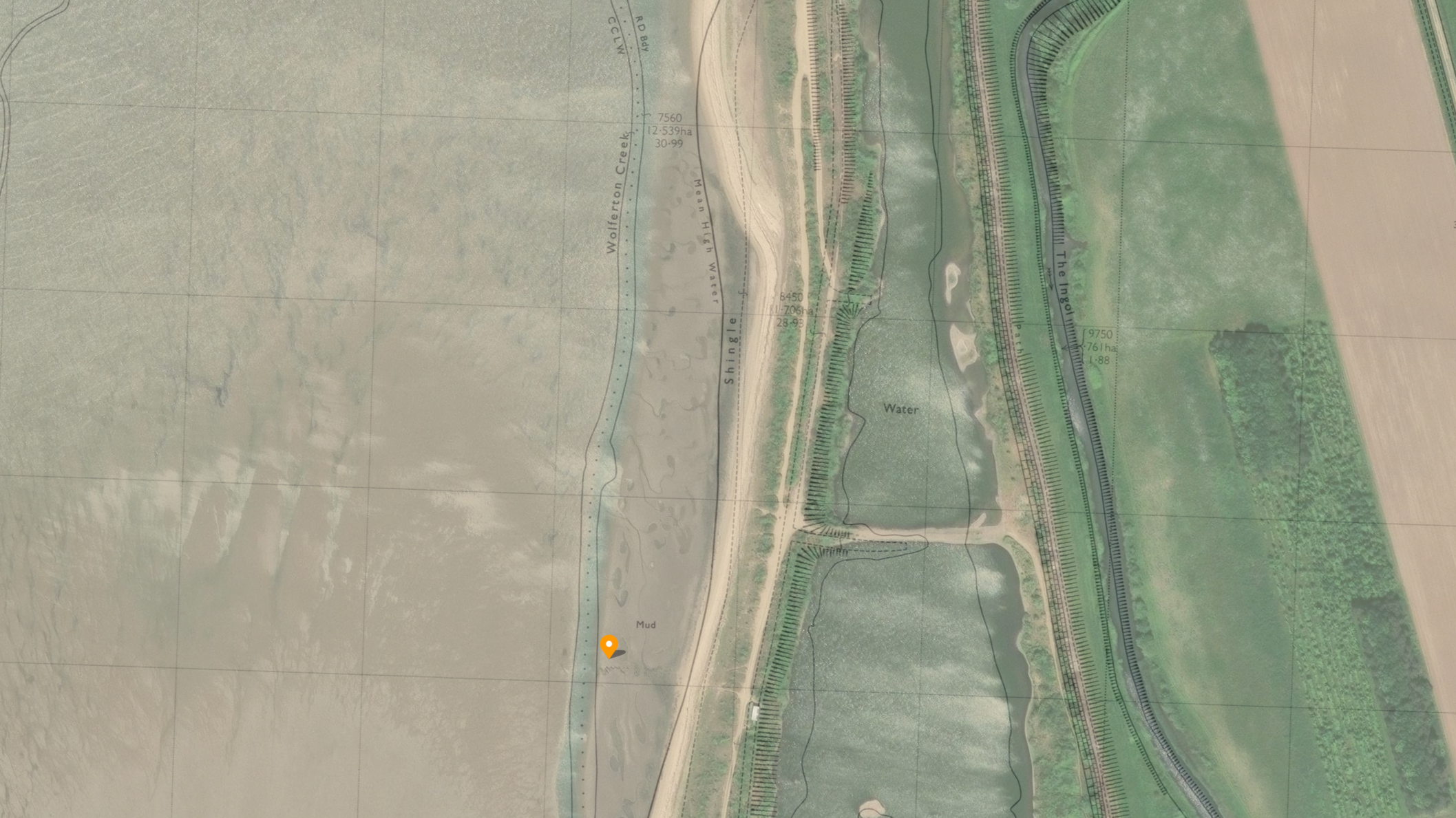
©National Library of Scotland
This old channel called Wolferton Creek would take goods from the old jetty off towards the deeper waters in the wash.
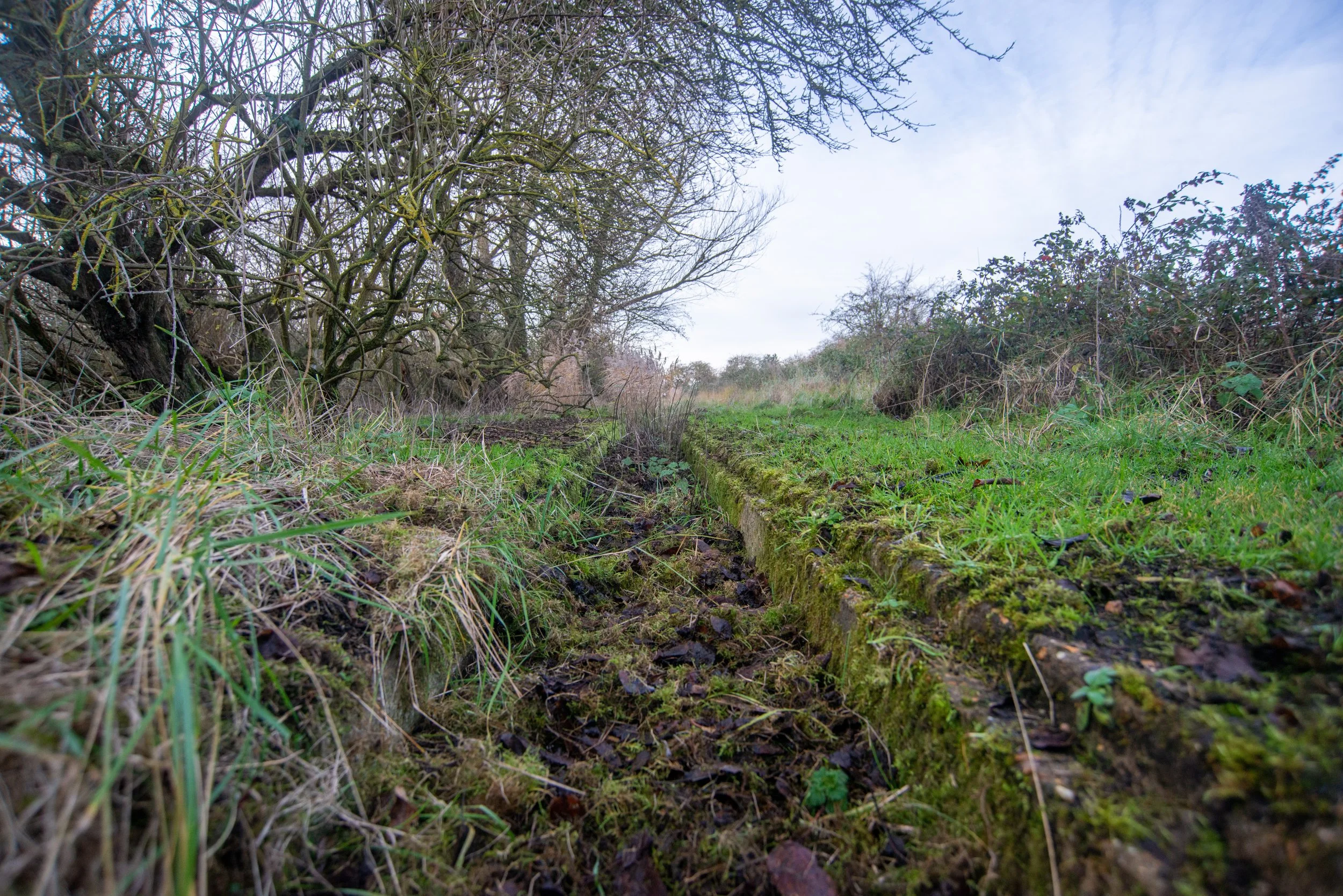
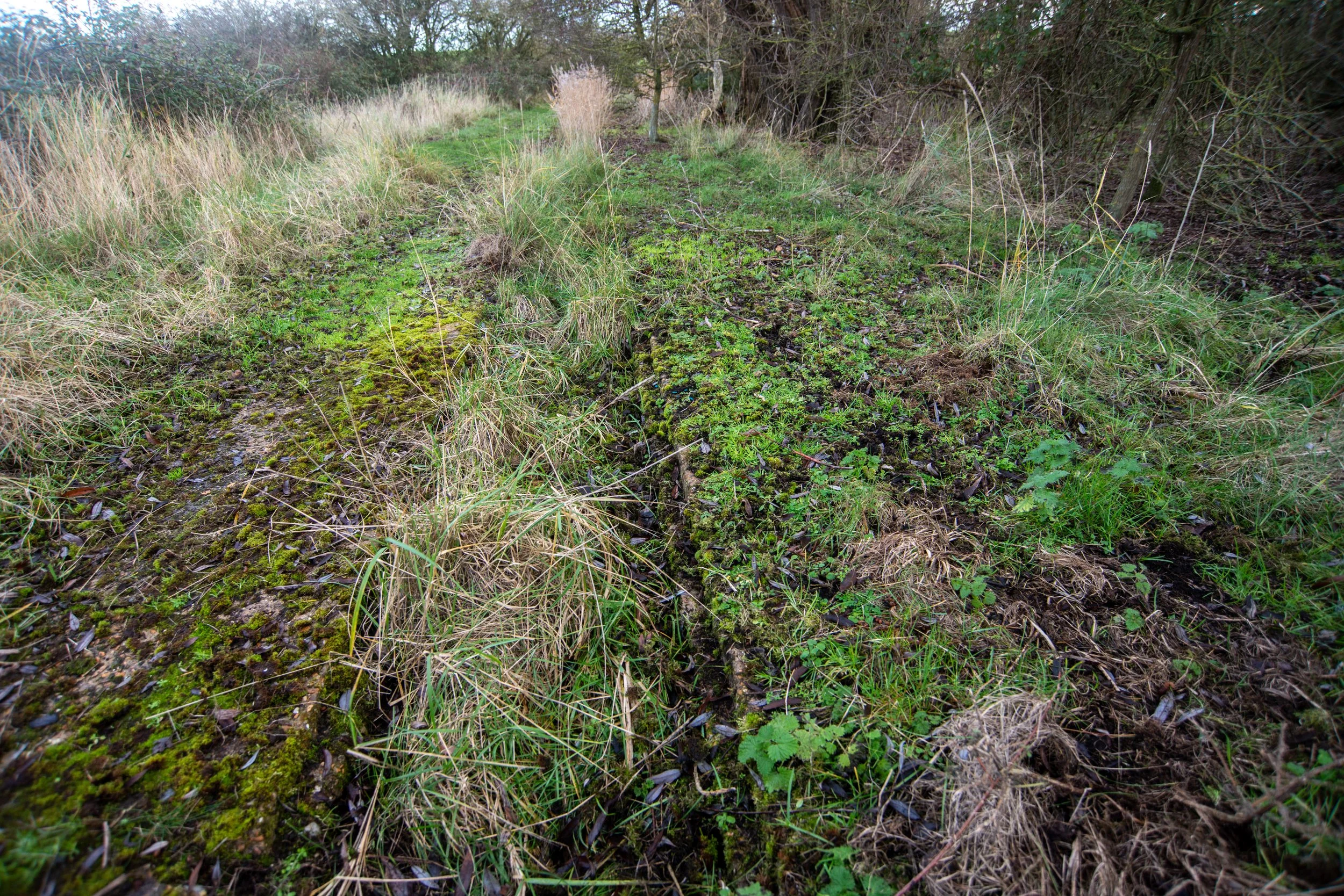
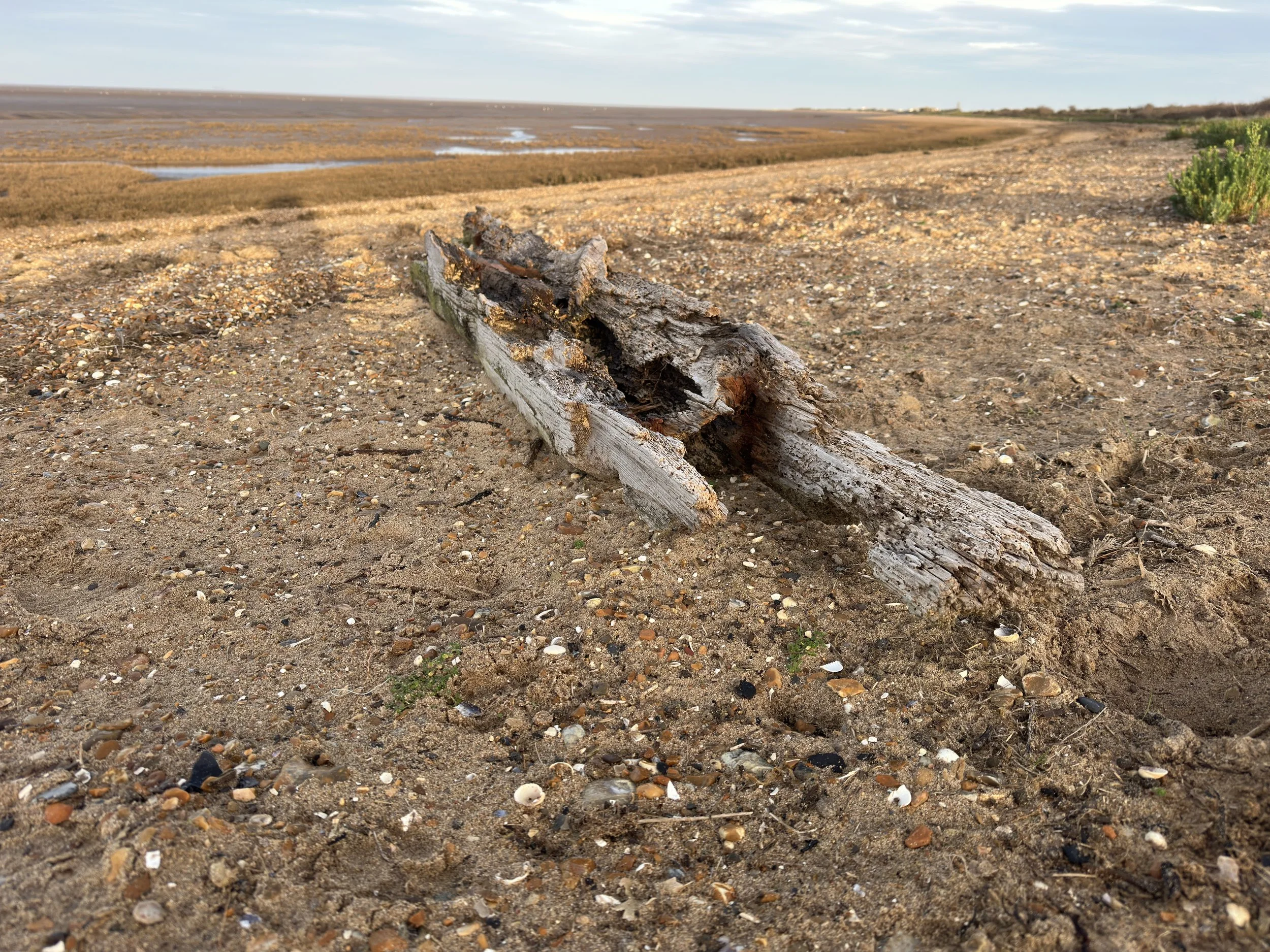
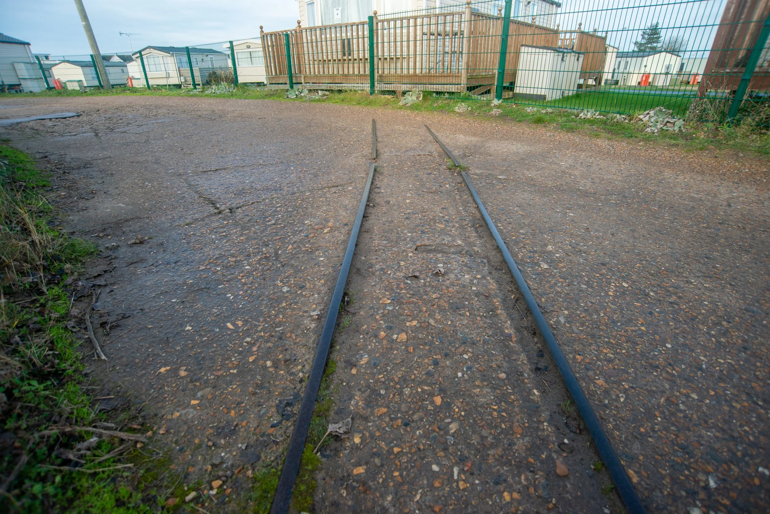
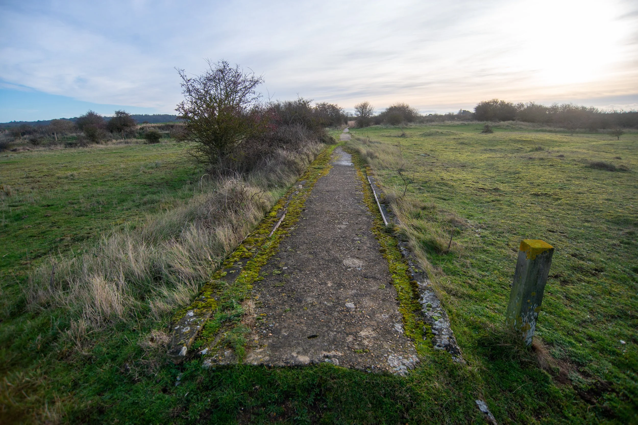
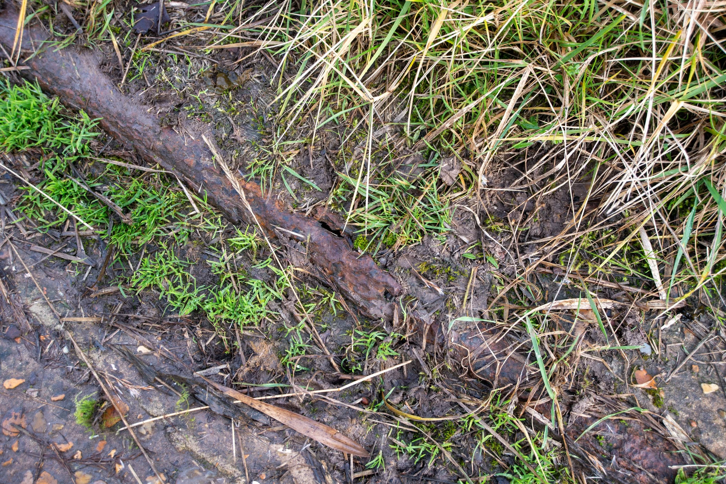
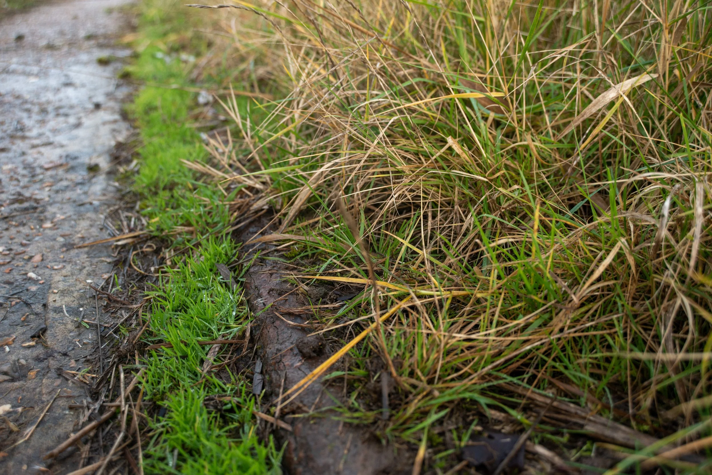
Disused track section.
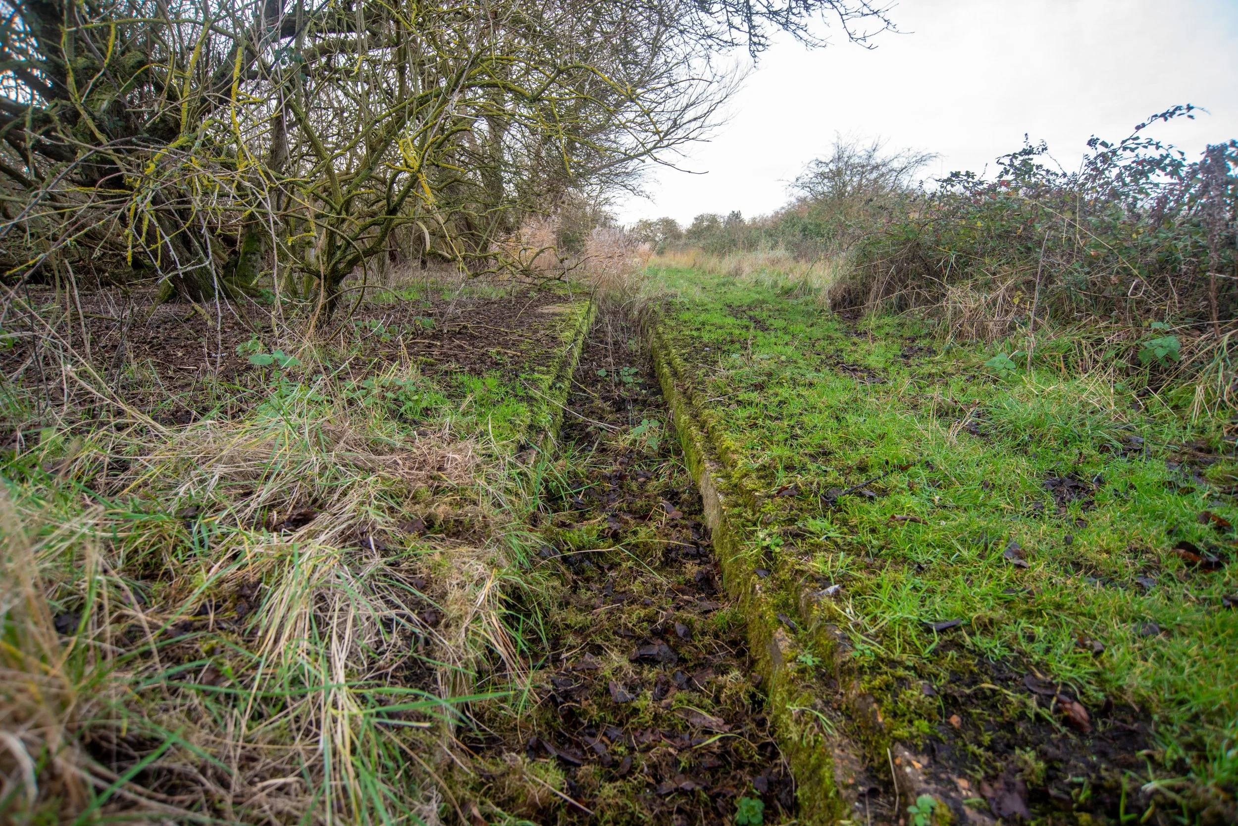
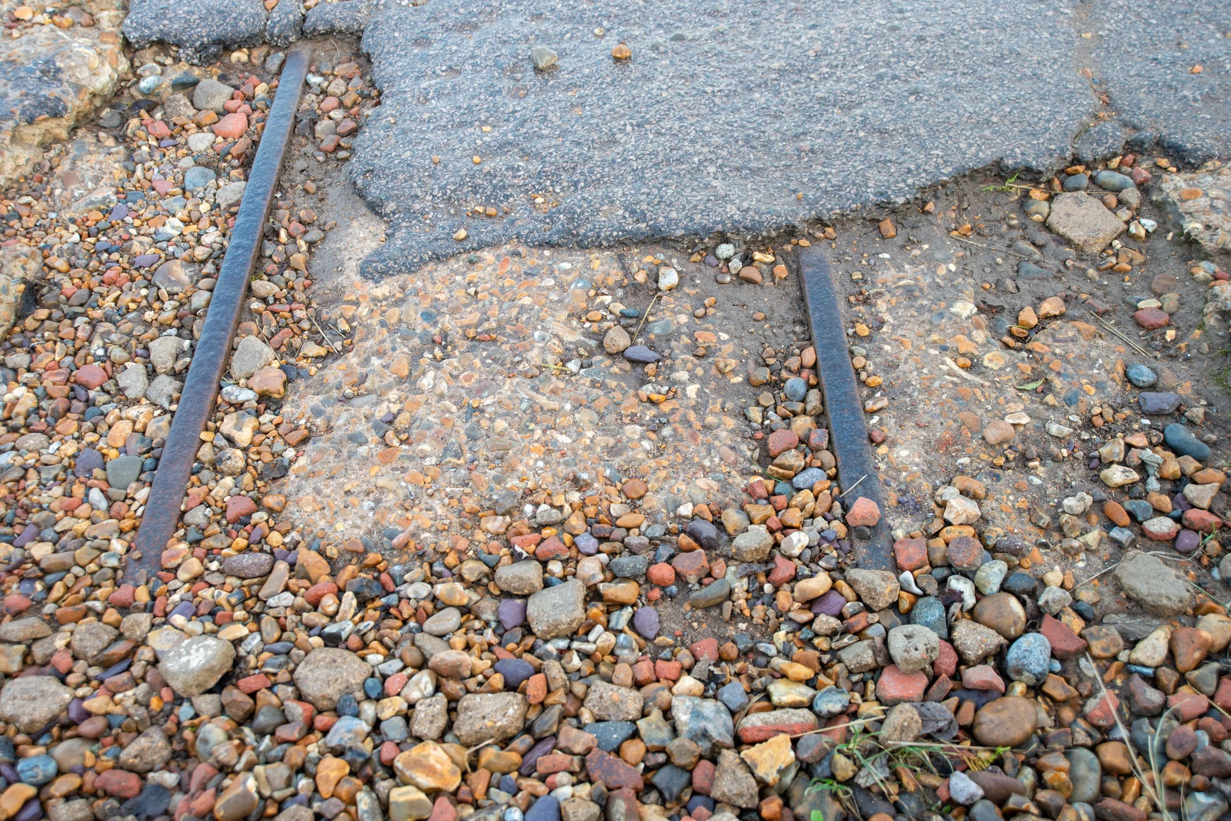
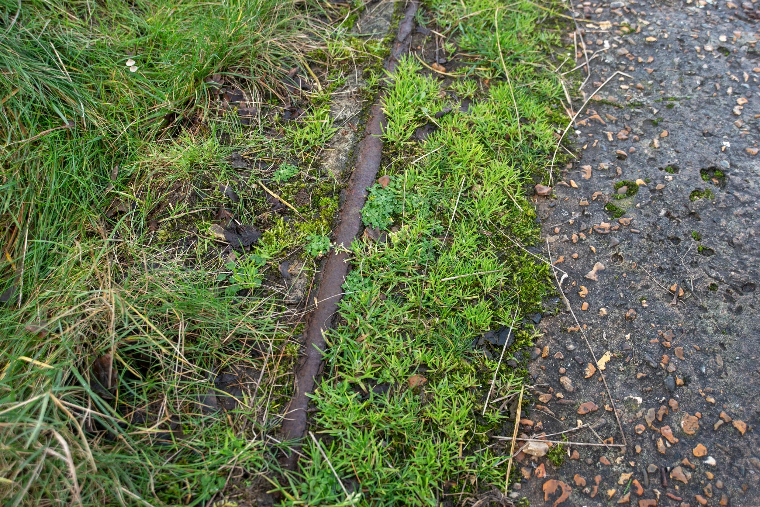
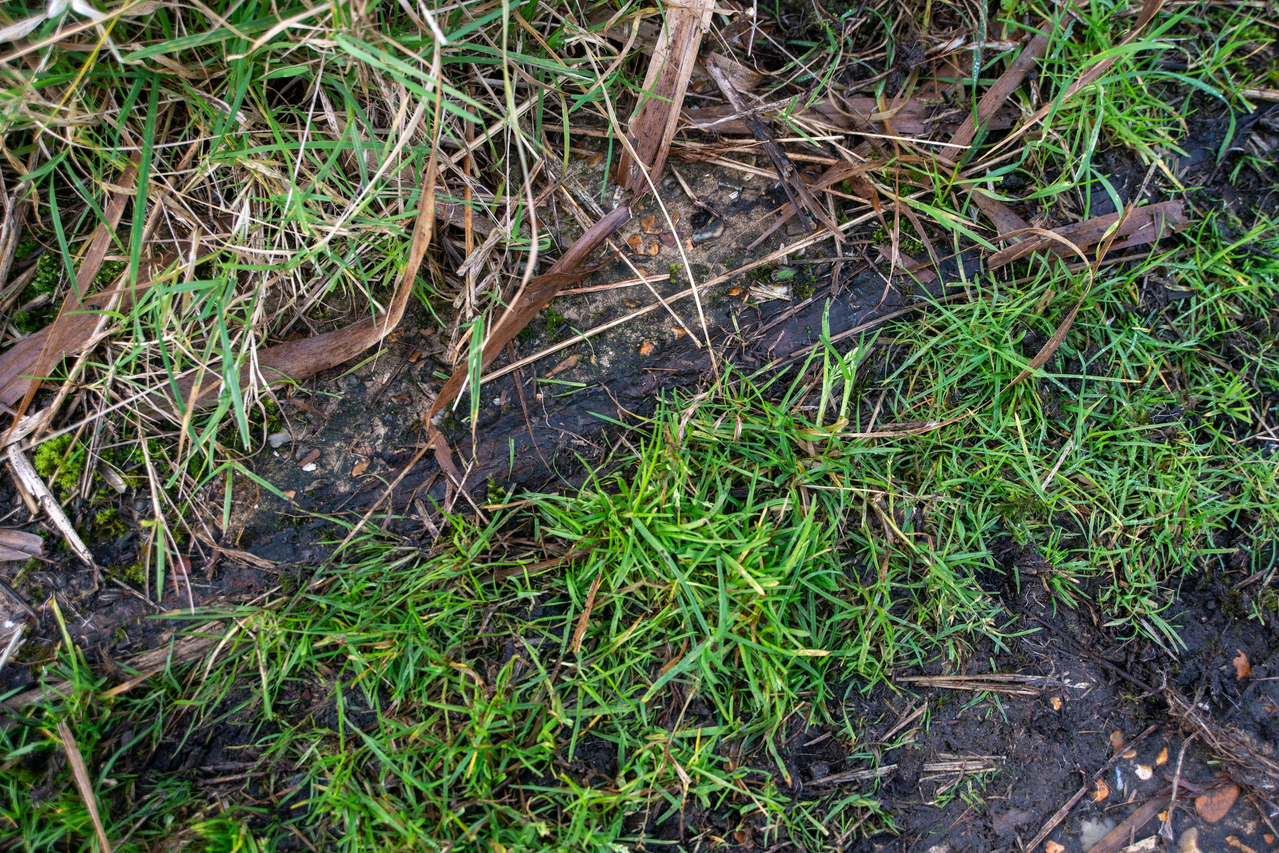
Close to the caravan parks and the first lake, I found these old railway tracks exposed by the concrete path.
These tracks would have been in use in the early days of shingle extraction. When visiting them, they now face the flooded pits.
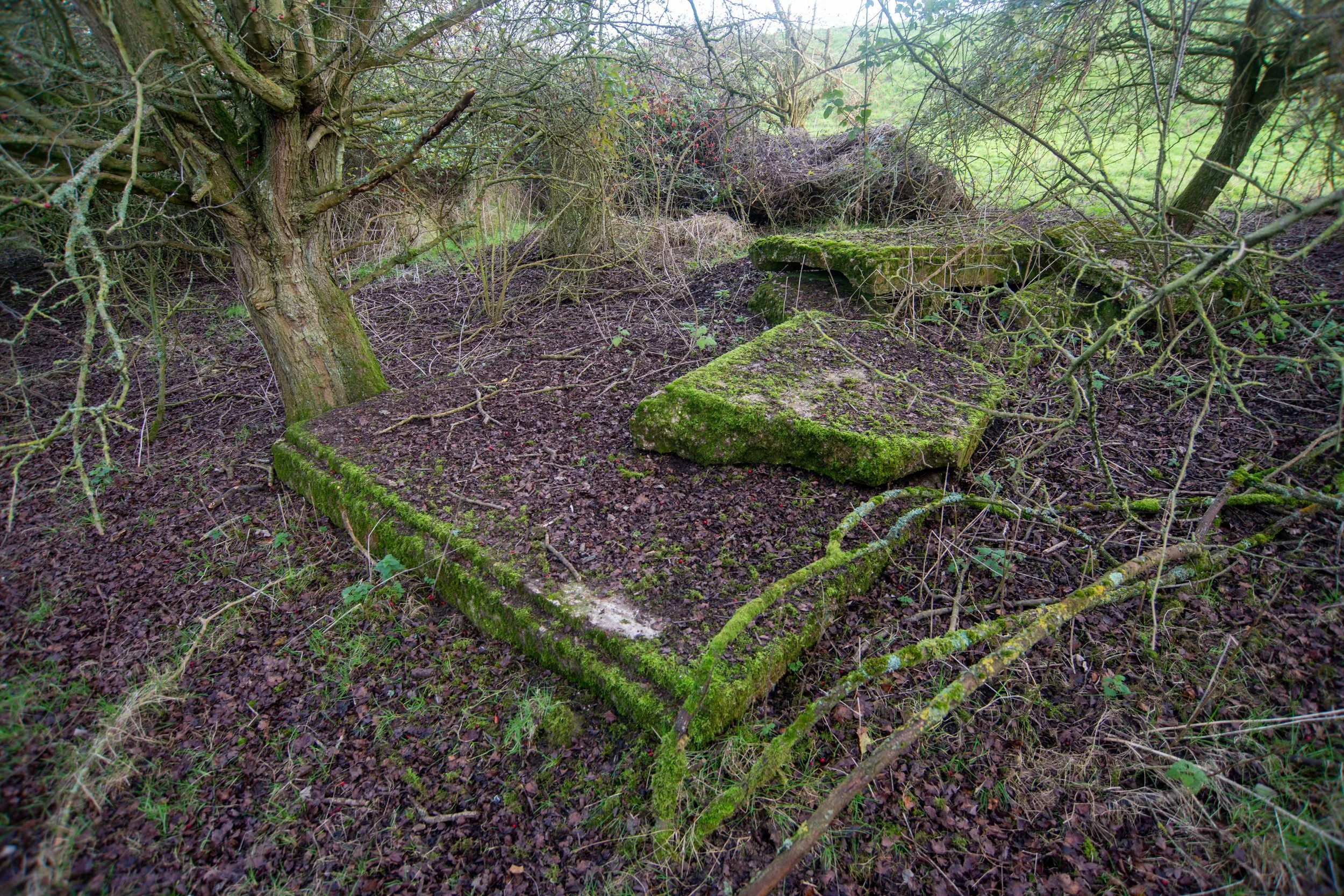
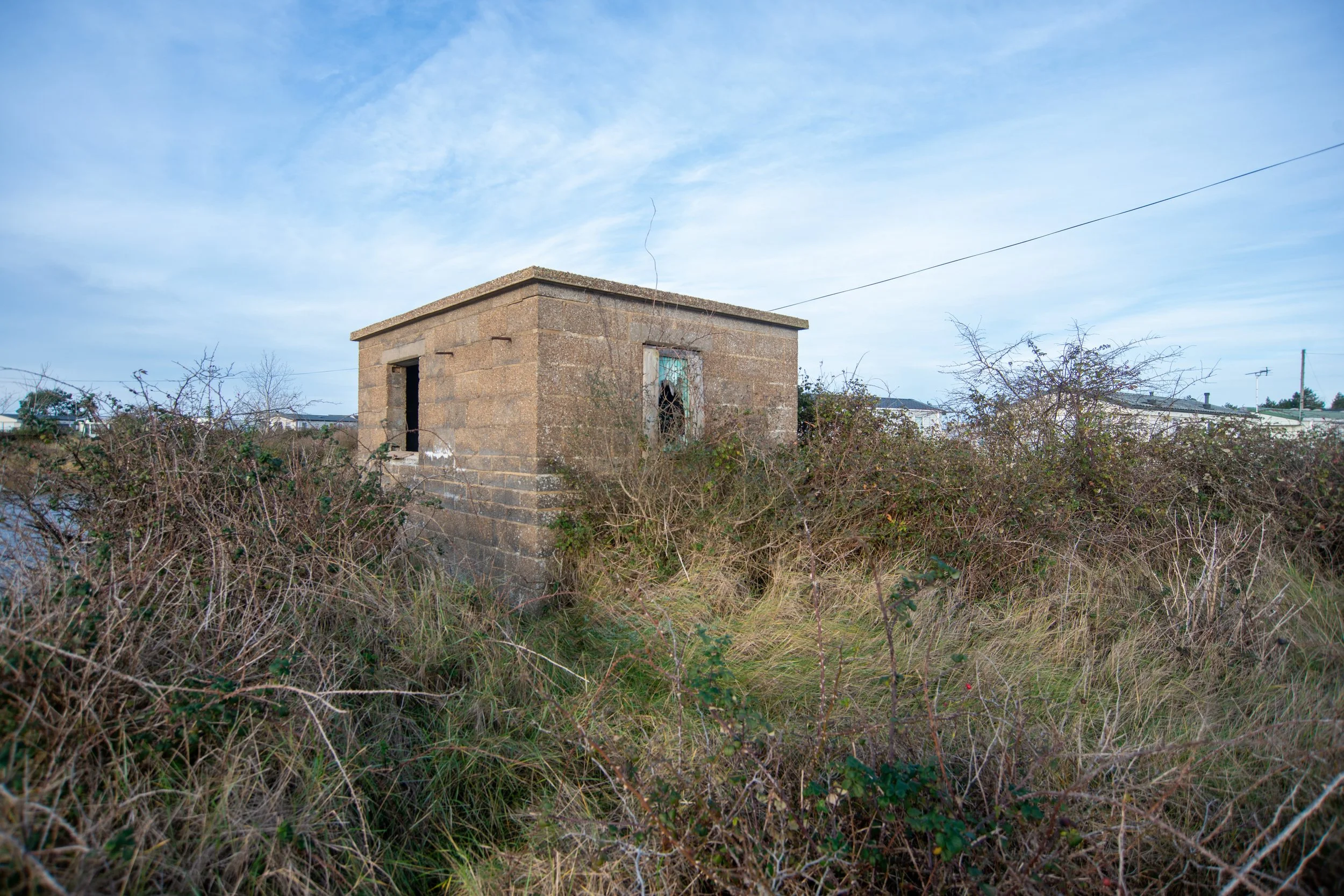
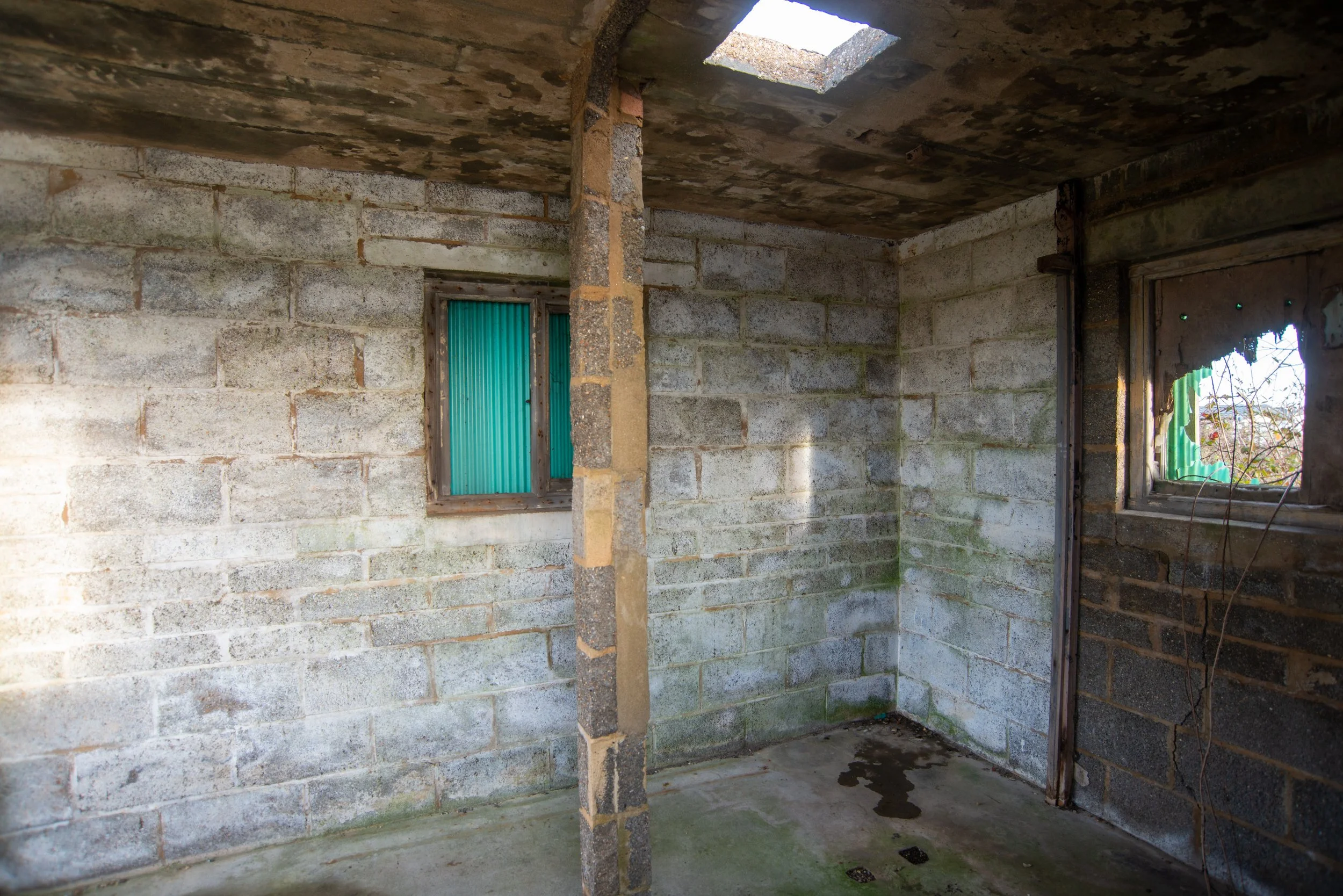
Disused hut.
This old hut was situated beside the old railway tracks near the caravan site.
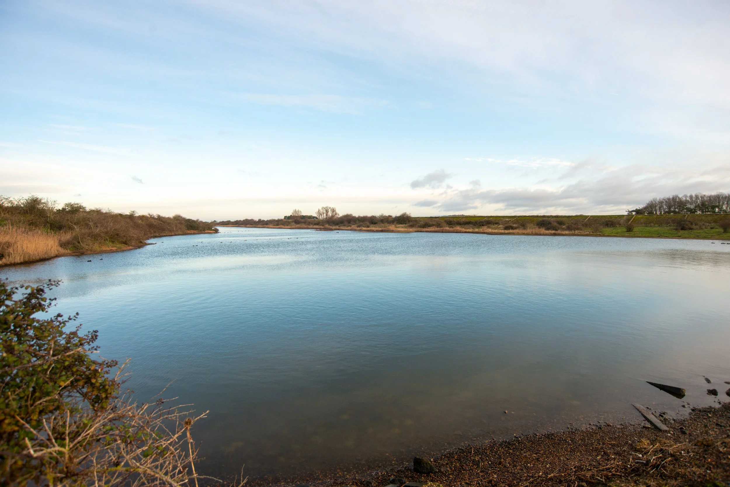
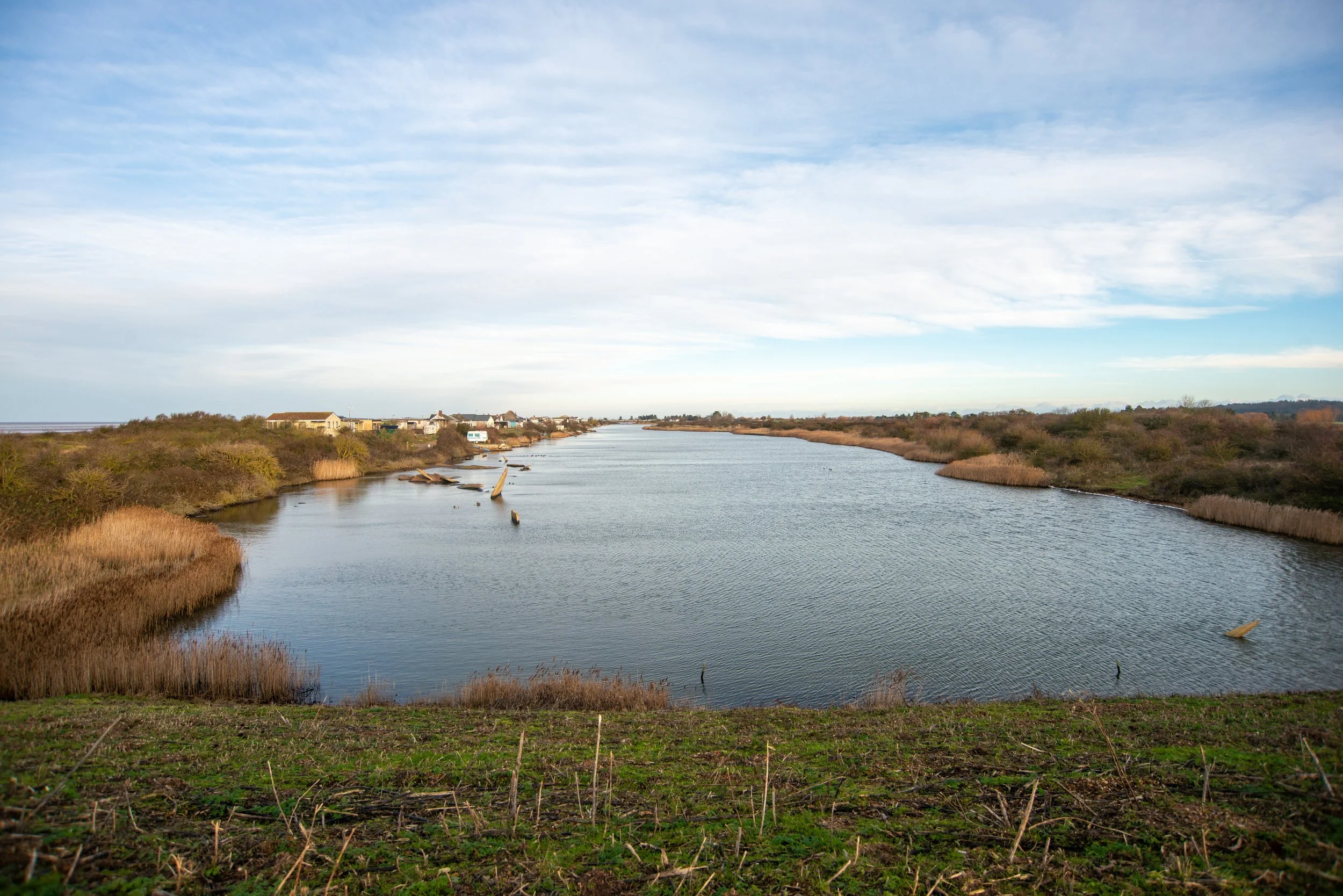
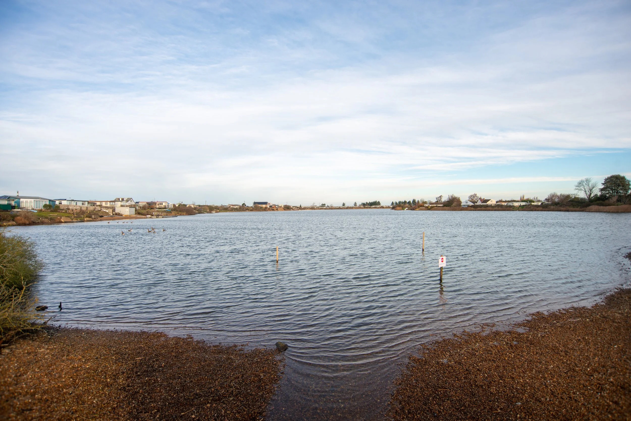
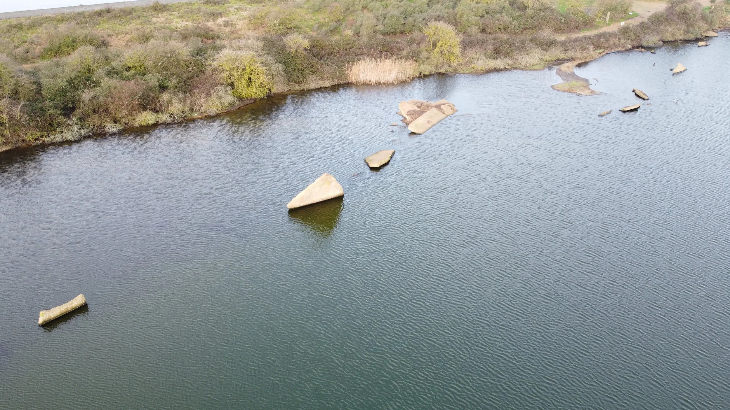
Old Shingle pits.
The old shingle pits at Snettisham are now owned by the RSPB and are now used as a nature reserve after being flooded during the 1953 floods.
Aerial views.
Parts of the concrete path stick up in the old pits, having been washed into them by the high tide in 1953
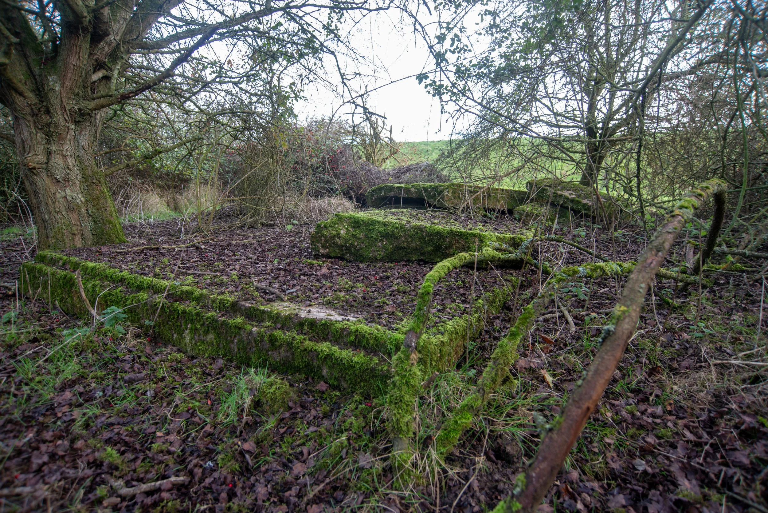
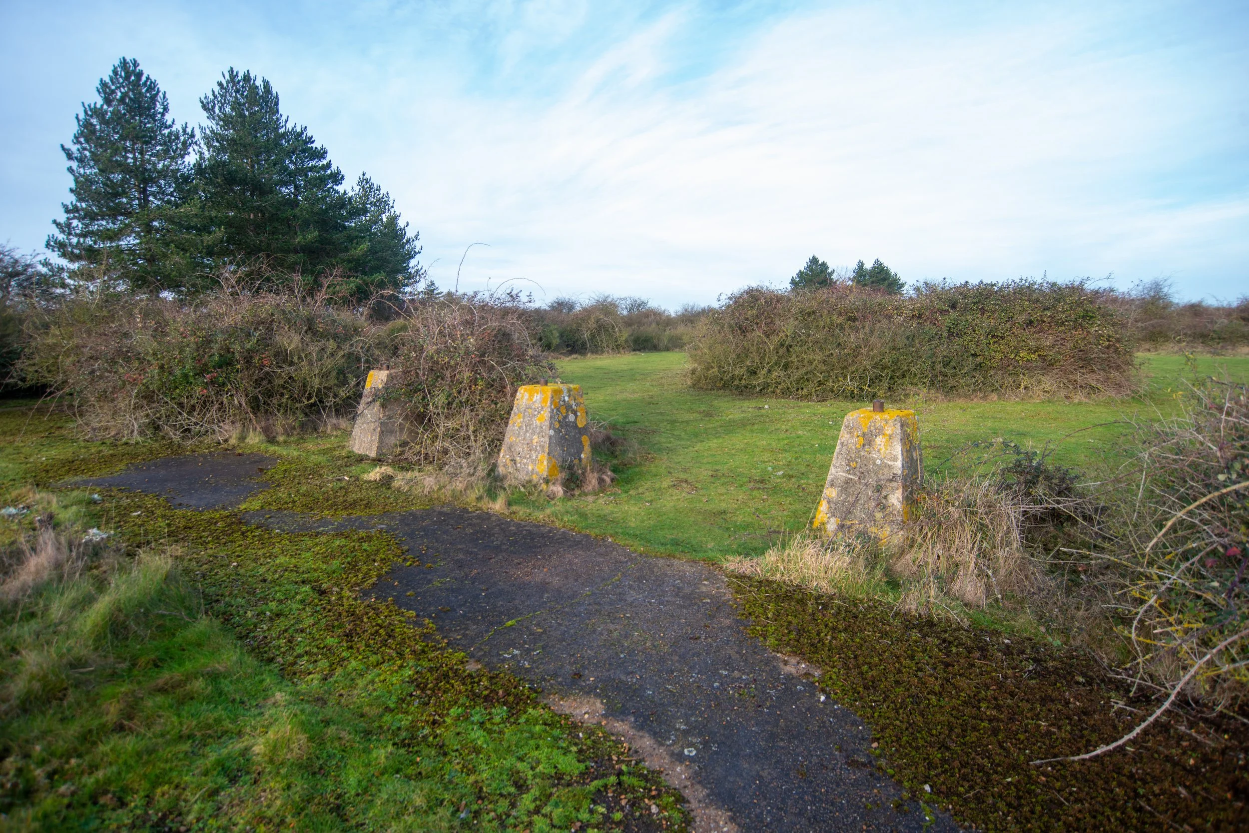
North of the main beach road, I found an area that could be part of the old shingle works or part of the military range.
As stated above, historical records and historic maps are scarce, and I'll be honest, this area with the dragon's teeth could be part of the military range.
If anyone has any information, please feel free to get in contact, and full credit will be given.
Thanks in advance.
On entering this site, I found these dragon's teeth near the concrete path.
They were first used during the Second World War to stop military tanks from entering military sites.
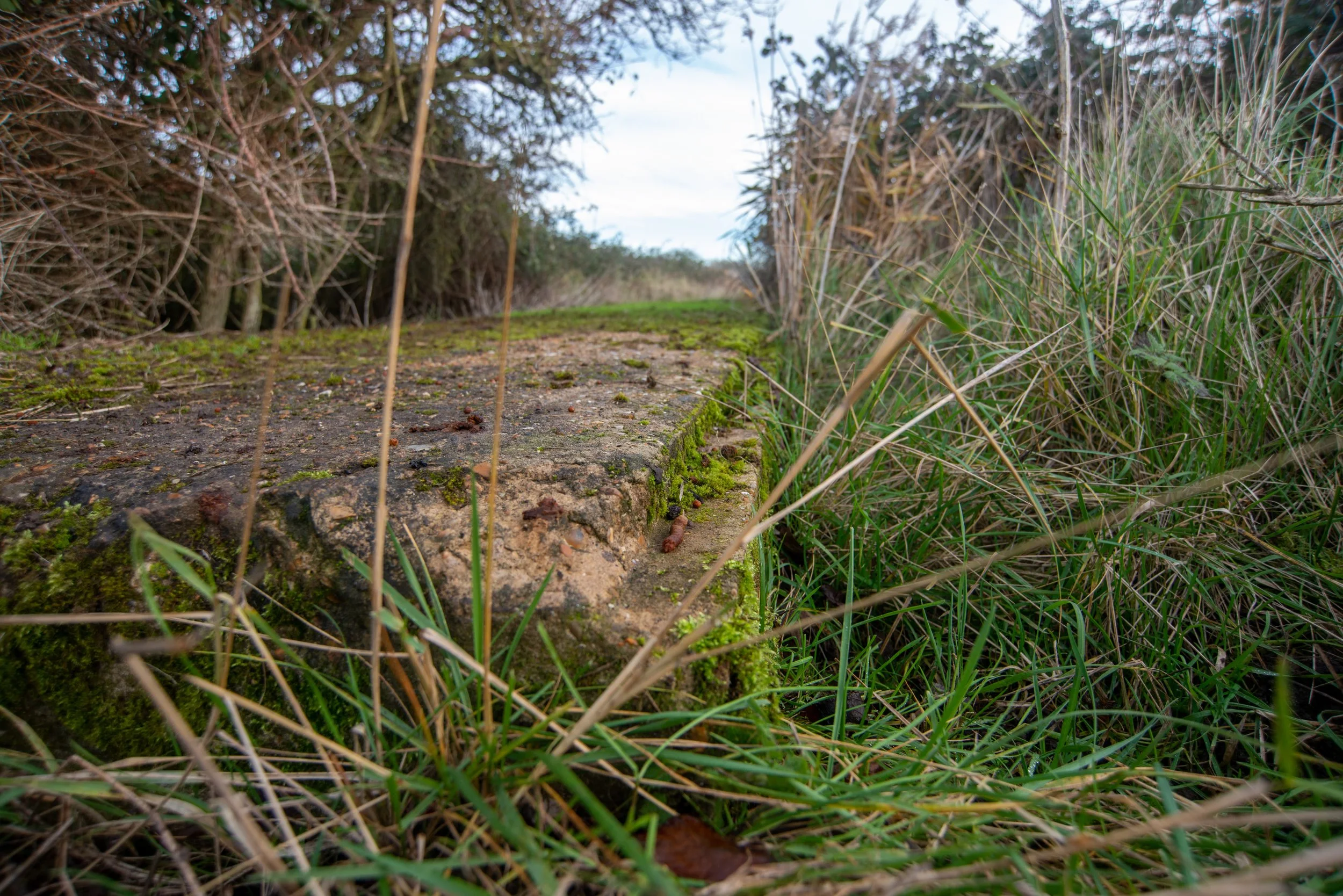
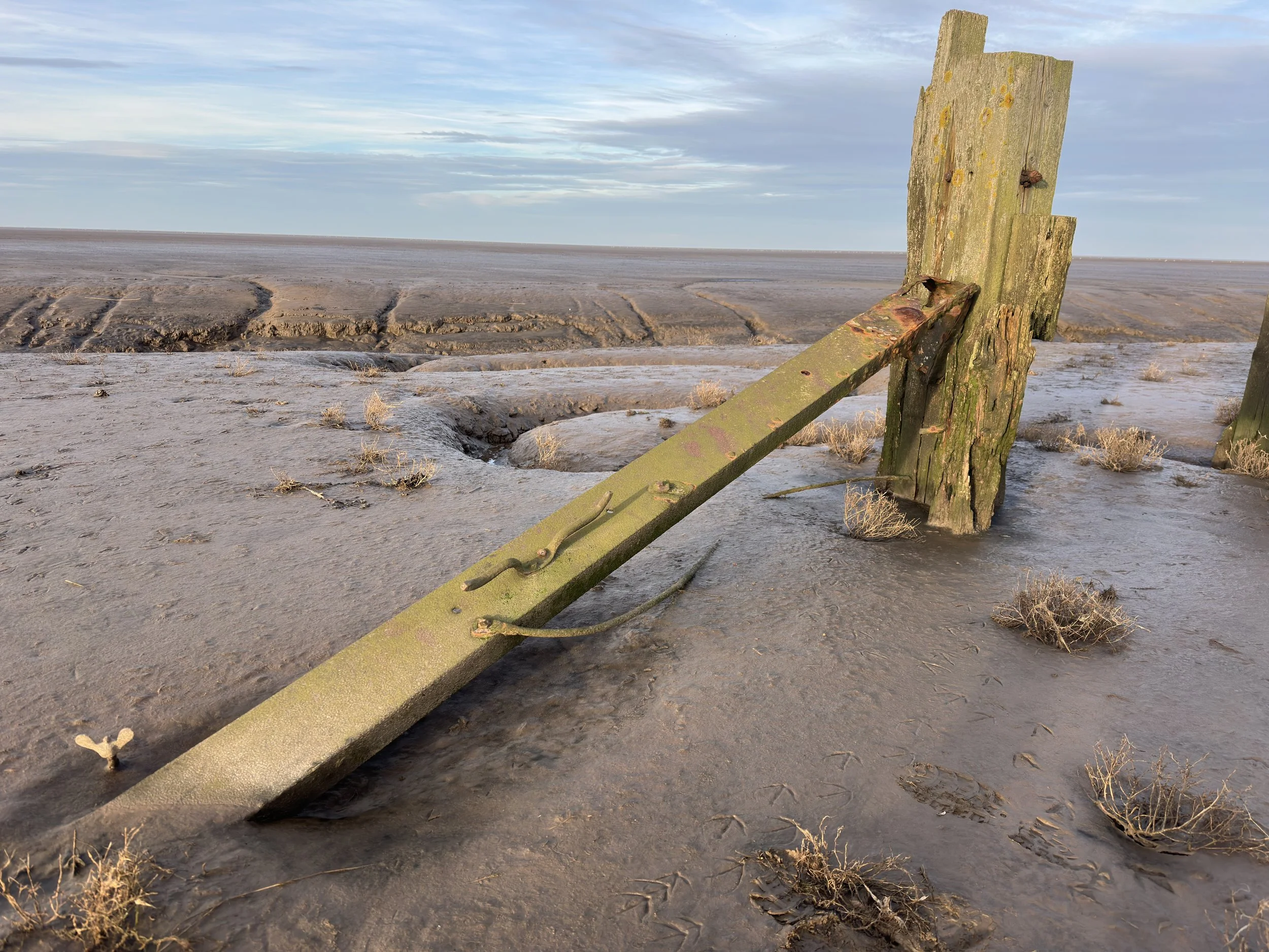
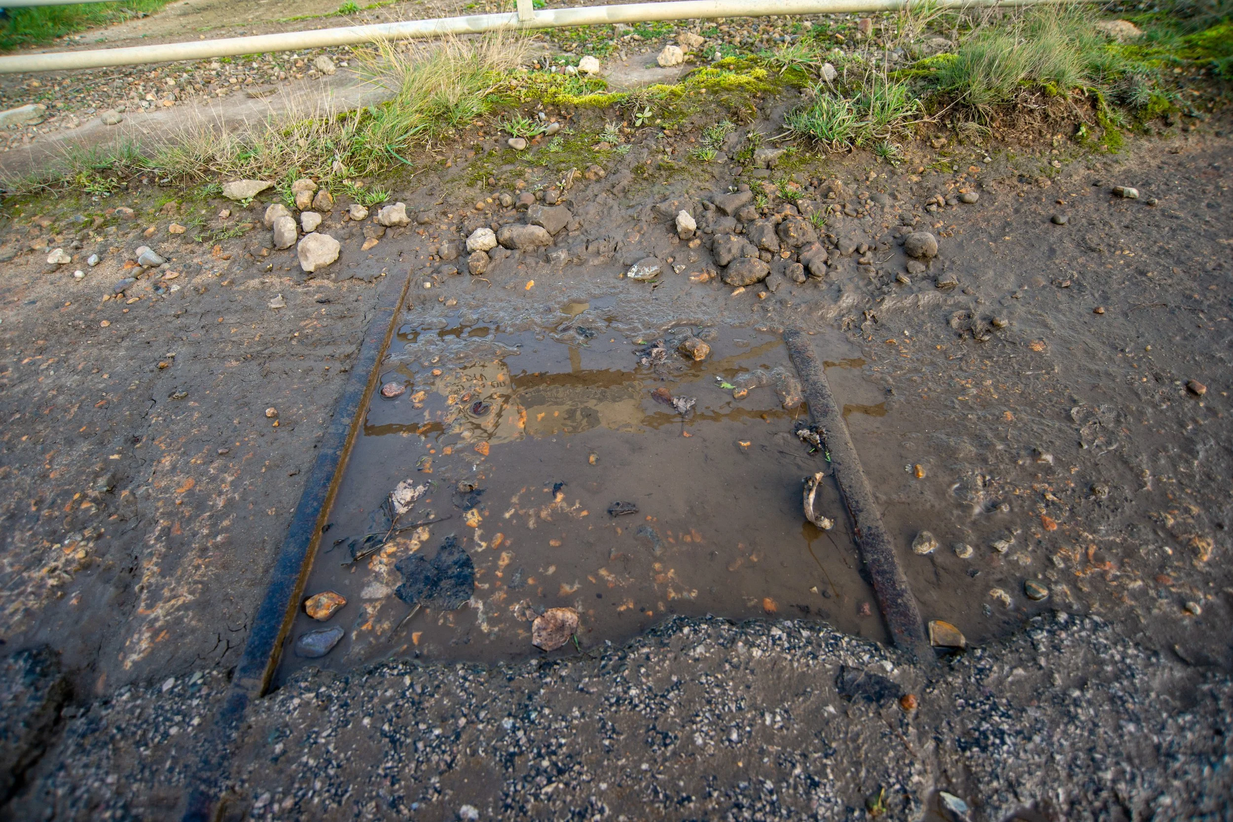
Just after the Dragon's teeth, I found this concrete path where it seemed there were possible remnants of track.
When I examined what seemed to be a railway track more closely, I noticed that it had a unique curved shape. In my prior experiences with railway tracks, I have never encountered one that curved like this at the top.
However, I could be mistaken.
If anyone has additional information, please feel free to share it with us.
Thank you in advance!
Just after the concrete path i found these concrete remains close to the flood defences at Snettisham.