FRANSHAM TO DEREHAM
1846-1968
To navigate through the route, kindly make use of the navigational icons located below that correspond to each part of the route.
FRANSHAM STATION
Fransham station is about 19 miles and 59 chains from King's Lynn. It was established in 1848 and ceased operations in 1968, much like other stations along the disused route in Norfolk.
Fransham was the smallest station on the route, initially having two platforms with a passing loop. However, it was converted into a one-platform station and later became a request station for a short time. The station had a small signal box, a level crossing, and a limited freight service without cattle loading facilities or a goods shed. Moreover, Fransham did not have its own station master in later times; the station master from the nearby Great Dunham and served this station. Diesel Multiple Units replaced all passenger services at the beginning of the 1955 winter timetable. Fransham saw an increase in services using this station, but like all other stations along the route, the station was closed in 1968 under the Beeching report as part of BR's efforts to modernise its network.
Fransham station Layout
Dated 1892-1914
Thanks to the national library of Scotland.

Past & present Maps.
Most things have stayed the same around Fransham since the railway closed.

Please look at Google Maps below for the position of Fransham station.
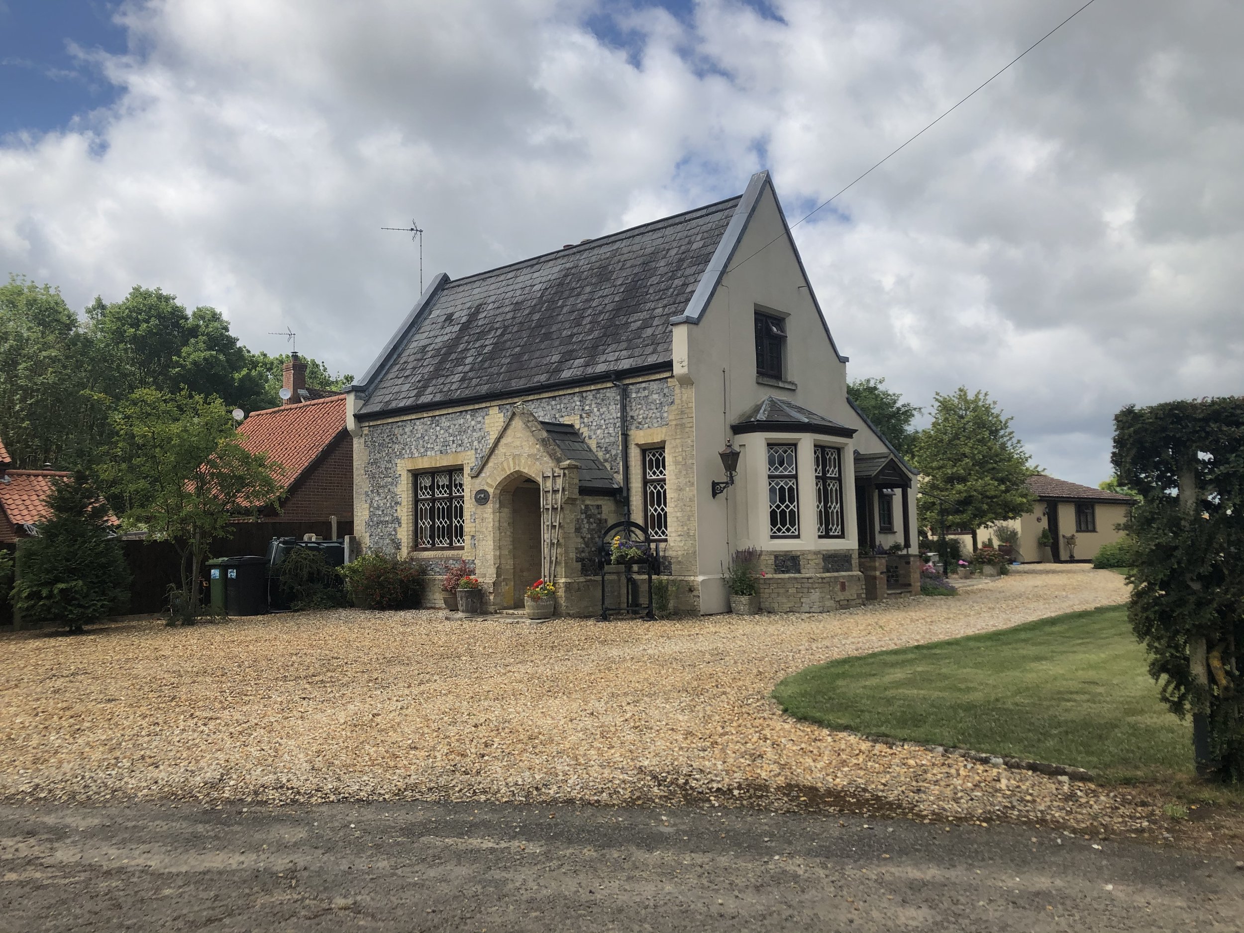
Fransham Station
Fransham station in 2020
Leaving Fransham
Leaving Fransham, the disused railway route headed towards Wendling station, which was approximately three miles away. The railway line passed through a shallow cutting and over various road and farm bridges before reaching its destination.
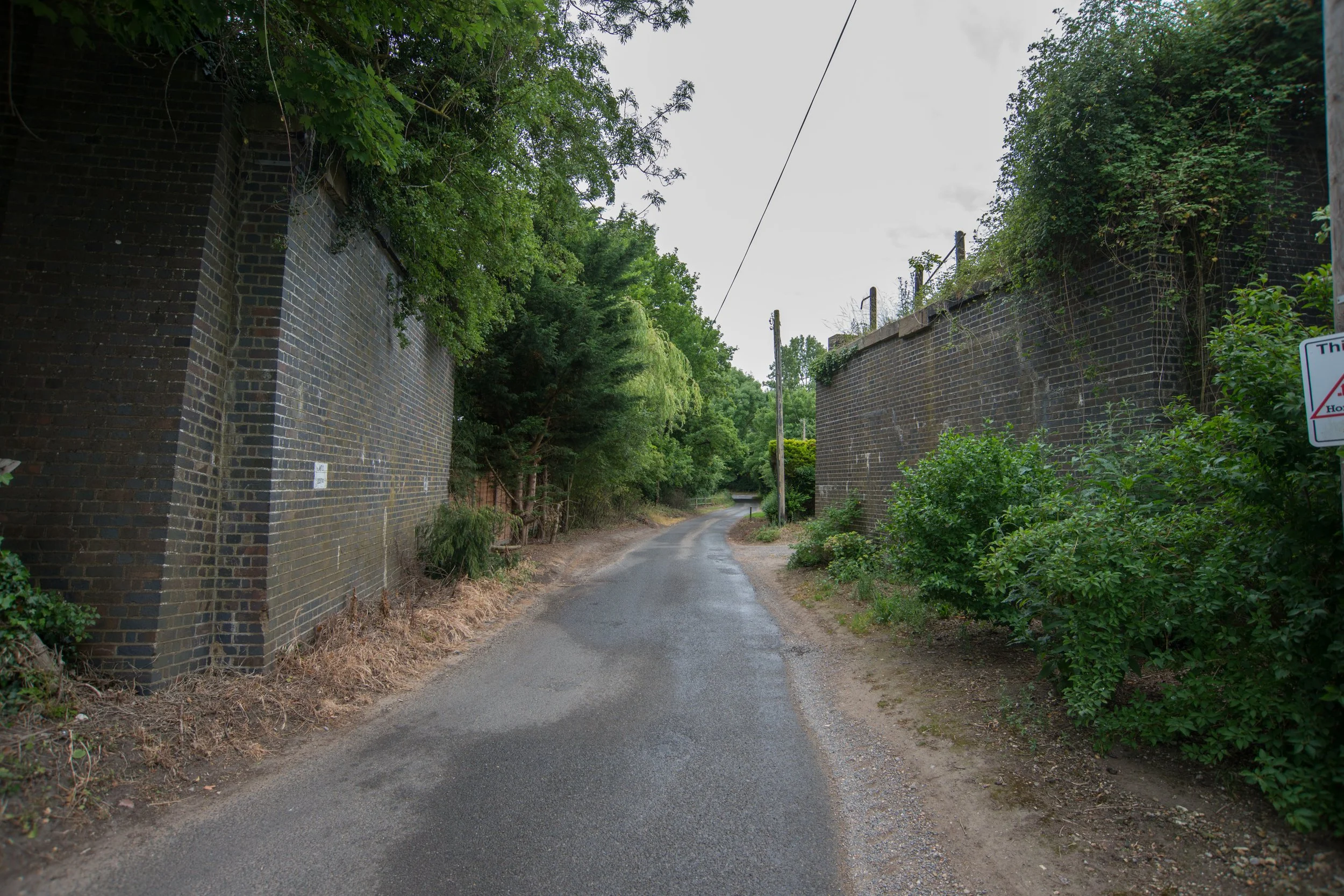
MTD 2374 bridge Buttresses
The railway's first bridge over Beeston Lane (bridge MTD 2374) only had two remaining buttresses when I photographed it in June 2022.


Travelling over MTD 2374, the railway would have passed over various crossings. One bridge, still visible on Google Maps, remains in a private garden, while the other bridges or crossings appear to have been demolished.

MTD 2377
The next bridge i found and photographed was on Dereham lane and the code was MTD 2377

MTD 2379
"The final bridge before the railway line reached Wendling crosses over Beeston Lane."


Top View of MTD 2379 with another bridge code found on the top of this old railway bridge.


The railway then headed off on a straight trajectory for a short distance before reaching the next stop Wendling
WENDLING STATION
Wendling station was located 22 miles and 35 chains away from King’s Lynn. It was a larger station than Fransham and had two platforms. The goods yard was placed on the up side, while the waiting room and signal box were located on the downside of the station. Initially, Wendling was built with a single platform, but soon after its opening, it was converted into a double platformed station. Like many stations in its early days, Wendling was a request stop. In later years, during the Diesel services era, the station saw more activity. However, like all stations along this route, it was closed down in 1968 under the Beeching Act.
After the closure of Scarning station in 1850, Wendling became the last stop before Dereham.
Wendling station no longer exists. It was demolished during the 1970s to construct the Dereham bypass, which is now known as the A47. The East Dereham Bypass, a 7-mile (11.3 km) road that cost £5 million and includes a part-dual-carriageway, was constructed on a section of the abandoned railway line and opened in the spring of 1978.
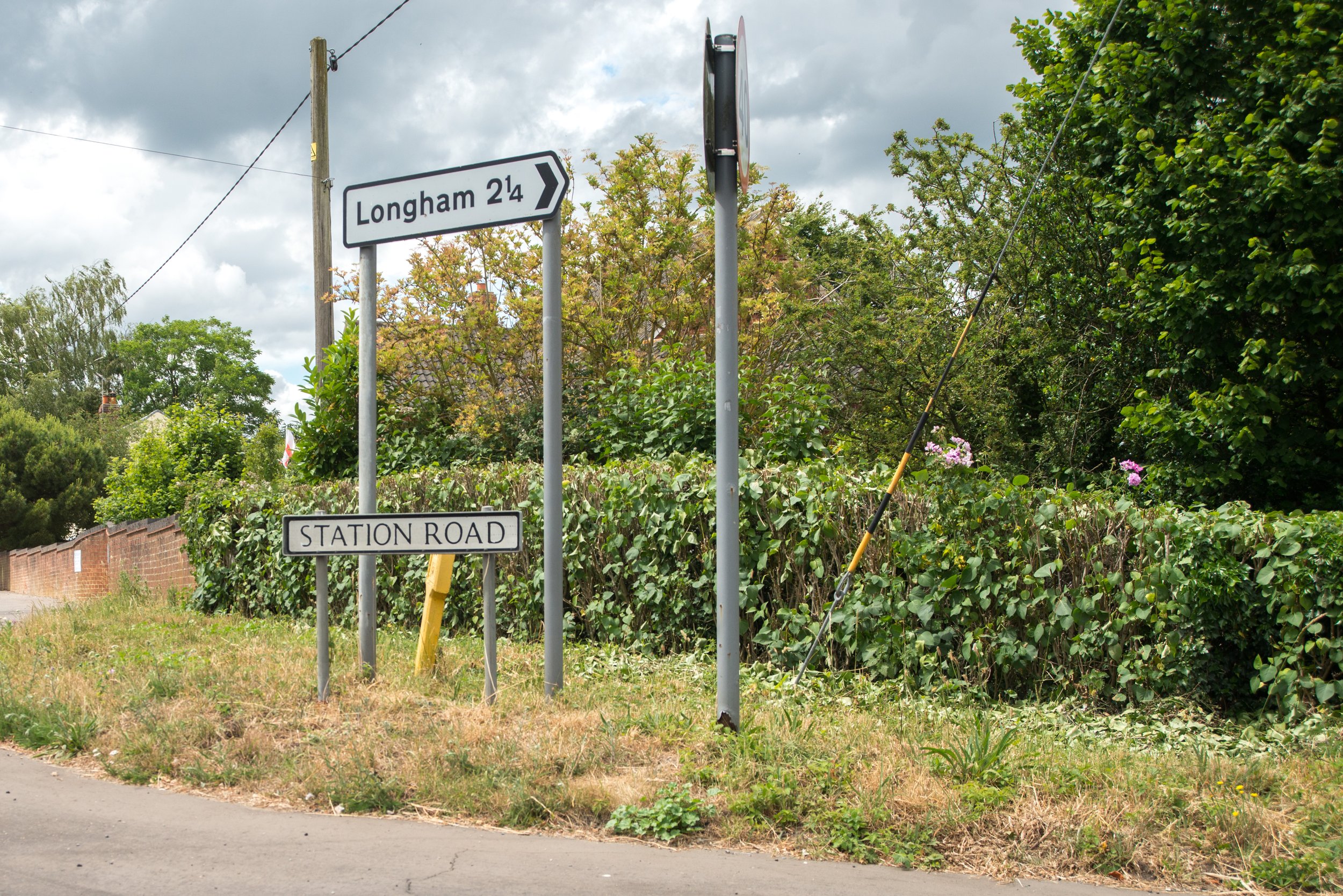
In the village of Wendling the only reminder that a railway station was one here is the road that bears the name “Station Road”
The episodes Battle School and The Day the Balloon Went Up from Dad's Army were also filmed at this station.
"This is the approximate location where the station at Wendling would have been situated."
Thanks to Google Maps.
Wendling station on Historic maps

Thanks to the National Library of Scotland for the maps used
50/50 maps showing Fransham station and the location of the former station on modern maps where the A47 now runs.

Thanks to the National Library of Scotland for the maps used
Wendling Station past

©Facebook Photographer unknown
Thanks to King's Lynn and area Model by J T Colquhoun for suppling this photo
©D Thompson

Wendling station present
Photographs of the Wendling station site were taken in June 2022 from an overpass bridge located near Wendling village. As of today, there is no trace of the station left as it now lies under the A47. The only reminder of the station is the name of the road in Wendling, which is still called Station Road.

Wendling Station Road is the only remaining reminder that a railway station was once located in this area.
SCARNING STATION
1848-1850
Scarning Station, located on the Lynn Dereham line, had a very short lifespan. As of today, there are no visible remains left of the station. Despite research efforts online, there are no pictures available that depict what Scarning Station looked like during the two years it was open. Additionally, there is minimal information about the history of this long-lost station. Scarning Station was located only three miles away from Dereham and even less distance from Wendling Station.
Scarning had three crossings and two bridges. One of the bridges was a wrought iron bridge, which was replaced in 1978 after the construction of the A47 bypass. The other bridge was formerly known as Fen Bridge, but it is now known as Cattle Arch bridge.
Thanks to Scarning.info
The replacement bridge that was constructed in 1978 for the A47

Approaching Dereham
The railway line leading to Dereham had a slight curve to the left. On its way, it crossed over two level crossings, one at South End Road and the other on London Road, which is approximately where the petrol station stands now. Approaching Dereham station the passengers would see a engine shed and also Dereham’s 45ft Turntable.
Also, passing the avoiding track junction that took services off towards Norwich without the need to reverse at Dereham.
Finally, the train reached its last station on the route, Dereham.
Presently, the disused track bed has been converted into housing, buildings and a bowling complex.
We can see from historical maps how the old track bed was built over after the closure of the railway on the approach to Dereham station.

The track's historical route through Dereham can now be viewed on a 50/50 map with the modern map, showing its path from the location of the current A47 through the newly constructed housing estate.

After the London Road Crossing, also approaching Dereham, an avoiding double track line was constructed to the south of the Dereham station. This allowed the Wymondham to King's Lynn line to be used as a cross-country route, stopping Reversing at Dereham station and heading straight off towards Wymondham and Norwich. The avoiding line was utilised by freight, excursion, and diverted main-line trains.

"Historical maps that display the Goods Shed and Turntable."

Thanks to The national Library of Scotland for all the maps used above.
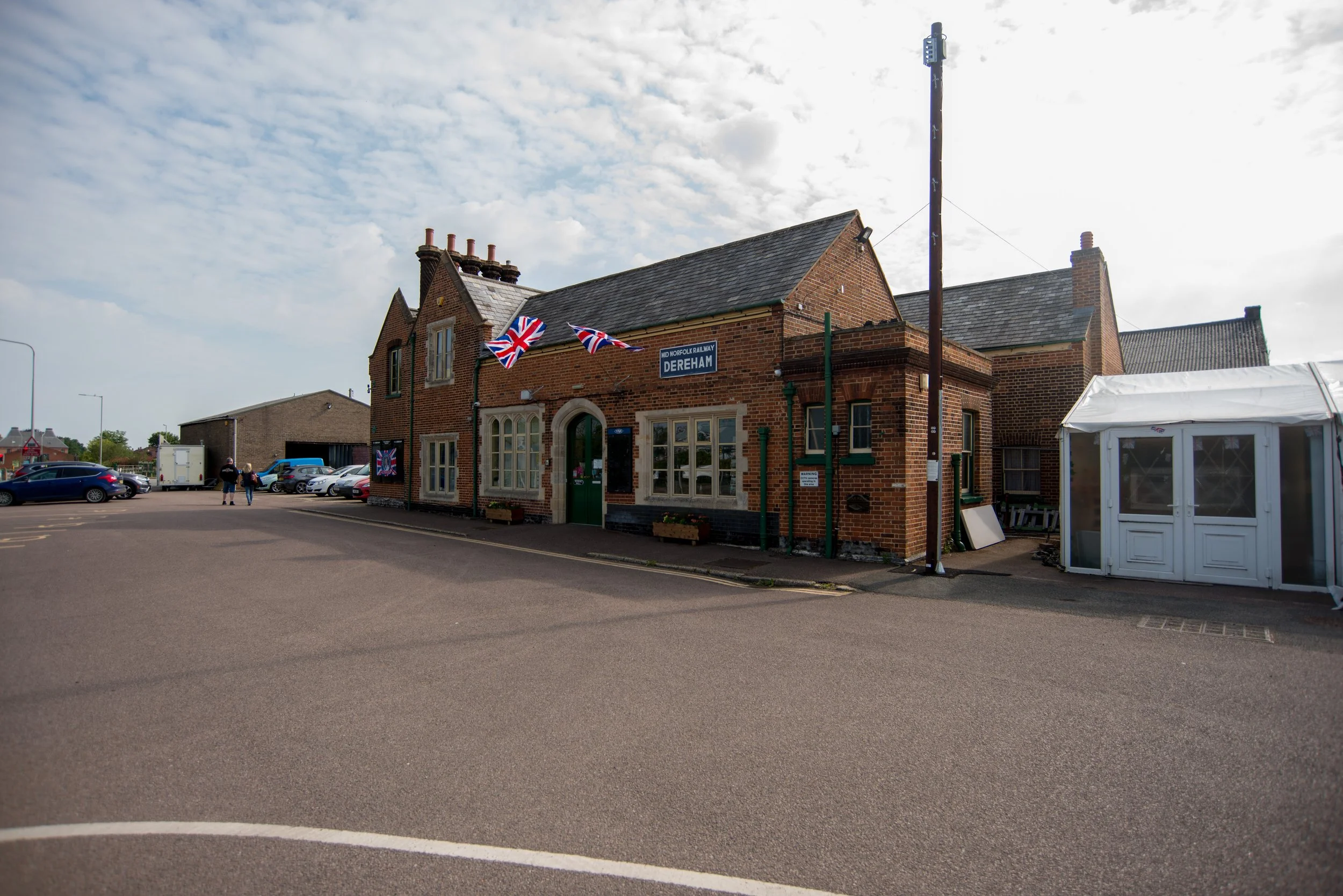
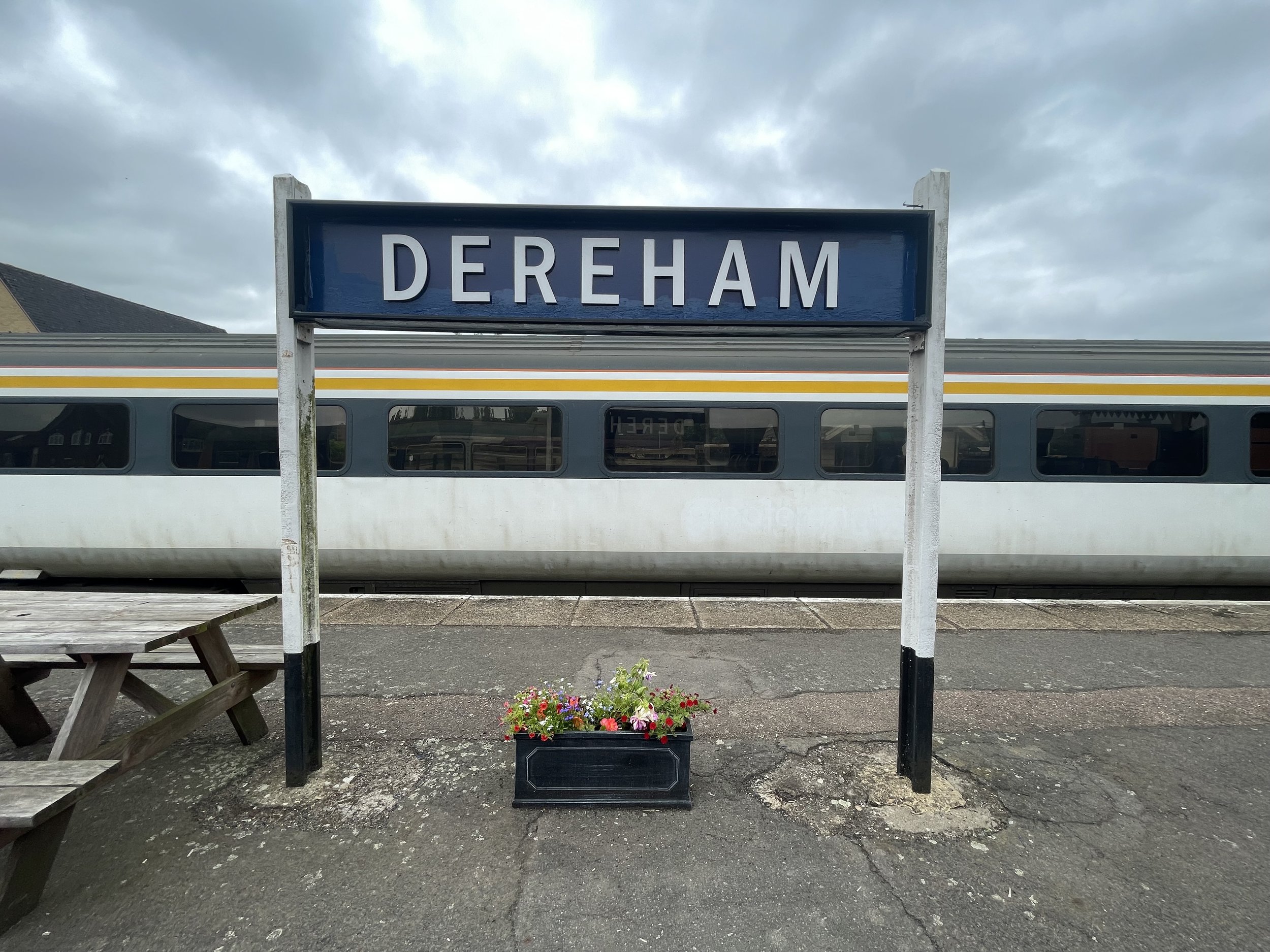
DEREHAM STATION
End of the Line
Dereham Maps
Google maps position of the station at Dereham now used by the Mid Norfolk Railway.
The National Library of Scotland has provided access to historical maps.


50/50 Past & Present maps from Dereham Station

At 26 miles 43 chains away from King’s Lynn the King’s Lynn to Dereham reached its final destination Dereham.
The Norfolk Railway Company opened the Dereham station in February 1847 with the line from Wymondham. The King's Lynn line arrived in 1848 and the Lynn & Dereham railway built its own terminal just before the junction with the Dereham Wymondham line. This station was closed in 1850 and services stopped at the station we see today at Dereham.
The current Dereham station was built in stages over several decades. It has four platforms, with platforms 2 and 3 being set back to back. Platform 4 is a short bay platform that was initially dedicated for trains heading towards King's Lynn. Dereham used to have several signal cabins that controlled the freight yards in the area. The central signal box and the west signal box are still present as part of the Mid Norfolk railway. The main goods shed was located behind the up platforms. There were also many sidings in Dereham that were used for local mills and agriculture. The up-and-down platforms were connected by a steel footbridge, but it no longer exists. Dereham also had its own Turntable. The Dereham loco sheds closed in 1955 for steam use and were used to stable DMU trains until 1968, when they were then demolished a leisure centre now sits on part of the land. In 2020, a smaller shed was built with funds from the EU on the part of the site of the old shed once sat. The Beeching report intended to keep the Lynn Dereham Norwich route. Despite this, the King's Lynn part was closed in 1968 and the rest to Norwich was closed in 1969. Services to Wells from Dereham had already closed as early as 1964. Freight services carried on in use to Fakenham East until 1980. The station closed down in the mid-80s and was left to the elements.
The Past.
Dereham in 1991

Ben Brooksbank / Dereham station remains, 1991 / CC BY-SA 2.0
Dereham in 1995

This file is licensed under the Creative Commons Attribution-Share Alike 3.0 Unported license.
Attribution: DiverScout at en.wikipedia
Dereham Station in 1996

CC BY-SA 3.0 DiverScout at English Wikipedia
Dereham is now a Heritage railway called the Mid Norfolk Railway. It was reopened gradually, and a new station called Wymondham Abbey was opened in 1999. The station is located just off a Junction close to Wymondham main station on the Breckland line.
The Mid Norfolk Railway aims to operate services towards County School using the Wells to Wymondham branch line. Currently, the services have only reached Hoe Crossing, located just outside Dereham.
The Mid Norfolk Railway uses the line that once connected Dereham to Wymondham. Unfortunately, none of the King's Lynn to Dereham line remains. The only remaining part is platform 4, the bay platform at Dereham, mainly used for King’s Lynn services.
The junction has been replaced with a leisure complex, and the level crossings have been removed. Only one crossing cottage remains, which could have been the original station at Dereham. This station was built between 1847 and 1850. The other level crossing has been replaced with housing and a fuel station.
The present time
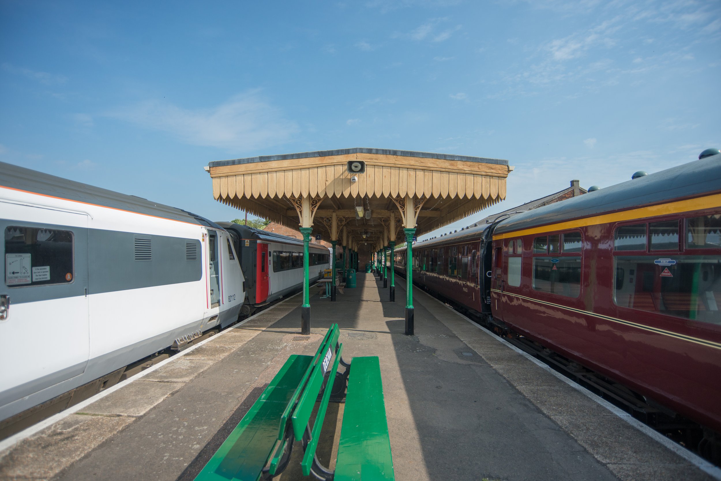
Dereham station now in use with the
Mid Norfolk Railway
Dereham station frontage


King's Lynn trains would arrive from a junction roughly where the leisure centre now is.
The white roof that can be seen in the distance to the right of this picture is the leisure centre/Bowls alley and would have been where King's Lynn trains arrived at Dereham.
When this picture was taken there is no trace of the junction at all and the track bed here has been built over .
The British Railways Mk3 Stock sat to the right is stationed on Platform where mostly King’s Lynn Services terminated.

The Mid Norfolks Heritage pacer sat where the King’s Lynn Trains would arrive into Dereham pre-closure.

Platform 4
Historic maps displaying Platform 4.

Platform 4 to the left, seen here, is where the King's Lynn Trains mainly arrived and departed from.
The line to the right was where the through trains from Wymondham to Wells stopped.
This platform is now used for the Mid Norfolk Heritage railway, and platform four is used to stable spare heritage stock.

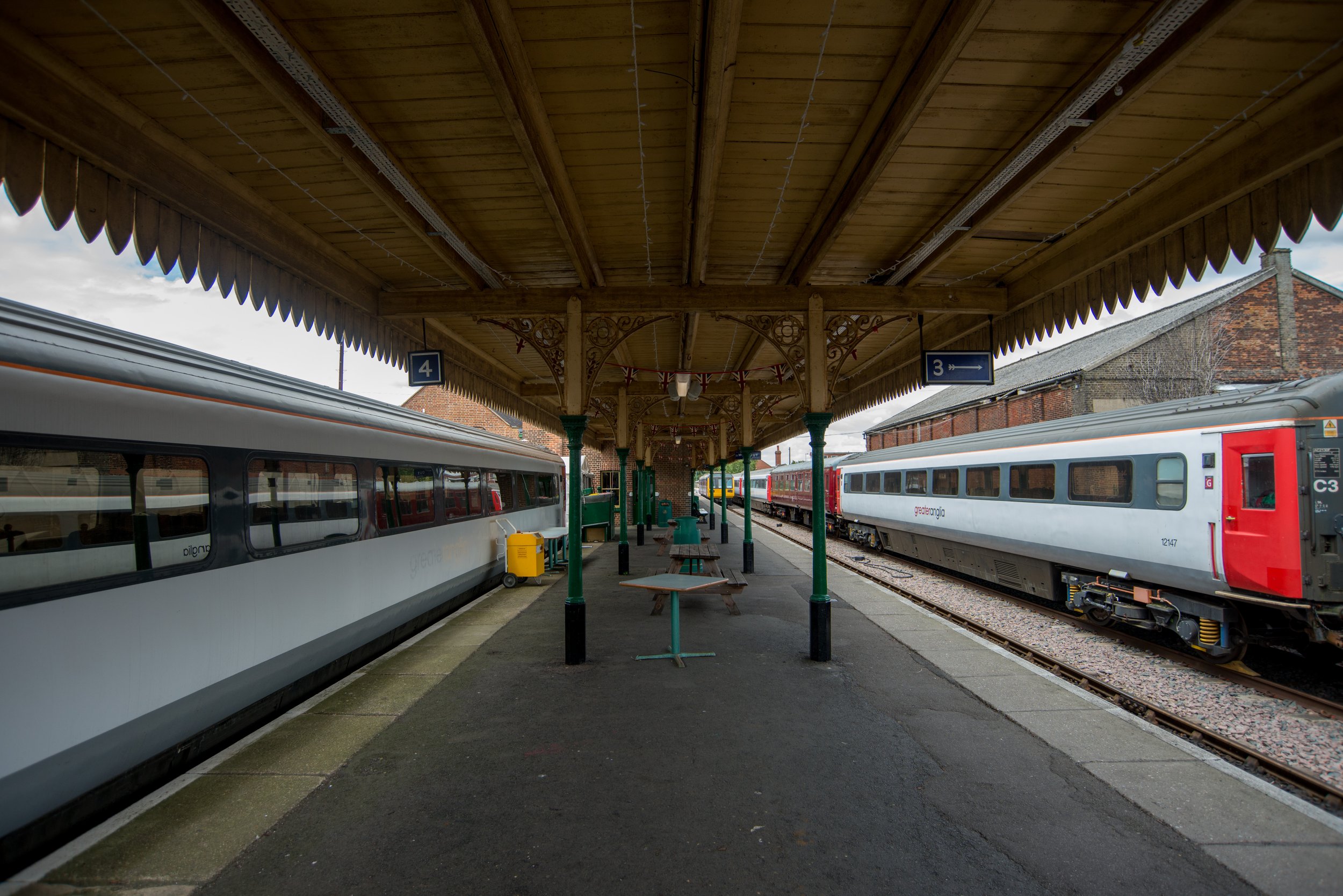

Platform 4 to the right stabling British rail Mk3 Greater Anglia stock mainly used for the Polar Express.


Dereham’s other Platforms
These platforms would have been used for Wells, Fakenham and through to Wymondham services.


This is a view of Dereham station as seen from the level crossing on Norwich Road.
Dereham North Signal Box is visible in the two pictures below. The signal box originally came from Laundry Lane, Lowestoft.
Dereham Station Signs


Signal Box’s
Dereham Central box contained a sizeable 50-lever control and oversaw most of the operations at Dereham, with a few smaller boxes in the station area.

Dereham North Signal Box and Norwich Road level crossing.
Viewed from platform two.
Dereham North viewed from Norwich road.
Dereham Goods yard
What was part Of Dereham's old goods yard photographed from Norwich Road?
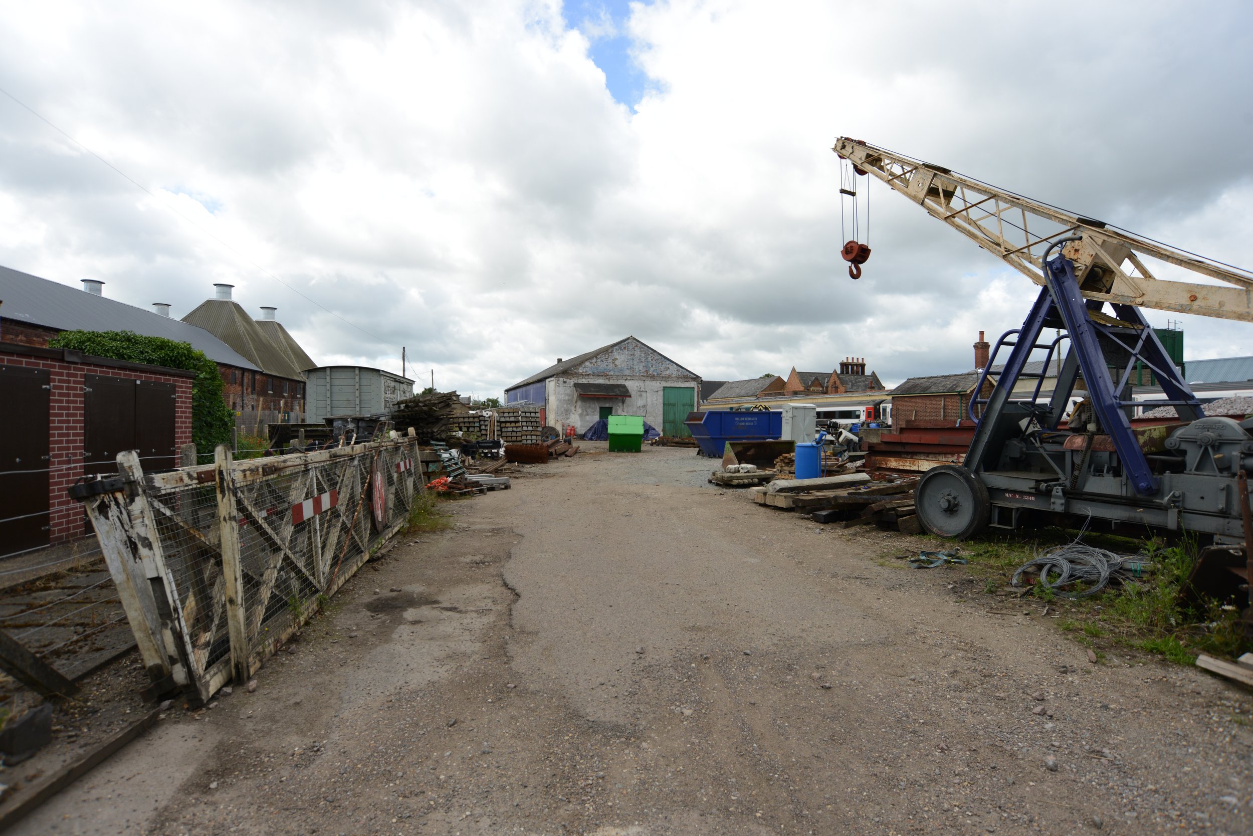
An old good’s shed at Dereham.


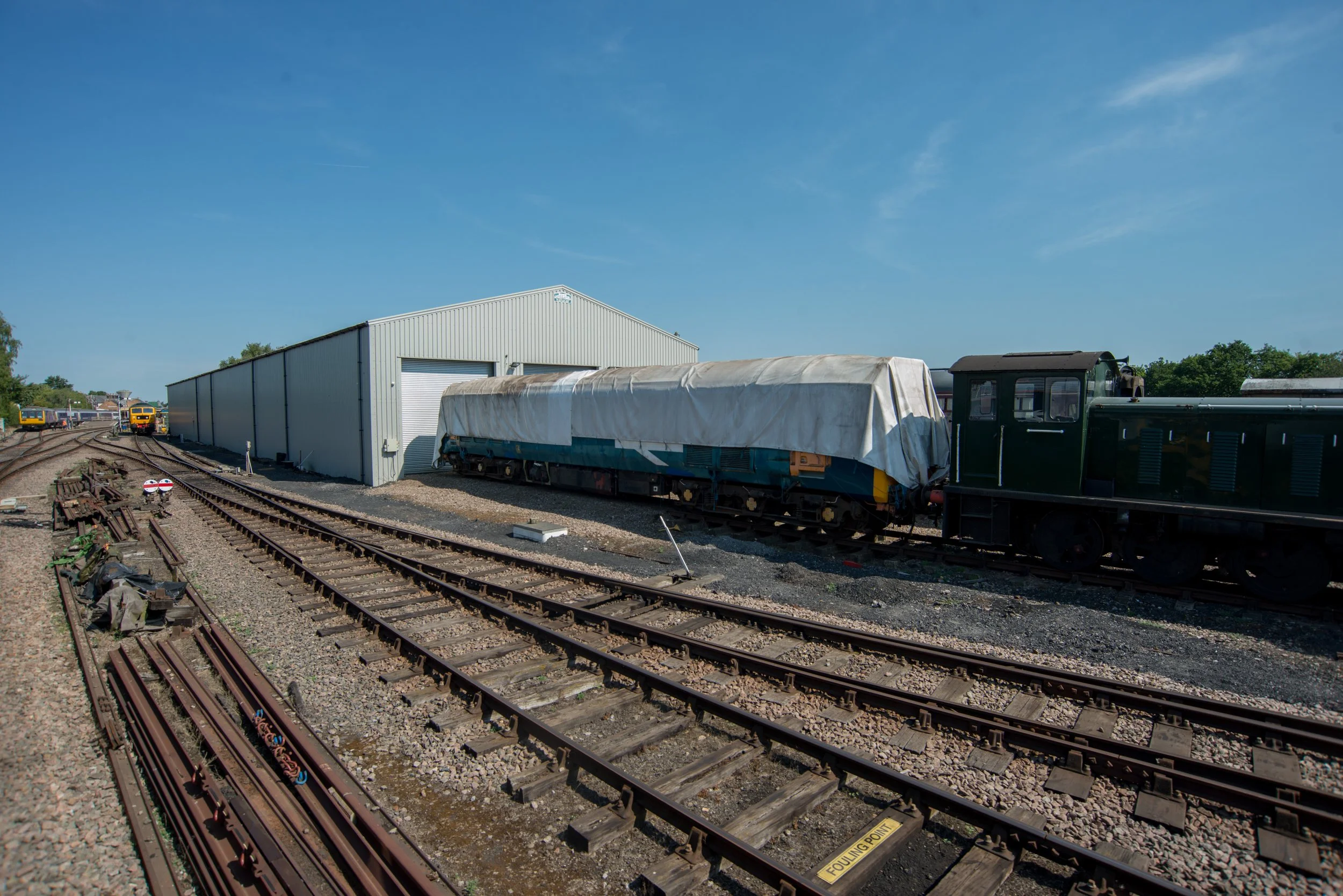
The new Engine Shed.
Random items from Dereham Station


Items stored in Dereham Carpark
A signal box I initially mistook for Spooner row thats was going to Wymondham Abbey was stored in the car park at Dereham.
Please if any one has any infomation where this signal box came from please feel free to get into contact.
I have been told this Signal box came from Soham.

An old railway turntable stored at Dereham, awaiting restoration. This turntable was said to have come from Hitchin and has since been sold again.


END OF THE LINE
I appreciate you sticking with me thus far, and I hope my account of Norfolk's railway past hasn't been tedious. The Lynn to Dereham line was the second line I researched, following the Lynn to Hunstanton branch. As a local of the King's Lynn area , these two railways held significant historical value for me. The Dereham line, like the Hunstanton branch, has been a frequent subject of my studies.
As I delved deeper into my research, I came across more and more remnants and relics that still existed. Scouring social media only added to my discoveries, revealing an endless array of bridges to explore. Yet, I knew that if I didn't act quickly, many of these long-lost wonders could disappear forever, much like the fate of Wendling station. In fact, many bridges across Norfolk have already been filled in and lost to history.
I was pleasantly surprised by the number of bridges present along the Dereham railway line, given that Norfolk is known for its flat terrain. In contrast, the Hunstanton line only had a single, small bridge spanning a small river. The numerous impressive bridges on the Dereham line are a testament to the skill and dedication of the railway navvies who built the railways in the past. These structures continue to stand strong today, showcasing the quality of construction during that time.
It was interesting to discover that both King's Lynn and Dereham stations are still operational. King's Lynn is currently being used as the Cambridge-London Fenline, while Dereham has been repurposed as the Mid-Norfolk Heritage Railway. However, it's worth noting that the railway at Dereham is no longer the same one that was once used by the Lynn line, as it is now privately owned and used for heritage purposes. At present, only platform 4 remains at Dereham, as the rails have been removed and the entry path has been built over. The Mid Norfolk railway now uses the Wells Wymondham branch instead.
Several public walks offer unique bridge sightings, such as the Narborough Walk and the Walk at Swaffham. While some bridges were easy to locate, others required some effort and even resulted in a few run-ins with stinging nettles. Despite this, I managed to capture some stunning pictures. However, I have yet to visit the bridge in King's Lynn where the M&gn passed over the Dereham line. Although this bridge is visible from the A149 bypass, accessing it would require trespassing on farmland and Network rail land, as the old crossing is still in use for freight traffic up to Middleton Towers.
As I travelled along the Lynn Dereham line, I couldn't help but notice that it has remained largely undeveloped. In fact, in many parts, it is still visible to Swaffham. Sadly parts of the A47 have been constructed over the track bed after Swaffham, here the once audible sound of the railway has been replaced by the passing of cars that contributed to its demise.
I have learned that there was a bridge before the Swaffham raceway. However, according to social media, it appears to have either been filled in or overgrown to the extent that accessing it would be difficult and would require trespassing to see any remaining remnants.
I'm hopeful that this page will be completed with more parts added from 2020 onwards. Perhaps I'll stumble upon another bridge during my quest, or someone will notify me of one I missed via Twitter, and I'll be off on another adventure. Tracing this line has proved to me that there is so much to discover and more and more I missed.
Once finishing the King’s Lynn to Dereham railway pages i decided to aff the final part from Dereham to Norwich and incorporate the Mid-Norfolk Railway.
I would love to give a personal thanks to
Alex Brammer from the Middleton Towers restoration group for pictures of the Lynn Dereham and M&gn bridge between King’s Lynn and East Winch
Steve Heywood from the Midland & Great Northern Joint Railway M&GN Facebook Group for pictures of the Lynn Dereham and M&gn bridge between King’s Lynn and East Winch.
Ivan Staines, for the excellent information about the bridges at Narborough.